
Sardar Vallabh Patel International Airport
 Ахмадабад · Индия· Sardar Vallabh Patel International Airport
Sardar Vallabh Patel International Airport (IATA: AMD, ICAO VAAH) — крупный аэропорт в городе Ахмадабад, Индия.
Sardar Vallabh Patel International Airport is a large airport, at an elevation of about 189 ft, with scheduled passenger service. This page gathers its location map, airport codes and travel information.
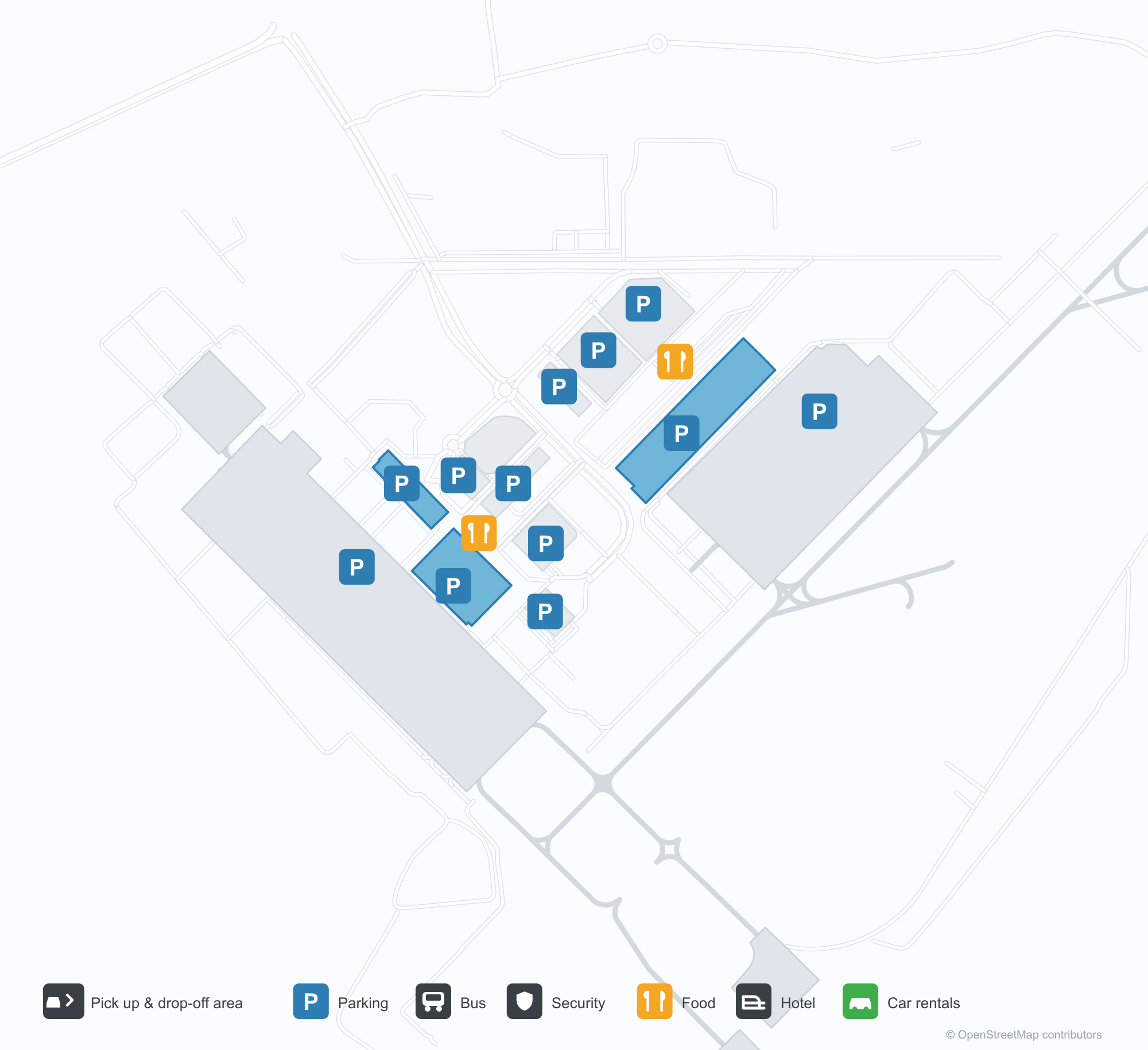
Скачать карты аэропортаЗагрузки
Фотографии аэропортаФото аэропорта
Реальные фотографии этого аэропорта; у каждой указан источник — общедоступная веб-страница. Авторские права принадлежат фотографам. Нажмите на фото, чтобы увеличить, или на подпись, чтобы открыть источник.
Терминал ночью — фиолетовый свет заливает консольную крышу, над бордюром стоят колонны, а по фризу тянется название аэропорта на гуджарати.
Терминал со стороны зоны высадки — белые тентовые навесы над дорогой и сплошной стеклянно-стальной фасад.
Художественная стена внутри терминала — две бронзовые фигуры перед линейным городским пейзажем и экран с полным названием аэропорта.
Днём на фасаде терминала синими буквами написано полное название аэропорта, внизу вдоль бордюра движутся путешественники и белые машины.
С наступлением сумерек фиолетовый свет заливает фасад терминала, а белый тентовый переход пересекает дорогу к подсвеченному ряду небольших магазинов.
Авиалайнер в ливрее IndiGo стоит на бетонном перроне, на заднем плане видны терминал и нанесённая разметка рулёжных дорожек.
Вид с воздуха на терминал: многосекционная серебристая крыша, парковки и кольцевая дорога впереди, рядом на перроне стоит один авиалайнер.
Ночью белые тентовые навесы, подсвеченные снизу, укрывают гуляющих на площади перед терминалом, позади светится его фасад.
Сумеречный аэроснимок высокой башни, расширяющейся кверху и светящейся тёплыми полосами цветного света, рядом — невысокие здания и освещённый город у подножия холмов.
На мокром от дождя ночном перроне самолёт IndiGo ждёт у стоянки, у его носа стоит наземное оборудование.
Sardar Vallabh Patel International Airport: карта маршрутов — прямые направленияКарта маршрутов
18 прямых направлений: карта, авиакомпании и расстояния.
Sardar Vallabh Patel International Airport: рейсы — вылеты и прилётыТабло рейсов
847 номеров рейсов у 45 авиакомпаний по 55 направлениям, с разбивкой по направлению. Номера код-шеринга также включены.
| Рейс | Авиакомпания | Направление | Страна/регион |
|---|---|---|---|
| 3L112 | Air Arabia Abu Dhabi | Zayed International Airport | Объединённые Арабские Эмираты |
| 6E75 | IndiGo | King Abdulaziz International Airport | Саудовская Аравия |
| 6E133 | IndiGo | Dehradun (Jauligrant) (DED) Dehradun Jolly Grant Airport | Индия |
| 6E181 | IndiGo | Rajiv Gandhi International Airport | Индия |
| 6E319 | IndiGo | Netaji Subhash Chandra Bose International Airport | Индия |
| 6E346 | IndiGo | Амритсар (ATQ) Sri Guru Ram Das Ji International Airport | Индия |
| 6E348 | IndiGo | Chennai International Airport | Индия |
| 6E367 | IndiGo | Vasco da Gama (GOI) Goa Dabolim International Airport | Индия |
| 6E383 | IndiGo | Rajiv Gandhi International Airport | Индия |
| 6E396 | IndiGo | Международный аэропорт имени Индиры Ганди | Индия |
| 6E431 | IndiGo | Chennai International Airport | Индия |
| 6E450 | IndiGo | Netaji Subhash Chandra Bose International Airport | Индия |
| 6E479 | IndiGo | Chennai International Airport | Индия |
| 6E481 | IndiGo | Kempegowda International Airport Bengaluru | Индия |
| 6E522 | IndiGo | Navi Mumbai (NMI) Navi Mumbai International Airport | Индия |
| 6E522 | IndiGo | Pune (PNQ) Pune International Airport | Индия |
| 6E635 | IndiGo | Rajiv Gandhi International Airport | Индия |
| 6E699 | IndiGo | Pune (PNQ) Pune International Airport | Индия |
| 6E751 | IndiGo | Netaji Subhash Chandra Bose International Airport | Индия |
| 6E793 | IndiGo | Chhatrapati Shivaji Maharaj International Airport | Индия |
Номера рейсов и маршруты из индекса рейсов aviability.com (снимок 26 октября 2026 г.); номера код-шеринга включены, время вылета не указано. Источник: aviability.com ↗
Информация об аэропортеСведения об аэропорте
Интерактивная карта: Sardar Vallabh Patel International AirportИнтерактивная карта
Посмотреть этот аэропорт на других картографических сервисах:
Ahmedabad Airport (AMD): Eighteen Routes Under a Purple RoofПутеводитель по аэропорту
The official photos of Ahmedabad's airport lead with colour: the terminal's cantilevered roof washed in purple light, columns over the kerbside, and a second view where white tensile canopies spread above the drop-off road and a glass-and-steel frontage runs along the building. This is not an airport that relies on sheer size for identity. Inside, an art wall sets two bronze figures against a line-drawn cityscape, with a screen carrying the airport's full name.
Sardar Vallabhbhai Patel International Airport (IATA AMD, ICAO VAAH) serves Ahmedabad in Gujarat, India, at an elevation of about 58 m, with a single 3,505 m runway (05/23). The 2014 route snapshot records 18 non-stop destinations, split evenly between domestic and international.
Airport photos
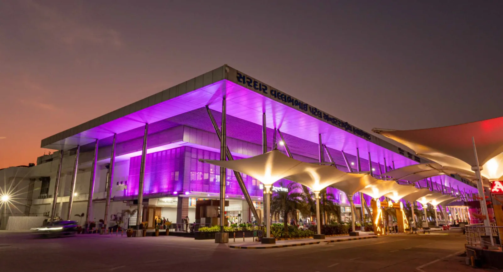
The terminal at night — purple light washing the cantilevered roof, columns over the kerbside, and the airport name in Gujarati along the fascia.

The terminal from the drop-off area — white tensile canopies over the roadway, with a continuous glass-and-steel frontage.

An art wall inside the terminal — two bronze figures in front of a line-drawn cityscape, with a screen showing the airport full name.
The photos come from the airport's official Adani Airports site and remain the copyright of their photographers; full credits and source links sit in the photo gallery on this page.
Airport at a glance
| Item | Detail |
|---|---|
| IATA / ICAO | AMD / VAAH |
| Role | Large airport and international gateway for Gujarat |
| Elevation | about 58 m |
| Coordinates | 23.0772, 72.6347 |
| Runway | 1: 05/23, 3,505 m × 46 m asphalt |
| Non-stop destinations | 18 (9 domestic, 9 international; 2014 snapshot) |
| Official site | svpia-ahmedabad.adaniairports.com |
Network shape: nine domestic, nine international
By distance: 6 destinations within 1,000 km, 10 between 1,000 and 3,000 km, 2 between 3,000 and 6,000 km, and none beyond 6,000 km. The near layer is Mumbai (444 km), Pune (517 km) and Jaipur (526 km). The far layer is Kuwait (2,549 km), Kuala Lumpur (3,861 km) and Singapore (4,157 km). Nine domestic routes tie Ahmedabad to India's main cities; nine international ones point to the Gulf, Southeast Asia and South Asian neighbours.
| Distance band | Destinations |
|---|---|
| Under 1,000 km | 6 |
| 1,000–3,000 km | 10 |
| 3,000–6,000 km | 2 |
| Over 6,000 km | 0 |
IndiGo Airlines appears on 9 routes, SpiceJet on 7, Air India on 4, and Jet Airways and Go Air on 3 each. The carrier column includes codeshares, so the figures describe concentration. The full list is on the Ahmedabad route map.
Getting there and navigating
- Coordinates: 23.0772, 72.6347
- Official site: svpia-ahmedabad.adaniairports.com
- Open in a map: Google Maps | Amap | Baidu Maps
If fares are close, compare Delhi (DEL): about 755 km away with 96 non-stop destinations. Delhi is also on AMD's own route map, so a short connection is practical; for Europe or North America, the usual path is via Delhi, Mumbai or a Gulf hub.
The location map on this page shows the field against Ahmedabad and the road network. This page does not cover terminal connections or local transport; confirm them with the airport or airline.
Before you fly
- Allow 2–3 hours for an international departure and 90–120 minutes for a domestic one. A single-runway airport can queue at morning and evening peaks.
- The 18 destinations are a 2014 snapshot. IndiGo and SpiceJet have expanded their Indian networks substantially since; check the airline's current schedule.
- The purple lighting and tensile canopies are part of the terminal's exterior. At night the kerbside is darker than the building, so agree on a pickup point with your driver in advance.
About the data
Runways, elevation and coordinates come from OurAirports open data. Routes and carriers come from the June 2014 OpenFlights snapshot and include codeshares and interline services; they indicate network shape and scale, not current schedules. Photos come from the airport's official Adani Airports site and remain the copyright of their photographers.
History
Named after India's first deputy prime minister, Sardar Vallabhbhai Patel, the airport serves Ahmedabad and Gandhinagar as the country's eighth busiest field — some 250 movements a day. It spans 1,124 acres with a 3,600 m runway and four terminals (domestic, international, secondary and cargo).
Source: Ahmedabad Airport.
Комментарии читателейОбсуждение
Вопросы, отчёты о поездках и исправления приветствуются. Комментарии видны всем.
Загрузка…
Загрузка комментариев…