
Sardar Vallabh Patel International Airport
 アーメダバード · インド· Sardar Vallabh Patel International Airport
Sardar Vallabh Patel International Airport(IATA: AMD、ICAO: VAAH)はアーメダバード、インドにある大型空港です。
Sardar Vallabh Patel International Airport is a large airport, at an elevation of about 189 ft, with scheduled passenger service. This page gathers its location map, airport codes and travel information.
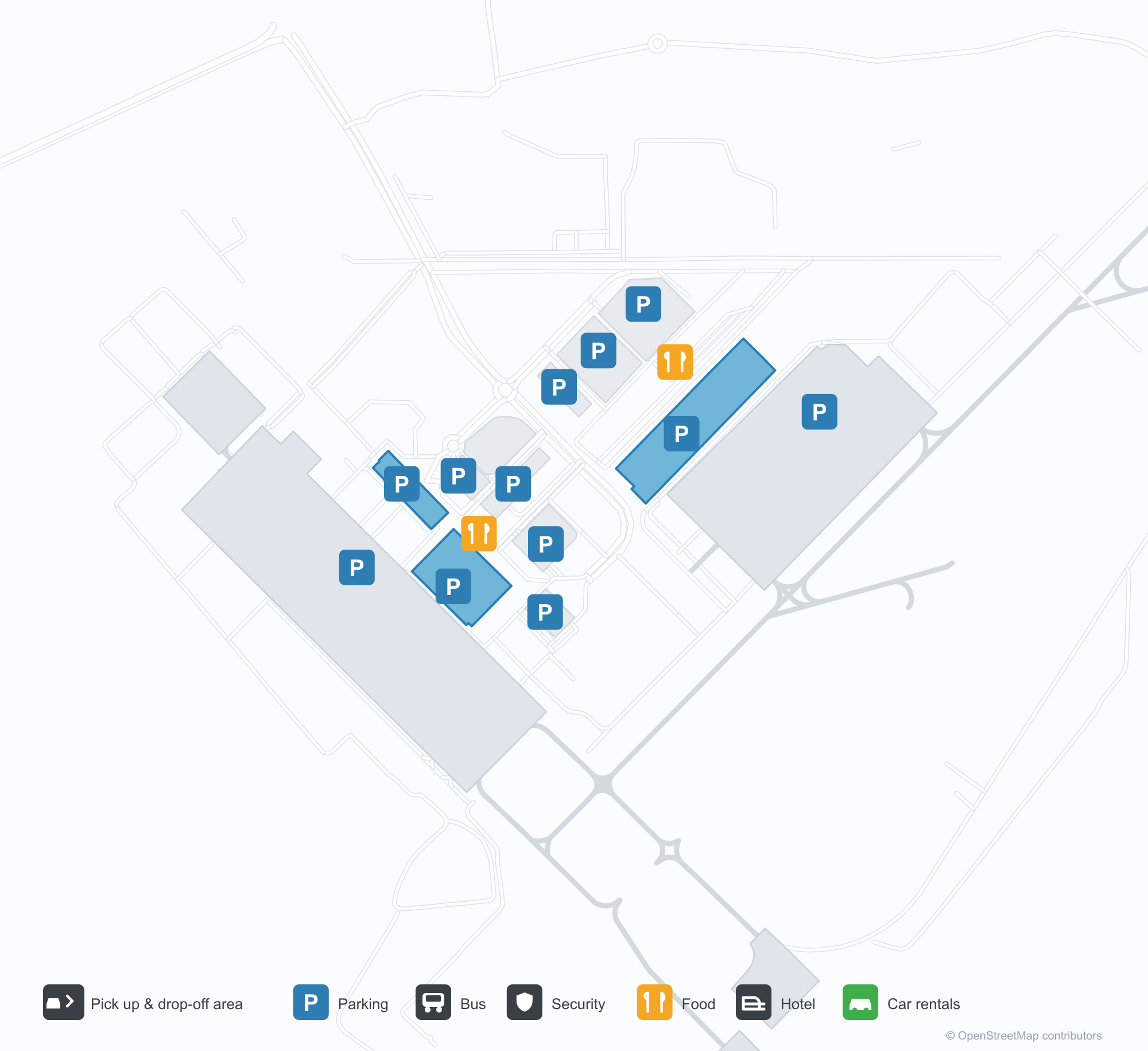
空港マップをダウンロードダウンロード
空港写真空港写真
この空港の実際の写真です。いずれも公開ウェブページを出典として明記しており、著作権は撮影者に帰属します。写真をクリックすると拡大表示され、クレジットをクリックすると元のページが開きます。
夜のターミナル——紫の光が片持ち屋根を染め、縁石の上には柱、ファサード沿いにはグジャラート語の空港名。
車寄せから見たターミナル——道路の上に白いテンション構造のキャノピー、連続するガラスと鉄の正面。
ターミナル内のアートウォール——線描の街並みを背にしたブロンズ像2体、画面には空港の正式名。
昼間、ターミナル正面に青い文字で空港の正式名が記され、縁石沿いを旅行者と白い車が行き交う。
夕闇が深まると紫の光がターミナル正面を染め、白いキャノピーの通路が道路をまたいで灯りのともる小店の列へ延びる。
インディゴの塗装の旅客機がコンクリートエプロンに停まり、背景にターミナルと描かれた誘導路標示が見える。
ターミナルの空撮:複数に分かれた銀色の屋根、手前に駐車場と環状道路、そばのエプロンには旅客機1機。
夜には下から照らされた白いテンションキャノピーが前庭広場の散策者を覆い、背後に照らされたターミナルのファサード。
夕暮れの空撮:頂部が外へ広がる高い塔が暖色に光り、色とりどりの光の帯をまとい、低い建物と丘の下の灯りのともる町のそばに立つ。
雨に濡れた夜のエプロンで、インディゴのジェット機が駐機場で待ち、機首のそばに地上機材。
Sardar Vallabh Patel International Airportの路線マップ — 直行便の目的地路線マップ
直行目的地18か所。地図、就航航空会社、距離を掲載しています。
Sardar Vallabh Patel International Airport発着便 — 出発と到着フライトボード
便名847件、45社の航空会社、55か所の目的地を出発・到着別に掲載しています。コードシェア便も含みます。
| 便 | 航空会社 | 目的地 | 国・地域 |
|---|---|---|---|
| 3L112 | Air Arabia Abu Dhabi | Zayed International Airport | アラブ首長国連邦 |
| 6E75 | IndiGo | King Abdulaziz International Airport | サウジアラビア |
| 6E133 | IndiGo | Dehradun (Jauligrant) (DED) Dehradun Jolly Grant Airport | インド |
| 6E181 | IndiGo | Rajiv Gandhi International Airport | インド |
| 6E319 | IndiGo | Netaji Subhash Chandra Bose International Airport | インド |
| 6E346 | IndiGo | アムリトサル (ATQ) Sri Guru Ram Das Ji International Airport | インド |
| 6E348 | IndiGo | Chennai International Airport | インド |
| 6E367 | IndiGo | Vasco da Gama (GOI) Goa Dabolim International Airport | インド |
| 6E383 | IndiGo | Rajiv Gandhi International Airport | インド |
| 6E396 | IndiGo | インディラ・ガンディー国際空港 | インド |
| 6E431 | IndiGo | Chennai International Airport | インド |
| 6E450 | IndiGo | Netaji Subhash Chandra Bose International Airport | インド |
| 6E479 | IndiGo | Chennai International Airport | インド |
| 6E481 | IndiGo | Kempegowda International Airport Bengaluru | インド |
| 6E522 | IndiGo | Navi Mumbai (NMI) Navi Mumbai International Airport | インド |
| 6E522 | IndiGo | Pune (PNQ) Pune International Airport | インド |
| 6E635 | IndiGo | Rajiv Gandhi International Airport | インド |
| 6E699 | IndiGo | Pune (PNQ) Pune International Airport | インド |
| 6E751 | IndiGo | Netaji Subhash Chandra Bose International Airport | インド |
| 6E793 | IndiGo | Chhatrapati Shivaji Maharaj International Airport | インド |
便名と路線はaviability.comのフライトインデックス(スナップショット:2026年10月26日)に基づきます。コードシェア便を含み、出発時刻は掲載していません。出典:aviability.com ↗
空港情報と詳細空港の詳細
インタラクティブマップ — Sardar Vallabh Patel International Airportの位置インタラクティブマップ
他の地図サービスでこの空港を見る:
Ahmedabad Airport (AMD): Eighteen Routes Under a Purple Roof空港ガイド
The official photos of Ahmedabad's airport lead with colour: the terminal's cantilevered roof washed in purple light, columns over the kerbside, and a second view where white tensile canopies spread above the drop-off road and a glass-and-steel frontage runs along the building. This is not an airport that relies on sheer size for identity. Inside, an art wall sets two bronze figures against a line-drawn cityscape, with a screen carrying the airport's full name.
Sardar Vallabhbhai Patel International Airport (IATA AMD, ICAO VAAH) serves Ahmedabad in Gujarat, India, at an elevation of about 58 m, with a single 3,505 m runway (05/23). The 2014 route snapshot records 18 non-stop destinations, split evenly between domestic and international.
Airport photos
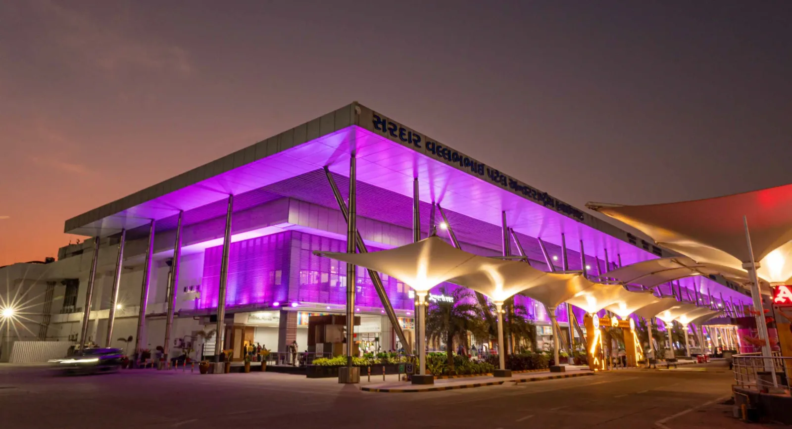
The terminal at night — purple light washing the cantilevered roof, columns over the kerbside, and the airport name in Gujarati along the fascia.
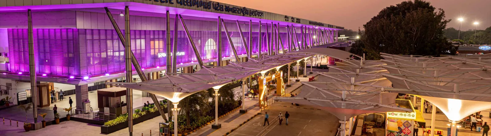
The terminal from the drop-off area — white tensile canopies over the roadway, with a continuous glass-and-steel frontage.

An art wall inside the terminal — two bronze figures in front of a line-drawn cityscape, with a screen showing the airport full name.
The photos come from the airport's official Adani Airports site and remain the copyright of their photographers; full credits and source links sit in the photo gallery on this page.
Airport at a glance
| Item | Detail |
|---|---|
| IATA / ICAO | AMD / VAAH |
| Role | Large airport and international gateway for Gujarat |
| Elevation | about 58 m |
| Coordinates | 23.0772, 72.6347 |
| Runway | 1: 05/23, 3,505 m × 46 m asphalt |
| Non-stop destinations | 18 (9 domestic, 9 international; 2014 snapshot) |
| Official site | svpia-ahmedabad.adaniairports.com |
Network shape: nine domestic, nine international
By distance: 6 destinations within 1,000 km, 10 between 1,000 and 3,000 km, 2 between 3,000 and 6,000 km, and none beyond 6,000 km. The near layer is Mumbai (444 km), Pune (517 km) and Jaipur (526 km). The far layer is Kuwait (2,549 km), Kuala Lumpur (3,861 km) and Singapore (4,157 km). Nine domestic routes tie Ahmedabad to India's main cities; nine international ones point to the Gulf, Southeast Asia and South Asian neighbours.
| Distance band | Destinations |
|---|---|
| Under 1,000 km | 6 |
| 1,000–3,000 km | 10 |
| 3,000–6,000 km | 2 |
| Over 6,000 km | 0 |
IndiGo Airlines appears on 9 routes, SpiceJet on 7, Air India on 4, and Jet Airways and Go Air on 3 each. The carrier column includes codeshares, so the figures describe concentration. The full list is on the Ahmedabad route map.
Getting there and navigating
- Coordinates: 23.0772, 72.6347
- Official site: svpia-ahmedabad.adaniairports.com
- Open in a map: Google Maps | Amap | Baidu Maps
If fares are close, compare Delhi (DEL): about 755 km away with 96 non-stop destinations. Delhi is also on AMD's own route map, so a short connection is practical; for Europe or North America, the usual path is via Delhi, Mumbai or a Gulf hub.
The location map on this page shows the field against Ahmedabad and the road network. This page does not cover terminal connections or local transport; confirm them with the airport or airline.
Before you fly
- Allow 2–3 hours for an international departure and 90–120 minutes for a domestic one. A single-runway airport can queue at morning and evening peaks.
- The 18 destinations are a 2014 snapshot. IndiGo and SpiceJet have expanded their Indian networks substantially since; check the airline's current schedule.
- The purple lighting and tensile canopies are part of the terminal's exterior. At night the kerbside is darker than the building, so agree on a pickup point with your driver in advance.
About the data
Runways, elevation and coordinates come from OurAirports open data. Routes and carriers come from the June 2014 OpenFlights snapshot and include codeshares and interline services; they indicate network shape and scale, not current schedules. Photos come from the airport's official Adani Airports site and remain the copyright of their photographers.
History
Named after India's first deputy prime minister, Sardar Vallabhbhai Patel, the airport serves Ahmedabad and Gandhinagar as the country's eighth busiest field — some 250 movements a day. It spans 1,124 acres with a 3,600 m runway and four terminals (domestic, international, secondary and cargo).
Source: Ahmedabad Airport.
読者コメントディスカッション
質問、旅行記、訂正など、お気軽にお寄せください。コメントは公開されます。
読み込み中…
コメントを読み込み中…