
Adampur Airport
 Adampur · Индия· Adampur Airport
Adampur Airport (IATA: AIP, ICAO VIAX) — малый аэропорт в городе Adampur, Индия.
Adampur Airport is a small airport, at an elevation of about 775 ft, with scheduled passenger service. This page gathers its location map, airport codes and travel information.
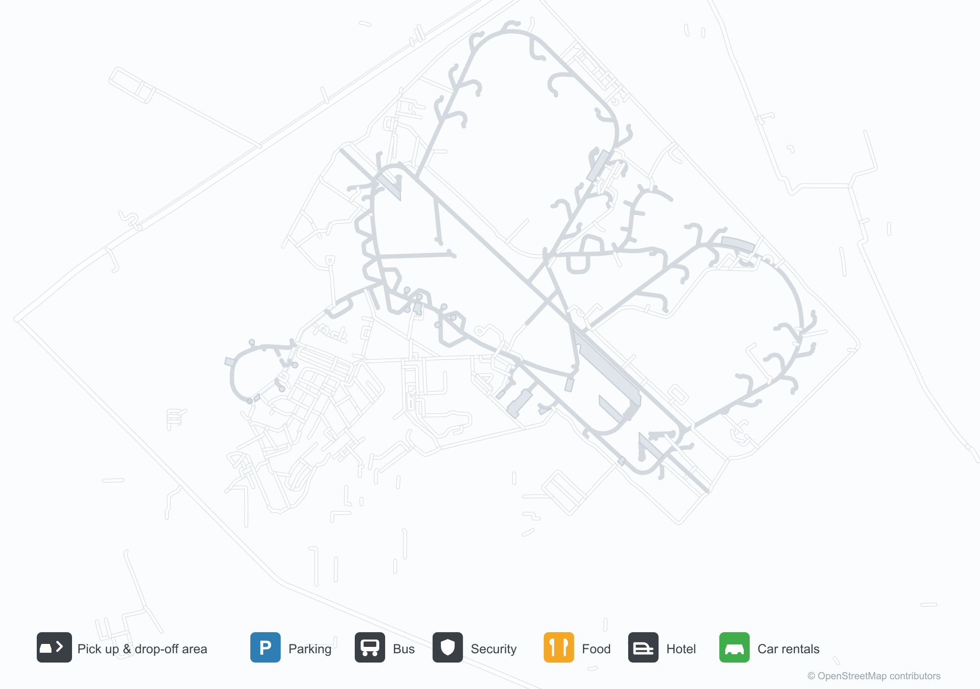
Скачать карты аэропортаЗагрузки
Фотографии аэропортаФото аэропорта
Реальные фотографии этого аэропорта; у каждой указан источник — общедоступная веб-страница. Авторские права принадлежат фотографам. Нажмите на фото, чтобы увеличить, или на подпись, чтобы открыть источник.
Вид со спутника: аэропорт Адампур (AIP) окружён зелёной растительностью и сельхозугодьями.
Под ясным небом синяя вывеска Adampur венчает стеклянный терминал, а на ступенях позирует группа людей.
Арочные окна и небольшой купольный павильон украшают терминал аэропорта Адампур, на газоне — высокий флагшток и красная дорожка.
Две пожарные машины пускают водяные струи аркой над авиалайнером на перроне, в стороне стоит вертолёт.
В сумерках перед подсвеченным терминалом бьёт фонтан, а на высоком флагштоке висит индийский флаг.
Сотрудники в ярких светоотражающих жилетах выстроились длинной шеренгой на мощёной площадке перед терминалом.
Красно-белый турбовинтовой самолёт SpiceJet отдыхает на перроне, рядом под дымчатым небом ходят наземные службы и посетители.
Низкое одноэтажное здание с синей вывеской, где название аэропорта Адампур написано на панджаби и английском, у двери — полосатый навес.
Adampur Airport: рейсы — вылеты и прилётыТабло рейсов
4 номеров рейсов у 2 авиакомпаний по 2 направлениям, с разбивкой по направлению. Номера код-шеринга также включены.
| Рейс | Авиакомпания | Направление | Страна/регион |
|---|---|---|---|
| 6E5932 | IndiGo | Chhatrapati Shivaji Maharaj International Airport | Индия |
| S5235 | Star Air | HDO |
Номера рейсов и маршруты из индекса рейсов aviability.com (снимок 26 октября 2026 г.); номера код-шеринга включены, время вылета не указано. Источник: aviability.com ↗
Информация об аэропортеСведения об аэропорте
Интерактивная карта: Adampur AirportИнтерактивная карта
Посмотреть этот аэропорт на других картографических сервисах:
Adampur Airport (AIP) Guide: A small field and its surroundingsПутеводитель по аэропорту
Adampur Airport (AIP) lies in India, with satellite imagery showing green vegetation and farmland. The field sits at about 236 m above sea level and has a single 2,755 m runway; the 2014 route snapshot records no scheduled services. The nearest airport is Halwara International Airport (77.2 km).
Satellite view
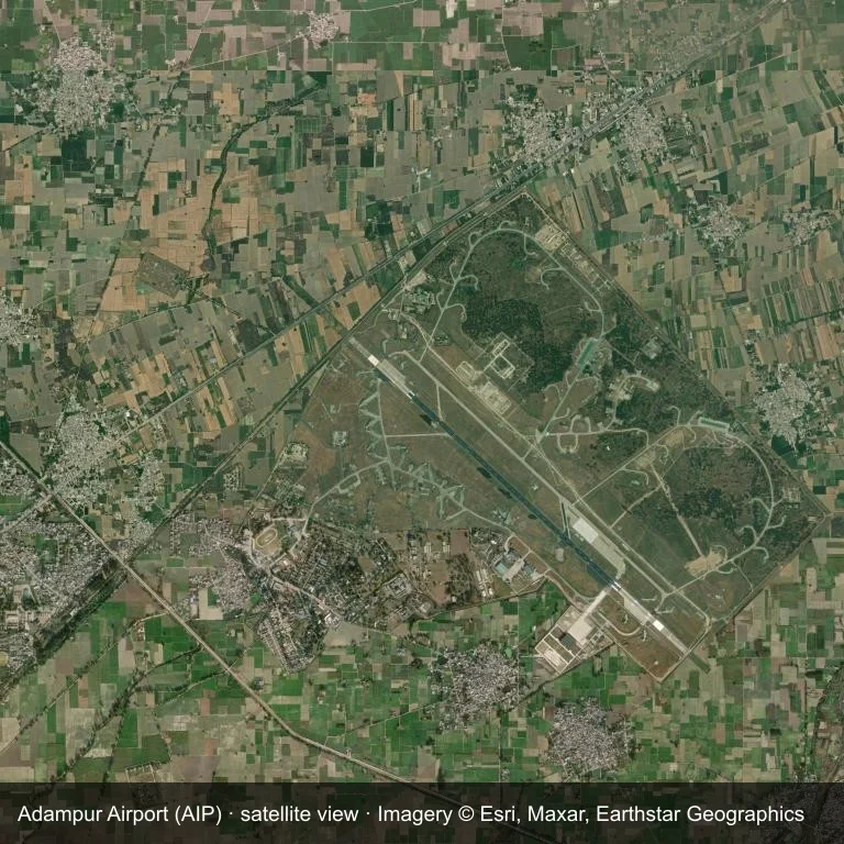
The field at Adampur Airport (AIP) seen from orbit, set in green vegetation and farmland.
The image is Esri World Imagery (© Esri, Maxar, Earthstar Geographics), labelled with the field and source. It is a satellite view, not a ground photo.
Airport at a glance
| Item | Detail |
|---|---|
| IATA / ICAO | AIP / VIAX |
| Role | small airport |
| Elevation | about 236 m |
| Coordinates | 31.4338, 75.7588 |
| Runways | 1, longest 2,755 m |
| Non-stop destinations | 0 in the 2014 snapshot |
Runways
| Runway | Length | Surface |
|---|---|---|
| 13/31 | 2,755 m | ASP |
Why there is no route table
No non-stop schedule was captured for AIP in 2014. For current movements, consult the airport operator or a recent flight-planning source.
Nearby airports
| Airport | Distance | Non-stop destinations |
|---|---|---|
| Halwara International Airport (HWR) | ~77.2 km | — |
| Pathankot Airport (IXP) | ~89.7 km | — |
| Kangra Airport (DHM) | ~94.2 km | 1 |
Getting there and navigating
- Coordinates: 31.4338, 75.7588
- Open in a map: Google Maps | Amap | Baidu Maps
The location map gives the field's position relative to nearby roads and towns. Terminal and local-transport details are outside this dataset.
Runway and surroundings
From the air, Adampur Airport appears within green vegetation and farmland in India. The primary strip, 13/31, is oriented northwest–southeast and extends 2,755 m at about 236 m.
That 2,755 m length is typical of narrowbody operations. The paved surface supports regular operations, though it does not imply scheduled service. The nearest airport is Halwara International Airport, 77.2 km away, with no recorded destinations in the same snapshot.
No scheduled services appear in the 2014 snapshot, so the field is best treated as a general-aviation or charter stop; confirm handling and current movements with the operator.
Before you fly
- The 2,755 m runway can take larger regional aircraft, but that does not guarantee scheduled service.
- The runway is paved, which supports year-round operations, but scheduled service is still not guaranteed.
- Halwara International Airport is the nearest airport in this dataset, 77.2 km away, but it also has no recorded destinations for 2014.
- Because the 2014 route table is empty, check the airport operator's current notices before making travel plans.
- Treat this as a general-aviation or charter field rather than a large terminal; confirm handling and opening hours in advance.
About the data
The airport facts on this page are drawn from OurAirports. Route data is the June 2014 OpenFlights snapshot, so treat it as historical context rather than a timetable.
Комментарии читателейОбсуждение
Вопросы, отчёты о поездках и исправления приветствуются. Комментарии видны всем.
Загрузка…
Загрузка комментариев…