
Sardar Vallabh Patel International Airport
 Ahmedabad · Índia· Sardar Vallabh Patel International Airport
O Sardar Vallabh Patel International Airport (IATA: AMD, ICAO VAAH) é um aeroporto grande que atende Ahmedabad, Índia.
Sardar Vallabh Patel International Airport is a large airport, at an elevation of about 189 ft, with scheduled passenger service. This page gathers its location map, airport codes and travel information.
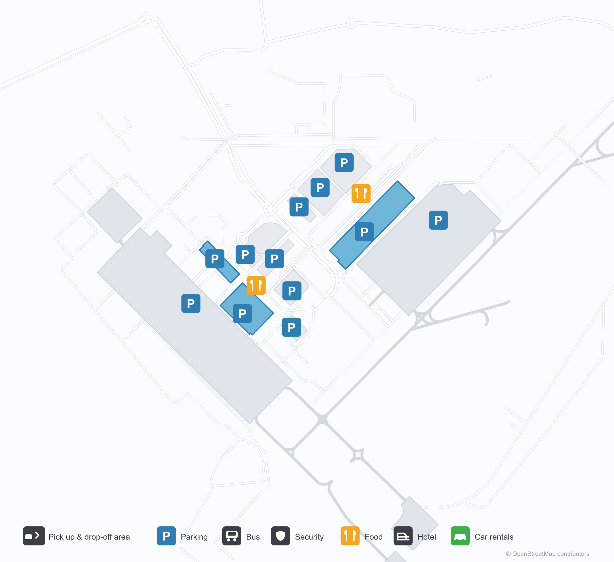
Baixar mapas do aeroportoDownloads
Fotos do aeroportoFotos do aeroporto
Fotos reais deste aeroporto, cada uma creditada à página pública da web onde foi encontrada; os direitos autorais continuam com os fotógrafos originais. Clique em uma foto para ampliar ou em uma linha de crédito para abrir a página de origem.
O terminal à noite — luz roxa banhando o telhado em balanço, colunas sobre o meio-fio e o nome do aeroporto em guzerate ao longo da faixa.
O terminal visto da área de desembarque — coberturas tensionadas brancas sobre a via, com uma fachada contínua de vidro e aço.
Uma parede de arte dentro do terminal — duas figuras de bronze diante de uma cidade desenhada a traço, com uma tela exibindo o nome completo do aeroporto.
À luz do dia, a frente do terminal exibe o nome completo do aeroporto em letras azuis, com viajantes e carros brancos passando pelo meio-fio abaixo.
Com o anoitecer, a luz roxa banha a frente do terminal enquanto uma passarela de cobertura branca atravessa a via em direção a uma fileira iluminada de pequenas lojas.
Um avião com pintura da IndiGo está no pátio de concreto, com o terminal e marcações pintadas da pista de táxi visíveis ao fundo.
Uma vista aérea do terminal mostra um telhado prateado em várias partes, estacionamentos e uma via circular em frente, com um avião estacionado no pátio ao lado.
À noite, coberturas tensionadas brancas iluminadas por baixo abrigam pedestres na praça frontal, com a fachada iluminada do terminal atrás deles.
Vista aérea ao anoitecer de uma torre alta que se abre no topo, brilhando em tons quentes com faixas de luz colorida, ao lado de edifícios mais baixos e uma cidade iluminada abaixo das colinas.
Em um pátio molhado pela chuva à noite, um jato da IndiGo aguarda em seu posicionamento enquanto equipamentos de solo ficam perto do nariz.
Sardar Vallabh Patel International Airport: mapa de rotas — destinos diretosMapa de rotas
18 destinos diretos: mapa, companhias aéreas em operação e distâncias.
Sardar Vallabh Patel International Airport: voos — partidas e chegadasPainel de voos
847 números de voo de 45 companhias aéreas para 55 destinos, separados por direção. Números de codeshare estão incluídos.
| Voo | Companhia aérea | Destino | País/região |
|---|---|---|---|
| 3L112 | Air Arabia Abu Dhabi | Zayed International Airport | Emirados Árabes Unidos |
| 6E75 | IndiGo | King Abdulaziz International Airport | Arábia Saudita |
| 6E133 | IndiGo | Dehradun (Jauligrant) (DED) Dehradun Jolly Grant Airport | Índia |
| 6E181 | IndiGo | Rajiv Gandhi International Airport | Índia |
| 6E319 | IndiGo | Netaji Subhash Chandra Bose International Airport | Índia |
| 6E346 | IndiGo | Amritsar (ATQ) Sri Guru Ram Das Ji International Airport | Índia |
| 6E348 | IndiGo | Chennai International Airport | Índia |
| 6E367 | IndiGo | Vasco da Gama (GOI) Goa Dabolim International Airport | Índia |
| 6E383 | IndiGo | Rajiv Gandhi International Airport | Índia |
| 6E396 | IndiGo | Aeroporto Internacional Indira Gandhi | Índia |
| 6E431 | IndiGo | Chennai International Airport | Índia |
| 6E450 | IndiGo | Netaji Subhash Chandra Bose International Airport | Índia |
| 6E479 | IndiGo | Chennai International Airport | Índia |
| 6E481 | IndiGo | Kempegowda International Airport Bengaluru | Índia |
| 6E522 | IndiGo | Navi Mumbai (NMI) Navi Mumbai International Airport | Índia |
| 6E522 | IndiGo | Pune (PNQ) Pune International Airport | Índia |
| 6E635 | IndiGo | Rajiv Gandhi International Airport | Índia |
| 6E699 | IndiGo | Pune (PNQ) Pune International Airport | Índia |
| 6E751 | IndiGo | Netaji Subhash Chandra Bose International Airport | Índia |
| 6E793 | IndiGo | Chhatrapati Shivaji Maharaj International Airport | Índia |
Números de voo e rotas do índice de voos da aviability.com (instantâneo de 26 de outubro de 2026); números de codeshare estão incluídos e nenhum horário de partida é exibido. Fonte: aviability.com ↗
Informações e detalhes do aeroportoDetalhes do aeroporto
Mapa interativo — localização do Sardar Vallabh Patel International AirportMapa interativo
Veja este aeroporto em outros serviços de mapas:
Ahmedabad Airport (AMD): Eighteen Routes Under a Purple RoofGuia do aeroporto
The official photos of Ahmedabad's airport lead with colour: the terminal's cantilevered roof washed in purple light, columns over the kerbside, and a second view where white tensile canopies spread above the drop-off road and a glass-and-steel frontage runs along the building. This is not an airport that relies on sheer size for identity. Inside, an art wall sets two bronze figures against a line-drawn cityscape, with a screen carrying the airport's full name.
Sardar Vallabhbhai Patel International Airport (IATA AMD, ICAO VAAH) serves Ahmedabad in Gujarat, India, at an elevation of about 58 m, with a single 3,505 m runway (05/23). The 2014 route snapshot records 18 non-stop destinations, split evenly between domestic and international.
Airport photos
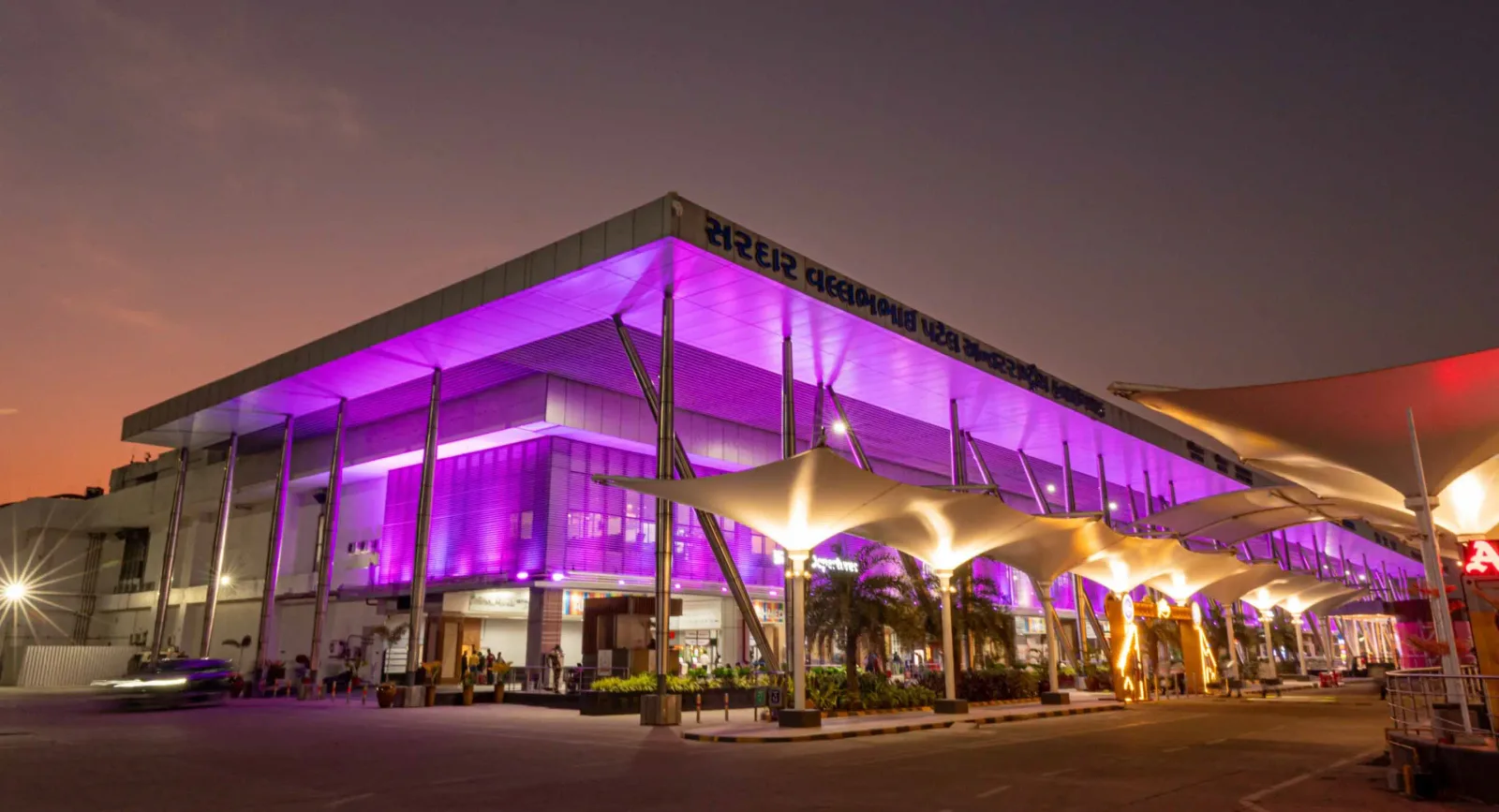
The terminal at night — purple light washing the cantilevered roof, columns over the kerbside, and the airport name in Gujarati along the fascia.
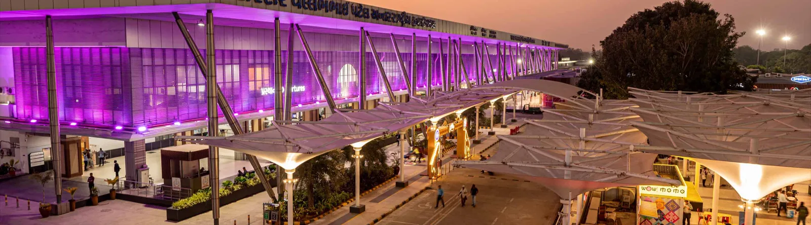
The terminal from the drop-off area — white tensile canopies over the roadway, with a continuous glass-and-steel frontage.

An art wall inside the terminal — two bronze figures in front of a line-drawn cityscape, with a screen showing the airport full name.
The photos come from the airport's official Adani Airports site and remain the copyright of their photographers; full credits and source links sit in the photo gallery on this page.
Airport at a glance
| Item | Detail |
|---|---|
| IATA / ICAO | AMD / VAAH |
| Role | Large airport and international gateway for Gujarat |
| Elevation | about 58 m |
| Coordinates | 23.0772, 72.6347 |
| Runway | 1: 05/23, 3,505 m × 46 m asphalt |
| Non-stop destinations | 18 (9 domestic, 9 international; 2014 snapshot) |
| Official site | svpia-ahmedabad.adaniairports.com |
Network shape: nine domestic, nine international
By distance: 6 destinations within 1,000 km, 10 between 1,000 and 3,000 km, 2 between 3,000 and 6,000 km, and none beyond 6,000 km. The near layer is Mumbai (444 km), Pune (517 km) and Jaipur (526 km). The far layer is Kuwait (2,549 km), Kuala Lumpur (3,861 km) and Singapore (4,157 km). Nine domestic routes tie Ahmedabad to India's main cities; nine international ones point to the Gulf, Southeast Asia and South Asian neighbours.
| Distance band | Destinations |
|---|---|
| Under 1,000 km | 6 |
| 1,000–3,000 km | 10 |
| 3,000–6,000 km | 2 |
| Over 6,000 km | 0 |
IndiGo Airlines appears on 9 routes, SpiceJet on 7, Air India on 4, and Jet Airways and Go Air on 3 each. The carrier column includes codeshares, so the figures describe concentration. The full list is on the Ahmedabad route map.
Getting there and navigating
- Coordinates: 23.0772, 72.6347
- Official site: svpia-ahmedabad.adaniairports.com
- Open in a map: Google Maps | Amap | Baidu Maps
If fares are close, compare Delhi (DEL): about 755 km away with 96 non-stop destinations. Delhi is also on AMD's own route map, so a short connection is practical; for Europe or North America, the usual path is via Delhi, Mumbai or a Gulf hub.
The location map on this page shows the field against Ahmedabad and the road network. This page does not cover terminal connections or local transport; confirm them with the airport or airline.
Before you fly
- Allow 2–3 hours for an international departure and 90–120 minutes for a domestic one. A single-runway airport can queue at morning and evening peaks.
- The 18 destinations are a 2014 snapshot. IndiGo and SpiceJet have expanded their Indian networks substantially since; check the airline's current schedule.
- The purple lighting and tensile canopies are part of the terminal's exterior. At night the kerbside is darker than the building, so agree on a pickup point with your driver in advance.
About the data
Runways, elevation and coordinates come from OurAirports open data. Routes and carriers come from the June 2014 OpenFlights snapshot and include codeshares and interline services; they indicate network shape and scale, not current schedules. Photos come from the airport's official Adani Airports site and remain the copyright of their photographers.
History
Named after India's first deputy prime minister, Sardar Vallabhbhai Patel, the airport serves Ahmedabad and Gandhinagar as the country's eighth busiest field — some 250 movements a day. It spans 1,124 acres with a 3,600 m runway and four terminals (domestic, international, secondary and cargo).
Source: Ahmedabad Airport.
Comentários dos leitoresDiscussão
Perguntas, relatos de viagem e correções são bem-vindos. Os comentários são públicos.
Carregando…
Carregando comentários…