
Sardar Vallabh Patel International Airport
 Ahmedabad · India· Sardar Vallabh Patel International Airport
Sardar Vallabh Patel International Airport (IATA: AMD, OACI VAAH) es un aeropuerto grande que da servicio a Ahmedabad, India.
Sardar Vallabh Patel International Airport is a large airport, at an elevation of about 189 ft, with scheduled passenger service. This page gathers its location map, airport codes and travel information.
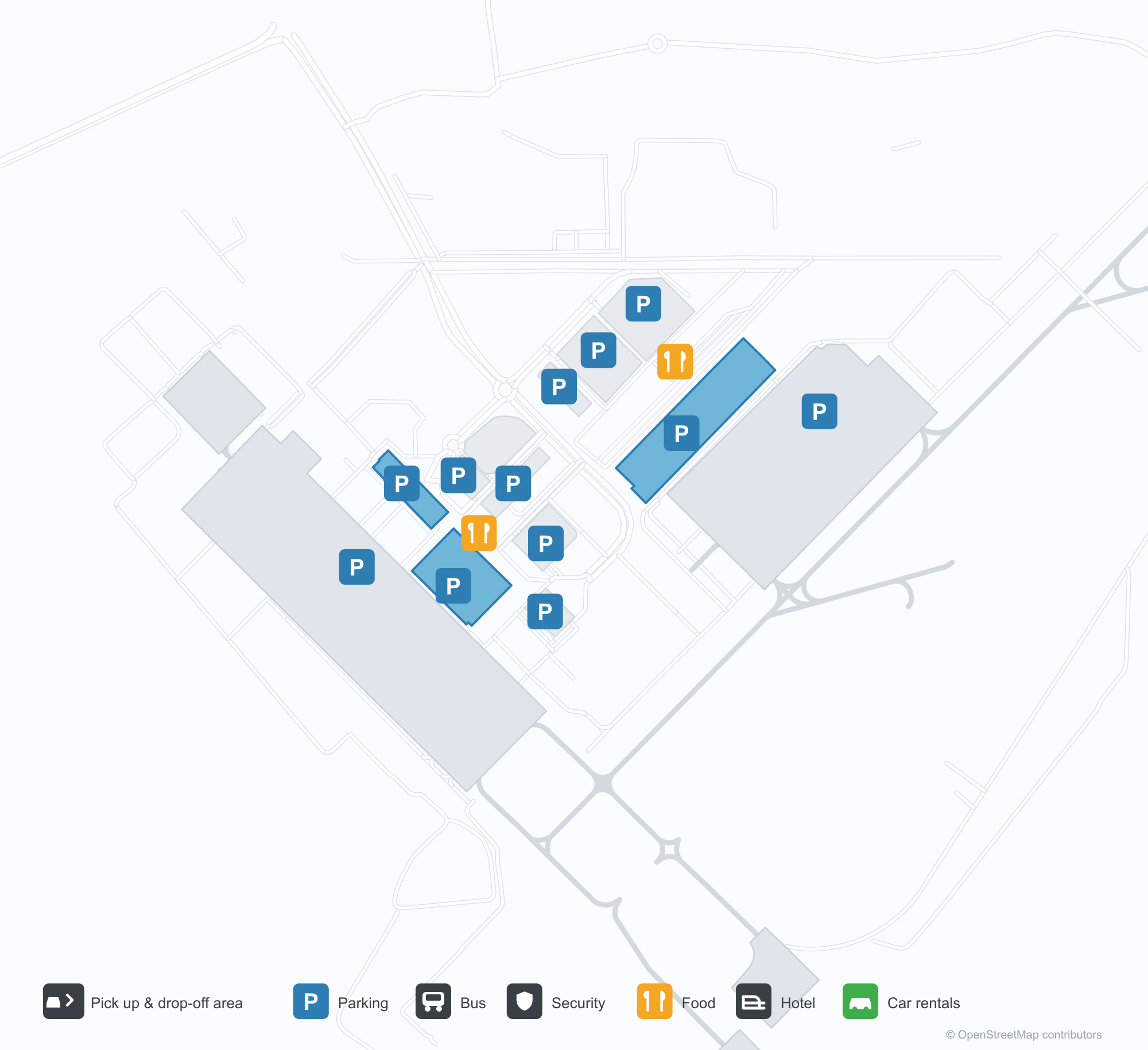
Descargar mapas de aeropuertosDescargas
Fotos del aeropuertoFotos del aeropuerto
Fotos reales de este aeropuerto, cada una con la referencia de la página web pública donde se encontró; los derechos de autor siguen siendo de los fotógrafos originales. Haz clic en una foto para ampliarla o en la línea de crédito para abrir su página de origen.
La terminal de noche: una luz violeta baña el tejado voladizo, hay columnas sobre el bordillo y el nombre del aeropuerto en guyaratí recorre el friso.
La terminal desde la zona de descenso de pasajeros: marquesinas tensadas blancas sobre la calzada, con una fachada continua de vidrio y acero.
Un muro artístico dentro de la terminal: dos figuras de bronce frente a un perfil urbano dibujado a línea, con una pantalla que muestra el nombre completo del aeropuerto.
De día, la fachada de la terminal luce el nombre completo del aeropuerto en letras azules, con viajeros y coches blancos moviéndose por el bordillo de abajo.
Cuando cae la noche, una luz violeta baña la fachada de la terminal mientras una pasarela de marquesina blanca cruza la calzada hacia una hilera iluminada de pequeñas tiendas.
Un avión con la librea de IndiGo está en la plataforma de hormigón, con la terminal y las marcas pintadas de la calle de rodaje visibles al fondo.
Una vista aérea de la terminal muestra un tejado plateado de varias partes, aparcamientos y una ronda delante, con un avión aparcado en la plataforma junto a él.
De noche, marquesinas tensadas blancas iluminadas desde abajo cobijan a los paseantes en la plaza del patio, con la fachada iluminada de la terminal detrás.
Vista aérea al atardecer de una torre alta que se ensancha en la parte superior, brillando con franjas de luz de colores, junto a edificios más bajos y una localidad iluminada bajo las colinas.
En una plataforma mojada por la lluvia de noche, un avión de IndiGo espera en su posición mientras el equipo de tierra está cerca del morro.
Mapa de rutas de Sardar Vallabh Patel International Airport — destinos directosMapa de rutas
18 destinos directos: mapa, aerolíneas que operan y distancias.
Vuelos de Sardar Vallabh Patel International Airport — salidas y llegadasPanel de vuelos
847 números de vuelo de 45 aerolíneas y 55 destinos, divididos por dirección. Se incluyen los números de código compartido.
| Vuelo | Aerolínea | Destino | País/región |
|---|---|---|---|
| 3L112 | Air Arabia Abu Dhabi | Zayed International Airport | Emiratos Árabes Unidos |
| 6E75 | IndiGo | King Abdulaziz International Airport | Arabia Saudita |
| 6E133 | IndiGo | Dehradun (Jauligrant) (DED) Dehradun Jolly Grant Airport | India |
| 6E181 | IndiGo | Rajiv Gandhi International Airport | India |
| 6E319 | IndiGo | Netaji Subhash Chandra Bose International Airport | India |
| 6E346 | IndiGo | Amritsar (ATQ) Sri Guru Ram Das Ji International Airport | India |
| 6E348 | IndiGo | Chennai International Airport | India |
| 6E367 | IndiGo | Vasco da Gama (GOI) Goa Dabolim International Airport | India |
| 6E383 | IndiGo | Rajiv Gandhi International Airport | India |
| 6E396 | IndiGo | Aeropuerto Internacional Indira Gandhi | India |
| 6E431 | IndiGo | Chennai International Airport | India |
| 6E450 | IndiGo | Netaji Subhash Chandra Bose International Airport | India |
| 6E479 | IndiGo | Chennai International Airport | India |
| 6E481 | IndiGo | Kempegowda International Airport Bengaluru | India |
| 6E522 | IndiGo | Navi Mumbai (NMI) Navi Mumbai International Airport | India |
| 6E522 | IndiGo | Pune (PNQ) Pune International Airport | India |
| 6E635 | IndiGo | Rajiv Gandhi International Airport | India |
| 6E699 | IndiGo | Pune (PNQ) Pune International Airport | India |
| 6E751 | IndiGo | Netaji Subhash Chandra Bose International Airport | India |
| 6E793 | IndiGo | Chhatrapati Shivaji Maharaj International Airport | India |
Números de vuelo y rutas del índice de vuelos de aviability.com (instantánea de 26 de octubre de 2026); se incluyen los números de código compartido y no se muestran horarios de salida. Fuente: aviability.com ↗
Información y datos del aeropuertoDatos del aeropuerto
Mapa interactivo — ubicación de Sardar Vallabh Patel International AirportMapa interactivo
Consulta este aeropuerto en otros servicios de mapas:
Ahmedabad Airport (AMD): Eighteen Routes Under a Purple RoofGuía del aeropuerto
The official photos of Ahmedabad's airport lead with colour: the terminal's cantilevered roof washed in purple light, columns over the kerbside, and a second view where white tensile canopies spread above the drop-off road and a glass-and-steel frontage runs along the building. This is not an airport that relies on sheer size for identity. Inside, an art wall sets two bronze figures against a line-drawn cityscape, with a screen carrying the airport's full name.
Sardar Vallabhbhai Patel International Airport (IATA AMD, ICAO VAAH) serves Ahmedabad in Gujarat, India, at an elevation of about 58 m, with a single 3,505 m runway (05/23). The 2014 route snapshot records 18 non-stop destinations, split evenly between domestic and international.
Airport photos
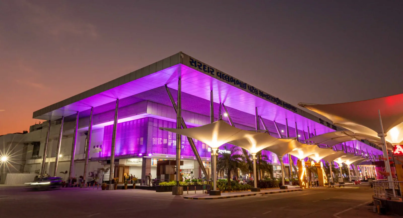
The terminal at night — purple light washing the cantilevered roof, columns over the kerbside, and the airport name in Gujarati along the fascia.
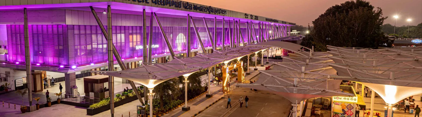
The terminal from the drop-off area — white tensile canopies over the roadway, with a continuous glass-and-steel frontage.

An art wall inside the terminal — two bronze figures in front of a line-drawn cityscape, with a screen showing the airport full name.
The photos come from the airport's official Adani Airports site and remain the copyright of their photographers; full credits and source links sit in the photo gallery on this page.
Airport at a glance
| Item | Detail |
|---|---|
| IATA / ICAO | AMD / VAAH |
| Role | Large airport and international gateway for Gujarat |
| Elevation | about 58 m |
| Coordinates | 23.0772, 72.6347 |
| Runway | 1: 05/23, 3,505 m × 46 m asphalt |
| Non-stop destinations | 18 (9 domestic, 9 international; 2014 snapshot) |
| Official site | svpia-ahmedabad.adaniairports.com |
Network shape: nine domestic, nine international
By distance: 6 destinations within 1,000 km, 10 between 1,000 and 3,000 km, 2 between 3,000 and 6,000 km, and none beyond 6,000 km. The near layer is Mumbai (444 km), Pune (517 km) and Jaipur (526 km). The far layer is Kuwait (2,549 km), Kuala Lumpur (3,861 km) and Singapore (4,157 km). Nine domestic routes tie Ahmedabad to India's main cities; nine international ones point to the Gulf, Southeast Asia and South Asian neighbours.
| Distance band | Destinations |
|---|---|
| Under 1,000 km | 6 |
| 1,000–3,000 km | 10 |
| 3,000–6,000 km | 2 |
| Over 6,000 km | 0 |
IndiGo Airlines appears on 9 routes, SpiceJet on 7, Air India on 4, and Jet Airways and Go Air on 3 each. The carrier column includes codeshares, so the figures describe concentration. The full list is on the Ahmedabad route map.
Getting there and navigating
- Coordinates: 23.0772, 72.6347
- Official site: svpia-ahmedabad.adaniairports.com
- Open in a map: Google Maps | Amap | Baidu Maps
If fares are close, compare Delhi (DEL): about 755 km away with 96 non-stop destinations. Delhi is also on AMD's own route map, so a short connection is practical; for Europe or North America, the usual path is via Delhi, Mumbai or a Gulf hub.
The location map on this page shows the field against Ahmedabad and the road network. This page does not cover terminal connections or local transport; confirm them with the airport or airline.
Before you fly
- Allow 2–3 hours for an international departure and 90–120 minutes for a domestic one. A single-runway airport can queue at morning and evening peaks.
- The 18 destinations are a 2014 snapshot. IndiGo and SpiceJet have expanded their Indian networks substantially since; check the airline's current schedule.
- The purple lighting and tensile canopies are part of the terminal's exterior. At night the kerbside is darker than the building, so agree on a pickup point with your driver in advance.
About the data
Runways, elevation and coordinates come from OurAirports open data. Routes and carriers come from the June 2014 OpenFlights snapshot and include codeshares and interline services; they indicate network shape and scale, not current schedules. Photos come from the airport's official Adani Airports site and remain the copyright of their photographers.
History
Named after India's first deputy prime minister, Sardar Vallabhbhai Patel, the airport serves Ahmedabad and Gandhinagar as the country's eighth busiest field — some 250 movements a day. It spans 1,124 acres with a 3,600 m runway and four terminals (domestic, international, secondary and cargo).
Source: Ahmedabad Airport.
Comentarios de los lectoresDebate
Las preguntas, los relatos de viaje y las correcciones son bienvenidos. Los comentarios son públicos.
Cargando…
Cargando comentarios…