
Sardar Vallabh Patel International Airport
 Ahmedabad · Hindistan· Sardar Vallabh Patel International Airport
Sardar Vallabh Patel International Airport (IATA: AMD, ICAO VAAH), Ahmedabad, Hindistan kentine hizmet veren bir büyük havalimanıdır.
Sardar Vallabh Patel International Airport is a large airport, at an elevation of about 189 ft, with scheduled passenger service. This page gathers its location map, airport codes and travel information.
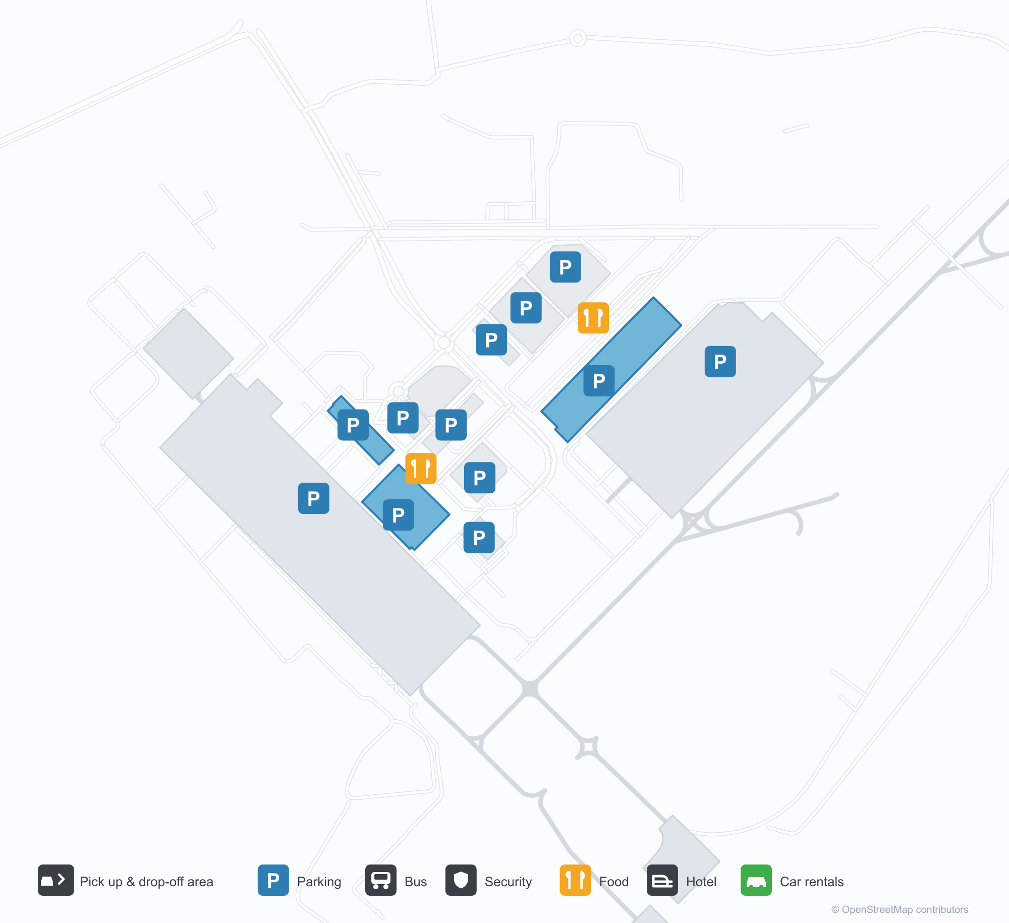
Havalimanı Haritalarını İndirinİndirmeler
Havalimanı fotoğraflarıHavalimanı Fotoğrafları
Bu havalimanının gerçek fotoğrafları; her fotoğrafın altında, fotoğrafın bulunduğu kamuya açık web sayfasına bir atıf yer alır ve telif hakkı özgün fotoğrafçılarda kalır. Yakınlaştırmak için bir fotoğrafa, kaynak sayfasını açmak için bir atıf satırına tıklayın.
Geceleyin terminal — mor ışık konsol çatıyı yıkıyor, kaldırım üzerinde kolonlar var ve cephe boyunca havalimanının adı Gucaratça yazılı.
İndirme alanından terminal — yolun üzerinde beyaz çekme tenteler ve kesintisiz cam-çelik bir cephe.
Terminalin içindeki bir sanat duvarı — çizgisel şehir siluetinin önünde iki bronz figür; ekranda havalimanının tam adı görünüyor.
Gündüz vakti terminal cephesinde havalimanının tam adı mavi harflerle yazılı; aşağıda kaldırım boyunca yolcular ve beyaz arabalar hareket ediyor.
Alacakaranlık derinleşirken mor ışık terminal cephesini yıkıyor; beyaz tenteli bir yürüyüş yolu, aydınlatılmış küçük dükkân sırasına doğru yolu kat ediyor.
IndiGo boyalı bir yolcu uçağı beton apronda duruyor; arka planda terminal ve boyalı taksi yolu işaretleri görünüyor.
Terminalin havadan görünümü, çok parçalı gümüş bir çatı, önünde otoparklar ve bir çevre yolu gösteriyor; yanındaki apronda bir yolcu uçağı park etmiş.
Geceleyin alttan aydınlatılan beyaz çekme tenteler, ön avlu meydanında yürüyenleri koruyor; arkalarında aydınlatılmış terminal cephesi var.
Alacakaranlıkta havadan: tepesinde genişleyen, sıcak renkte parlayan ve renkli ışık şeritleri taşıyan yüksek bir kule; yanında alçak binalar ve tepelerin altında aydınlatılmış bir kasaba.
Geceleyin yağmurla ıslanmış apronda bir IndiGo jeti park yerinde bekliyor; burnunun yakınında yer ekipmanları duruyor.
Sardar Vallabh Patel International Airport rota haritası — doğrudan varış noktalarıRota Haritası
18 doğrudan varış noktası: harita, sefer yapan havayolu şirketleri ve mesafeler.
Sardar Vallabh Patel International Airport uçuşları — kalkışlar ve varışlarUçuş Panosu
847 uçuş numarası, 45 havayolu şirketi ve 55 varış noktası, yönlere göre ayrılmıştır. Ortak uçuş numaraları dahildir.
| Uçuş | Havayolu şirketi | Varış noktası | Ülke/bölge |
|---|---|---|---|
| 3L112 | Air Arabia Abu Dhabi | Zayed International Airport | Birleşik Arap Emirlikleri |
| 6E75 | IndiGo | King Abdulaziz International Airport | Suudi Arabistan |
| 6E133 | IndiGo | Dehradun (Jauligrant) (DED) Dehradun Jolly Grant Airport | Hindistan |
| 6E181 | IndiGo | Rajiv Gandhi International Airport | Hindistan |
| 6E319 | IndiGo | Netaji Subhash Chandra Bose International Airport | Hindistan |
| 6E346 | IndiGo | Amritsar (ATQ) Sri Guru Ram Das Ji International Airport | Hindistan |
| 6E348 | IndiGo | Chennai International Airport | Hindistan |
| 6E367 | IndiGo | Vasco da Gama (GOI) Goa Dabolim International Airport | Hindistan |
| 6E383 | IndiGo | Rajiv Gandhi International Airport | Hindistan |
| 6E396 | IndiGo | Indira Gandhi Uluslararası Havalimanı | Hindistan |
| 6E431 | IndiGo | Chennai International Airport | Hindistan |
| 6E450 | IndiGo | Netaji Subhash Chandra Bose International Airport | Hindistan |
| 6E479 | IndiGo | Chennai International Airport | Hindistan |
| 6E481 | IndiGo | Kempegowda International Airport Bengaluru | Hindistan |
| 6E522 | IndiGo | Navi Mumbai (NMI) Navi Mumbai International Airport | Hindistan |
| 6E522 | IndiGo | Pune (PNQ) Pune International Airport | Hindistan |
| 6E635 | IndiGo | Rajiv Gandhi International Airport | Hindistan |
| 6E699 | IndiGo | Pune (PNQ) Pune International Airport | Hindistan |
| 6E751 | IndiGo | Netaji Subhash Chandra Bose International Airport | Hindistan |
| 6E793 | IndiGo | Chhatrapati Shivaji Maharaj International Airport | Hindistan |
Uçuş numaraları ve rotalar aviability.com uçuş dizininden (anlık görüntü: 26 Ekim 2026); ortak uçuş numaraları dahildir ve kalkış saatleri gösterilmez. Kaynak: aviability.com ↗
Havalimanı bilgileri ve ayrıntılarıHavalimanı Ayrıntıları
Etkileşimli harita — Sardar Vallabh Patel International Airport konumuEtkileşimli Harita
Bu havalimanını diğer harita hizmetlerinde görüntüleyin:
Ahmedabad Airport (AMD): Eighteen Routes Under a Purple RoofHavalimanı Rehberi
The official photos of Ahmedabad's airport lead with colour: the terminal's cantilevered roof washed in purple light, columns over the kerbside, and a second view where white tensile canopies spread above the drop-off road and a glass-and-steel frontage runs along the building. This is not an airport that relies on sheer size for identity. Inside, an art wall sets two bronze figures against a line-drawn cityscape, with a screen carrying the airport's full name.
Sardar Vallabhbhai Patel International Airport (IATA AMD, ICAO VAAH) serves Ahmedabad in Gujarat, India, at an elevation of about 58 m, with a single 3,505 m runway (05/23). The 2014 route snapshot records 18 non-stop destinations, split evenly between domestic and international.
Airport photos
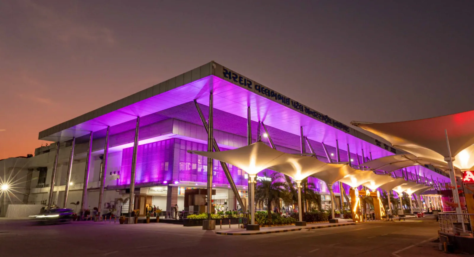
The terminal at night — purple light washing the cantilevered roof, columns over the kerbside, and the airport name in Gujarati along the fascia.

The terminal from the drop-off area — white tensile canopies over the roadway, with a continuous glass-and-steel frontage.

An art wall inside the terminal — two bronze figures in front of a line-drawn cityscape, with a screen showing the airport full name.
The photos come from the airport's official Adani Airports site and remain the copyright of their photographers; full credits and source links sit in the photo gallery on this page.
Airport at a glance
| Item | Detail |
|---|---|
| IATA / ICAO | AMD / VAAH |
| Role | Large airport and international gateway for Gujarat |
| Elevation | about 58 m |
| Coordinates | 23.0772, 72.6347 |
| Runway | 1: 05/23, 3,505 m × 46 m asphalt |
| Non-stop destinations | 18 (9 domestic, 9 international; 2014 snapshot) |
| Official site | svpia-ahmedabad.adaniairports.com |
Network shape: nine domestic, nine international
By distance: 6 destinations within 1,000 km, 10 between 1,000 and 3,000 km, 2 between 3,000 and 6,000 km, and none beyond 6,000 km. The near layer is Mumbai (444 km), Pune (517 km) and Jaipur (526 km). The far layer is Kuwait (2,549 km), Kuala Lumpur (3,861 km) and Singapore (4,157 km). Nine domestic routes tie Ahmedabad to India's main cities; nine international ones point to the Gulf, Southeast Asia and South Asian neighbours.
| Distance band | Destinations |
|---|---|
| Under 1,000 km | 6 |
| 1,000–3,000 km | 10 |
| 3,000–6,000 km | 2 |
| Over 6,000 km | 0 |
IndiGo Airlines appears on 9 routes, SpiceJet on 7, Air India on 4, and Jet Airways and Go Air on 3 each. The carrier column includes codeshares, so the figures describe concentration. The full list is on the Ahmedabad route map.
Getting there and navigating
- Coordinates: 23.0772, 72.6347
- Official site: svpia-ahmedabad.adaniairports.com
- Open in a map: Google Maps | Amap | Baidu Maps
If fares are close, compare Delhi (DEL): about 755 km away with 96 non-stop destinations. Delhi is also on AMD's own route map, so a short connection is practical; for Europe or North America, the usual path is via Delhi, Mumbai or a Gulf hub.
The location map on this page shows the field against Ahmedabad and the road network. This page does not cover terminal connections or local transport; confirm them with the airport or airline.
Before you fly
- Allow 2–3 hours for an international departure and 90–120 minutes for a domestic one. A single-runway airport can queue at morning and evening peaks.
- The 18 destinations are a 2014 snapshot. IndiGo and SpiceJet have expanded their Indian networks substantially since; check the airline's current schedule.
- The purple lighting and tensile canopies are part of the terminal's exterior. At night the kerbside is darker than the building, so agree on a pickup point with your driver in advance.
About the data
Runways, elevation and coordinates come from OurAirports open data. Routes and carriers come from the June 2014 OpenFlights snapshot and include codeshares and interline services; they indicate network shape and scale, not current schedules. Photos come from the airport's official Adani Airports site and remain the copyright of their photographers.
History
Named after India's first deputy prime minister, Sardar Vallabhbhai Patel, the airport serves Ahmedabad and Gandhinagar as the country's eighth busiest field — some 250 movements a day. It spans 1,124 acres with a 3,600 m runway and four terminals (domestic, international, secondary and cargo).
Source: Ahmedabad Airport.
Okuyucu yorumlarıTartışma
Sorular, seyahat deneyimleri ve düzeltmeler memnuniyetle karşılanır. Yorumlar herkese açıktır.
Yükleniyor…
Yorumlar yükleniyor…