
Adampur Airport
 Adampur · インド· Adampur Airport
Adampur Airport(IATA: AIP、ICAO: VIAX)はAdampur、インドにある小型空港です。
Adampur Airport is a small airport, at an elevation of about 775 ft, with scheduled passenger service. This page gathers its location map, airport codes and travel information.
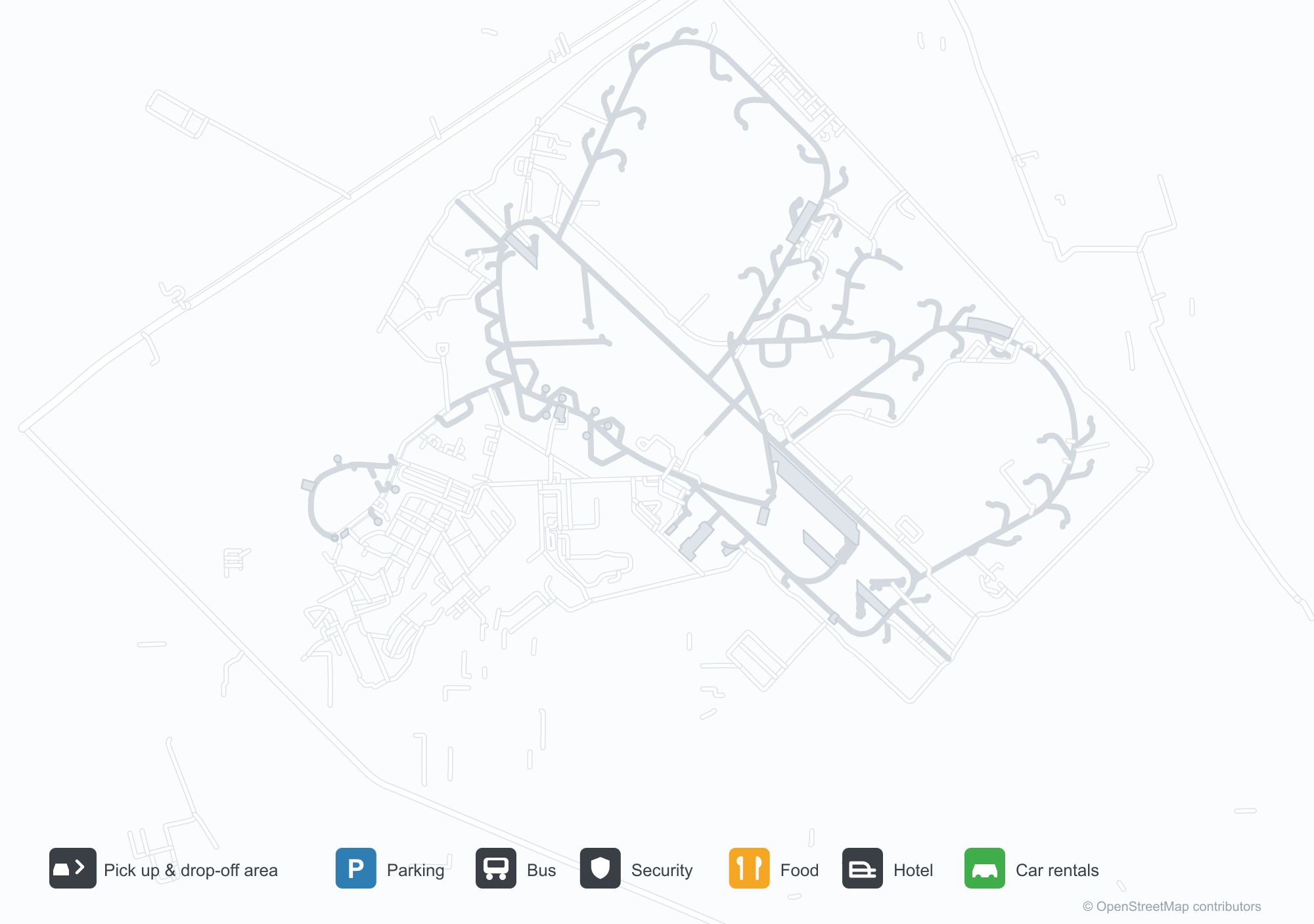
空港マップをダウンロードダウンロード
空港写真空港写真
この空港の実際の写真です。いずれも公開ウェブページを出典として明記しており、著作権は撮影者に帰属します。写真をクリックすると拡大表示され、クレジットをクリックすると元のページが開きます。
衛星画像:アダンプル空港(AIP)は緑の植生と農地に囲まれている。
澄んだ空の下、ガラス張りターミナルの上に青いアダンプルの看板が立ち、階段の上で一団が写真に納まっている。
アダンプル空港のターミナルはアーチ窓と小さなドーム型の亭で飾られ、芝生には高い旗竿と赤いカーペットが敷かれている。
消防車2台がエプロンの旅客機の上へ放水アーチを描き、脇にはヘリコプターが停まる。
夕暮れ、照らされたターミナルの前で噴水が水を吹き上げ、高い旗竿にはインド国旗が掲げられている。
明るい高視認性ベストを着た職員が、ターミナル前の舗装された前庭に長い列をつくる。
赤と白のスパイスジェットのターボプロップ機がエプロンに停まり、霞んだ空の下、地上係員と見学者が近くを歩く。
平屋の低い建物に青い看板があり、パンジャブ語と英語でアダンプル空港と記されている。扉の上には縞模様の日よけ。
Adampur Airport発着便 — 出発と到着フライトボード
便名4件、2社の航空会社、2か所の目的地を出発・到着別に掲載しています。コードシェア便も含みます。
便名と路線はaviability.comのフライトインデックス(スナップショット:2026年10月26日)に基づきます。コードシェア便を含み、出発時刻は掲載していません。出典:aviability.com ↗
空港情報と詳細空港の詳細
インタラクティブマップ — Adampur Airportの位置インタラクティブマップ
他の地図サービスでこの空港を見る:
Adampur Airport (AIP) Guide: A small field and its surroundings空港ガイド
Adampur Airport (AIP) lies in India, with satellite imagery showing green vegetation and farmland. The field sits at about 236 m above sea level and has a single 2,755 m runway; the 2014 route snapshot records no scheduled services. The nearest airport is Halwara International Airport (77.2 km).
Satellite view
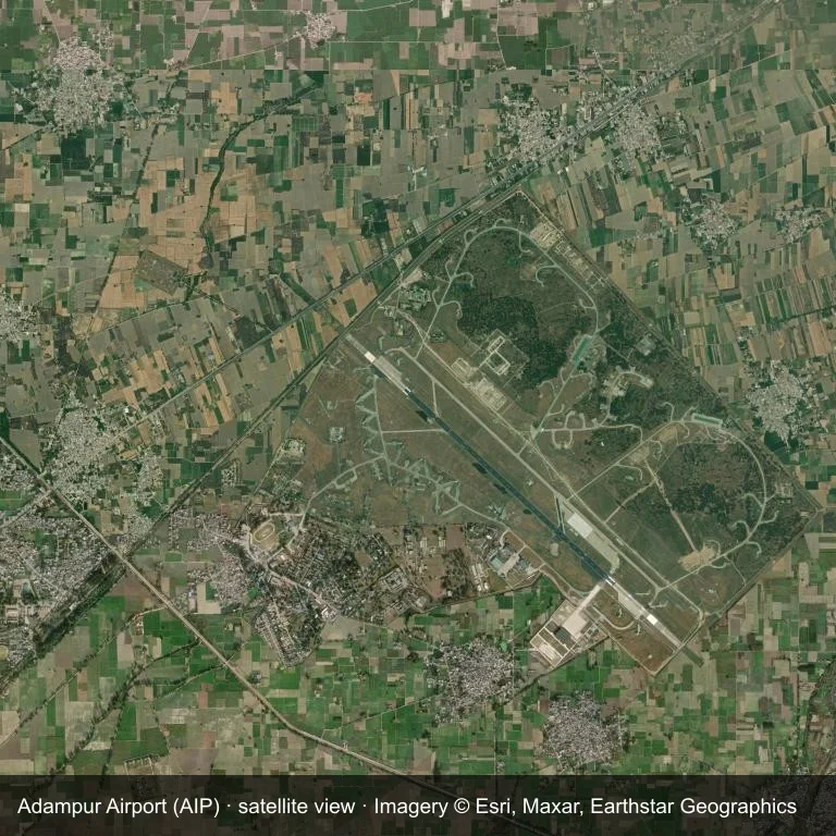
The field at Adampur Airport (AIP) seen from orbit, set in green vegetation and farmland.
The image is Esri World Imagery (© Esri, Maxar, Earthstar Geographics), labelled with the field and source. It is a satellite view, not a ground photo.
Airport at a glance
| Item | Detail |
|---|---|
| IATA / ICAO | AIP / VIAX |
| Role | small airport |
| Elevation | about 236 m |
| Coordinates | 31.4338, 75.7588 |
| Runways | 1, longest 2,755 m |
| Non-stop destinations | 0 in the 2014 snapshot |
Runways
| Runway | Length | Surface |
|---|---|---|
| 13/31 | 2,755 m | ASP |
Why there is no route table
No non-stop schedule was captured for AIP in 2014. For current movements, consult the airport operator or a recent flight-planning source.
Nearby airports
| Airport | Distance | Non-stop destinations |
|---|---|---|
| Halwara International Airport (HWR) | ~77.2 km | — |
| Pathankot Airport (IXP) | ~89.7 km | — |
| Kangra Airport (DHM) | ~94.2 km | 1 |
Getting there and navigating
- Coordinates: 31.4338, 75.7588
- Open in a map: Google Maps | Amap | Baidu Maps
The location map gives the field's position relative to nearby roads and towns. Terminal and local-transport details are outside this dataset.
Runway and surroundings
From the air, Adampur Airport appears within green vegetation and farmland in India. The primary strip, 13/31, is oriented northwest–southeast and extends 2,755 m at about 236 m.
That 2,755 m length is typical of narrowbody operations. The paved surface supports regular operations, though it does not imply scheduled service. The nearest airport is Halwara International Airport, 77.2 km away, with no recorded destinations in the same snapshot.
No scheduled services appear in the 2014 snapshot, so the field is best treated as a general-aviation or charter stop; confirm handling and current movements with the operator.
Before you fly
- The 2,755 m runway can take larger regional aircraft, but that does not guarantee scheduled service.
- The runway is paved, which supports year-round operations, but scheduled service is still not guaranteed.
- Halwara International Airport is the nearest airport in this dataset, 77.2 km away, but it also has no recorded destinations for 2014.
- Because the 2014 route table is empty, check the airport operator's current notices before making travel plans.
- Treat this as a general-aviation or charter field rather than a large terminal; confirm handling and opening hours in advance.
About the data
The airport facts on this page are drawn from OurAirports. Route data is the June 2014 OpenFlights snapshot, so treat it as historical context rather than a timetable.
読者コメントディスカッション
質問、旅行記、訂正など、お気軽にお寄せください。コメントは公開されます。
読み込み中…
コメントを読み込み中…