
Alice Springs Airport
 Alice Springs · Австралия· Alice Springs Airport
Alice Springs Airport (IATA: ASP, ICAO YBAS) — аэропорт среднего размера в городе Alice Springs, Австралия.
Alice Springs Airport is a medium-sized airport, at an elevation of about 1,789 ft, with scheduled passenger service. This page gathers its location map, airport codes and travel information.
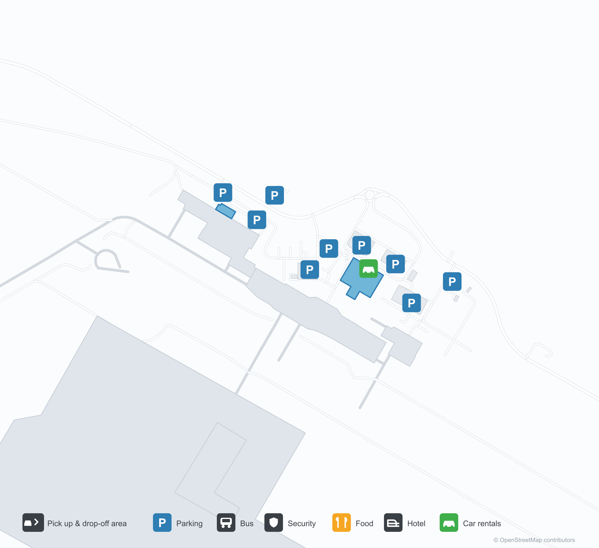
Скачать карты аэропортаЗагрузки
Фотографии аэропортаФото аэропорта
Реальные фотографии этого аэропорта; у каждой указан источник — общедоступная веб-страница. Авторские права принадлежат фотографам. Нажмите на фото, чтобы увеличить, или на подпись, чтобы открыть источник.
Старая диспетчерская вышка Алис-Спрингс — кирпичный ствол под застеклённой кабиной, на перроне ждёт Fokker F.27 (ок. 1970; фото Терри Мартина, коллекция CAHS, через музей Airways).
Алис-Спрингс с воздуха — полосы и рулёжные дорожки проложены по красной пустыне, вышка, терминал и перрон выстроены вдоль аэродрома (коллекция CAHS, через музей Airways).
Красные колонны и белые тентовые навесы тянутся вдоль бордюра терминала, над фризом — вывеска Qantas, снаружи ждут машины и белый фургон.
Вид с воздуха выделяет длинную полосу, рулёжную дорожку и перрон с несколькими лёгкими самолётами; терминал, ангары и парковки разбросаны по красной пустыне.
Красный хвост авиалайнера Virgin заполняет кадр над задними двигателями, под крылом среди жёлтых полевых цветов стоят двое наземных сотрудников.
Пустые чёрные сиденья заполняют тихий зал ожидания, рядом закрытая решёткой стойка турагентства, полосатые стеновые панели и полированный пол под потолочными лампами.
Вид с воздуха: четыре авиалайнера стоят рядом на стоянках с красной землёй, за кустарником пересекает полосу, на горизонте — невысокие хребты.
Региональный самолёт QantasLink набирает высоту с пустынной полосы, его красный хвост ярко выделяется на ясном небе, а за сухой травой поперёк полосы стоят два законсервированных авиалайнера.
Стойки регистрации Qantas тянутся вдоль зала за красными ограждениями очереди, изгибающимися к доске объявлений о здоровье; всё уложено на ковёр с сине-жёлтым узором.
Alice Springs Airport: карта маршрутов — прямые направленияКарта маршрутов
8 прямых направлений: карта, авиакомпании и расстояния.
Alice Springs Airport: рейсы — вылеты и прилётыТабло рейсов
63 номеров рейсов у 12 авиакомпаний по 8 направлениям, с разбивкой по направлению. Номера код-шеринга также включены.
| Рейс | Авиакомпания | Направление | Страна/регион |
|---|---|---|---|
| AA7273 | American Airlines | Аэропорт Сиднея имени Кингсфорда Смита | Австралия |
| AS5140 | Alaska Airlines | Аэропорт Сиднея имени Кингсфорда Смита | Австралия |
| CX9032 | Cathay Pacific | Аэропорт Сиднея имени Кингсфорда Смита | Австралия |
| EK5079 | Emirates | Adelaide International Airport | Австралия |
| EK5373 | Emirates | Аэропорт Сиднея имени Кингсфорда Смита | Австралия |
| EK5722 | Emirates | Adelaide International Airport | Австралия |
| NZ7036 | Air New Zealand | Melbourne Airport | Австралия |
| NZ7098 | Air New Zealand | Brisbane International Airport | Австралия |
| NZ7356 | Air New Zealand | Adelaide International Airport | Австралия |
| NZ7460 | Air New Zealand | Adelaide International Airport | Австралия |
| NZ7473 | Air New Zealand | Adelaide International Airport | Австралия |
| NZ7791 | Air New Zealand | Аэропорт Сиднея имени Кингсфорда Смита | Австралия |
| QF791 | Qantas | Аэропорт Сиднея имени Кингсфорда Смита | Австралия |
| QF1599 | Qantas | Melbourne Airport | Австралия |
| QF1817 | Qantas | Adelaide International Airport | Австралия |
| QF1875 | Qantas | Brisbane International Airport | Австралия |
| QF1955 | Qantas | Adelaide International Airport | Австралия |
| QF1959 | Qantas | Дарвин (DRW) Darwin International Airport / RAAF Darwin | Австралия |
| QF1961 | Qantas | Дарвин (DRW) Darwin International Airport / RAAF Darwin | Австралия |
| QF8657 | Qantas | Кэрнс (CNS) Cairns International Airport | Австралия |
Номера рейсов и маршруты из индекса рейсов aviability.com (снимок 26 октября 2026 г.); номера код-шеринга включены, время вылета не указано. Источник: aviability.com ↗
Информация об аэропортеСведения об аэропорте
Интерактивная карта: Alice Springs AirportИнтерактивная карта
Посмотреть этот аэропорт на других картографических сервисах:
Alice Springs Airport (ASP): From a 1970 Control Tower to a Red-Desert RunwayПутеводитель по аэропорту
The photos of Alice Springs Airport (IATA ASP, ICAO YBAS) span half a century. One shows the old control tower around 1970 — a brick shaft under a glazed cab, with a Fokker F.27 turboprop waiting on the apron. The other is a current aerial: runways and taxiways laid across red desert, with the tower, terminal and apron lined up along the field. The frame has barely changed; only the aircraft have.
The airport serves Alice Springs in Australia's Northern Territory at an elevation of about 545 m. Its main runway, 12/30, is 2,438 m long, with a second 1,133 m strip (17/35). The 2014 route snapshot records 8 non-stop destinations, all within Australia.
Airport photos
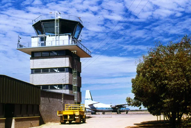
Alice Springs' old control tower — a brick shaft under the glazed cab, a Fokker F.27 waiting on the apron (c. 1970; photo Terry Martin, CAHS collection, via the Airways Museum).
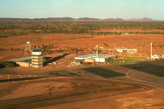
Alice Springs from the air — runways and taxiways laid across the red desert, the tower, terminal and apron lined up along the field (CAHS collection, via the Airways Museum).
The photos come from public web sources and remain the copyright of their photographers; full credits and source links sit in the photo gallery on this page.
Airport at a glance
| Item | Detail |
|---|---|
| IATA / ICAO | ASP / YBAS |
| Role | Medium-sized airport and regional gateway for central Australia |
| Elevation | about 545 m |
| Coordinates | -23.8066, 133.9034 |
| Runways | 2: 12/30 at 2,438 m, 17/35 at 1,133 m |
| Non-stop destinations | 8 (2014 snapshot, all domestic) |
| Official site | alicespringsairport.com.au |
Network shape: eight destinations, all listed for Qantas
By distance, only Ayers Rock (333 km) is within 1,000 km. The other 7 fall between 1,000 and 3,000 km, the farthest being Sydney (2,020 km), Perth (1,978 km) and Brisbane (1,965 km). This is a classic desert-spoke map: a short hop to Ayers Rock, then medium-haul links to Darwin, Adelaide, Melbourne, Perth and Sydney.
| Distance band | Destinations |
|---|---|
| Under 1,000 km | 1 |
| 1,000–3,000 km | 7 |
| Over 3,000 km | 0 |
All 8 routes list Qantas, with Tiger Airways Australia and American Airlines appearing on individual routes (including codeshares). The carrier column describes concentration, not who operates every flight. The full list is on the Alice Springs route map.
Getting there and navigating
- Coordinates: -23.8066, 133.9034
- Official site: alicespringsairport.com.au
- Open in a map: Google Maps | Amap | Baidu Maps
If your destination is not on the list, Adelaide (ADL) is the nearest larger alternative in the snapshot: about 1,317 km away with 25 destinations. Travellers heading to Ayers Rock can compare ASP and AYQ directly on distance and schedule.
The location map on this page shows the field against Alice Springs and the surrounding highway network. Terminal connections and local transport fall outside this dataset; the airport or airline can confirm them.
Before you fly
- Desert temperatures swing sharply between day and night, and summer heat is intense. The road into town is not short; a rental car or pre-booked transfer is more reliable than finding one on arrival.
- The 8 destinations are a 2014 snapshot. Qantas adjusts its central Australian schedule seasonally, so check the current timetable.
- The old tower and Fokker F.27 are historical images, not evidence of today's operators. If you plan to photograph aircraft, confirm the airport's spotting rules first.
About the data
Runways, elevation and coordinates come from OurAirports open data. Routes and carriers come from the June 2014 OpenFlights snapshot and include codeshares and interline services; they indicate network shape and scale, not current schedules. Historical photos are from the CAHS collection via the Airways Museum and remain the copyright of their photographers.
Комментарии читателейОбсуждение
Вопросы, отчёты о поездках и исправления приветствуются. Комментарии видны всем.
Загрузка…
Загрузка комментариев…