
Alice Springs Airport
 Alice Springs · Austrália· Alice Springs Airport
O Alice Springs Airport (IATA: ASP, ICAO YBAS) é um aeroporto de porte médio que atende Alice Springs, Austrália.
Alice Springs Airport is a medium-sized airport, at an elevation of about 1,789 ft, with scheduled passenger service. This page gathers its location map, airport codes and travel information.
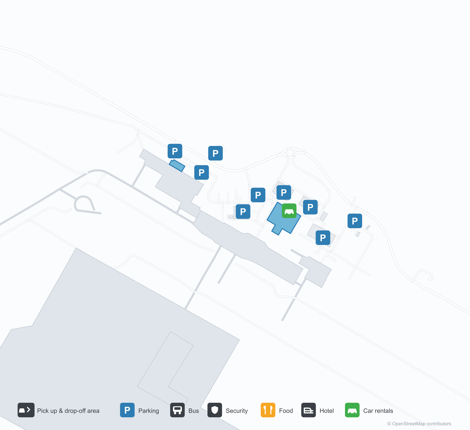
Baixar mapas do aeroportoDownloads
Fotos do aeroportoFotos do aeroporto
Fotos reais deste aeroporto, cada uma creditada à página pública da web onde foi encontrada; os direitos autorais continuam com os fotógrafos originais. Clique em uma foto para ampliar ou em uma linha de crédito para abrir a página de origem.
A antiga torre de controle de Alice Springs — um fuste de tijolos sob a cabine envidraçada, com um Fokker F.27 aguardando no pátio (c. 1970; foto Terry Martin, acervo CAHS, via Airways Museum).
Alice Springs vista do ar — pistas e pistas de táxi traçadas sobre o deserto vermelho, com torre, terminal e pátio alinhados ao longo do campo (acervo CAHS, via Airways Museum).
Colunas vermelhas e velas de sombra brancas alinham o meio-fio do terminal, com a placa da Qantas na faixa acima e carros e uma van branca esperando do lado de fora.
Uma vista aérea destaca a longa pista, a pista de táxi e o pátio com alguns aviões leves estacionados, e o terminal, os hangares e os estacionamentos pontuando o terreno vermelho do deserto.
A cauda vermelha de um avião da Virgin preenche o quadro acima de seus motores traseiros, com dois funcionários de solo sob a asa entre flores silvestres amarelas.
Assentos pretos vazios preenchem uma sala de embarque silenciosa, com o balcão da agência de viagens fechado atrás de sua grade ao lado, painéis de parede listrados e piso polido sob as luzes do teto.
Uma vista aérea olha para quatro aviões estacionados lado a lado em posicionamentos de terra vermelha, com uma pista cruzando o mato além e serras baixas no horizonte.
Um jato regional da QantasLink sobe da pista do deserto, com a cauda vermelha brilhando contra o céu claro, enquanto dois aviões armazenados estão estacionados do outro lado da faixa, além do capim seco.
Balcões de check-in da Qantas alinham o saguão atrás de barreiras vermelhas de fila que serpenteiam até um quadro de avisos sanitários, tudo sobre um carpete estampado em azul e amarelo.
Alice Springs Airport: mapa de rotas — destinos diretosMapa de rotas
8 destinos diretos: mapa, companhias aéreas em operação e distâncias.
Alice Springs Airport: voos — partidas e chegadasPainel de voos
63 números de voo de 12 companhias aéreas para 8 destinos, separados por direção. Números de codeshare estão incluídos.
| Voo | Companhia aérea | Destino | País/região |
|---|---|---|---|
| AA7273 | American Airlines | Aeroporto Kingsford Smith de Sydney | Austrália |
| AS5140 | Alaska Airlines | Aeroporto Kingsford Smith de Sydney | Austrália |
| CX9032 | Cathay Pacific | Aeroporto Kingsford Smith de Sydney | Austrália |
| EK5079 | Emirates | Adelaide International Airport | Austrália |
| EK5373 | Emirates | Aeroporto Kingsford Smith de Sydney | Austrália |
| EK5722 | Emirates | Adelaide International Airport | Austrália |
| NZ7036 | Air New Zealand | Melbourne Airport | Austrália |
| NZ7098 | Air New Zealand | Brisbane International Airport | Austrália |
| NZ7356 | Air New Zealand | Adelaide International Airport | Austrália |
| NZ7460 | Air New Zealand | Adelaide International Airport | Austrália |
| NZ7473 | Air New Zealand | Adelaide International Airport | Austrália |
| NZ7791 | Air New Zealand | Aeroporto Kingsford Smith de Sydney | Austrália |
| QF791 | Qantas | Aeroporto Kingsford Smith de Sydney | Austrália |
| QF1599 | Qantas | Melbourne Airport | Austrália |
| QF1817 | Qantas | Adelaide International Airport | Austrália |
| QF1875 | Qantas | Brisbane International Airport | Austrália |
| QF1955 | Qantas | Adelaide International Airport | Austrália |
| QF1959 | Qantas | Darwin (DRW) Darwin International Airport / RAAF Darwin | Austrália |
| QF1961 | Qantas | Darwin (DRW) Darwin International Airport / RAAF Darwin | Austrália |
| QF8657 | Qantas | Cairns (CNS) Cairns International Airport | Austrália |
Números de voo e rotas do índice de voos da aviability.com (instantâneo de 26 de outubro de 2026); números de codeshare estão incluídos e nenhum horário de partida é exibido. Fonte: aviability.com ↗
Informações e detalhes do aeroportoDetalhes do aeroporto
Mapa interativo — localização do Alice Springs AirportMapa interativo
Veja este aeroporto em outros serviços de mapas:
Alice Springs Airport (ASP): From a 1970 Control Tower to a Red-Desert RunwayGuia do aeroporto
The photos of Alice Springs Airport (IATA ASP, ICAO YBAS) span half a century. One shows the old control tower around 1970 — a brick shaft under a glazed cab, with a Fokker F.27 turboprop waiting on the apron. The other is a current aerial: runways and taxiways laid across red desert, with the tower, terminal and apron lined up along the field. The frame has barely changed; only the aircraft have.
The airport serves Alice Springs in Australia's Northern Territory at an elevation of about 545 m. Its main runway, 12/30, is 2,438 m long, with a second 1,133 m strip (17/35). The 2014 route snapshot records 8 non-stop destinations, all within Australia.
Airport photos
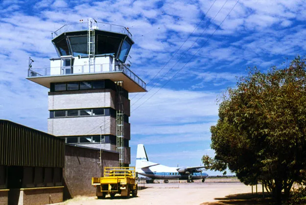
Alice Springs' old control tower — a brick shaft under the glazed cab, a Fokker F.27 waiting on the apron (c. 1970; photo Terry Martin, CAHS collection, via the Airways Museum).
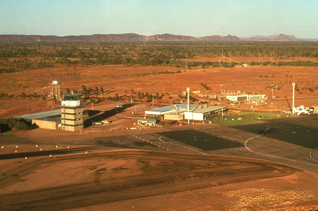
Alice Springs from the air — runways and taxiways laid across the red desert, the tower, terminal and apron lined up along the field (CAHS collection, via the Airways Museum).
The photos come from public web sources and remain the copyright of their photographers; full credits and source links sit in the photo gallery on this page.
Airport at a glance
| Item | Detail |
|---|---|
| IATA / ICAO | ASP / YBAS |
| Role | Medium-sized airport and regional gateway for central Australia |
| Elevation | about 545 m |
| Coordinates | -23.8066, 133.9034 |
| Runways | 2: 12/30 at 2,438 m, 17/35 at 1,133 m |
| Non-stop destinations | 8 (2014 snapshot, all domestic) |
| Official site | alicespringsairport.com.au |
Network shape: eight destinations, all listed for Qantas
By distance, only Ayers Rock (333 km) is within 1,000 km. The other 7 fall between 1,000 and 3,000 km, the farthest being Sydney (2,020 km), Perth (1,978 km) and Brisbane (1,965 km). This is a classic desert-spoke map: a short hop to Ayers Rock, then medium-haul links to Darwin, Adelaide, Melbourne, Perth and Sydney.
| Distance band | Destinations |
|---|---|
| Under 1,000 km | 1 |
| 1,000–3,000 km | 7 |
| Over 3,000 km | 0 |
All 8 routes list Qantas, with Tiger Airways Australia and American Airlines appearing on individual routes (including codeshares). The carrier column describes concentration, not who operates every flight. The full list is on the Alice Springs route map.
Getting there and navigating
- Coordinates: -23.8066, 133.9034
- Official site: alicespringsairport.com.au
- Open in a map: Google Maps | Amap | Baidu Maps
If your destination is not on the list, Adelaide (ADL) is the nearest larger alternative in the snapshot: about 1,317 km away with 25 destinations. Travellers heading to Ayers Rock can compare ASP and AYQ directly on distance and schedule.
The location map on this page shows the field against Alice Springs and the surrounding highway network. Terminal connections and local transport fall outside this dataset; the airport or airline can confirm them.
Before you fly
- Desert temperatures swing sharply between day and night, and summer heat is intense. The road into town is not short; a rental car or pre-booked transfer is more reliable than finding one on arrival.
- The 8 destinations are a 2014 snapshot. Qantas adjusts its central Australian schedule seasonally, so check the current timetable.
- The old tower and Fokker F.27 are historical images, not evidence of today's operators. If you plan to photograph aircraft, confirm the airport's spotting rules first.
About the data
Runways, elevation and coordinates come from OurAirports open data. Routes and carriers come from the June 2014 OpenFlights snapshot and include codeshares and interline services; they indicate network shape and scale, not current schedules. Historical photos are from the CAHS collection via the Airways Museum and remain the copyright of their photographers.
Comentários dos leitoresDiscussão
Perguntas, relatos de viagem e correções são bem-vindos. Os comentários são públicos.
Carregando…
Carregando comentários…