
Agartala - Maharaja Bir Bikram Airport
 Agartala · Ấn Độ· Agartala - Maharaja Bir Bikram Airport
Agartala - Maharaja Bir Bikram Airport (IATA: IXA, ICAO VEAT) là một sân bay trung bình phục vụ Agartala, Ấn Độ.
Agartala - Maharaja Bir Bikram Airport is a medium-sized airport, at an elevation of about 46 ft, with scheduled passenger service. This page gathers its location map, airport codes and travel information.
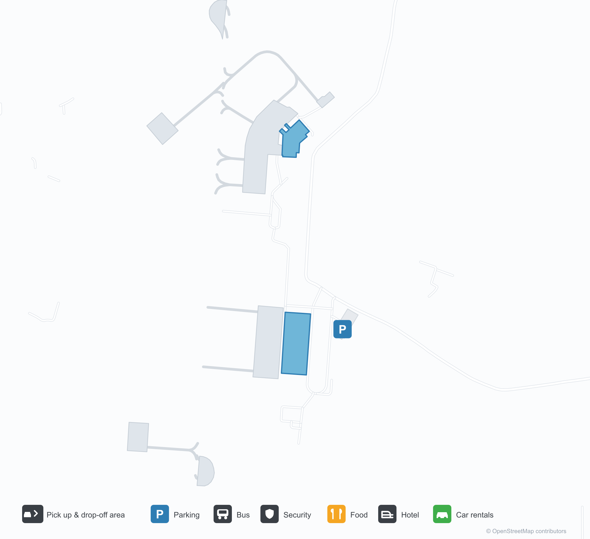
Tải bản đồ sân bayTải xuống
Ảnh sân bayẢnh sân bay
Ảnh thực tế của sân bay này, mỗi ảnh đều ghi nguồn từ trang web công khai nơi tìm thấy ảnh; bản quyền thuộc về nhiếp ảnh gia gốc. Nhấp vào ảnh để phóng to, hoặc nhấp vào dòng ghi nguồn để mở trang nguồn.
Một chiếc máy bay cánh quạt hai động cơ hướng về phía máy ảnh trên sân đỗ Agartala, phía xa sân bay là những ngọn đồi thấp của Tripura.
Mái che trắng của nhà ga mang tên sân bay bằng chữ xanh, cọ và luống hoa dọc lối đi lát dưới bầu trời u ám.
Trong sảnh khởi hành, một biển tối chỉ tới quầy làm thủ tục và vé điện tử, phía trên tường có một hàng đồ gốm đất nung.
Một chiếc máy bay thân hẹp sơn màu IndiGo đỗ tại cầu ống trong khi nhân viên mặt đất làm việc quanh thân và động cơ.
Về đêm, biển tên sân bay bằng chữ Devanagari xanh của nhà ga sáng lên phía trên một dãy mái căng trắng.
Nhìn qua hàng rào dây thép gai, một máy bay đuôi đỏ lăn dọc đường băng trên nền hàng cây mờ sương.
Một nhà ga trắng thấp với mái xanh nhạt đứng sau sân đỗ, phía trước là cột đèn pha dạng lưới và tháp không lưu ở phía xa bên phải.
Một cầu thang lên máy bay được đẩy áp vào cửa trước của một chiếc máy bay IndiGo dưới những đám mây tích cao vút.
Bản đồ tuyến bay Agartala - Maharaja Bir Bikram Airport — điểm đến thẳngBản đồ tuyến bay
3 điểm đến thẳng: bản đồ, hãng hàng không khai thác và khoảng cách.
Chuyến bay tại Agartala - Maharaja Bir Bikram Airport — khởi hành & đếnBảng chuyến bay
53 số hiệu chuyến bay của 4 hãng hàng không, kết nối 5 điểm đến, phân theo chiều bay. Bao gồm số hiệu liên danh.
| Chuyến bay | Hãng hàng không | Điểm đến | Quốc gia/khu vực |
|---|---|---|---|
| 6E114 | IndiGo | Netaji Subhash Chandra Bose International Airport | Ấn Độ |
| 6E213 | IndiGo | Netaji Subhash Chandra Bose International Airport | Ấn Độ |
| 6E292 | IndiGo | Netaji Subhash Chandra Bose International Airport | Ấn Độ |
| 6E394 | IndiGo | Netaji Subhash Chandra Bose International Airport | Ấn Độ |
| 6E491 | IndiGo | Netaji Subhash Chandra Bose International Airport | Ấn Độ |
| 6E525 | IndiGo | Kempegowda International Airport Bengaluru | Ấn Độ |
| 6E572 | IndiGo | Guwahati (GAU) Lokpriya Gopinath Bordoloi International Airport | Ấn Độ |
| 6E2181 | IndiGo | Sân bay Quốc tế Indira Gandhi | Ấn Độ |
| 6E6069 | IndiGo | Netaji Subhash Chandra Bose International Airport | Ấn Độ |
| 6E6097 | IndiGo | Netaji Subhash Chandra Bose International Airport | Ấn Độ |
| 6E6204 | IndiGo | Dibrugarh (DIB) Dibrugarh Airport | Ấn Độ |
| 6E6383 | IndiGo | Sân bay Quốc tế Indira Gandhi | Ấn Độ |
| 6E6504 | IndiGo | Sân bay Quốc tế Indira Gandhi | Ấn Độ |
| 6E6552 | IndiGo | Guwahati (GAU) Lokpriya Gopinath Bordoloi International Airport | Ấn Độ |
| 6E6705 | IndiGo | Netaji Subhash Chandra Bose International Airport | Ấn Độ |
| 6E6724 | IndiGo | Guwahati (GAU) Lokpriya Gopinath Bordoloi International Airport | Ấn Độ |
| 6E7419 | IndiGo | Netaji Subhash Chandra Bose International Airport | Ấn Độ |
| AI9588 | Air India | Netaji Subhash Chandra Bose International Airport | Ấn Độ |
| AI9610 | Air India | Netaji Subhash Chandra Bose International Airport | Ấn Độ |
| AI9624 | Air India | Netaji Subhash Chandra Bose International Airport | Ấn Độ |
Số hiệu chuyến bay và tuyến bay từ chỉ mục chuyến bay aviability.com (ảnh chụp 26 tháng 10, 2026); bao gồm số hiệu liên danh và không hiển thị giờ khởi hành. Nguồn: aviability.com ↗
Thông tin & chi tiết sân bayChi tiết sân bay
Bản đồ tương tác — vị trí Agartala - Maharaja Bir Bikram AirportBản đồ tương tác
Xem sân bay này trên các dịch vụ bản đồ khác:
Agartala Airport (IXA): Low Hills and Three Domestic Routes in TripuraHướng dẫn sân bay
A twin-turboprop faces the camera on Agartala's apron, with the low hills of Tripura beyond. The airport serves Agartala in Tripura, India, at an elevation of about 14 m, with a 2,286 m runway; the 2014 snapshot records three domestic destinations, Guwahati at 249 km, Imphal at 286 km and Kolkata at 316 km.
Airport photos

A twin turboprop facing the camera on Agartala's apron, the low hills of Tripura beyond the airfield.
The photos come from public web sources and remain the copyright of their photographers; full credits and source links sit in the photo gallery on this page.
Airport at a glance
| Item | Detail |
|---|---|
| IATA / ICAO | IXA / VEAT |
| Role | Medium-sized airport |
| Elevation | about 14 m |
| Coordinates | 23.8870, 91.2404 |
| Runways | 1, 2,286 m |
| Non-stop destinations | 3 (2014 snapshot, all domestic) |
Runways
| Runway | Length | Width | Surface |
|---|---|---|---|
| 18/36 | 2,286 m | 45 m | asphalt |
1 runway, the longest 2,286 m.
Non-stop routes
3 non-stop destinations, nearest first (OpenFlights route snapshot compiled in 2014 — confirm with the airline or airport):
| Destination | Distance | Carriers |
|---|---|---|
| Lokpriya Gopinath Bordoloi International Airport (GAU) | ~249 km | IndiGo Airlines, Spicejet |
| Bir Tikendrajit International Airport (IMF) | ~286 km | IndiGo Airlines |
| Netaji Subhash Chandra Bose International Airport (CCU) | ~316 km | IndiGo Airlines, Jet Airways, Air India Limited |
The carrier column comes from the same snapshot and includes codeshare and interline services; treat it as an indication of how busy the route is and check the airline for who actually flies it.
Nearby airports to compare
If the fares are close, these are the nearest airports of the same class (medium-sized airport) — straight-line distance, with their own non-stop counts from the same dataset:
| Airport | Distance | Non-stop destinations |
|---|---|---|
| Lengpui Airport (AJL) | ~140 km | 3 |
Before you fly
- With three domestic routes, 90–120 minutes is usually enough; land border crossings towards Bangladesh are separate from air travel.
- The 2014 snapshot records three destinations and the north-east Indian network has changed; check current information.
About the data
Runways, elevation and coordinates come from OurAirports open data. Routes and carriers come from the June 2014 OpenFlights snapshot and include codeshares and interline services; they indicate network shape and scale, not current schedules.
History
Administered by the Airports Authority of India about 9 km from Agartala, the field is the second busiest in Northeast India after Guwahati — 22nd among India's 50 major airports in 2010–11.
Source: Agartala Airport.
Bình luận của độc giảThảo luận
Hoan nghênh mọi câu hỏi, báo cáo chuyến đi và góp ý chỉnh sửa. Bình luận được công khai.
Đang tải…
Đang tải bình luận…