
Agartala - Maharaja Bir Bikram Airport
 Agartala · India· Agartala - Maharaja Bir Bikram Airport
Agartala - Maharaja Bir Bikram Airport (IATA: IXA, ICAO VEAT) adalah bandara sedang yang melayani Agartala, India.
Agartala - Maharaja Bir Bikram Airport is a medium-sized airport, at an elevation of about 46 ft, with scheduled passenger service. This page gathers its location map, airport codes and travel information.
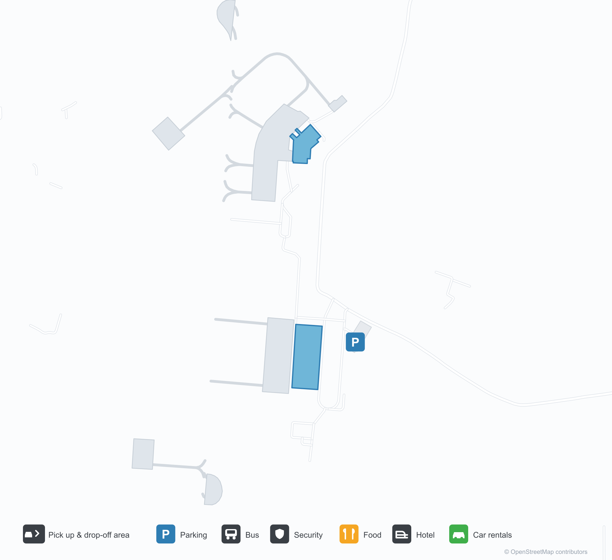
Unduh Peta BandaraUnduhan
Foto bandaraFoto Bandara
Foto asli bandara ini, masing-masing dikreditkan ke halaman web publik tempat foto ditemukan; hak cipta tetap milik fotografer aslinya. Klik foto untuk memperbesar, atau baris kredit untuk membuka halaman sumbernya.
Pesawat turboprop kembar menghadap kamera di apron Agartala, perbukitan rendah Tripura di balik lapangan udara.
Kanopi putih terminal memuat nama bandara dalam huruf biru, dengan pohon palem dan bedeng bunga di sepanjang jalur beraspal di bawah langit mendung.
Di aula keberangkatan, papan gelap menunjuk ke meja check-in dan e-tiket, dengan sederet hiasan terakota tertanam di dinding di atasnya.
Pesawat berbadan sempit berlivery IndiGo duduk di garbarata sementara petugas darat bekerja di sekitar badan dan mesinnya.
Pada malam hari, papan bandara biru beraksara Devanagari bersinar di atas deretan kanopi tarik putih.
Dilihat melewati pagar kawat berduri, pesawat jet berekor merah bergulir di landasan pacu dengan latar barisan pohon berkabut.
Terminal putih rendah beratap hijau pucat berdiri di belakang apron, tiang lampu sorot berkisi di depan dan menara kontrol di ujung kanan.
Tangga naik pesawat didorong ke pintu depan pesawat jet IndiGo di bawah awan kumulus menjulang.
Peta rute Agartala - Maharaja Bir Bikram Airport — tujuan langsungPeta Rute
3 tujuan langsung: peta, maskapai yang beroperasi, dan jarak.
Penerbangan Agartala - Maharaja Bir Bikram Airport — keberangkatan & kedatanganPapan Penerbangan
53 nomor penerbangan dari 4 maskapai dan 5 tujuan, dipisahkan menurut arah. Nomor codeshare disertakan.
| Penerbangan | Maskapai | Tujuan | Negara/wilayah |
|---|---|---|---|
| 6E114 | IndiGo | Netaji Subhash Chandra Bose International Airport | India |
| 6E213 | IndiGo | Netaji Subhash Chandra Bose International Airport | India |
| 6E292 | IndiGo | Netaji Subhash Chandra Bose International Airport | India |
| 6E394 | IndiGo | Netaji Subhash Chandra Bose International Airport | India |
| 6E491 | IndiGo | Netaji Subhash Chandra Bose International Airport | India |
| 6E525 | IndiGo | Kempegowda International Airport Bengaluru | India |
| 6E572 | IndiGo | Guwahati (GAU) Lokpriya Gopinath Bordoloi International Airport | India |
| 6E2181 | IndiGo | Bandara Internasional Indira Gandhi | India |
| 6E6069 | IndiGo | Netaji Subhash Chandra Bose International Airport | India |
| 6E6097 | IndiGo | Netaji Subhash Chandra Bose International Airport | India |
| 6E6204 | IndiGo | Dibrugarh (DIB) Dibrugarh Airport | India |
| 6E6383 | IndiGo | Bandara Internasional Indira Gandhi | India |
| 6E6504 | IndiGo | Bandara Internasional Indira Gandhi | India |
| 6E6552 | IndiGo | Guwahati (GAU) Lokpriya Gopinath Bordoloi International Airport | India |
| 6E6705 | IndiGo | Netaji Subhash Chandra Bose International Airport | India |
| 6E6724 | IndiGo | Guwahati (GAU) Lokpriya Gopinath Bordoloi International Airport | India |
| 6E7419 | IndiGo | Netaji Subhash Chandra Bose International Airport | India |
| AI9588 | Air India | Netaji Subhash Chandra Bose International Airport | India |
| AI9610 | Air India | Netaji Subhash Chandra Bose International Airport | India |
| AI9624 | Air India | Netaji Subhash Chandra Bose International Airport | India |
Nomor penerbangan dan rute dari indeks penerbangan aviability.com (cuplikan 26 Oktober 2026); nomor codeshare disertakan dan waktu keberangkatan tidak ditampilkan. Sumber: aviability.com ↗
Informasi & detail bandaraDetail Bandara
Peta interaktif — lokasi Agartala - Maharaja Bir Bikram AirportPeta Interaktif
Lihat bandara ini di layanan peta lain:
Agartala Airport (IXA): Low Hills and Three Domestic Routes in TripuraPanduan Bandara
A twin-turboprop faces the camera on Agartala's apron, with the low hills of Tripura beyond. The airport serves Agartala in Tripura, India, at an elevation of about 14 m, with a 2,286 m runway; the 2014 snapshot records three domestic destinations, Guwahati at 249 km, Imphal at 286 km and Kolkata at 316 km.
Airport photos

A twin turboprop facing the camera on Agartala's apron, the low hills of Tripura beyond the airfield.
The photos come from public web sources and remain the copyright of their photographers; full credits and source links sit in the photo gallery on this page.
Airport at a glance
| Item | Detail |
|---|---|
| IATA / ICAO | IXA / VEAT |
| Role | Medium-sized airport |
| Elevation | about 14 m |
| Coordinates | 23.8870, 91.2404 |
| Runways | 1, 2,286 m |
| Non-stop destinations | 3 (2014 snapshot, all domestic) |
Runways
| Runway | Length | Width | Surface |
|---|---|---|---|
| 18/36 | 2,286 m | 45 m | asphalt |
1 runway, the longest 2,286 m.
Non-stop routes
3 non-stop destinations, nearest first (OpenFlights route snapshot compiled in 2014 — confirm with the airline or airport):
| Destination | Distance | Carriers |
|---|---|---|
| Lokpriya Gopinath Bordoloi International Airport (GAU) | ~249 km | IndiGo Airlines, Spicejet |
| Bir Tikendrajit International Airport (IMF) | ~286 km | IndiGo Airlines |
| Netaji Subhash Chandra Bose International Airport (CCU) | ~316 km | IndiGo Airlines, Jet Airways, Air India Limited |
The carrier column comes from the same snapshot and includes codeshare and interline services; treat it as an indication of how busy the route is and check the airline for who actually flies it.
Nearby airports to compare
If the fares are close, these are the nearest airports of the same class (medium-sized airport) — straight-line distance, with their own non-stop counts from the same dataset:
| Airport | Distance | Non-stop destinations |
|---|---|---|
| Lengpui Airport (AJL) | ~140 km | 3 |
Before you fly
- With three domestic routes, 90–120 minutes is usually enough; land border crossings towards Bangladesh are separate from air travel.
- The 2014 snapshot records three destinations and the north-east Indian network has changed; check current information.
About the data
Runways, elevation and coordinates come from OurAirports open data. Routes and carriers come from the June 2014 OpenFlights snapshot and include codeshares and interline services; they indicate network shape and scale, not current schedules.
History
Administered by the Airports Authority of India about 9 km from Agartala, the field is the second busiest in Northeast India after Guwahati — 22nd among India's 50 major airports in 2010–11.
Source: Agartala Airport.
Komentar pembacaDiskusi
Pertanyaan, laporan perjalanan, dan koreksi sangat kami harapkan. Komentar bersifat publik.
Memuat…
Memuat komentar…