
Adampur Airport
 Adampur · Ấn Độ· Adampur Airport
Adampur Airport (IATA: AIP, ICAO VIAX) là một sân bay nhỏ phục vụ Adampur, Ấn Độ.
Adampur Airport is a small airport, at an elevation of about 775 ft, with scheduled passenger service. This page gathers its location map, airport codes and travel information.
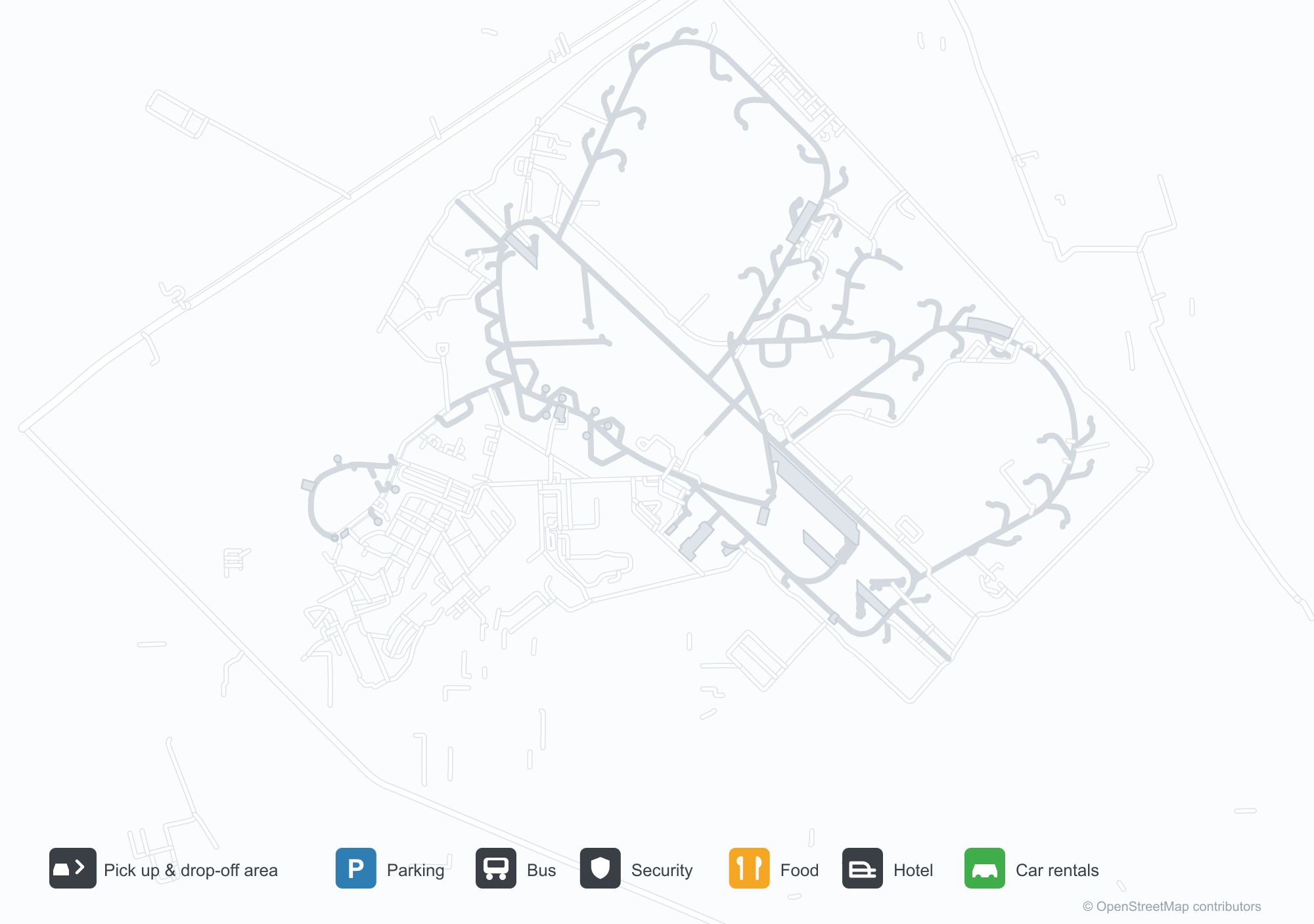
Tải bản đồ sân bayTải xuống
Ảnh sân bayẢnh sân bay
Ảnh thực tế của sân bay này, mỗi ảnh đều ghi nguồn từ trang web công khai nơi tìm thấy ảnh; bản quyền thuộc về nhiếp ảnh gia gốc. Nhấp vào ảnh để phóng to, hoặc nhấp vào dòng ghi nguồn để mở trang nguồn.
Ảnh vệ tinh: Sân bay Adampur (AIP) được bao quanh bởi thảm thực vật xanh và đồng ruộng.
Dưới bầu trời quang đãng, biển hiệu Adampur màu xanh đặt trên nhà ga mặt tiền kính trong khi một nhóm người tạo dáng trên bậc thang.
Cửa sổ hình vòm và một gian nhà nhỏ hình vòm trang trí nhà ga Sân bay Adampur, bên cạnh là cột cờ cao và thảm đỏ trải trên bãi cỏ.
Hai xe cứu hỏa phun những tia nước vòng qua một máy bay chở khách trên sân đỗ, một chiếc trực thăng đỗ ở một bên.
Lúc chạng vạng, đài phun nước phun trước nhà ga sáng đèn trong khi lá cờ Ấn Độ treo trên cột cao.
Nhân viên mặc áo phản quang sáng màu đứng thành hàng dài khắp sân trước lát đá trước nhà ga.
Một chiếc máy bay cánh quạt đỏ trắng của SpiceJet nghỉ trên sân đỗ trong khi nhân viên mặt đất và khách đi bộ gần đó dưới bầu trời mù sương.
Một tòa nhà một tầng thấp mang biển xanh ghi tên Sân bay Adampur bằng tiếng Punjab và tiếng Anh, cửa có mái hiên sọc.
Chuyến bay tại Adampur Airport — khởi hành & đếnBảng chuyến bay
4 số hiệu chuyến bay của 2 hãng hàng không, kết nối 2 điểm đến, phân theo chiều bay. Bao gồm số hiệu liên danh.
| Chuyến bay | Hãng hàng không | Điểm đến | Quốc gia/khu vực |
|---|---|---|---|
| 6E5932 | IndiGo | Chhatrapati Shivaji Maharaj International Airport | Ấn Độ |
| S5235 | Star Air | HDO |
Số hiệu chuyến bay và tuyến bay từ chỉ mục chuyến bay aviability.com (ảnh chụp 26 tháng 10, 2026); bao gồm số hiệu liên danh và không hiển thị giờ khởi hành. Nguồn: aviability.com ↗
Thông tin & chi tiết sân bayChi tiết sân bay
Bản đồ tương tác — vị trí Adampur AirportBản đồ tương tác
Xem sân bay này trên các dịch vụ bản đồ khác:
Adampur Airport (AIP) Guide: A small field and its surroundingsHướng dẫn sân bay
Adampur Airport (AIP) lies in India, with satellite imagery showing green vegetation and farmland. The field sits at about 236 m above sea level and has a single 2,755 m runway; the 2014 route snapshot records no scheduled services. The nearest airport is Halwara International Airport (77.2 km).
Satellite view
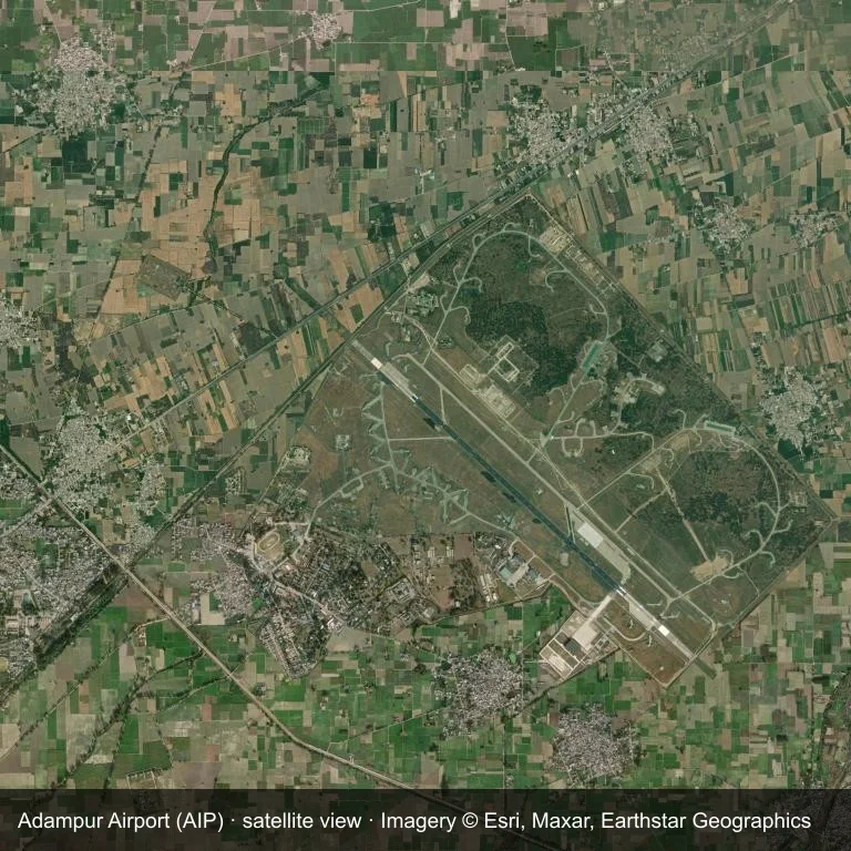
The field at Adampur Airport (AIP) seen from orbit, set in green vegetation and farmland.
The image is Esri World Imagery (© Esri, Maxar, Earthstar Geographics), labelled with the field and source. It is a satellite view, not a ground photo.
Airport at a glance
| Item | Detail |
|---|---|
| IATA / ICAO | AIP / VIAX |
| Role | small airport |
| Elevation | about 236 m |
| Coordinates | 31.4338, 75.7588 |
| Runways | 1, longest 2,755 m |
| Non-stop destinations | 0 in the 2014 snapshot |
Runways
| Runway | Length | Surface |
|---|---|---|
| 13/31 | 2,755 m | ASP |
Why there is no route table
No non-stop schedule was captured for AIP in 2014. For current movements, consult the airport operator or a recent flight-planning source.
Nearby airports
| Airport | Distance | Non-stop destinations |
|---|---|---|
| Halwara International Airport (HWR) | ~77.2 km | — |
| Pathankot Airport (IXP) | ~89.7 km | — |
| Kangra Airport (DHM) | ~94.2 km | 1 |
Getting there and navigating
- Coordinates: 31.4338, 75.7588
- Open in a map: Google Maps | Amap | Baidu Maps
The location map gives the field's position relative to nearby roads and towns. Terminal and local-transport details are outside this dataset.
Runway and surroundings
From the air, Adampur Airport appears within green vegetation and farmland in India. The primary strip, 13/31, is oriented northwest–southeast and extends 2,755 m at about 236 m.
That 2,755 m length is typical of narrowbody operations. The paved surface supports regular operations, though it does not imply scheduled service. The nearest airport is Halwara International Airport, 77.2 km away, with no recorded destinations in the same snapshot.
No scheduled services appear in the 2014 snapshot, so the field is best treated as a general-aviation or charter stop; confirm handling and current movements with the operator.
Before you fly
- The 2,755 m runway can take larger regional aircraft, but that does not guarantee scheduled service.
- The runway is paved, which supports year-round operations, but scheduled service is still not guaranteed.
- Halwara International Airport is the nearest airport in this dataset, 77.2 km away, but it also has no recorded destinations for 2014.
- Because the 2014 route table is empty, check the airport operator's current notices before making travel plans.
- Treat this as a general-aviation or charter field rather than a large terminal; confirm handling and opening hours in advance.
About the data
The airport facts on this page are drawn from OurAirports. Route data is the June 2014 OpenFlights snapshot, so treat it as historical context rather than a timetable.
Bình luận của độc giảThảo luận
Hoan nghênh mọi câu hỏi, báo cáo chuyến đi và góp ý chỉnh sửa. Bình luận được công khai.
Đang tải…
Đang tải bình luận…