
Agartala - Maharaja Bir Bikram Airport
 Agartala · インド· Agartala - Maharaja Bir Bikram Airport
Agartala - Maharaja Bir Bikram Airport(IATA: IXA、ICAO: VEAT)はAgartala、インドにある中型空港です。
Agartala - Maharaja Bir Bikram Airport is a medium-sized airport, at an elevation of about 46 ft, with scheduled passenger service. This page gathers its location map, airport codes and travel information.
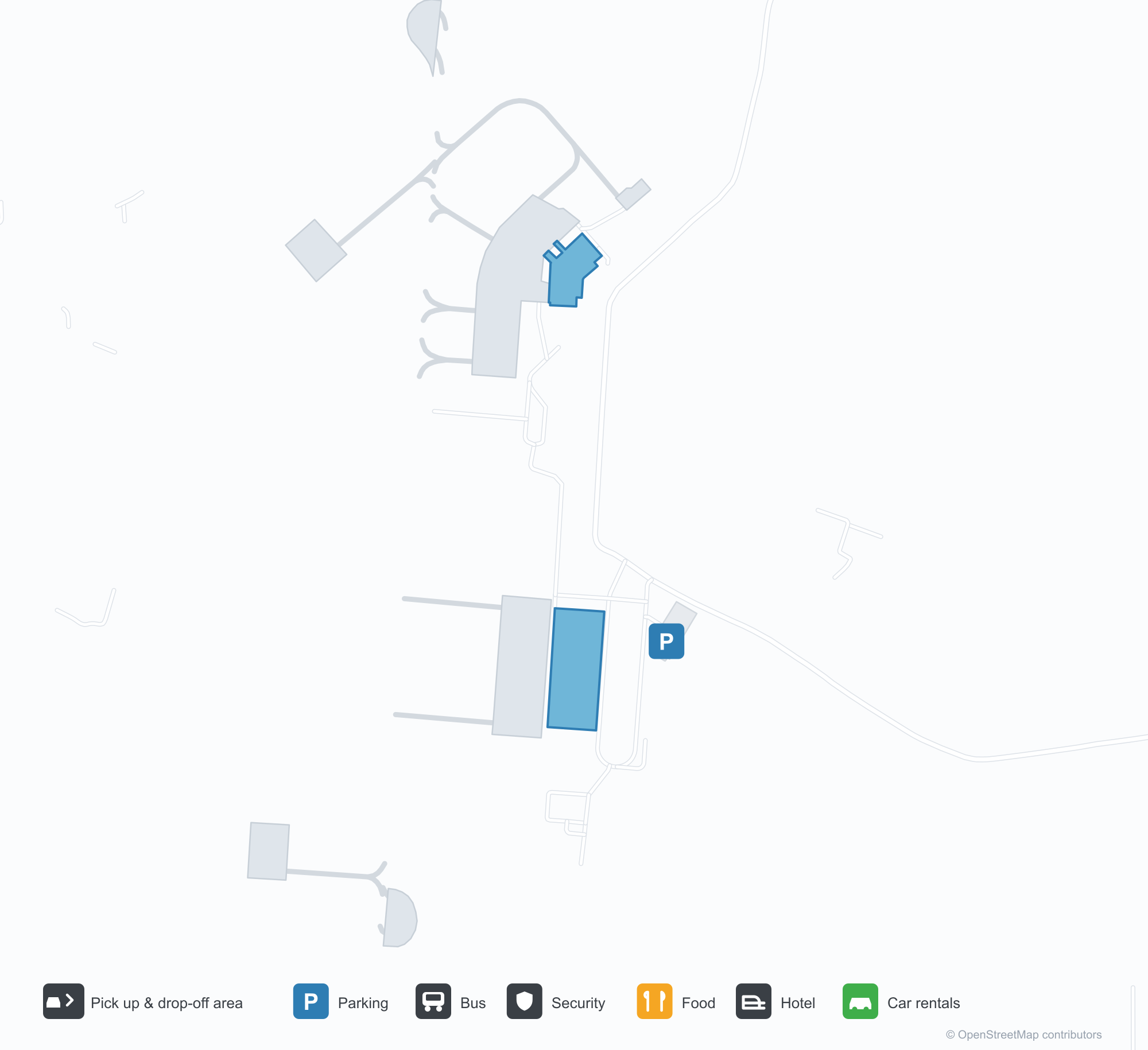
空港マップをダウンロードダウンロード
空港写真空港写真
この空港の実際の写真です。いずれも公開ウェブページを出典として明記しており、著作権は撮影者に帰属します。写真をクリックすると拡大表示され、クレジットをクリックすると元のページが開きます。
アガルタラのエプロンで双発ターボプロップ機がカメラに向き、飛行場の先にトリプラの低い丘陵。
ターミナルの白いキャノピーに青い文字で空港名、曇り空の下、舗装された小道沿いにヤシと花壇。
出発ロビーでは暗い色の看板がチェックインカウンターと電子チケットを示し、上の壁にはテラコッタの小品が並ぶ。
インディゴ塗装のナローボディ機がボーディングブリッジに停まり、地上係員が胴体とエンジンの周りで作業する。
夜にはターミナルの青いデーヴァナーガリー文字の空港名が、白いテンションキャノピーの列の上に光る。
有刺鉄線フェンス越しに、赤い尾翼のジェット機が霞んだ木立の前の滑走路を進む。
淡い緑の屋根の低い白いターミナルがエプロンの背後に立ち、手前には格子状の投光照明塔、右端に管制塔。
搭乗階段がインディゴのジェット機の前部扉に付けられ、その上には巨大な積乱雲がそびえる。
Agartala - Maharaja Bir Bikram Airportの路線マップ — 直行便の目的地路線マップ
直行目的地3か所。地図、就航航空会社、距離を掲載しています。
Agartala - Maharaja Bir Bikram Airport発着便 — 出発と到着フライトボード
便名53件、4社の航空会社、5か所の目的地を出発・到着別に掲載しています。コードシェア便も含みます。
| 便 | 航空会社 | 目的地 | 国・地域 |
|---|---|---|---|
| 6E114 | IndiGo | Netaji Subhash Chandra Bose International Airport | インド |
| 6E213 | IndiGo | Netaji Subhash Chandra Bose International Airport | インド |
| 6E292 | IndiGo | Netaji Subhash Chandra Bose International Airport | インド |
| 6E394 | IndiGo | Netaji Subhash Chandra Bose International Airport | インド |
| 6E491 | IndiGo | Netaji Subhash Chandra Bose International Airport | インド |
| 6E525 | IndiGo | Kempegowda International Airport Bengaluru | インド |
| 6E572 | IndiGo | Guwahati (GAU) Lokpriya Gopinath Bordoloi International Airport | インド |
| 6E2181 | IndiGo | インディラ・ガンディー国際空港 | インド |
| 6E6069 | IndiGo | Netaji Subhash Chandra Bose International Airport | インド |
| 6E6097 | IndiGo | Netaji Subhash Chandra Bose International Airport | インド |
| 6E6204 | IndiGo | Dibrugarh (DIB) Dibrugarh Airport | インド |
| 6E6383 | IndiGo | インディラ・ガンディー国際空港 | インド |
| 6E6504 | IndiGo | インディラ・ガンディー国際空港 | インド |
| 6E6552 | IndiGo | Guwahati (GAU) Lokpriya Gopinath Bordoloi International Airport | インド |
| 6E6705 | IndiGo | Netaji Subhash Chandra Bose International Airport | インド |
| 6E6724 | IndiGo | Guwahati (GAU) Lokpriya Gopinath Bordoloi International Airport | インド |
| 6E7419 | IndiGo | Netaji Subhash Chandra Bose International Airport | インド |
| AI9588 | Air India | Netaji Subhash Chandra Bose International Airport | インド |
| AI9610 | Air India | Netaji Subhash Chandra Bose International Airport | インド |
| AI9624 | Air India | Netaji Subhash Chandra Bose International Airport | インド |
便名と路線はaviability.comのフライトインデックス(スナップショット:2026年10月26日)に基づきます。コードシェア便を含み、出発時刻は掲載していません。出典:aviability.com ↗
空港情報と詳細空港の詳細
インタラクティブマップ — Agartala - Maharaja Bir Bikram Airportの位置インタラクティブマップ
他の地図サービスでこの空港を見る:
Agartala Airport (IXA): Low Hills and Three Domestic Routes in Tripura空港ガイド
A twin-turboprop faces the camera on Agartala's apron, with the low hills of Tripura beyond. The airport serves Agartala in Tripura, India, at an elevation of about 14 m, with a 2,286 m runway; the 2014 snapshot records three domestic destinations, Guwahati at 249 km, Imphal at 286 km and Kolkata at 316 km.
Airport photos

A twin turboprop facing the camera on Agartala's apron, the low hills of Tripura beyond the airfield.
The photos come from public web sources and remain the copyright of their photographers; full credits and source links sit in the photo gallery on this page.
Airport at a glance
| Item | Detail |
|---|---|
| IATA / ICAO | IXA / VEAT |
| Role | Medium-sized airport |
| Elevation | about 14 m |
| Coordinates | 23.8870, 91.2404 |
| Runways | 1, 2,286 m |
| Non-stop destinations | 3 (2014 snapshot, all domestic) |
Runways
| Runway | Length | Width | Surface |
|---|---|---|---|
| 18/36 | 2,286 m | 45 m | asphalt |
1 runway, the longest 2,286 m.
Non-stop routes
3 non-stop destinations, nearest first (OpenFlights route snapshot compiled in 2014 — confirm with the airline or airport):
| Destination | Distance | Carriers |
|---|---|---|
| Lokpriya Gopinath Bordoloi International Airport (GAU) | ~249 km | IndiGo Airlines, Spicejet |
| Bir Tikendrajit International Airport (IMF) | ~286 km | IndiGo Airlines |
| Netaji Subhash Chandra Bose International Airport (CCU) | ~316 km | IndiGo Airlines, Jet Airways, Air India Limited |
The carrier column comes from the same snapshot and includes codeshare and interline services; treat it as an indication of how busy the route is and check the airline for who actually flies it.
Nearby airports to compare
If the fares are close, these are the nearest airports of the same class (medium-sized airport) — straight-line distance, with their own non-stop counts from the same dataset:
| Airport | Distance | Non-stop destinations |
|---|---|---|
| Lengpui Airport (AJL) | ~140 km | 3 |
Before you fly
- With three domestic routes, 90–120 minutes is usually enough; land border crossings towards Bangladesh are separate from air travel.
- The 2014 snapshot records three destinations and the north-east Indian network has changed; check current information.
About the data
Runways, elevation and coordinates come from OurAirports open data. Routes and carriers come from the June 2014 OpenFlights snapshot and include codeshares and interline services; they indicate network shape and scale, not current schedules.
History
Administered by the Airports Authority of India about 9 km from Agartala, the field is the second busiest in Northeast India after Guwahati — 22nd among India's 50 major airports in 2010–11.
Source: Agartala Airport.
読者コメントディスカッション
質問、旅行記、訂正など、お気軽にお寄せください。コメントは公開されます。
読み込み中…
コメントを読み込み中…