
Agartala - Maharaja Bir Bikram Airport
 Agartala · อินเดีย· Agartala - Maharaja Bir Bikram Airport
Agartala - Maharaja Bir Bikram Airport (IATA: IXA, ICAO VEAT) เป็นสนามบินขนาดกลางที่ให้บริการAgartala, อินเดีย
Agartala - Maharaja Bir Bikram Airport is a medium-sized airport, at an elevation of about 46 ft, with scheduled passenger service. This page gathers its location map, airport codes and travel information.
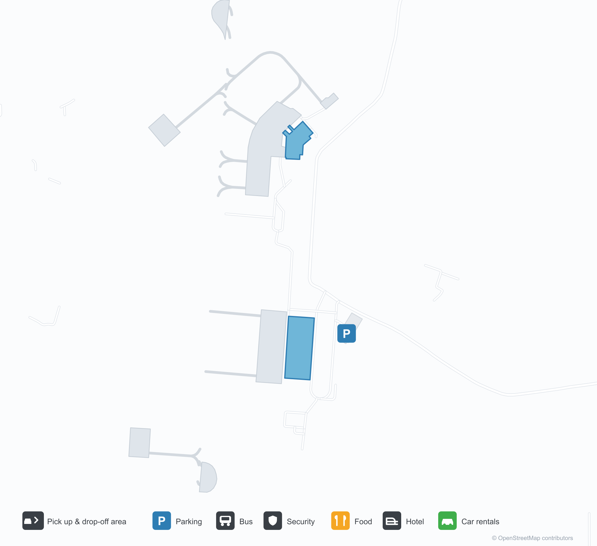
ดาวน์โหลดแผนที่สนามบินดาวน์โหลด
ภาพสนามบินภาพสนามบิน
ภาพจริงของสนามบินแห่งนี้ พร้อมเครดิตของหน้าเว็บสาธารณะที่พบภาพ; ลิขสิทธิ์ยังเป็นของผู้ถ่ายภาพต้นฉบับ คลิกที่ภาพเพื่อขยาย หรือคลิกบรรทัดเครดิตเพื่อเปิดหน้าแหล่งที่มา
เครื่องบินสองใบพัดหันหน้าเข้าหากล้องบนลานจอดอาการ์ตลา โดยมีเนินเขาเตี้ย ๆ ของตรีปุระอยู่เลยสนามบินออกไป
หลังคากันแดดสีขาวของอาคารผู้โดยสารมีชื่อสนามบินเป็นตัวอักษรสีน้ำเงิน พร้อมต้นปาล์มและแปลงดอกไม้ตามทางเดินปูพื้นภายใต้ท้องฟ้าครึ้ม
ในโถงขาออก ป้ายสีเข้มชี้ไปยังเคาน์เตอร์เช็คอินและตั๋วอิเล็กทรอนิกส์ โดยมีแถวชิ้นดินเผาติดตั้งบนผนังด้านบน
เครื่องบินลำตัวแคบลาย IndiGo จอดอยู่ที่สะพานเชื่อม ขณะที่เจ้าหน้าที่ภาคพื้นทำงานรอบลำตัวและเครื่องยนต์
ยามค่ำคืน ป้ายสนามบินอักษรเทวนาครีสีฟ้าของอาคารผู้โดยสารเรืองแสงเหนือแนวหลังคาแรงดึงสีขาว
มองผ่านรั้วลวดหนาม เครื่องบินเจ็ตหางสีแดงแล่นไปตามทางวิ่งตัดกับแนวต้นไม้ที่มีหมอก
อาคารผู้โดยสารสีขาวเตี้ยหลังคาสีเขียวอ่อนตั้งอยู่หลังลานจอด มีเสาไฟตาข่ายอยู่ด้านหน้าและหอบังคับการบินอยู่ทางขวาสุด
บันไดขึ้นเครื่องถูกดันไปชิดประตูหน้าของเครื่องบินเจ็ต IndiGo ใต้เมฆคิวมูลัสสูงตระหง่าน
แผนที่เส้นทาง Agartala - Maharaja Bir Bikram Airport — จุดหมายบินตรงแผนที่เส้นทาง
3 จุดหมายบินตรง: แผนที่ สายการบินที่ให้บริการ และระยะทาง
เที่ยวบินของAgartala - Maharaja Bir Bikram Airport — ขาออกและขาเข้าป้ายเที่ยวบิน
53 หมายเลขเที่ยวบิน ครอบคลุม 4 สายการบิน และ 5 จุดหมายปลายทาง แยกตามทิศทาง หมายเลขเที่ยวบินร่วม (codeshare) รวมอยู่ด้วย
| เที่ยวบิน | สายการบิน | จุดหมายปลายทาง | ประเทศ/ภูมิภาค |
|---|---|---|---|
| 6E114 | IndiGo | Netaji Subhash Chandra Bose International Airport | อินเดีย |
| 6E213 | IndiGo | Netaji Subhash Chandra Bose International Airport | อินเดีย |
| 6E292 | IndiGo | Netaji Subhash Chandra Bose International Airport | อินเดีย |
| 6E394 | IndiGo | Netaji Subhash Chandra Bose International Airport | อินเดีย |
| 6E491 | IndiGo | Netaji Subhash Chandra Bose International Airport | อินเดีย |
| 6E525 | IndiGo | Kempegowda International Airport Bengaluru | อินเดีย |
| 6E572 | IndiGo | Guwahati (GAU) Lokpriya Gopinath Bordoloi International Airport | อินเดีย |
| 6E2181 | IndiGo | ท่าอากาศยานนานาชาติอินทิรา คานธี | อินเดีย |
| 6E6069 | IndiGo | Netaji Subhash Chandra Bose International Airport | อินเดีย |
| 6E6097 | IndiGo | Netaji Subhash Chandra Bose International Airport | อินเดีย |
| 6E6204 | IndiGo | Dibrugarh (DIB) Dibrugarh Airport | อินเดีย |
| 6E6383 | IndiGo | ท่าอากาศยานนานาชาติอินทิรา คานธี | อินเดีย |
| 6E6504 | IndiGo | ท่าอากาศยานนานาชาติอินทิรา คานธี | อินเดีย |
| 6E6552 | IndiGo | Guwahati (GAU) Lokpriya Gopinath Bordoloi International Airport | อินเดีย |
| 6E6705 | IndiGo | Netaji Subhash Chandra Bose International Airport | อินเดีย |
| 6E6724 | IndiGo | Guwahati (GAU) Lokpriya Gopinath Bordoloi International Airport | อินเดีย |
| 6E7419 | IndiGo | Netaji Subhash Chandra Bose International Airport | อินเดีย |
| AI9588 | Air India | Netaji Subhash Chandra Bose International Airport | อินเดีย |
| AI9610 | Air India | Netaji Subhash Chandra Bose International Airport | อินเดีย |
| AI9624 | Air India | Netaji Subhash Chandra Bose International Airport | อินเดีย |
หมายเลขเที่ยวบินและเส้นทางจากดัชนีเที่ยวบิน aviability.com (ข้อมูล ณ วันที่ 26 ตุลาคม 2569); รวมหมายเลขเที่ยวบินร่วมและไม่แสดงเวลาเดินทาง ที่มา: aviability.com ↗
ข้อมูลและรายละเอียดสนามบินรายละเอียดสนามบิน
แผนที่อินเทอร์แอกทีฟ — ตำแหน่ง Agartala - Maharaja Bir Bikram Airportแผนที่อินเทอร์แอกทีฟ
ดูสนามบินนี้บนบริการแผนที่อื่น:
Agartala Airport (IXA): Low Hills and Three Domestic Routes in Tripuraคู่มือสนามบิน
A twin-turboprop faces the camera on Agartala's apron, with the low hills of Tripura beyond. The airport serves Agartala in Tripura, India, at an elevation of about 14 m, with a 2,286 m runway; the 2014 snapshot records three domestic destinations, Guwahati at 249 km, Imphal at 286 km and Kolkata at 316 km.
Airport photos

A twin turboprop facing the camera on Agartala's apron, the low hills of Tripura beyond the airfield.
The photos come from public web sources and remain the copyright of their photographers; full credits and source links sit in the photo gallery on this page.
Airport at a glance
| Item | Detail |
|---|---|
| IATA / ICAO | IXA / VEAT |
| Role | Medium-sized airport |
| Elevation | about 14 m |
| Coordinates | 23.8870, 91.2404 |
| Runways | 1, 2,286 m |
| Non-stop destinations | 3 (2014 snapshot, all domestic) |
Runways
| Runway | Length | Width | Surface |
|---|---|---|---|
| 18/36 | 2,286 m | 45 m | asphalt |
1 runway, the longest 2,286 m.
Non-stop routes
3 non-stop destinations, nearest first (OpenFlights route snapshot compiled in 2014 — confirm with the airline or airport):
| Destination | Distance | Carriers |
|---|---|---|
| Lokpriya Gopinath Bordoloi International Airport (GAU) | ~249 km | IndiGo Airlines, Spicejet |
| Bir Tikendrajit International Airport (IMF) | ~286 km | IndiGo Airlines |
| Netaji Subhash Chandra Bose International Airport (CCU) | ~316 km | IndiGo Airlines, Jet Airways, Air India Limited |
The carrier column comes from the same snapshot and includes codeshare and interline services; treat it as an indication of how busy the route is and check the airline for who actually flies it.
Nearby airports to compare
If the fares are close, these are the nearest airports of the same class (medium-sized airport) — straight-line distance, with their own non-stop counts from the same dataset:
| Airport | Distance | Non-stop destinations |
|---|---|---|
| Lengpui Airport (AJL) | ~140 km | 3 |
Before you fly
- With three domestic routes, 90–120 minutes is usually enough; land border crossings towards Bangladesh are separate from air travel.
- The 2014 snapshot records three destinations and the north-east Indian network has changed; check current information.
About the data
Runways, elevation and coordinates come from OurAirports open data. Routes and carriers come from the June 2014 OpenFlights snapshot and include codeshares and interline services; they indicate network shape and scale, not current schedules.
History
Administered by the Airports Authority of India about 9 km from Agartala, the field is the second busiest in Northeast India after Guwahati — 22nd among India's 50 major airports in 2010–11.
Source: Agartala Airport.
ความคิดเห็นจากผู้อ่านการสนทนา
ยินดีรับคำถาม รายงานการเดินทาง และการแก้ไข ความคิดเห็นเป็นสาธารณะ
กำลังโหลด…
กำลังโหลดความคิดเห็น…