
Armidale Airport
 Armidale · ออสเตรเลีย· Armidale Airport
Armidale Airport (IATA: ARM, ICAO YARM) เป็นสนามบินขนาดกลางที่ให้บริการArmidale, ออสเตรเลีย
Armidale Airport is a medium-sized airport, at an elevation of about 3,556 ft, with scheduled passenger service. This page gathers its location map, airport codes and travel information.
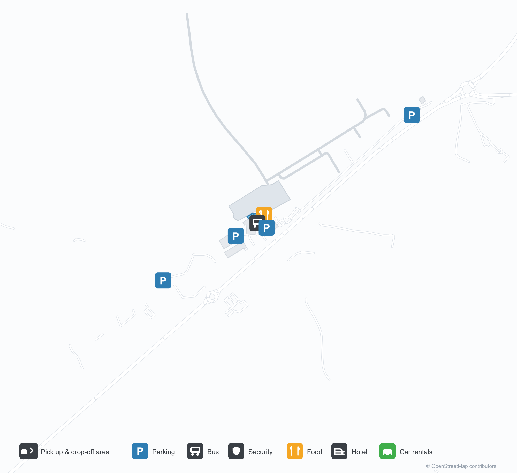
ดาวน์โหลดแผนที่สนามบินดาวน์โหลด
ภาพสนามบินภาพสนามบิน
ภาพจริงของสนามบินแห่งนี้ พร้อมเครดิตของหน้าเว็บสาธารณะที่พบภาพ; ลิขสิทธิ์ยังเป็นของผู้ถ่ายภาพต้นฉบับ คลิกที่ภาพเพื่อขยาย หรือคลิกบรรทัดเครดิตเพื่อเปิดหน้าแหล่งที่มา
ภาพถ่ายดาวเทียม: ทางวิ่งของอาร์มเดลอยู่ท่ามกลางเนินเขาและพื้นที่เกษตรกรรมบนที่ราบสูงนิวอิงแลนด์ โดยมีอาคารผู้โดยสารและลานจอดอยู่เคียงข้างสนามบิน
ภายใต้ท้องฟ้ามืดครึ้ม ผู้เดินทางสองคนเข็นกระเป๋าผ่านทางเข้ากระจกของอาคารผู้โดยสารสีเทาเตี้ย ๆ ของท่าอากาศยานภูมิภาคอาร์มเดล
มองจากอากาศ ทางวิ่งทอดตรงผ่านทุ่งหญ้าสีเขียว ขณะที่ทางขับวงแหวนที่เพิ่งปูใหม่โค้งรอบลานจอดและโรงเก็บอากาศยาน
ยามพลบค่ำ เครื่องบินใบพัดสองเครื่องยนต์พักอยู่บนลานจอดข้างอาคารผู้โดยสารผนังกระจก เงาของมันทอดยาวข้ามลานแอสฟัลต์สีเข้ม
ปลายจั่วสีเข้มของอาคารผู้โดยสารเป็นกระจกตั้งแต่ชายคาจรดพื้น โดยมีแผงศิลปะสีสนิมตั้งอยู่ข้างทางเดินอิฐแดง
โคมไฟโทนอุ่นเรืองแสงใต้หลังคากันแดดของอาคารผู้โดยสารยามค่ำ ขณะที่หางอากาศยานบนลานจอดไกล ๆ รับแสงสุดท้าย
ภายในโถงเช็คอินที่ว่างเปล่า เจ้าหน้าที่ในเครื่องแบบพิงเคาน์เตอร์ใต้จอที่ระบุ Qantas และ Link Airways
ภายใต้ท้องฟ้าสีฟ้าใส ผู้โดยสารลงจากเครื่องบินใบพัด QantasLink สู่ลานจอด ขณะที่เจ้าหน้าที่ภาคพื้นรออยู่ข้างปีก
แผนที่เส้นทาง Armidale Airport — จุดหมายบินตรงแผนที่เส้นทาง
1 จุดหมายบินตรง: แผนที่ สายการบินที่ให้บริการ และระยะทาง
เที่ยวบินของArmidale Airport — ขาออกและขาเข้าป้ายเที่ยวบิน
52 หมายเลขเที่ยวบิน ครอบคลุม 6 สายการบิน และ 3 จุดหมายปลายทาง แยกตามทิศทาง หมายเลขเที่ยวบินร่วม (codeshare) รวมอยู่ด้วย
| เที่ยวบิน | สายการบิน | จุดหมายปลายทาง | ประเทศ/ภูมิภาค |
|---|---|---|---|
| EK5118 | Emirates | ท่าอากาศยานซิดนีย์คิงส์ฟอร์ดสมิธ | ออสเตรเลีย |
| EK5154 | Emirates | ท่าอากาศยานซิดนีย์คิงส์ฟอร์ดสมิธ | ออสเตรเลีย |
| EK5170 | Emirates | ท่าอากาศยานซิดนีย์คิงส์ฟอร์ดสมิธ | ออสเตรเลีย |
| EK5190 | Emirates | ท่าอากาศยานซิดนีย์คิงส์ฟอร์ดสมิธ | ออสเตรเลีย |
| EK5194 | Emirates | ท่าอากาศยานซิดนีย์คิงส์ฟอร์ดสมิธ | ออสเตรเลีย |
| FC884 | Link Airways | Brisbane International Airport | ออสเตรเลีย |
| FC5184 | Link Airways | Brisbane International Airport | ออสเตรเลีย |
| FC8154 | Link Airways | Coffs Harbour (CFS) Coffs Harbour Airport | ออสเตรเลีย |
| MU4056 | China Eastern Airlines | ท่าอากาศยานซิดนีย์คิงส์ฟอร์ดสมิธ | ออสเตรเลีย |
| NZ7015 | Air New Zealand | ท่าอากาศยานซิดนีย์คิงส์ฟอร์ดสมิธ | ออสเตรเลีย |
| NZ7017 | Air New Zealand | ท่าอากาศยานซิดนีย์คิงส์ฟอร์ดสมิธ | ออสเตรเลีย |
| NZ7222 | Air New Zealand | ท่าอากาศยานซิดนีย์คิงส์ฟอร์ดสมิธ | ออสเตรเลีย |
| NZ7265 | Air New Zealand | ท่าอากาศยานซิดนีย์คิงส์ฟอร์ดสมิธ | ออสเตรเลีย |
| NZ7448 | Air New Zealand | ท่าอากาศยานซิดนีย์คิงส์ฟอร์ดสมิธ | ออสเตรเลีย |
| NZ7478 | Air New Zealand | ท่าอากาศยานซิดนีย์คิงส์ฟอร์ดสมิธ | ออสเตรเลีย |
| QF2019 | Qantas | ท่าอากาศยานซิดนีย์คิงส์ฟอร์ดสมิธ | ออสเตรเลีย |
| QF2021 | Qantas | ท่าอากาศยานซิดนีย์คิงส์ฟอร์ดสมิธ | ออสเตรเลีย |
| QF2023 | Qantas | ท่าอากาศยานซิดนีย์คิงส์ฟอร์ดสมิธ | ออสเตรเลีย |
| QF2025 | Qantas | ท่าอากาศยานซิดนีย์คิงส์ฟอร์ดสมิธ | ออสเตรเลีย |
| QF2031 | Qantas | ท่าอากาศยานซิดนีย์คิงส์ฟอร์ดสมิธ | ออสเตรเลีย |
หมายเลขเที่ยวบินและเส้นทางจากดัชนีเที่ยวบิน aviability.com (ข้อมูล ณ วันที่ 26 ตุลาคม 2569); รวมหมายเลขเที่ยวบินร่วมและไม่แสดงเวลาเดินทาง ที่มา: aviability.com ↗
ข้อมูลและรายละเอียดสนามบินรายละเอียดสนามบิน
แผนที่อินเทอร์แอกทีฟ — ตำแหน่ง Armidale Airportแผนที่อินเทอร์แอกทีฟ
ดูสนามบินนี้บนบริการแผนที่อื่น:
Armidale Airport (ARM): One Domestic Route on the New England Tablelandsคู่มือสนามบิน
Seen from above, Armidale's runways lie among hills and farmland on the New England tablelands, with the terminal and apron alongside the field. The airport serves Armidale in New South Wales, Australia, at an elevation of about 1,084 m, with runways up to 1,738 m; Armidale is a university and farming town on the New England tablelands, and its route map is short — only Sydney (382 km), the link to the national network.
Satellite view
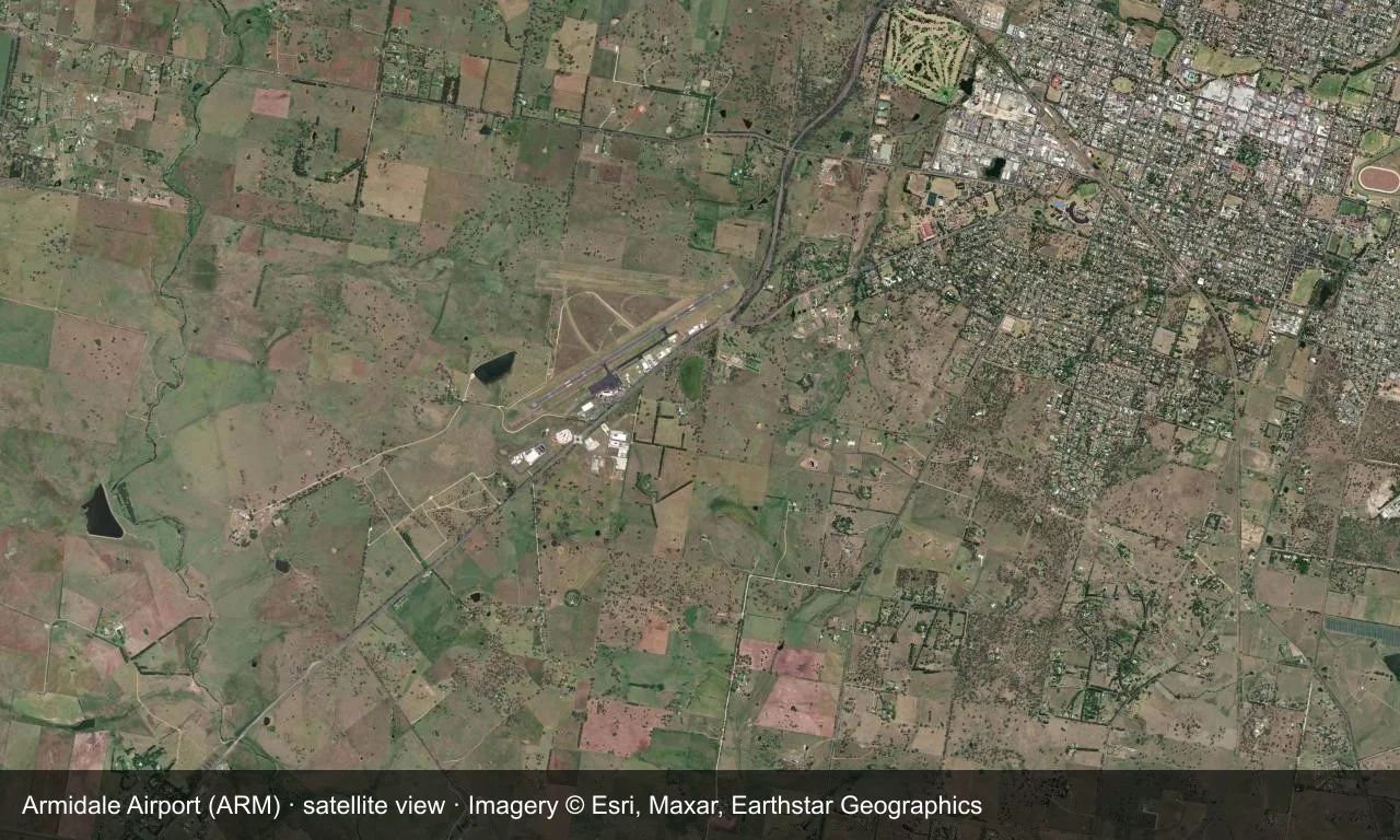
Satellite view: Armidale's runways lie among hills and farmland on the New England tablelands, with the terminal and apron alongside the field.
The satellite image comes from Esri World Imagery (© Esri, Maxar, Earthstar Geographics); the field and attribution are labelled in the image. This is a satellite view, not a ground-level photograph.
Airport at a glance
| Item | Detail |
|---|---|
| IATA / ICAO | ARM / YARM |
| Role | Medium-sized airport |
| Elevation | about 1,084 m |
| Coordinates | -30.5281, 151.6170 |
| Runways | 2, longest 1,738 m |
| Non-stop destinations | 1 (Sydney; 2014 snapshot) |
Runways
| Runway | Length | Width | Surface |
|---|---|---|---|
| 05/23 | 1,738 m | 30 m | asphalt |
| 09/27 | 1,116 m | 30 m | GVL |
2 runways, the longest 1,738 m.
Non-stop routes
1 non-stop destinations, nearest first (OpenFlights route snapshot compiled in 2014 — confirm with the airline or airport):
| Destination | Distance | Carriers |
|---|---|---|
| Sydney Kingsford Smith International Airport (SYD) | ~382 km | Qantas, Regional Express |
The carrier column comes from the same snapshot and includes codeshare and interline services; treat it as an indication of how busy the route is and check the airline for who actually flies it.
Nearby airports to compare
If the fares are close, these are the nearest airports of the same class (medium-sized airport) — straight-line distance, with their own non-stop counts from the same dataset:
| Airport | Distance | Non-stop destinations |
|---|---|---|
| Albury Airport (ABX) | ~753 km | 2 |
Before you fly
- With only Sydney, confirm the flight is operating after booking.
- Tableland winters are cold, with morning frost and low cloud possible.
About the data
Runways, elevation and coordinates come from OurAirports open data. Routes and carriers come from the June 2014 OpenFlights snapshot and include codeshares and interline services; they indicate network shape and scale, not current schedules.
ความคิดเห็นจากผู้อ่านการสนทนา
ยินดีรับคำถาม รายงานการเดินทาง และการแก้ไข ความคิดเห็นเป็นสาธารณะ
กำลังโหลด…
กำลังโหลดความคิดเห็น…