
Armidale Airport
 Armidale · オーストラリア· Armidale Airport
Armidale Airport(IATA: ARM、ICAO: YARM)はArmidale、オーストラリアにある中型空港です。
Armidale Airport is a medium-sized airport, at an elevation of about 3,556 ft, with scheduled passenger service. This page gathers its location map, airport codes and travel information.
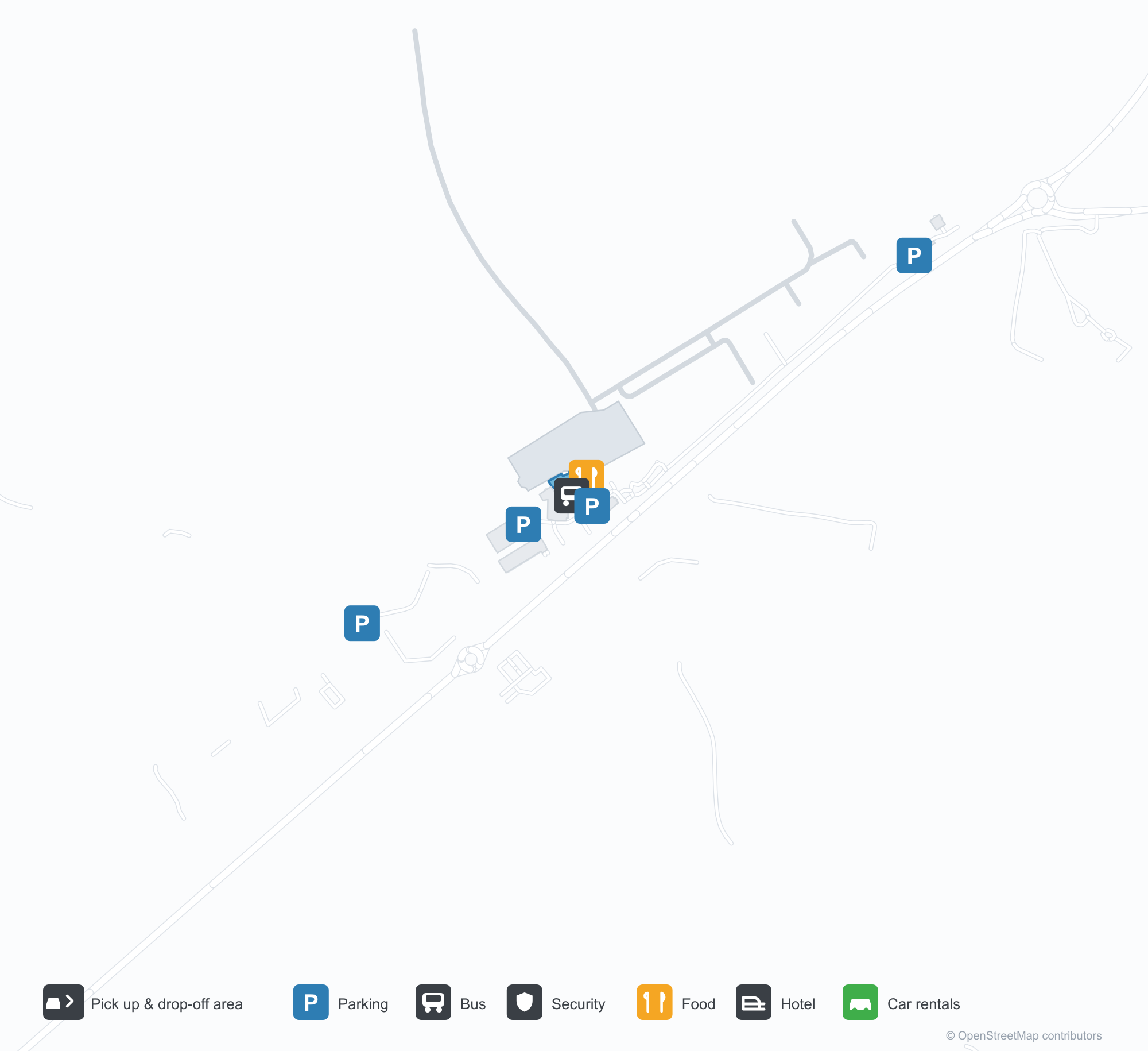
空港マップをダウンロードダウンロード
空港写真空港写真
この空港の実際の写真です。いずれも公開ウェブページを出典として明記しており、著作権は撮影者に帰属します。写真をクリックすると拡大表示され、クレジットをクリックすると元のページが開きます。
衛星画像:アーミデイルの滑走路はニューイングランド台地の丘陵と農地の中にあり、ターミナルとエプロンが飛行場に沿って並ぶ。
曇り空の下、旅行者2人がスーツケースを引き、アーミデイル地域空港の低い灰色ターミナルのガラス入口を通り過ぎる。
空から見ると、滑走路が緑の牧草地の脇をまっすぐ延び、新しく舗装されたループ状の誘導路がエプロンと格納庫を回り込む。
夕暮れ、双発ターボプロップ機がガラス張りターミナル脇のエプロンに停まり、その影が暗い舗装の上に長く伸びる。
ターミナルの暗い切妻の端は軒から地面までガラス張りで、赤レンガの小道沿いに錆色のアートパネルが立つ。
日暮れ、ターミナルのキャノピーの下に暖かな灯りがともり、遠いエプロンの機体の尾翼が最後の光を受ける。
空っぽのチェックインロビーで、制服姿の職員がカウンターにもたれ、上にはカンタスとリンク航空の表示画面。
澄んだ青空の下、乗客がカンタスリンクのターボプロップ機からエプロンへ降り、翼のそばで地上係員が待つ。
Armidale Airportの路線マップ — 直行便の目的地路線マップ
直行目的地1か所。地図、就航航空会社、距離を掲載しています。
Armidale Airport発着便 — 出発と到着フライトボード
便名52件、6社の航空会社、3か所の目的地を出発・到着別に掲載しています。コードシェア便も含みます。
| 便 | 航空会社 | 目的地 | 国・地域 |
|---|---|---|---|
| EK5118 | Emirates | シドニー・キングスフォード・スミス空港 | オーストラリア |
| EK5154 | Emirates | シドニー・キングスフォード・スミス空港 | オーストラリア |
| EK5170 | Emirates | シドニー・キングスフォード・スミス空港 | オーストラリア |
| EK5190 | Emirates | シドニー・キングスフォード・スミス空港 | オーストラリア |
| EK5194 | Emirates | シドニー・キングスフォード・スミス空港 | オーストラリア |
| FC884 | Link Airways | Brisbane International Airport | オーストラリア |
| FC5184 | Link Airways | Brisbane International Airport | オーストラリア |
| FC8154 | Link Airways | Coffs Harbour (CFS) Coffs Harbour Airport | オーストラリア |
| MU4056 | China Eastern Airlines | シドニー・キングスフォード・スミス空港 | オーストラリア |
| NZ7015 | Air New Zealand | シドニー・キングスフォード・スミス空港 | オーストラリア |
| NZ7017 | Air New Zealand | シドニー・キングスフォード・スミス空港 | オーストラリア |
| NZ7222 | Air New Zealand | シドニー・キングスフォード・スミス空港 | オーストラリア |
| NZ7265 | Air New Zealand | シドニー・キングスフォード・スミス空港 | オーストラリア |
| NZ7448 | Air New Zealand | シドニー・キングスフォード・スミス空港 | オーストラリア |
| NZ7478 | Air New Zealand | シドニー・キングスフォード・スミス空港 | オーストラリア |
| QF2019 | Qantas | シドニー・キングスフォード・スミス空港 | オーストラリア |
| QF2021 | Qantas | シドニー・キングスフォード・スミス空港 | オーストラリア |
| QF2023 | Qantas | シドニー・キングスフォード・スミス空港 | オーストラリア |
| QF2025 | Qantas | シドニー・キングスフォード・スミス空港 | オーストラリア |
| QF2031 | Qantas | シドニー・キングスフォード・スミス空港 | オーストラリア |
便名と路線はaviability.comのフライトインデックス(スナップショット:2026年10月26日)に基づきます。コードシェア便を含み、出発時刻は掲載していません。出典:aviability.com ↗
空港情報と詳細空港の詳細
インタラクティブマップ — Armidale Airportの位置インタラクティブマップ
他の地図サービスでこの空港を見る:
Armidale Airport (ARM): One Domestic Route on the New England Tablelands空港ガイド
Seen from above, Armidale's runways lie among hills and farmland on the New England tablelands, with the terminal and apron alongside the field. The airport serves Armidale in New South Wales, Australia, at an elevation of about 1,084 m, with runways up to 1,738 m; Armidale is a university and farming town on the New England tablelands, and its route map is short — only Sydney (382 km), the link to the national network.
Satellite view
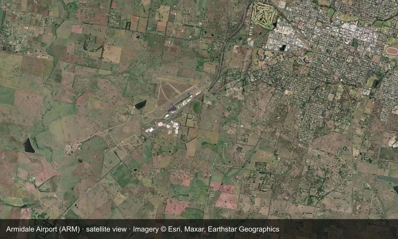
Satellite view: Armidale's runways lie among hills and farmland on the New England tablelands, with the terminal and apron alongside the field.
The satellite image comes from Esri World Imagery (© Esri, Maxar, Earthstar Geographics); the field and attribution are labelled in the image. This is a satellite view, not a ground-level photograph.
Airport at a glance
| Item | Detail |
|---|---|
| IATA / ICAO | ARM / YARM |
| Role | Medium-sized airport |
| Elevation | about 1,084 m |
| Coordinates | -30.5281, 151.6170 |
| Runways | 2, longest 1,738 m |
| Non-stop destinations | 1 (Sydney; 2014 snapshot) |
Runways
| Runway | Length | Width | Surface |
|---|---|---|---|
| 05/23 | 1,738 m | 30 m | asphalt |
| 09/27 | 1,116 m | 30 m | GVL |
2 runways, the longest 1,738 m.
Non-stop routes
1 non-stop destinations, nearest first (OpenFlights route snapshot compiled in 2014 — confirm with the airline or airport):
| Destination | Distance | Carriers |
|---|---|---|
| Sydney Kingsford Smith International Airport (SYD) | ~382 km | Qantas, Regional Express |
The carrier column comes from the same snapshot and includes codeshare and interline services; treat it as an indication of how busy the route is and check the airline for who actually flies it.
Nearby airports to compare
If the fares are close, these are the nearest airports of the same class (medium-sized airport) — straight-line distance, with their own non-stop counts from the same dataset:
| Airport | Distance | Non-stop destinations |
|---|---|---|
| Albury Airport (ABX) | ~753 km | 2 |
Before you fly
- With only Sydney, confirm the flight is operating after booking.
- Tableland winters are cold, with morning frost and low cloud possible.
About the data
Runways, elevation and coordinates come from OurAirports open data. Routes and carriers come from the June 2014 OpenFlights snapshot and include codeshares and interline services; they indicate network shape and scale, not current schedules.
読者コメントディスカッション
質問、旅行記、訂正など、お気軽にお寄せください。コメントは公開されます。
読み込み中…
コメントを読み込み中…