
멕시코시티 국제공항 터미널 지도
 멕시코시티 · 멕시코· Mexico City International Airport
멕시코시티 국제공항(IATA: MEX, ICAO: MMMX)은 멕시코 멕시코시티에 위치한 대형 공항입니다. 터미널은 2개, 게이트는 60개이며, 멕시코시티 시내 중심에서 약 6 km 떨어져 있습니다.
Mexico City International Airport (MEX) serves Mexico City, Mexico. It has 2 terminals with 60 gates in total and handles about 50 million passengers a year. The airport is about 6 km from the city centre. Ground transport into the city: rail, bus and taxi.
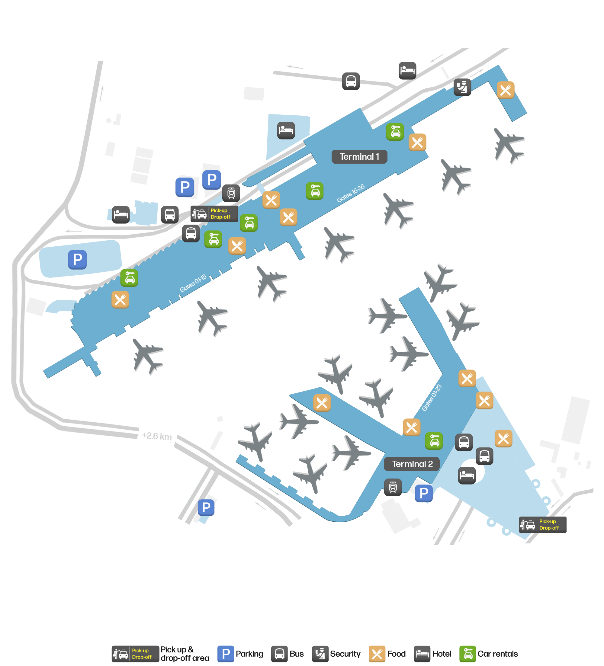
공항 지도 다운로드다운로드
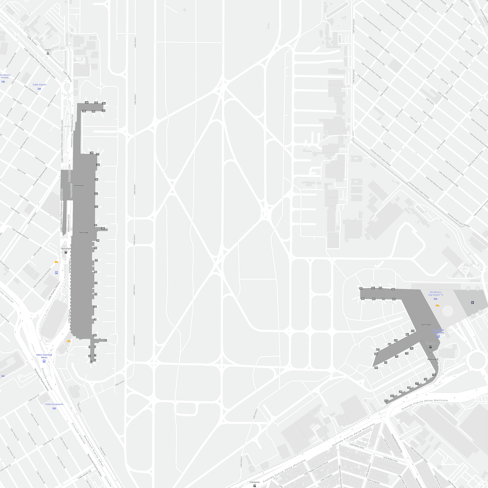
공항 실제 사진공항 사진
다음은 이 공항의 실제 사진으로, 모두 공개된 인터넷 출처에서 가져왔으며 사진마다 출처를 표시했습니다. 저작권은 원저작자에게 있습니다. 사진을 클릭하면 크게 볼 수 있고, 출처를 클릭하면 원본 페이지가 열립니다.
위성 사진: 도시와 해안, 지형에 둘러싸인 멕시코시티 국제공항(MEX) — 활주로가 화면을 가로지르는 모습.
공항 시간 정보 — MEX 현재 시간공항 시간
MEX의 현재 시간(America/Mexico_City)과 현지 시간을 비교합니다.
멕시코시티 국제공항 노선도 · 직항 목적지노선도
직항 목적지 91개: 노선도, 운항 항공사, 비행 거리.
공항 정보 및 상세공항 상세
멕시코시티 국제공항 인터랙티브 지도 — 공항 위치인터랙티브 지도
다른 지도 서비스에서 이 공항 보기:
Mexico City Benito Juárez International Airport terminal guide공항 안내
Mexico City's airport lies about 13 km from the city centre and handles around 44.6 million passengers a year (2025), making it one of the busiest in Latin America. It has two terminals, 2–3 km apart, linked by a free monorail shuttle (Aerotrén) — but one thing matters more than that: Mexico City now has two airports, so whenever you see "Mexico City" on a booking, check the three-letter code.
Satellite view
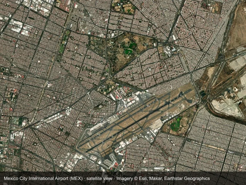
Satellite view: Mexico City International Airport (MEX) is framed by city, coast or terrain, with the runway crossing the scene.
The satellite image comes from Esri World Imagery (© Esri, Maxar, Earthstar Geographics); the field and attribution are labelled in the image. This is a satellite view, not a ground-level photograph.
The two terminals
| Code | Name | Main carriers | Notes |
|---|---|---|---|
| T1 | Terminal 1 | Most international carriers, along with domestic and foreign airlines | Built earlier and the largest; Metro Line 5 has a station here |
| T2 | Terminal 2 | Aeroméxico (hub) and SkyTeam | Newer, with long-haul and connecting flights concentrated here |
How to tell where you are:
- The Aeroméxico group is in T2; almost all other carriers are in T1 — start with the airline, then check your boarding pass.
- T1 ↔ T2 has two links: the airside Aerotrén monorail, which is free (boarding pass required, roughly 05:00–23:00), or the landside shuttle bus, free or low-cost (24 hours).
- For a cross-terminal connection allow 45–60 minutes.
Our diagram draws the two buildings as separate structures joined by a single monorail line precisely to show the distance between them.
Transfers and connections
- A connection inside T1 or inside T2 is quickest; for a cross-terminal connection allow more than 1.5 hours.
- The airside cross-terminal link depends on the Aerotrén and on your boarding pass, and it stops running late at night, leaving only the landside shuttle.
- Mexico City sits at about 2,200 metres, and a long-haul flight takes more out of you here, so err on the generous side with connection time.
Routes and flights
- Routes — around 20-plus airlines flying to about 100 destinations; long-haul points include Madrid, Barcelona, Paris, Amsterdam, London, Tokyo, São Paulo and Buenos Aires.
- Flights — 44.61 million passengers in 2025 (27.12 million domestic, 17.48 million international), down about 1.7% as some services have shifted to NLU.
- Aircraft — main base is Aeroméxico (T2) and SkyTeam, followed by Viva Aerobús and Volaris; the fleet is 737 and A320 family narrowbodies, with Aeroméxico using 787 and 777 on long-haul.
Getting into Mexico City
- Metro Line 5 — has a station on the T1 side and costs very little; the main way to dodge the traffic, but T2 has no direct metro, so you must shuttle to T1 first.
- The Metro Line 1 extension — connects parts of the network to the area around the airport.
- Airport buses — cover the main hubs and hotel districts of the city.
- Taxi / rideshare — authorised taxis must be paid for at a counter inside the terminal; rideshare pick-ups are from set points.
Practical tips
- The biggest trap is confusing the airports: Mexico City now has Benito Juárez (MEX) and Felipe Ángeles (NLU), with NLU 35–50 km north of the city and used mainly by low-cost carriers. Check the three-letter code before booking or arranging a pick-up.
- Travellers heading for NLU can take the suburban railway that opened in April 2026 (direct from Buenavista station in the north of the city) instead of relying on a long coach ride.
- Traffic in Mexico City is severe, so when you have a flight to catch, budget for peak road conditions — rail is the only predictable option.
References
터미널 안내터미널 안내
멕시코시티 국제공항 각 터미널의 게이트 범위, 주요 항공사, 시설 분포를 정리했습니다.