
Adampur Airport
 Adampur · India· Adampur Airport
Adampur Airport (IATA: AIP, ICAO VIAX) adalah bandara kecil yang melayani Adampur, India.
Adampur Airport is a small airport, at an elevation of about 775 ft, with scheduled passenger service. This page gathers its location map, airport codes and travel information.
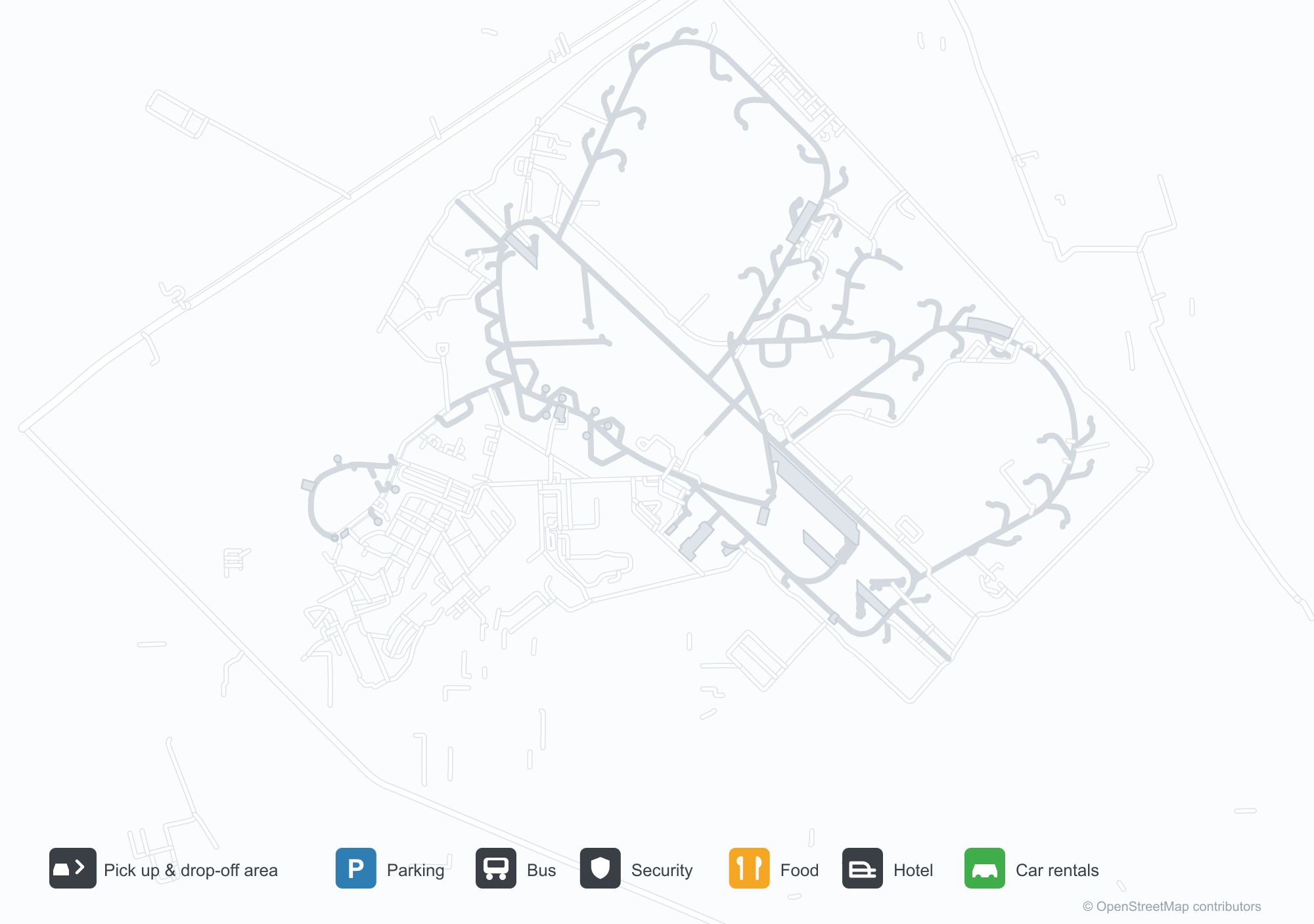
Unduh Peta BandaraUnduhan
Foto bandaraFoto Bandara
Foto asli bandara ini, masing-masing dikreditkan ke halaman web publik tempat foto ditemukan; hak cipta tetap milik fotografer aslinya. Klik foto untuk memperbesar, atau baris kredit untuk membuka halaman sumbernya.
Citra satelit: Bandara Adampur (AIP) dikelilingi vegetasi hijau dan lahan pertanian.
Di bawah langit cerah, papan biru Adampur menghiasi terminal berfasad kaca sementara sekelompok orang berpose di tangga.
Jendela melengkung dan paviliun kubah kecil menghiasi terminal Bandara Adampur, dengan tiang bendera tinggi dan karpet merah di halaman.
Dua truk pemadam kebakaran menyemprotkan semburan air melengkung di atas pesawat penumpang di apron, dengan helikopter terparkir di satu sisi.
Saat senja, air mancur menyembur di depan terminal yang diterangi sementara bendera India tergantung di tiangnya yang tinggi.
Petugas berbaju rompi reflektif cerah berdiri berjajar panjang di halaman beraspal di depan terminal.
Pesawat turboprop SpiceJet merah putih beristirahat di apron sementara petugas darat dan pengunjung berjalan di dekatnya di bawah langit berkabut.
Bangunan satu lantai rendah berhiaskan papan biru bertuliskan Adampur Airport dalam bahasa Punjabi dan Inggris, dengan tenda bergaris di pintunya.
Penerbangan Adampur Airport — keberangkatan & kedatanganPapan Penerbangan
4 nomor penerbangan dari 2 maskapai dan 2 tujuan, dipisahkan menurut arah. Nomor codeshare disertakan.
| Penerbangan | Maskapai | Tujuan | Negara/wilayah |
|---|---|---|---|
| 6E5932 | IndiGo | Chhatrapati Shivaji Maharaj International Airport | India |
| S5235 | Star Air | HDO |
Nomor penerbangan dan rute dari indeks penerbangan aviability.com (cuplikan 26 Oktober 2026); nomor codeshare disertakan dan waktu keberangkatan tidak ditampilkan. Sumber: aviability.com ↗
Informasi & detail bandaraDetail Bandara
Peta interaktif — lokasi Adampur AirportPeta Interaktif
Lihat bandara ini di layanan peta lain:
Adampur Airport (AIP) Guide: A small field and its surroundingsPanduan Bandara
Adampur Airport (AIP) lies in India, with satellite imagery showing green vegetation and farmland. The field sits at about 236 m above sea level and has a single 2,755 m runway; the 2014 route snapshot records no scheduled services. The nearest airport is Halwara International Airport (77.2 km).
Satellite view
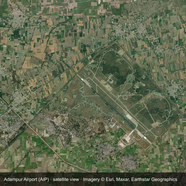
The field at Adampur Airport (AIP) seen from orbit, set in green vegetation and farmland.
The image is Esri World Imagery (© Esri, Maxar, Earthstar Geographics), labelled with the field and source. It is a satellite view, not a ground photo.
Airport at a glance
| Item | Detail |
|---|---|
| IATA / ICAO | AIP / VIAX |
| Role | small airport |
| Elevation | about 236 m |
| Coordinates | 31.4338, 75.7588 |
| Runways | 1, longest 2,755 m |
| Non-stop destinations | 0 in the 2014 snapshot |
Runways
| Runway | Length | Surface |
|---|---|---|
| 13/31 | 2,755 m | ASP |
Why there is no route table
No non-stop schedule was captured for AIP in 2014. For current movements, consult the airport operator or a recent flight-planning source.
Nearby airports
| Airport | Distance | Non-stop destinations |
|---|---|---|
| Halwara International Airport (HWR) | ~77.2 km | — |
| Pathankot Airport (IXP) | ~89.7 km | — |
| Kangra Airport (DHM) | ~94.2 km | 1 |
Getting there and navigating
- Coordinates: 31.4338, 75.7588
- Open in a map: Google Maps | Amap | Baidu Maps
The location map gives the field's position relative to nearby roads and towns. Terminal and local-transport details are outside this dataset.
Runway and surroundings
From the air, Adampur Airport appears within green vegetation and farmland in India. The primary strip, 13/31, is oriented northwest–southeast and extends 2,755 m at about 236 m.
That 2,755 m length is typical of narrowbody operations. The paved surface supports regular operations, though it does not imply scheduled service. The nearest airport is Halwara International Airport, 77.2 km away, with no recorded destinations in the same snapshot.
No scheduled services appear in the 2014 snapshot, so the field is best treated as a general-aviation or charter stop; confirm handling and current movements with the operator.
Before you fly
- The 2,755 m runway can take larger regional aircraft, but that does not guarantee scheduled service.
- The runway is paved, which supports year-round operations, but scheduled service is still not guaranteed.
- Halwara International Airport is the nearest airport in this dataset, 77.2 km away, but it also has no recorded destinations for 2014.
- Because the 2014 route table is empty, check the airport operator's current notices before making travel plans.
- Treat this as a general-aviation or charter field rather than a large terminal; confirm handling and opening hours in advance.
About the data
The airport facts on this page are drawn from OurAirports. Route data is the June 2014 OpenFlights snapshot, so treat it as historical context rather than a timetable.
Komentar pembacaDiskusi
Pertanyaan, laporan perjalanan, dan koreksi sangat kami harapkan. Komentar bersifat publik.
Memuat…
Memuat komentar…