
Anaa Airport
 Anaa · Polinesia Francesa· Anaa Airport
Anaa Airport (IATA: AAA, OACI NTGA) es un aeropuerto mediano que da servicio a Anaa, Polinesia Francesa.
Anaa Airport is a medium-sized airport, at an elevation of about 10 ft, with scheduled passenger service. This page gathers its location map, airport codes and travel information.

Descargar mapas de aeropuertosDescargas
Fotos del aeropuertoFotos del aeropuerto
Fotos reales de este aeropuerto, cada una con la referencia de la página web pública donde se encontró; los derechos de autor siguen siendo de los fotógrafos originales. Haz clic en una foto para ampliarla o en la línea de crédito para abrir su página de origen.
El atolón de Anaa fotografiado desde la Estación Espacial Internacional (imagen de la NASA ISS007-E-14624, dominio público): el estrecho atolón, su borde de arrecife blanco y su laguna turquesa; el aeropuerto se encuentra en el islote principal.
Vuelos de Anaa Airport — salidas y llegadasPanel de vuelos
6 números de vuelo de 1 aerolínea y 3 destinos, divididos por dirección. Se incluyen los números de código compartido.
| Vuelo | Aerolínea | Destino | País/región |
|---|---|---|---|
| VT959 | Air Tahiti | FAC | |
| VT979 | Air Tahiti | FAC | |
| VT980 | Air Tahiti | Makemo (MKP) Makemo Airport | Polinesia Francesa |
Números de vuelo y rutas del índice de vuelos de aviability.com (instantánea de 26 de octubre de 2026); se incluyen los números de código compartido y no se muestran horarios de salida. Fuente: aviability.com ↗
Información y datos del aeropuertoDatos del aeropuerto
Mapa interactivo — ubicación de Anaa AirportMapa interactivo
Consulta este aeropuerto en otros servicios de mapas:
Anaa Airport (AAA): An Atoll Airport Seen From SpaceGuía del aeropuerto
The photo comes from the International Space Station: the long, narrow Anaa atoll, its white reef edge and turquoise lagoon are clearly visible, and the airport sits on the main islet in the frame. The field serves Anaa in French Polynesia at an elevation of about 3 m, with a 1,500 m runway; the 2014 snapshot records no scheduled routes.
Airport photos
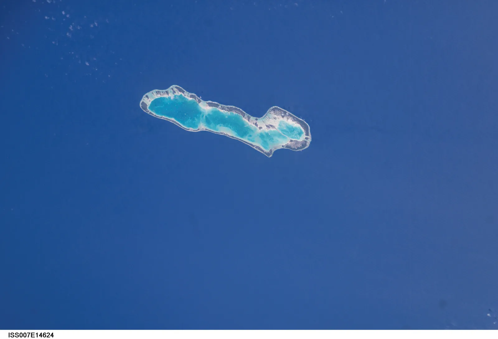
Anaa atoll photographed from the International Space Station (NASA image ISS007-E-14624, public domain) — the narrow atoll with its white reef edge and turquoise lagoon; the airport sits on the main islet.
The photos come from public web sources and remain the copyright of their photographers; full credits and source links sit in the photo gallery on this page.
Airport at a glance
| Item | Detail |
|---|---|
| IATA / ICAO | AAA / NTGA |
| Role | Medium-sized airport |
| Elevation | about 3 m |
| Coordinates | -17.3526, -145.5100 |
| Runways | 1, 1,500 m |
| Non-stop destinations | 0 in the 2014 snapshot |
Runways
| Runway | Length | Width | Surface |
|---|---|---|---|
| 14/32 | 1,500 m | 18 m | asphalt |
1 runway, the longest 1,500 m.
Non-stop routes
The route dataset carries no scheduled non-stop services for this airport. Regional schedules change often — confirm with the airline or airport before booking.
Nearby airports to compare
If the fares are close, these are the nearest airports of the same class (medium-sized airport) — straight-line distance, with their own non-stop counts from the same dataset:
| Airport | Distance | Non-stop destinations |
|---|---|---|
| Arutua Airport (AXR) | ~262 km | 1 |
| Ahe Airport (AHE) | ~335 km | 2 |
Before you fly
- Atoll schedules are usually run by regional carriers; an empty 2014 snapshot does not mean no flights today, so check the airline directly.
- With a 1,500 m runway, aircraft and payloads are limited; baggage and supplies follow small-aircraft rules.
About the data
Runways, elevation and coordinates come from OurAirports open data. Routes and carriers come from the June 2014 OpenFlights snapshot and include codeshares and interline services; they indicate network shape and scale, not current schedules.
Comentarios de los lectoresDebate
Las preguntas, los relatos de viaje y las correcciones son bienvenidos. Los comentarios son públicos.
Cargando…
Cargando comentarios…