
Anaa Airport
 Anaa · Fransız Polinezyası· Anaa Airport
Anaa Airport (IATA: AAA, ICAO NTGA), Anaa, Fransız Polinezyası kentine hizmet veren bir orta büyüklükte havalimanıdır.
Anaa Airport is a medium-sized airport, at an elevation of about 10 ft, with scheduled passenger service. This page gathers its location map, airport codes and travel information.

Havalimanı Haritalarını İndirinİndirmeler
Havalimanı fotoğraflarıHavalimanı Fotoğrafları
Bu havalimanının gerçek fotoğrafları; her fotoğrafın altında, fotoğrafın bulunduğu kamuya açık web sayfasına bir atıf yer alır ve telif hakkı özgün fotoğrafçılarda kalır. Yakınlaştırmak için bir fotoğrafa, kaynak sayfasını açmak için bir atıf satırına tıklayın.
Anaa atolü, Uluslararası Uzay İstasyonu'ndan fotoğraflandı (NASA görüntüsü ISS007-E-14624, kamu malı) — dar atol, beyaz resif kenarı ve turkuaz lagünüyle; havalimanı ana adacıkta yer alıyor.
Anaa Airport uçuşları — kalkışlar ve varışlarUçuş Panosu
6 uçuş numarası, 1 havayolu şirketi ve 3 varış noktası, yönlere göre ayrılmıştır. Ortak uçuş numaraları dahildir.
| Uçuş | Havayolu şirketi | Varış noktası | Ülke/bölge |
|---|---|---|---|
| VT959 | Air Tahiti | FAC | |
| VT979 | Air Tahiti | FAC | |
| VT980 | Air Tahiti | Makemo (MKP) Makemo Airport | Fransız Polinezyası |
Uçuş numaraları ve rotalar aviability.com uçuş dizininden (anlık görüntü: 26 Ekim 2026); ortak uçuş numaraları dahildir ve kalkış saatleri gösterilmez. Kaynak: aviability.com ↗
Havalimanı bilgileri ve ayrıntılarıHavalimanı Ayrıntıları
Etkileşimli harita — Anaa Airport konumuEtkileşimli Harita
Bu havalimanını diğer harita hizmetlerinde görüntüleyin:
Anaa Airport (AAA): An Atoll Airport Seen From SpaceHavalimanı Rehberi
The photo comes from the International Space Station: the long, narrow Anaa atoll, its white reef edge and turquoise lagoon are clearly visible, and the airport sits on the main islet in the frame. The field serves Anaa in French Polynesia at an elevation of about 3 m, with a 1,500 m runway; the 2014 snapshot records no scheduled routes.
Airport photos
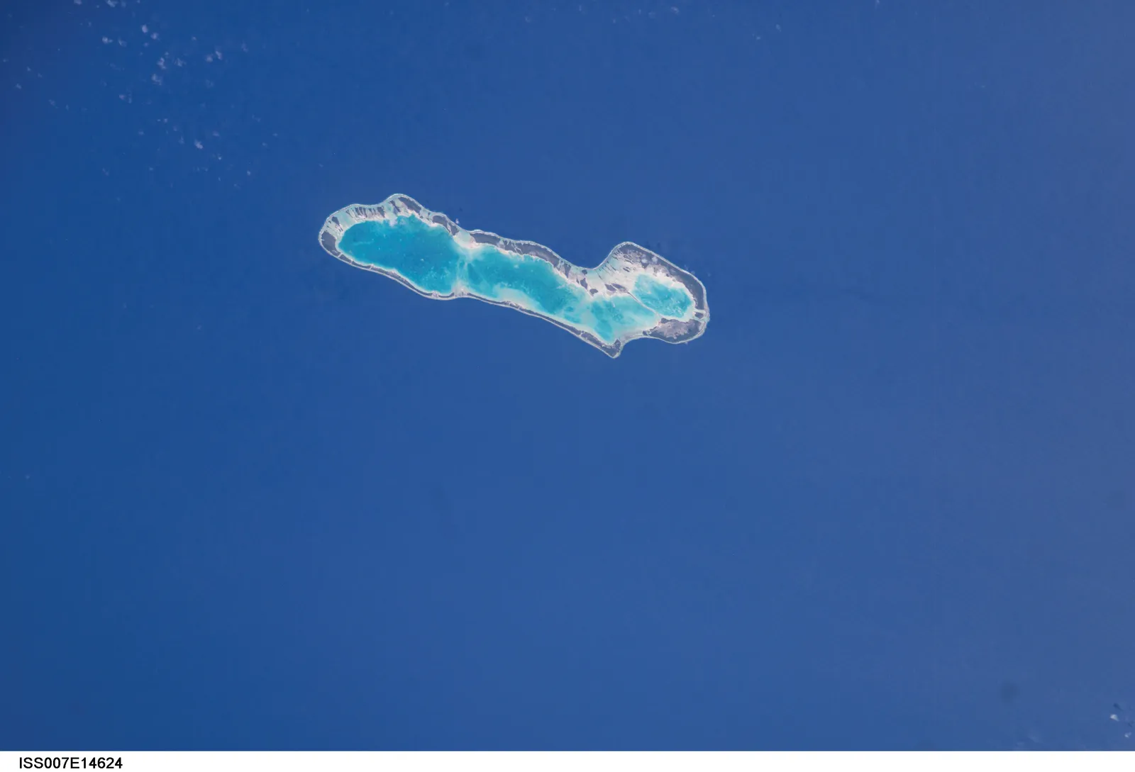
Anaa atoll photographed from the International Space Station (NASA image ISS007-E-14624, public domain) — the narrow atoll with its white reef edge and turquoise lagoon; the airport sits on the main islet.
The photos come from public web sources and remain the copyright of their photographers; full credits and source links sit in the photo gallery on this page.
Airport at a glance
| Item | Detail |
|---|---|
| IATA / ICAO | AAA / NTGA |
| Role | Medium-sized airport |
| Elevation | about 3 m |
| Coordinates | -17.3526, -145.5100 |
| Runways | 1, 1,500 m |
| Non-stop destinations | 0 in the 2014 snapshot |
Runways
| Runway | Length | Width | Surface |
|---|---|---|---|
| 14/32 | 1,500 m | 18 m | asphalt |
1 runway, the longest 1,500 m.
Non-stop routes
The route dataset carries no scheduled non-stop services for this airport. Regional schedules change often — confirm with the airline or airport before booking.
Nearby airports to compare
If the fares are close, these are the nearest airports of the same class (medium-sized airport) — straight-line distance, with their own non-stop counts from the same dataset:
| Airport | Distance | Non-stop destinations |
|---|---|---|
| Arutua Airport (AXR) | ~262 km | 1 |
| Ahe Airport (AHE) | ~335 km | 2 |
Before you fly
- Atoll schedules are usually run by regional carriers; an empty 2014 snapshot does not mean no flights today, so check the airline directly.
- With a 1,500 m runway, aircraft and payloads are limited; baggage and supplies follow small-aircraft rules.
About the data
Runways, elevation and coordinates come from OurAirports open data. Routes and carriers come from the June 2014 OpenFlights snapshot and include codeshares and interline services; they indicate network shape and scale, not current schedules.
Okuyucu yorumlarıTartışma
Sorular, seyahat deneyimleri ve düzeltmeler memnuniyetle karşılanır. Yorumlar herkese açıktır.
Yükleniyor…
Yorumlar yükleniyor…