
Anaa Airport
 Anaa · เฟรนช์โปลินีเซีย· Anaa Airport
Anaa Airport (IATA: AAA, ICAO NTGA) เป็นสนามบินขนาดกลางที่ให้บริการAnaa, เฟรนช์โปลินีเซีย
Anaa Airport is a medium-sized airport, at an elevation of about 10 ft, with scheduled passenger service. This page gathers its location map, airport codes and travel information.

ดาวน์โหลดแผนที่สนามบินดาวน์โหลด
ภาพสนามบินภาพสนามบิน
ภาพจริงของสนามบินแห่งนี้ พร้อมเครดิตของหน้าเว็บสาธารณะที่พบภาพ; ลิขสิทธิ์ยังเป็นของผู้ถ่ายภาพต้นฉบับ คลิกที่ภาพเพื่อขยาย หรือคลิกบรรทัดเครดิตเพื่อเปิดหน้าแหล่งที่มา
อะทอลล์อานา (Anaa) ถ่ายจากสถานีอวกาศนานาชาติ (ภาพ NASA ISS007-E-14624 สาธารณสมบัติ) — อะทอลล์แคบ ๆ ขอบแนวปะการังสีขาวและทะเลสาบน้ำเค็มสีเทอร์ควอยซ์ โดยมีท่าอากาศยานอยู่บนเกาะหลัก
เที่ยวบินของAnaa Airport — ขาออกและขาเข้าป้ายเที่ยวบิน
6 หมายเลขเที่ยวบิน ครอบคลุม 1 สายการบิน และ 3 จุดหมายปลายทาง แยกตามทิศทาง หมายเลขเที่ยวบินร่วม (codeshare) รวมอยู่ด้วย
| เที่ยวบิน | สายการบิน | จุดหมายปลายทาง | ประเทศ/ภูมิภาค |
|---|---|---|---|
| VT959 | Air Tahiti | FAC | |
| VT979 | Air Tahiti | FAC | |
| VT980 | Air Tahiti | Makemo (MKP) Makemo Airport | เฟรนช์โปลินีเซีย |
หมายเลขเที่ยวบินและเส้นทางจากดัชนีเที่ยวบิน aviability.com (ข้อมูล ณ วันที่ 26 ตุลาคม 2569); รวมหมายเลขเที่ยวบินร่วมและไม่แสดงเวลาเดินทาง ที่มา: aviability.com ↗
ข้อมูลและรายละเอียดสนามบินรายละเอียดสนามบิน
แผนที่อินเทอร์แอกทีฟ — ตำแหน่ง Anaa Airportแผนที่อินเทอร์แอกทีฟ
ดูสนามบินนี้บนบริการแผนที่อื่น:
Anaa Airport (AAA): An Atoll Airport Seen From Spaceคู่มือสนามบิน
The photo comes from the International Space Station: the long, narrow Anaa atoll, its white reef edge and turquoise lagoon are clearly visible, and the airport sits on the main islet in the frame. The field serves Anaa in French Polynesia at an elevation of about 3 m, with a 1,500 m runway; the 2014 snapshot records no scheduled routes.
Airport photos
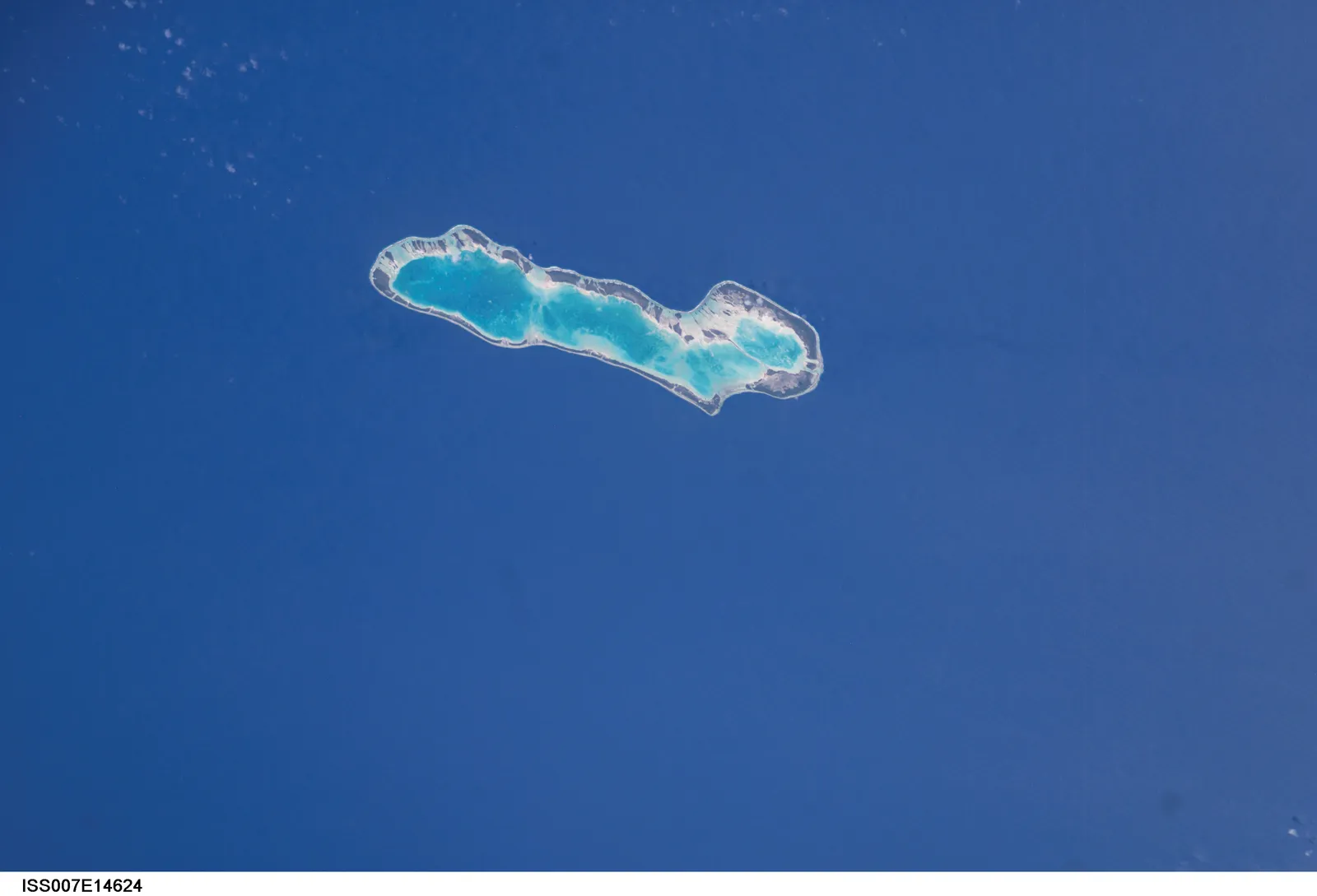
Anaa atoll photographed from the International Space Station (NASA image ISS007-E-14624, public domain) — the narrow atoll with its white reef edge and turquoise lagoon; the airport sits on the main islet.
The photos come from public web sources and remain the copyright of their photographers; full credits and source links sit in the photo gallery on this page.
Airport at a glance
| Item | Detail |
|---|---|
| IATA / ICAO | AAA / NTGA |
| Role | Medium-sized airport |
| Elevation | about 3 m |
| Coordinates | -17.3526, -145.5100 |
| Runways | 1, 1,500 m |
| Non-stop destinations | 0 in the 2014 snapshot |
Runways
| Runway | Length | Width | Surface |
|---|---|---|---|
| 14/32 | 1,500 m | 18 m | asphalt |
1 runway, the longest 1,500 m.
Non-stop routes
The route dataset carries no scheduled non-stop services for this airport. Regional schedules change often — confirm with the airline or airport before booking.
Nearby airports to compare
If the fares are close, these are the nearest airports of the same class (medium-sized airport) — straight-line distance, with their own non-stop counts from the same dataset:
| Airport | Distance | Non-stop destinations |
|---|---|---|
| Arutua Airport (AXR) | ~262 km | 1 |
| Ahe Airport (AHE) | ~335 km | 2 |
Before you fly
- Atoll schedules are usually run by regional carriers; an empty 2014 snapshot does not mean no flights today, so check the airline directly.
- With a 1,500 m runway, aircraft and payloads are limited; baggage and supplies follow small-aircraft rules.
About the data
Runways, elevation and coordinates come from OurAirports open data. Routes and carriers come from the June 2014 OpenFlights snapshot and include codeshares and interline services; they indicate network shape and scale, not current schedules.
ความคิดเห็นจากผู้อ่านการสนทนา
ยินดีรับคำถาม รายงานการเดินทาง และการแก้ไข ความคิดเห็นเป็นสาธารณะ
กำลังโหลด…
กำลังโหลดความคิดเห็น…