
John F. Kennedy International Airport Terminal Map
 New York · United States· John F. Kennedy International Airport
John F. Kennedy International Airport (IATA: JFK, ICAO KJFK) is a large airport serving New York, United States, with 5 terminals and 120 gates, about 24 km from central New York.
John F. Kennedy International Airport (JFK) serves New York, United States. It has 5 terminals with 120 gates in total and handles about 63 million passengers a year. The airport is about 24 km from the city centre. Ground transport into the city: rail, bus, taxi and car.
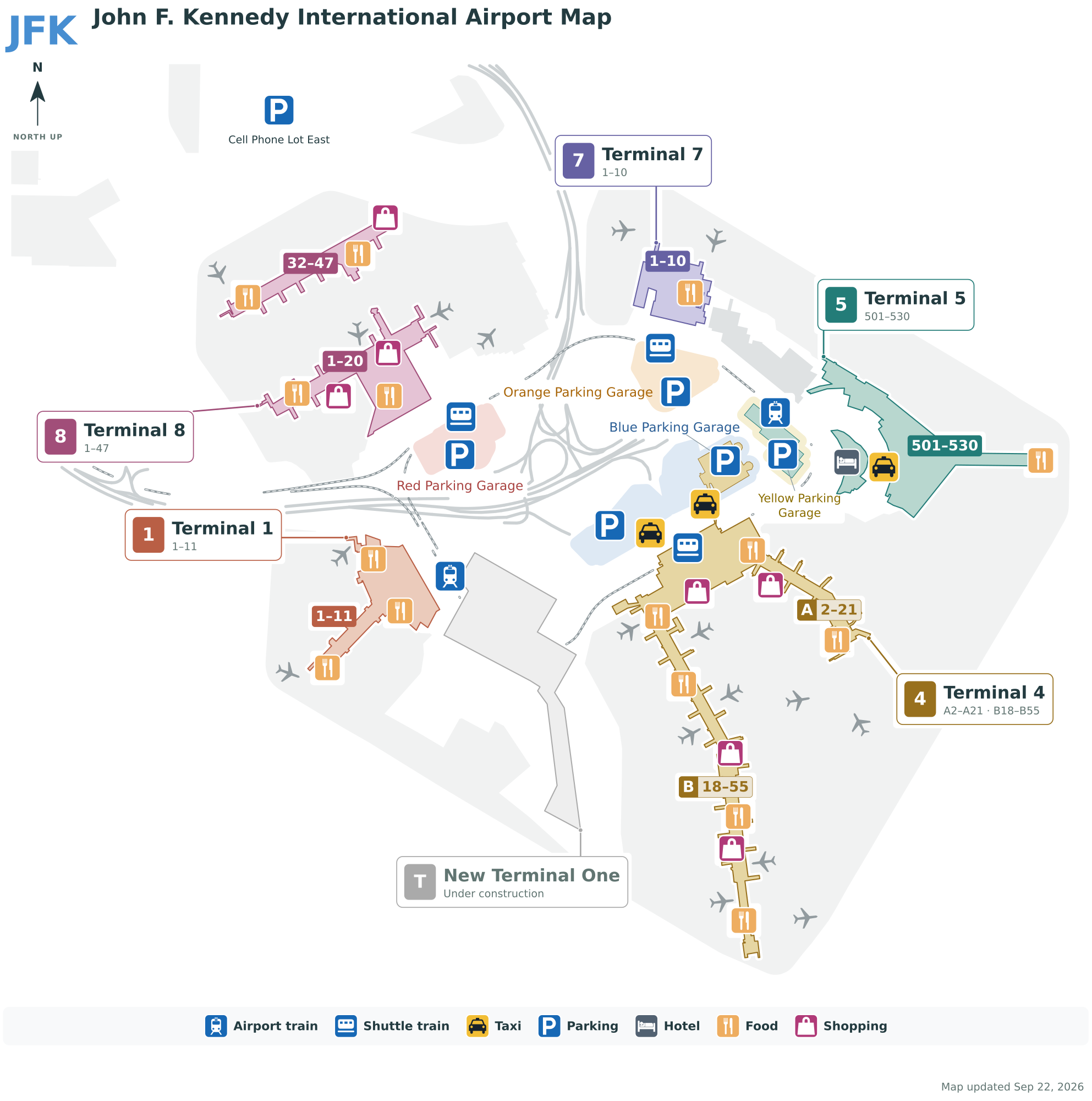
Download Airport MapsDownloads
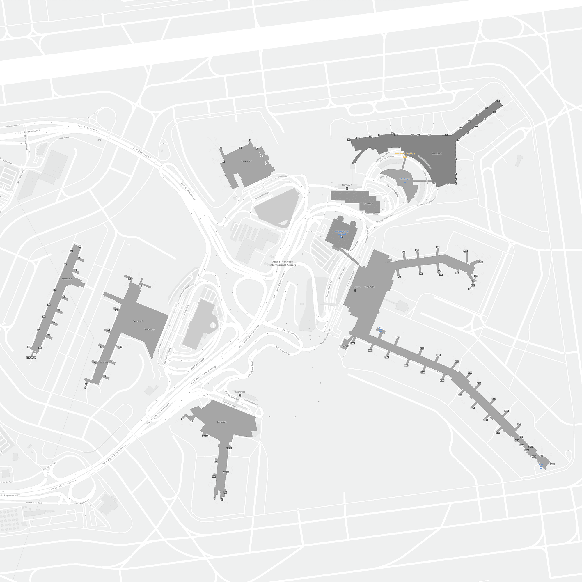
Airport time information — JFK current timeAirport Time
Current time at JFK (America/New_York) compared with your local time.
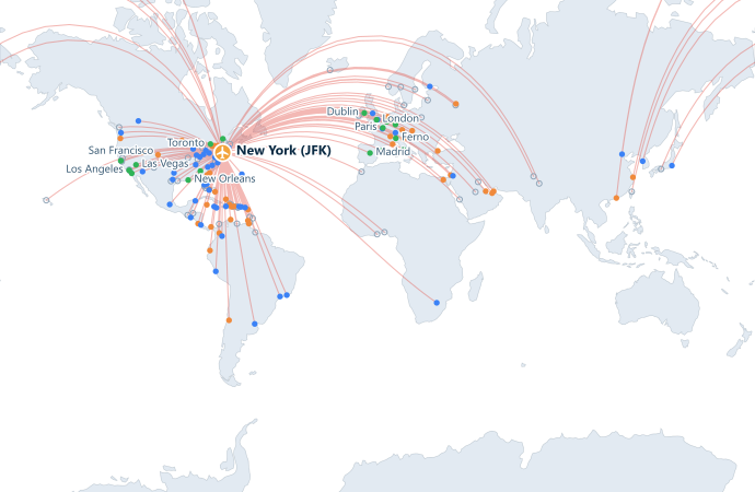
John F. Kennedy International Airport route map — direct destinationsRoute Map
158 direct destinations: map, operating airlines and distances.
Airport information & detailsAirport Details
Interactive map — John F. Kennedy International Airport locationInteractive Map
View this airport on other map services:
New York JFK terminal guideAirport Guide
JFK handles around 63 million passengers a year (2025) and sits about 24 km from Manhattan. Unlike most hubs it has no single main terminal — instead several separate terminals are spread around a ring road, which means which terminal you land at largely decides how long the trip into the city takes.
The five terminals
| Code | Name | Gates |
|---|---|---|
| T1 | Terminal 1 | 1–11 |
| T4 | Terminal 4 | Concourses A / B |
| T5 | Terminal 5 | 1–29 |
| T7 | Terminal 7 | 1–12 |
| T8 | Terminal 8 | Concourses A / B / C |
Why do the numbers skip? Because terminals that were demolished or rebuilt left gaps — Terminals 2, 3 and 6 are no longer in use. Seeing numbers jump is normal here; you have not missed one.
Moving between terminals
AirTrain JFK is the spine that links the terminals to each other and to onward transport:
- It loops between all terminals and is free.
- It also connects to the subway E / J / Z lines and the Long Island Rail Road (LIRR) — the key link into New York.
So the standard route into the city is: terminal → AirTrain → subway or LIRR. For a cross-terminal connection you also rely on the AirTrain, so factor in the wait and the loop.
Routes and flights
| Aspect | Details |
|---|---|
| Routes | The United States' leading international gateway; around 63 million passengers in 2025, with an especially dense transatlantic network to every major city worldwide |
| Flights | 1.6 million tonnes of air cargo in 2025; international passenger traffic remains the largest in the US |
| Aircraft | Delta Air Lines (T4) and JetBlue (T5) are the base carriers; American Airlines and British Airways and other oneworld carriers use T8, all flying widebodies such as the 767 / 777 / 787 and A321 / A330 / A350 on long-haul |
Getting into Manhattan
- AirTrain + subway — the cheapest option. The AirTrain connects to the E / J / Z lines.
- AirTrain + LIRR — faster to Penn Station, but a higher fare than the subway.
- Taxi — yellow cabs charge a flat rate into Manhattan, with tolls and tips on top.
- Airport buses — link to the main districts of the city.
- Car — via the Van Wyck Expressway.
Practical tips
- It is 24 km to Manhattan, but the real journey time swings heavily with traffic — take the rail options when time matters, and treat road traffic as the biggest source of uncertainty.
- The yellow-cab fare to Manhattan is flat, so do not accept a verbally quoted price from an unlicensed driver.
- Before connecting, check both terminal numbers: staying within T4 or within T8 is easiest, while a change of terminal means allowing for the AirTrain both ways.
Terminal guideTerminal Guide
Gate ranges, main airlines and facilities for each terminal at John F. Kennedy International Airport.