
Alamogordo White Sands Regional Airport
 Alamogordo · ABD· Alamogordo White Sands Regional Airport
Alamogordo White Sands Regional Airport (IATA: ALM, ICAO KALM), Alamogordo, ABD kentine hizmet veren bir orta büyüklükte havalimanıdır.
Alamogordo White Sands Regional Airport is a medium-sized airport, at an elevation of about 4,200 ft. This page gathers its location map, airport codes and travel information.
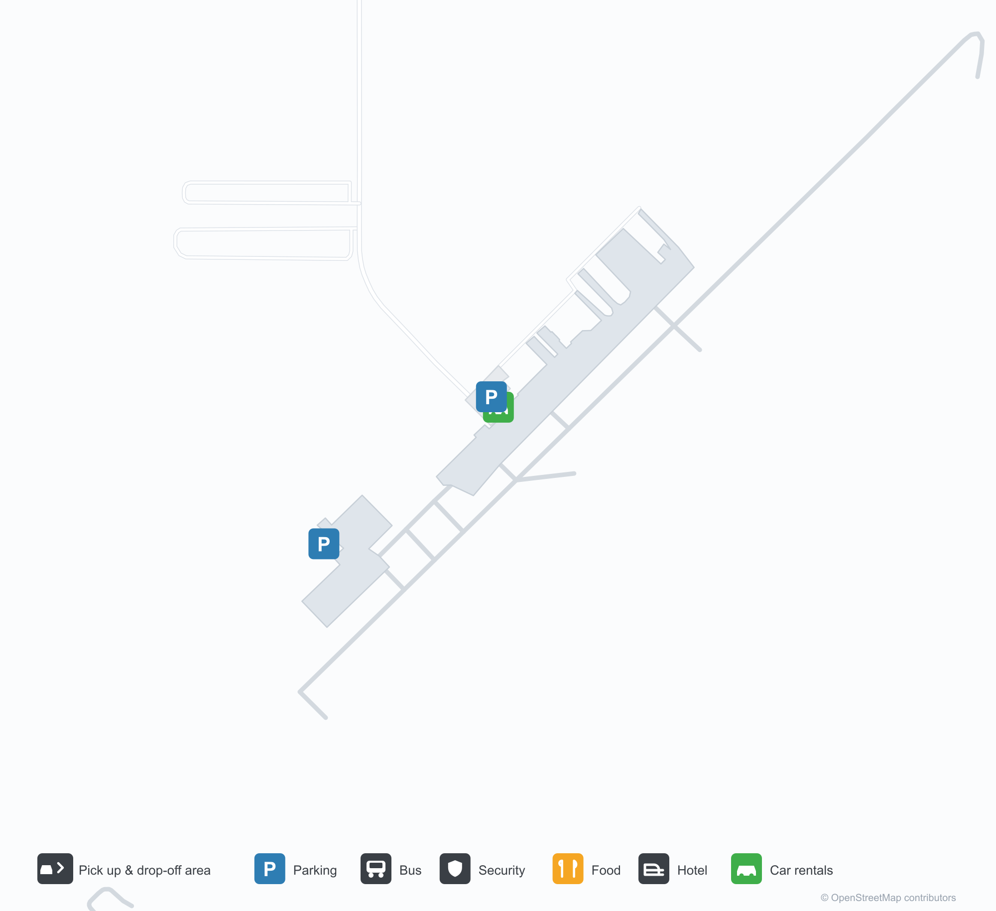
Havalimanı Haritalarını İndirinİndirmeler
Havalimanı fotoğraflarıHavalimanı Fotoğrafları
Bu havalimanının gerçek fotoğrafları; her fotoğrafın altında, fotoğrafın bulunduğu kamuya açık web sayfasına bir atıf yer alır ve telif hakkı özgün fotoğrafçılarda kalır. Yakınlaştırmak için bir fotoğrafa, kaynak sayfasını açmak için bir atıf satırına tıklayın.
Alamogordo-White Sands Bölge Havalimanı'nda korunan bir Lockheed P-2H Neptune (N14447); arkasında sahanın hangarları ve apronu (fotoğraf: silverhawkauthor.com).
Alamogordo-White Sands Bölge Havalimanı'nın ana girişi, kapılarının üzerinde sahanın adını taşıyor; açık mavi gökyüzü altında beton bir yürüyüş yoluna açılıyor.
Alamogordo-White Sands Bölge Havalimanı'ndaki 21 pistinin havadan görünümü; iki yanda çöl çalılıkları ve ufuk boyunca soluk bir kum şeridi.
Alamogordo'da çatlamış apronda üç hafif uçak park etmiş; solda metal bir hangar, uzak sırtın üzerinde yükselen kümülüs bulutları var.
Alamogordo Havalimanı'nın 4. pistindeki eşik işaretlerinin dron görüntüsü; alt kenar boyunca bir uçuş verisi şeridi basılmış.
Alamogordo-White Sands Bölge Havalimanı terminalinin önünde, çıplak ağaçların üzerindeki direkten Yıldızlar ve Çizgiler ile New Mexico eyalet bayrağı dalgalanıyor.
Havalimanı bilgileri ve ayrıntılarıHavalimanı Ayrıntıları
Etkileşimli harita — Alamogordo White Sands Regional Airport konumuEtkileşimli Harita
Bu havalimanını diğer harita hizmetlerinde görüntüleyin:
Alamogordo Airport (ALM): A P-2H Neptune Beside White SandsHavalimanı Rehberi
A Lockheed P-2H Neptune preserved at Alamogordo–White Sands Regional Airport stands before the hangars, registration N14447, with the hangars and apron behind it. The field serves Alamogordo, New Mexico, at an elevation of about 1,280 m, with a 2,806 m runway; the 2014 snapshot records no scheduled routes, and OurAirports lists it for general aviation and charters.
Airport photos
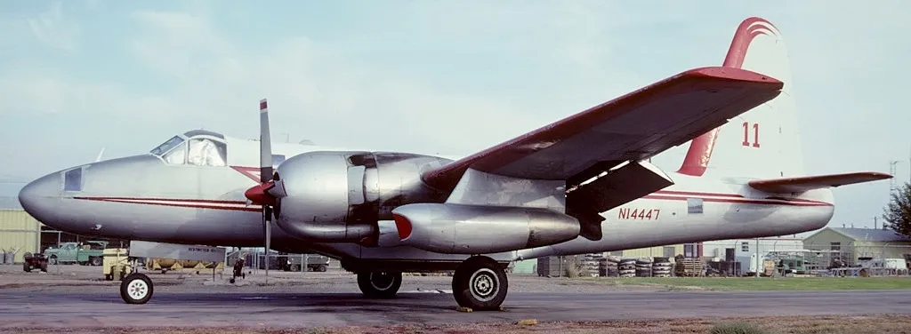
A Lockheed P-2H Neptune (N14447) preserved at Alamogordo-White Sands Regional Airport, the field's hangars and tarmac behind it (photo: silverhawkauthor.com).
The photos come from public web sources and remain the copyright of their photographers; full credits and source links sit in the photo gallery on this page.
Airport at a glance
| Item | Detail |
|---|---|
| IATA / ICAO | ALM / KALM |
| Role | Medium-sized airport |
| Elevation | about 1,280 m |
| Coordinates | 32.8378, -105.9931 |
| Runways | 1, 2,806 m |
| Non-stop destinations | 0 in the 2014 snapshot |
Runways
| Runway | Length | Width | Surface |
|---|---|---|---|
| 04/22 | 2,806 m | 46 m | asphalt |
1 runway, the longest 2,806 m.
Non-stop routes
The route dataset carries no scheduled non-stop services for this airport. Regional schedules change often — confirm with the airline or airport before booking.
Nearby airports to compare
If the fares are close, these are the nearest airports of the same class (medium-sized airport) — straight-line distance, with their own non-stop counts from the same dataset:
| Airport | Distance | Non-stop destinations |
|---|---|---|
| Abilene Regional Airport (ABI) | ~593 km | 1 |
| Altus Air Force Base (LTS) | ~654 km | — |
Before you fly
- General aviation, charters and aviation displays dominate; confirm any scheduled service with the operator.
- At about 1,280 m, summer heat reduces aircraft performance, so light aircraft should check payload before take-off.
About the data
Runways, elevation and coordinates come from OurAirports open data. Routes and carriers come from the June 2014 OpenFlights snapshot and include codeshares and interline services; they indicate network shape and scale, not current schedules.
History
Formerly Alamogordo Municipal Airport, the city-owned field keeps scheduled service alive through the Essential Air Service subsidy, flown by New Mexico Airlines to El Paso and Albuquerque. In November 2008 it installed an 8 kW solar array with a $100,000 state grant; its second runway, 16/34, is dirt.
Source: Alamogordo-white Sands Rgnl Airport.
Okuyucu yorumlarıTartışma
Sorular, seyahat deneyimleri ve düzeltmeler memnuniyetle karşılanır. Yorumlar herkese açıktır.
Yükleniyor…
Yorumlar yükleniyor…