
Adak Airport
 Adak · ABD· Adak Airport
Adak Airport (IATA: ADK, ICAO PADK), Adak, ABD kentine hizmet veren bir orta büyüklükte havalimanıdır.
Adak Airport is a medium-sized airport, at an elevation of about 18 ft, with scheduled passenger service. This page gathers its location map, airport codes and travel information.
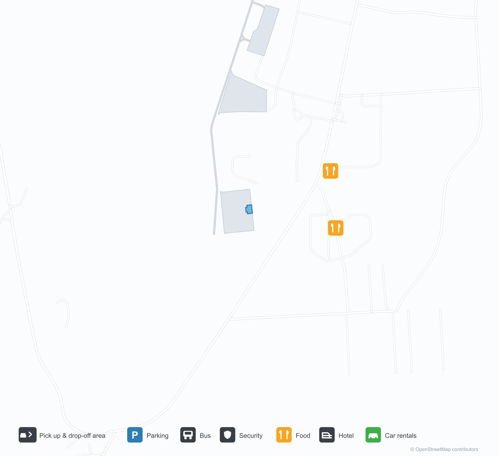
Havalimanı Haritalarını İndirinİndirmeler
Havalimanı fotoğraflarıHavalimanı Fotoğrafları
Bu havalimanının gerçek fotoğrafları; her fotoğrafın altında, fotoğrafın bulunduğu kamuya açık web sayfasına bir atıf yer alır ve telif hakkı özgün fotoğrafçılarda kalır. Yakınlaştırmak için bir fotoğrafa, kaynak sayfasını açmak için bir atıf satırına tıklayın.
Pistin sonunda Adak — volkanik tepelerin üzerinde alçak bulutlar, aydınlatılmış pist onların eteğine doğru uzanıyor.
Tundradan Adak havaalanına doğru — pist ve taksi yolu araziye yayılmış, havalimanı binaları ufukta küçücük.
Pist eşiğinden bir sıra kırmızı yaklaşma ışığı çimenleri geçiyor; gri pist karla çizgili volkanlara doğru dümdüz uzanıyor.
Çitin arkasındaki yoldan, mavi çatılı terminalin yanında bir jet duruyor; bulutlar karla lekelenmiş sırtlara baskı yapıyor.
Adak apronsunda bir Alaska Airlines jeti, merdiveni açık halde duruyor; volkanlarda hâlâ kar var, bulutlar alçakta asılı.
Terminalin kara tarafındaki cephesi — mavi çatı altında pembe ve kırmızı pencere şeritleri, üstü kapalı bir yürüyüş yolu ve boş bir asfalt şeridi.
İki yolcu, N.A.F. Adak'a hoş geldiniz tabelasının altında terminal kapısına yürüyor; kaldırım boyunca turuncu koniler dizilmiş.
Kuru çimenlerde taş kaplamalı bir giriş tabelası duruyor; ötesinde park etmiş bir jet ve terminal, bulut şeridinin altında karlı zirveler görünüyor.
Adak Airport rota haritası — doğrudan varış noktalarıRota Haritası
1 doğrudan varış noktası: harita, sefer yapan havayolu şirketleri ve mesafeler.
Adak Airport uçuşları — kalkışlar ve varışlarUçuş Panosu
10 uçuş numarası, 1 havayolu şirketi ve 1 varış noktası, yönlere göre ayrılmıştır. Ortak uçuş numaraları dahildir.
| Uçuş | Havayolu şirketi | Varış noktası | Ülke/bölge |
|---|---|---|---|
| AS53 | Alaska Airlines | Anchorage (ANC) Ted Stevens Anchorage International Airport | ABD |
| AS77 | Alaska Airlines | Anchorage (ANC) Ted Stevens Anchorage International Airport | ABD |
| AS236 | Alaska Airlines | Anchorage (ANC) Ted Stevens Anchorage International Airport | ABD |
| AS257 | Alaska Airlines | Anchorage (ANC) Ted Stevens Anchorage International Airport | ABD |
| AS283 | Alaska Airlines | Anchorage (ANC) Ted Stevens Anchorage International Airport | ABD |
Uçuş numaraları ve rotalar aviability.com uçuş dizininden (anlık görüntü: 26 Ekim 2026); ortak uçuş numaraları dahildir ve kalkış saatleri gösterilmez. Kaynak: aviability.com ↗
Havalimanı bilgileri ve ayrıntılarıHavalimanı Ayrıntıları
Etkileşimli harita — Adak Airport konumuEtkileşimli Harita
Bu havalimanını diğer harita hizmetlerinde görüntüleyin:
Adak Airport (ADK): A Runway Beneath the VolcanoesHavalimanı Rehberi
There is no terminal close-up in the photos of Adak Airport (IATA ADK, ICAO PADK). One looks down the runway: low cloud sitting on the volcanic hills, the lit runway and markings stretching towards their foot. The other looks across grassland towards the field, runway and taxiway lying flat on the tundra, the airport buildings reduced to a small row on the horizon. For an airport in the Aleutians, those two views explain the relationship with the environment better than any building photograph.
The field serves Adak Island, Alaska, at an elevation of only about 5 m, with a single runway 2,374 m long and 61 m wide (05/23). The 2014 route snapshot records one non-stop destination: Anchorage, 1,913 km away, operated by Alaska Airlines.
Airport photos
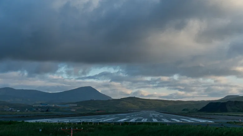
Adak at the end of the runway — low cloud over the volcanic hills, the lit runway stretching towards their foot.
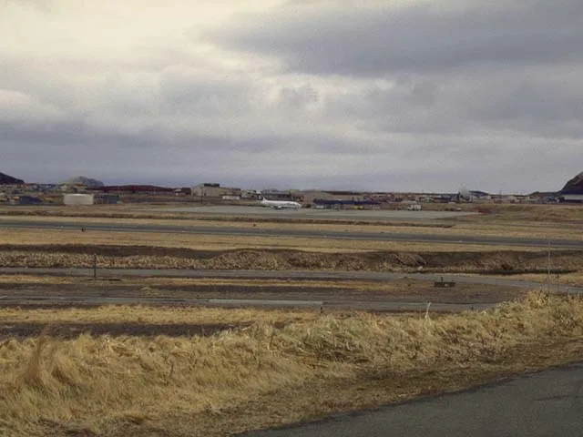
Across the tundra towards Adak's airfield — runway and taxiway lying flat on the land, the airport buildings small on the horizon.
The photos come from public web sources and remain the copyright of their photographers; full credits and source links sit in the photo gallery on this page.
Airport at a glance
| Item | Detail |
|---|---|
| IATA / ICAO | ADK / PADK |
| Role | Medium-sized airport in the remote Aleutian Islands |
| Elevation | about 5 m |
| Coordinates | 51.8836, -176.6428 |
| Runway | 1: 05/23, 2,374 m × 61 m |
| Non-stop destinations | 1 (Anchorage; 2014 snapshot) |
Network shape: a single 1,913 km link
ADK's 2014 table has one entry: Anchorage (ANC), 1,913 km away, operated by Alaska Airlines. It falls in the 1,000–3,000 km band, and there is no second destination. For residents and workers on the island, this route is the main link to mainland Alaska.
| Distance band | Destinations |
|---|---|
| Under 1,000 km | 0 |
| 1,000–3,000 km | 1 |
| Over 3,000 km | 0 |
The runway is 2,374 m long and 61 m wide — longer and wider than many airports of this size would need. Remote island weather and limited diversion options call for margins in aircraft performance and runway length; the low cloud and volcanic hills in the photos are a direct illustration of that operating environment. The one-route record is on the Adak route map.
Getting there and navigating
- Coordinates: 51.8836, -176.6428
- Open in a map: Google Maps | Amap | Baidu Maps
In the comparison table, Aleknagik (WKK) is about 1,393 km away with no comparable route data, and Aniak (ANI) about 1,491 km away with 3 destinations. Neither is a daily substitute; access to Adak effectively depends on the Anchorage route.
The location map on this page shows Adak Island against the surrounding sea and island roads. Terminal connections and island transport are not covered here; check the airport's or airline's own information.
Before you fly
- Aleutian weather changes quickly; low cloud, strong wind and precipitation can all cause delays or cancellations. Build a buffer into any Anchorage connection.
- There is no road link to the mainland, so the flight is the primary way in and out. If the route is disrupted, alternatives are very limited.
- The single destination is a 2014 snapshot; Alaska Airlines' schedule varies by season, so check the current timetable.
About the data
Runways, elevation and coordinates come from OurAirports open data. Routes and carriers come from the June 2014 OpenFlights snapshot and include codeshares and interline services; they indicate network shape and scale, not current schedules. Photos are from public web sources and remain the copyright of their photographers.
History
Owned by Alaska's Department of Transportation and Public Facilities, the field keeps two runways of 2,374 m and 2,318 m — the scheduled lifeline for an island that was a major Cold War naval base.
Source: Adak Airport.
Okuyucu yorumlarıTartışma
Sorular, seyahat deneyimleri ve düzeltmeler memnuniyetle karşılanır. Yorumlar herkese açıktır.
Yükleniyor…
Yorumlar yükleniyor…