
Adak Airport
 Adak · สหรัฐอเมริกา· Adak Airport
Adak Airport (IATA: ADK, ICAO PADK) เป็นสนามบินขนาดกลางที่ให้บริการAdak, สหรัฐอเมริกา
Adak Airport is a medium-sized airport, at an elevation of about 18 ft, with scheduled passenger service. This page gathers its location map, airport codes and travel information.
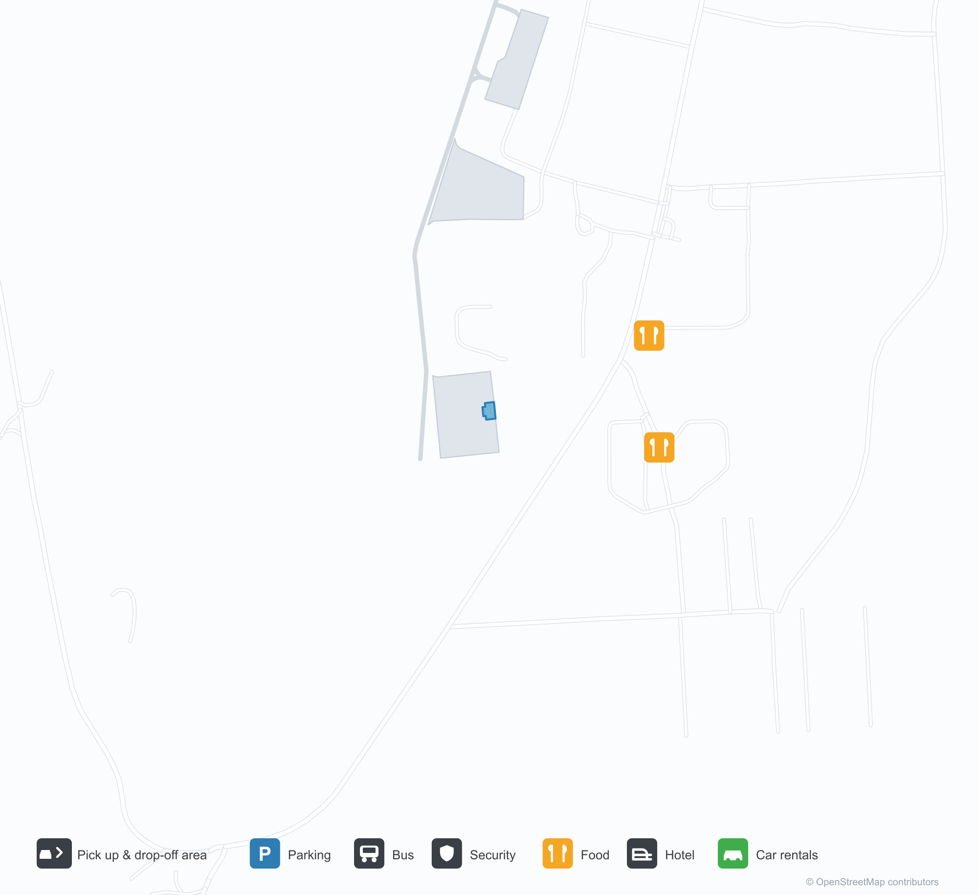
ดาวน์โหลดแผนที่สนามบินดาวน์โหลด
ภาพสนามบินภาพสนามบิน
ภาพจริงของสนามบินแห่งนี้ พร้อมเครดิตของหน้าเว็บสาธารณะที่พบภาพ; ลิขสิทธิ์ยังเป็นของผู้ถ่ายภาพต้นฉบับ คลิกที่ภาพเพื่อขยาย หรือคลิกบรรทัดเครดิตเพื่อเปิดหน้าแหล่งที่มา
อาดัก (Adak) ที่ปลายทางวิ่ง — เมฆต่ำเหนือเนินเขาไฟ ทางวิ่งที่สว่างทอดไปยังเชิงเนิน
ข้ามทุนดราไปยังสนามบินอาดัก — ทางวิ่งและทางขับนอนราบกับพื้นดิน อาคารสนามบินเล็ก ๆ อยู่ที่ขอบฟ้า
จากปลายทางวิ่ง แถวไฟนำร่องสีแดงพาดผ่านสนามหญ้า ทางวิ่งสีเทาวิ่งตรงไปยังภูเขาไฟที่มีหิมะเป็นลาย
จากถนนหลังรั้ว เครื่องบินเจ็ตจอดอยู่ข้างอาคารผู้โดยสารหลังคาสีฟ้า ขณะที่เมฆกดทับสันเขาที่มีหิมะเป็นหย่อม
ที่ลานจอดอาดัก เครื่องบินของ Alaska Airlines จอดอยู่โดยเปิดบันไดลงมา หิมะยังอยู่บนภูเขาไฟและเมฆลอยต่ำ
ด้านฝั่งบกของอาคารผู้โดยสาร — แถบหน้าต่างสีชมพูและแดงใต้หลังคาสีฟ้า ทางเดินมีหลังคา และพื้นแอสฟัลต์ที่ว่างเปล่า
ผู้เดินทางสองคนเดินไปยังประตูอาคารผู้โดยสารใต้ป้ายต้อนรับสู่ N.A.F. Adak โดยมีกรวยสีส้มเรียงตามทางเท้า
ป้ายทางเข้าหินในสนามหญ้าแห้ง มีเครื่องบินจอดและอาคารผู้โดยสารอยู่เบื้องหลัง ยอดเขาหิมะปรากฏใต้แถบเมฆ
แผนที่เส้นทาง Adak Airport — จุดหมายบินตรงแผนที่เส้นทาง
1 จุดหมายบินตรง: แผนที่ สายการบินที่ให้บริการ และระยะทาง
เที่ยวบินของAdak Airport — ขาออกและขาเข้าป้ายเที่ยวบิน
10 หมายเลขเที่ยวบิน ครอบคลุม 1 สายการบิน และ 1 จุดหมายปลายทาง แยกตามทิศทาง หมายเลขเที่ยวบินร่วม (codeshare) รวมอยู่ด้วย
| เที่ยวบิน | สายการบิน | จุดหมายปลายทาง | ประเทศ/ภูมิภาค |
|---|---|---|---|
| AS53 | Alaska Airlines | Anchorage (ANC) Ted Stevens Anchorage International Airport | สหรัฐอเมริกา |
| AS77 | Alaska Airlines | Anchorage (ANC) Ted Stevens Anchorage International Airport | สหรัฐอเมริกา |
| AS236 | Alaska Airlines | Anchorage (ANC) Ted Stevens Anchorage International Airport | สหรัฐอเมริกา |
| AS257 | Alaska Airlines | Anchorage (ANC) Ted Stevens Anchorage International Airport | สหรัฐอเมริกา |
| AS283 | Alaska Airlines | Anchorage (ANC) Ted Stevens Anchorage International Airport | สหรัฐอเมริกา |
หมายเลขเที่ยวบินและเส้นทางจากดัชนีเที่ยวบิน aviability.com (ข้อมูล ณ วันที่ 26 ตุลาคม 2569); รวมหมายเลขเที่ยวบินร่วมและไม่แสดงเวลาเดินทาง ที่มา: aviability.com ↗
ข้อมูลและรายละเอียดสนามบินรายละเอียดสนามบิน
แผนที่อินเทอร์แอกทีฟ — ตำแหน่ง Adak Airportแผนที่อินเทอร์แอกทีฟ
ดูสนามบินนี้บนบริการแผนที่อื่น:
Adak Airport (ADK): A Runway Beneath the Volcanoesคู่มือสนามบิน
There is no terminal close-up in the photos of Adak Airport (IATA ADK, ICAO PADK). One looks down the runway: low cloud sitting on the volcanic hills, the lit runway and markings stretching towards their foot. The other looks across grassland towards the field, runway and taxiway lying flat on the tundra, the airport buildings reduced to a small row on the horizon. For an airport in the Aleutians, those two views explain the relationship with the environment better than any building photograph.
The field serves Adak Island, Alaska, at an elevation of only about 5 m, with a single runway 2,374 m long and 61 m wide (05/23). The 2014 route snapshot records one non-stop destination: Anchorage, 1,913 km away, operated by Alaska Airlines.
Airport photos
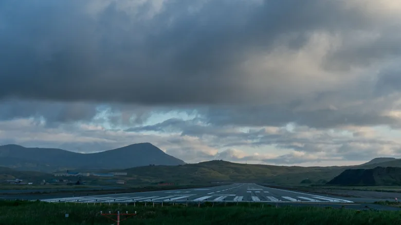
Adak at the end of the runway — low cloud over the volcanic hills, the lit runway stretching towards their foot.
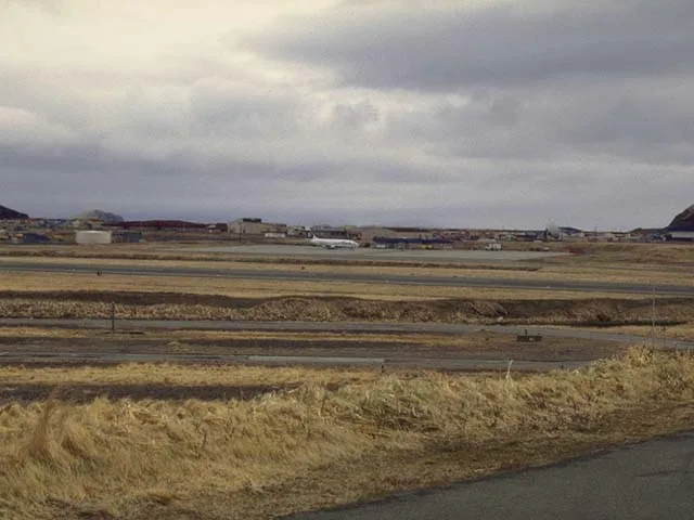
Across the tundra towards Adak's airfield — runway and taxiway lying flat on the land, the airport buildings small on the horizon.
The photos come from public web sources and remain the copyright of their photographers; full credits and source links sit in the photo gallery on this page.
Airport at a glance
| Item | Detail |
|---|---|
| IATA / ICAO | ADK / PADK |
| Role | Medium-sized airport in the remote Aleutian Islands |
| Elevation | about 5 m |
| Coordinates | 51.8836, -176.6428 |
| Runway | 1: 05/23, 2,374 m × 61 m |
| Non-stop destinations | 1 (Anchorage; 2014 snapshot) |
Network shape: a single 1,913 km link
ADK's 2014 table has one entry: Anchorage (ANC), 1,913 km away, operated by Alaska Airlines. It falls in the 1,000–3,000 km band, and there is no second destination. For residents and workers on the island, this route is the main link to mainland Alaska.
| Distance band | Destinations |
|---|---|
| Under 1,000 km | 0 |
| 1,000–3,000 km | 1 |
| Over 3,000 km | 0 |
The runway is 2,374 m long and 61 m wide — longer and wider than many airports of this size would need. Remote island weather and limited diversion options call for margins in aircraft performance and runway length; the low cloud and volcanic hills in the photos are a direct illustration of that operating environment. The one-route record is on the Adak route map.
Getting there and navigating
- Coordinates: 51.8836, -176.6428
- Open in a map: Google Maps | Amap | Baidu Maps
In the comparison table, Aleknagik (WKK) is about 1,393 km away with no comparable route data, and Aniak (ANI) about 1,491 km away with 3 destinations. Neither is a daily substitute; access to Adak effectively depends on the Anchorage route.
The location map on this page shows Adak Island against the surrounding sea and island roads. Terminal connections and island transport are not covered here; check the airport's or airline's own information.
Before you fly
- Aleutian weather changes quickly; low cloud, strong wind and precipitation can all cause delays or cancellations. Build a buffer into any Anchorage connection.
- There is no road link to the mainland, so the flight is the primary way in and out. If the route is disrupted, alternatives are very limited.
- The single destination is a 2014 snapshot; Alaska Airlines' schedule varies by season, so check the current timetable.
About the data
Runways, elevation and coordinates come from OurAirports open data. Routes and carriers come from the June 2014 OpenFlights snapshot and include codeshares and interline services; they indicate network shape and scale, not current schedules. Photos are from public web sources and remain the copyright of their photographers.
History
Owned by Alaska's Department of Transportation and Public Facilities, the field keeps two runways of 2,374 m and 2,318 m — the scheduled lifeline for an island that was a major Cold War naval base.
Source: Adak Airport.
ความคิดเห็นจากผู้อ่านการสนทนา
ยินดีรับคำถาม รายงานการเดินทาง และการแก้ไข ความคิดเห็นเป็นสาธารณะ
กำลังโหลด…
กำลังโหลดความคิดเห็น…