
Adak Airport
 Adak · 미국· Adak Airport
Adak Airport(IATA: ADK, ICAO: PADK)은 미국 Adak에 위치한 중형 공항입니다.
Adak Airport is a medium-sized airport, at an elevation of about 18 ft, with scheduled passenger service. This page gathers its location map, airport codes and travel information.
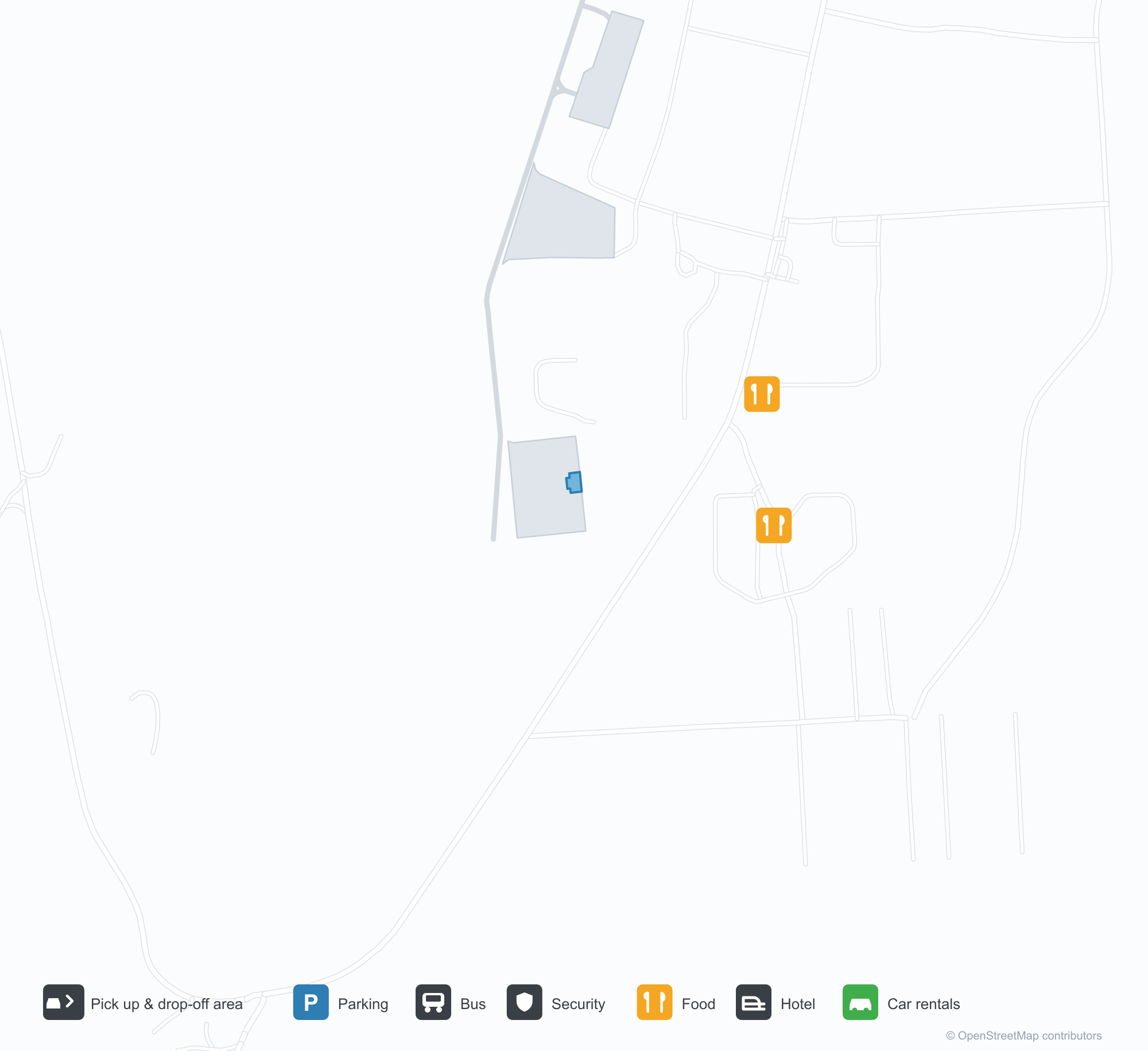
공항 지도 다운로드다운로드
공항 실제 사진공항 사진
다음은 이 공항의 실제 사진으로, 모두 공개된 인터넷 출처에서 가져왔으며 사진마다 출처를 표시했습니다. 저작권은 원저작자에게 있습니다. 사진을 클릭하면 크게 볼 수 있고, 출처를 클릭하면 원본 페이지가 열립니다.
활주로 끝에서 본 아다크 — 화산성 구릉 위의 낮은 구름, 그 발치를 향해 뻗은 불 켜진 활주로.
툰드라 너머 아다크 비행장 쪽 — 땅에 납작하게 누운 활주로와 유도로, 지평선에 작게 보이는 공항 건물들.
Adak Airport 노선도 · 직항 목적지노선도
직항 목적지 1개: 노선도, 운항 항공사, 비행 거리.
공항 정보 및 상세공항 상세
Adak Airport 인터랙티브 지도 — 공항 위치인터랙티브 지도
다른 지도 서비스에서 이 공항 보기:
Adak Airport (ADK): A Runway Beneath the Volcanoes공항 안내
There is no terminal close-up in the photos of Adak Airport (IATA ADK, ICAO PADK). One looks down the runway: low cloud sitting on the volcanic hills, the lit runway and markings stretching towards their foot. The other looks across grassland towards the field, runway and taxiway lying flat on the tundra, the airport buildings reduced to a small row on the horizon. For an airport in the Aleutians, those two views explain the relationship with the environment better than any building photograph.
The field serves Adak Island, Alaska, at an elevation of only about 5 m, with a single runway 2,374 m long and 61 m wide (05/23). The 2014 route snapshot records one non-stop destination: Anchorage, 1,913 km away, operated by Alaska Airlines.
Airport photos
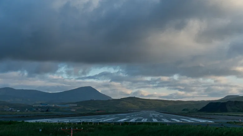
Adak at the end of the runway — low cloud over the volcanic hills, the lit runway stretching towards their foot.
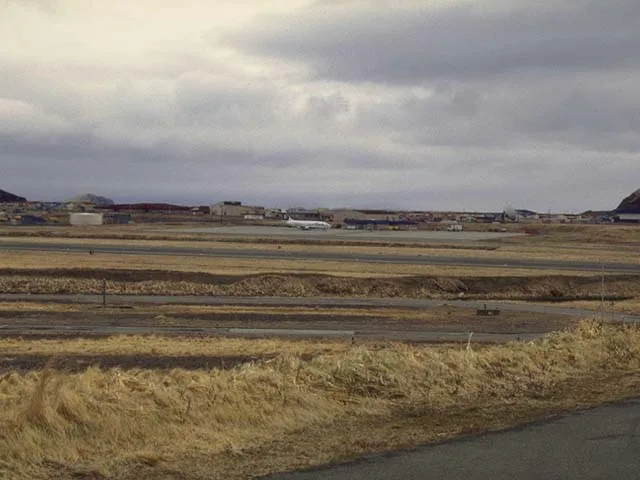
Across the tundra towards Adak's airfield — runway and taxiway lying flat on the land, the airport buildings small on the horizon.
The photos come from public web sources and remain the copyright of their photographers; full credits and source links sit in the photo gallery on this page.
Airport at a glance
| Item | Detail |
|---|---|
| IATA / ICAO | ADK / PADK |
| Role | Medium-sized airport in the remote Aleutian Islands |
| Elevation | about 5 m |
| Coordinates | 51.8836, -176.6428 |
| Runway | 1: 05/23, 2,374 m × 61 m |
| Non-stop destinations | 1 (Anchorage; 2014 snapshot) |
Network shape: a single 1,913 km link
ADK's 2014 table has one entry: Anchorage (ANC), 1,913 km away, operated by Alaska Airlines. It falls in the 1,000–3,000 km band, and there is no second destination. For residents and workers on the island, this route is the main link to mainland Alaska.
| Distance band | Destinations |
|---|---|
| Under 1,000 km | 0 |
| 1,000–3,000 km | 1 |
| Over 3,000 km | 0 |
The runway is 2,374 m long and 61 m wide — longer and wider than many airports of this size would need. Remote island weather and limited diversion options call for margins in aircraft performance and runway length; the low cloud and volcanic hills in the photos are a direct illustration of that operating environment. The one-route record is on the Adak route map.
Getting there and navigating
- Coordinates: 51.8836, -176.6428
- Open in a map: Google Maps | Amap | Baidu Maps
In the comparison table, Aleknagik (WKK) is about 1,393 km away with no comparable route data, and Aniak (ANI) about 1,491 km away with 3 destinations. Neither is a daily substitute; access to Adak effectively depends on the Anchorage route.
The location map on this page shows Adak Island against the surrounding sea and island roads. Terminal connections and island transport are not covered here; check the airport's or airline's own information.
Before you fly
- Aleutian weather changes quickly; low cloud, strong wind and precipitation can all cause delays or cancellations. Build a buffer into any Anchorage connection.
- There is no road link to the mainland, so the flight is the primary way in and out. If the route is disrupted, alternatives are very limited.
- The single destination is a 2014 snapshot; Alaska Airlines' schedule varies by season, so check the current timetable.
About the data
Runways, elevation and coordinates come from OurAirports open data. Routes and carriers come from the June 2014 OpenFlights snapshot and include codeshares and interline services; they indicate network shape and scale, not current schedules. Photos are from public web sources and remain the copyright of their photographers.
History
Owned by Alaska's Department of Transportation and Public Facilities, the field keeps two runways of 2,374 m and 2,318 m — the scheduled lifeline for an island that was a major Cold War naval base.
Source: Adak Airport.