
Clermont-Ferrand Auvergne airport
 Clermont-Ferrand · França· Clermont-Ferrand Auvergne airport
O Clermont-Ferrand Auvergne airport (IATA: CFE, ICAO LFLC) é um aeroporto grande que atende Clermont-Ferrand, França.
Clermont-Ferrand Auvergne airport is a large airport, at an elevation of about 1,090 ft, with scheduled passenger service. This page gathers its location map, airport codes and travel information.
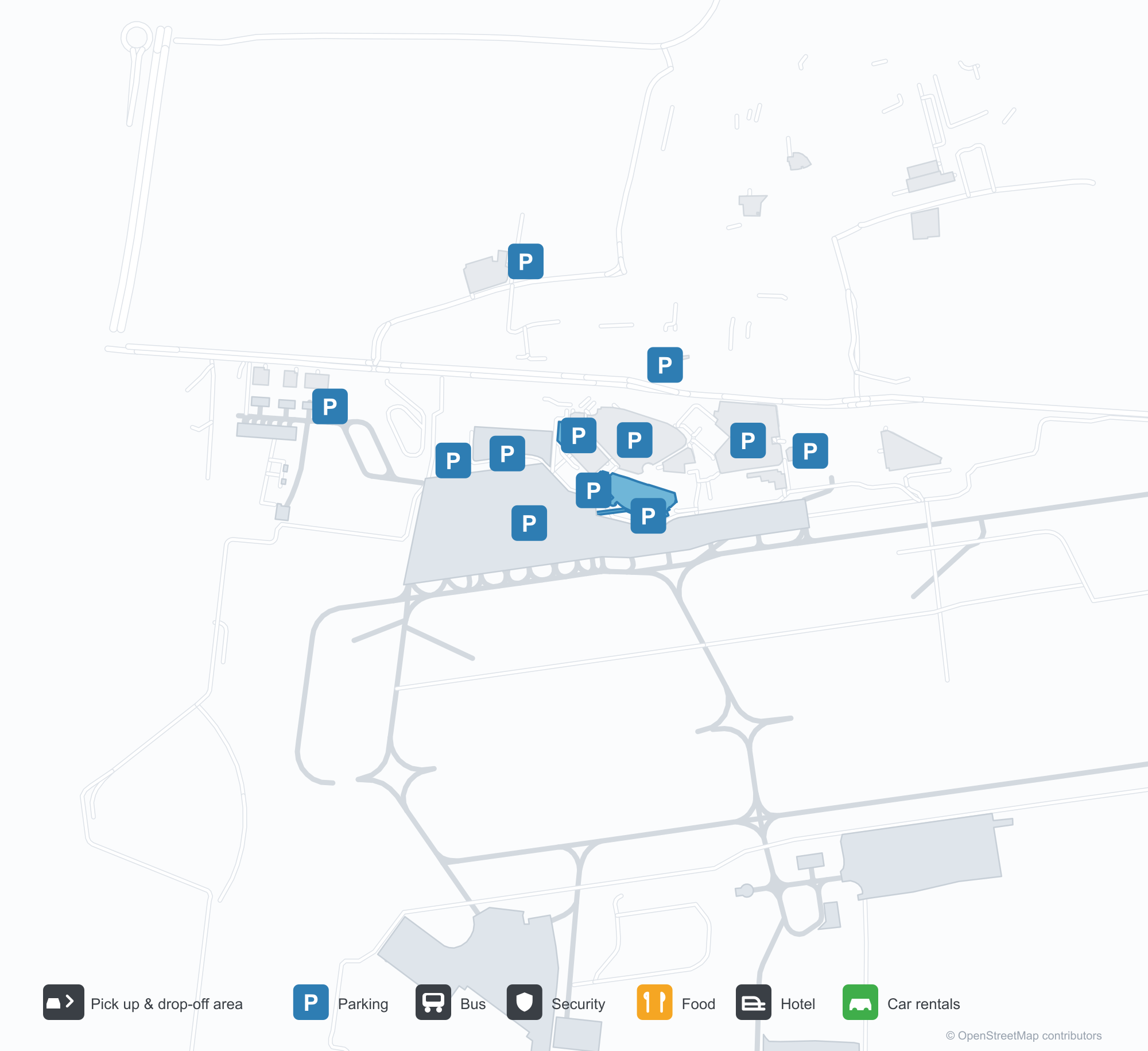
Baixar mapas do aeroportoDownloads
Fotos do aeroportoFotos do aeroporto
Fotos reais deste aeroporto, cada uma creditada à página pública da web onde foi encontrada; os direitos autorais continuam com os fotógrafos originais. Clique em uma foto para ampliar ou em uma linha de crédito para abrir a página de origem.
O terminal de aviação executiva — "départs / departures" em toda a fachada escura, com uma porta giratória e a via de desembarque à frente.
Um jato executivo Dassault Falcon no pátio, com a torre de controle e o terminal atrás.
Uma escultura de biplano está sobre um pilar no meio da rotatória de desembarque enquanto um viajante empurra uma mala em direção ao terminal de fachada de vidro.
Visto de cima, o píer se estende do edifício principal até o pátio, com alguns aviões pequenos estacionados e uma cidade de telhados vermelhos além.
Passageiros sobem escadas móveis para embarcar em um jato enquanto um trabalhador de solo com colete refletor aguarda ao lado, sob a placa com o nome do terminal.
Uma vista aérea anotada do aeródromo marca as pistas de grama e pavimentadas, com alguns aviões leves estacionados ao lado dos campos à esquerda.
Visto de cima, o terminal e seus estacionamentos lotados cercam um pátio onde dois aviões estão, com o monumento do biplano em sua ilha rodoviária.
Um jato regional Air France HOP descansa no pátio enquanto um carregador de bagagem e um veículo de solo trabalham ao seu lado, com colinas ao fundo.
Um viajante com mochila passa pelas portas giratórias sob as letras amarelas "départs" na cobertura escura do terminal.
Clermont-Ferrand Auvergne airport: mapa de rotas — destinos diretosMapa de rotas
6 destinos diretos: mapa, companhias aéreas em operação e distâncias.
Clermont-Ferrand Auvergne airport: voos — partidas e chegadasPainel de voos
56 números de voo de 12 companhias aéreas para 3 destinos, separados por direção. Números de codeshare estão incluídos.
| Voo | Companhia aérea | Destino | País/região |
|---|---|---|---|
| 5O133 | ASL Airlines France | Argel (ALG) Houari Boumediene Airport | Argélia |
| AF7391 | Air France | Aeroporto de Paris-Charles de Gaulle | França |
| AF7393 | Air France | Aeroporto de Paris-Charles de Gaulle | França |
| AF7395 | Air France | Aeroporto de Paris-Charles de Gaulle | França |
| AM5819 | Aeroméxico | Aeroporto de Paris-Charles de Gaulle | França |
| AM5828 | Aeroméxico | Aeroporto de Paris-Charles de Gaulle | França |
| AM6134 | Aeroméxico | Aeroporto de Paris-Charles de Gaulle | França |
| DL8350 | Delta Air Lines | Aeroporto de Paris-Charles de Gaulle | França |
| DL8612 | Delta Air Lines | Aeroporto de Paris-Charles de Gaulle | França |
| DL8613 | Delta Air Lines | Aeroporto de Paris-Charles de Gaulle | França |
| G35066 | Gol Airlines | Aeroporto de Paris-Charles de Gaulle | França |
| KL2027 | KLM | Aeroporto de Paris-Charles de Gaulle | França |
| KL2029 | KLM | Aeroporto de Paris-Charles de Gaulle | França |
| KL2455 | KLM | Aeroporto de Paris-Charles de Gaulle | França |
| KQ3080 | Kenya Airways | Aeroporto de Paris-Charles de Gaulle | França |
| MK9031 | Air Mauritius | Aeroporto de Paris-Charles de Gaulle | França |
| MK9035 | Air Mauritius | Aeroporto de Paris-Charles de Gaulle | França |
| MU1506 | China Eastern Airlines | Aeroporto de Paris-Charles de Gaulle | França |
| MU1534 | China Eastern Airlines | Aeroporto de Paris-Charles de Gaulle | França |
| V72268 | Volotea | Francisco de Sá Carneiro Airport | Portugal |
Números de voo e rotas do índice de voos da aviability.com (instantâneo de 26 de outubro de 2026); números de codeshare estão incluídos e nenhum horário de partida é exibido. Fonte: aviability.com ↗
Informações e detalhes do aeroportoDetalhes do aeroporto
Mapa interativo — localização do Clermont-Ferrand Auvergne airportMapa interativo
Veja este aeroporto em outros serviços de mapas:
Clermont-Ferrand Airport (CFE): Business Aviation and Six RoutesGuia do aeroporto
The photos of Clermont-Ferrand Auvergne airport (IATA CFE, ICAO LFLC) do not show the main terminal. They focus on business aviation: a dark façade carrying the words "départs · departures", a revolving door and a drop-off lane in front; then a Dassault Falcon on the apron with the control tower and terminal behind it. This is not an airport that runs on scheduled flights alone — business and general aviation have a real place here.
The field serves Clermont-Ferrand, France, at an elevation of about 332 m. Its main runway, 08/26, is 3,013 m of asphalt; the other two are grass strips of 900 m and 705 m. The 2014 route snapshot records only 6 non-stop destinations: 4 in France and 2 abroad.
Airport photos
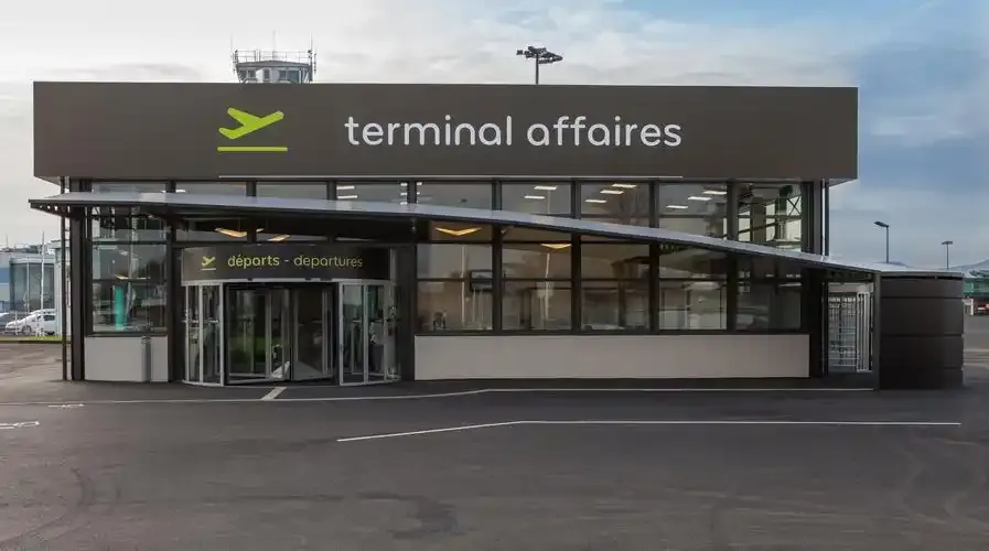
The business-aviation terminal — 'départs / departures' across its dark façade, a revolving door and drop-off lane in front.
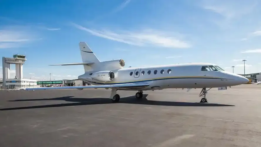
A Dassault Falcon business jet on the apron, with the control tower and terminal behind it.
The photos come from public web sources and remain the copyright of their photographers; full credits and source links sit in the photo gallery on this page.
Airport at a glance
| Item | Detail |
|---|---|
| IATA / ICAO | CFE / LFLC |
| Role | Large airport by this site's classification; regional gateway for Auvergne |
| Elevation | about 332 m |
| Coordinates | 45.7867, 3.1692 |
| Runways | 3: 08/26 at 3,013 m asphalt; 08L/26R at 900 m grass; 01/19 at 705 m grass |
| Non-stop destinations | 6 (4 domestic, 2 international; 2014 snapshot) |
| Official site | clermont-aeroport.com |
Network shape: six routes, five within 1,000 km
By distance: 5 destinations within 1,000 km, 1 between 1,000 and 3,000 km, and none beyond 3,000 km. The near layer is Lyon (149 km), Paris Orly (333 km) and Paris Charles de Gaulle (361 km); the only route over 1,000 km is Porto at 1,079 km. Air France and Airlinair each appear on 3 routes; the carrier column includes codeshares, so the figures describe concentration.
| Distance band | Destinations |
|---|---|
| Under 1,000 km | 5 |
| 1,000–3,000 km | 1 |
| Over 3,000 km | 0 |
Those six routes are all the 2014 snapshot recorded, not proof that the airport serves only six places today; seasonal and charter flights may be missing. The full list is on the Clermont-Ferrand route map.
Getting there and navigating
- Coordinates: 45.7867, 3.1692
- Official site: clermont-aeroport.com
- Open in a map: Google Maps | Amap | Baidu Maps
If fares are close, compare the two Paris airports: Orly (ORY) is about 333 km away with 109 destinations, and Charles de Gaulle (CDG) about 361 km away with 234. The snapshot also shows a CFE–Lyon route (149 km), making Lyon the nearest regional alternative.
The location map on this page shows the field against Clermont-Ferrand and the road network. This page does not cover terminal connections or local transport; confirm them with the airport or airline.
Before you fly
- The airport is small, so 90 minutes before departure is usually enough; add time for an international flight or checked bags.
- The "départs" entrance in the photos belongs to the business-aviation terminal, not the scheduled-flight terminal. Confirm which building you need before setting off.
- The two grass strips serve light aircraft; scheduled flights use the 3,013 m asphalt runway. The six routes are a 2014 snapshot, so check current schedules.
About the data
Runways, elevation and coordinates come from OurAirports open data. Routes and carriers come from the June 2014 OpenFlights snapshot and include codeshares and interline services; they indicate network shape and scale, not current schedules. Photos are from public web sources and remain the copyright of their photographers.
Comentários dos leitoresDiscussão
Perguntas, relatos de viagem e correções são bem-vindos. Os comentários são públicos.
Carregando…
Carregando comentários…