
Clermont-Ferrand Auvergne airport
 Clermont-Ferrand · フランス· Clermont-Ferrand Auvergne airport
Clermont-Ferrand Auvergne airport(IATA: CFE、ICAO: LFLC)はClermont-Ferrand、フランスにある大型空港です。
Clermont-Ferrand Auvergne airport is a large airport, at an elevation of about 1,090 ft, with scheduled passenger service. This page gathers its location map, airport codes and travel information.
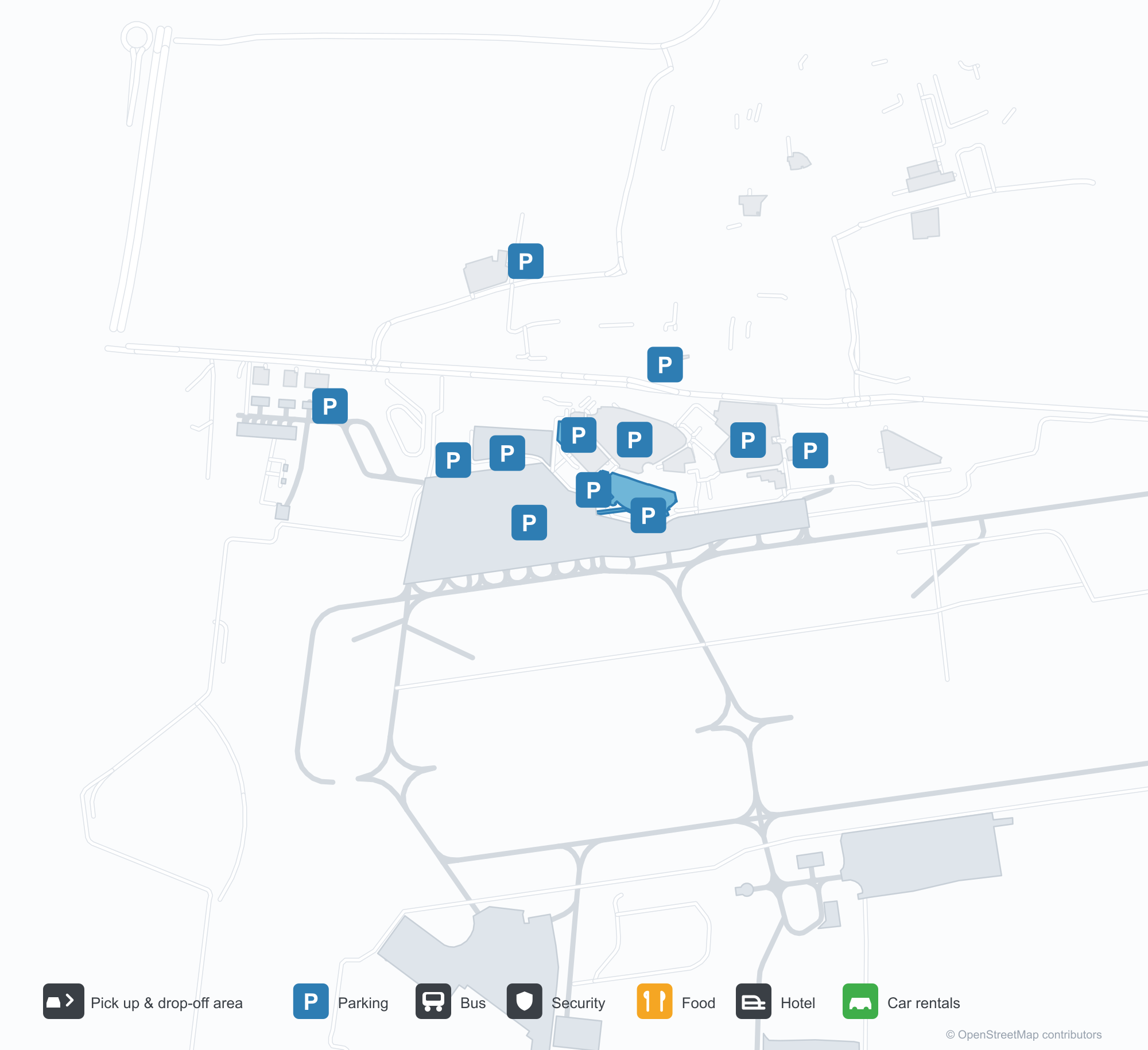
空港マップをダウンロードダウンロード
空港写真空港写真
この空港の実際の写真です。いずれも公開ウェブページを出典として明記しており、著作権は撮影者に帰属します。写真をクリックすると拡大表示され、クレジットをクリックすると元のページが開きます。
ビジネス航空ターミナル——暗いファサードに「départs / departures」、手前には回転扉と車寄せレーン。
エプロンにダッソー・ファルコンのビジネスジェット、背後に管制塔とターミナル。
車寄せロータリーの中央、柱の上に複葉機の彫刻。旅行者がスーツケースを引いてガラス張りターミナルへ向かう。
上空から見ると、桟橋状の建物が本館からエプロンへ延び、小型機が数機停まり、その先に赤い屋根の町。
乗客が移動式階段を上ってジェット機に搭乗し、高視認性ベストの地上係員がそばに立つ。上にはターミナルの名称看板。
注記付きの飛行場空撮:草地と舗装の滑走路が示され、左側の畑のそばに軽飛行機が数機停まる。
見下ろすと、ターミナルと満車の駐車場が、旅客機2機の停まるエプロンを囲み、ロータリー島には複葉機のモニュメント。
エールフランスHOPのリージョナルジェットがエプロンに停まり、そばで手荷物積み込み車と地上車両が作業する。その先に丘陵。
背負い袋の旅行者が、ターミナルの暗いキャノピーに記された黄色い「départs」の文字の下、回転扉を通る。
Clermont-Ferrand Auvergne airportの路線マップ — 直行便の目的地路線マップ
直行目的地6か所。地図、就航航空会社、距離を掲載しています。
Clermont-Ferrand Auvergne airport発着便 — 出発と到着フライトボード
便名56件、12社の航空会社、3か所の目的地を出発・到着別に掲載しています。コードシェア便も含みます。
| 便 | 航空会社 | 目的地 | 国・地域 |
|---|---|---|---|
| 5O133 | ASL Airlines France | アルジェ (ALG) Houari Boumediene Airport | アルジェリア |
| AF7391 | Air France | パリ=シャルル・ド・ゴール空港 | フランス |
| AF7393 | Air France | パリ=シャルル・ド・ゴール空港 | フランス |
| AF7395 | Air France | パリ=シャルル・ド・ゴール空港 | フランス |
| AM5819 | Aeroméxico | パリ=シャルル・ド・ゴール空港 | フランス |
| AM5828 | Aeroméxico | パリ=シャルル・ド・ゴール空港 | フランス |
| AM6134 | Aeroméxico | パリ=シャルル・ド・ゴール空港 | フランス |
| DL8350 | Delta Air Lines | パリ=シャルル・ド・ゴール空港 | フランス |
| DL8612 | Delta Air Lines | パリ=シャルル・ド・ゴール空港 | フランス |
| DL8613 | Delta Air Lines | パリ=シャルル・ド・ゴール空港 | フランス |
| G35066 | Gol Airlines | パリ=シャルル・ド・ゴール空港 | フランス |
| KL2027 | KLM | パリ=シャルル・ド・ゴール空港 | フランス |
| KL2029 | KLM | パリ=シャルル・ド・ゴール空港 | フランス |
| KL2455 | KLM | パリ=シャルル・ド・ゴール空港 | フランス |
| KQ3080 | Kenya Airways | パリ=シャルル・ド・ゴール空港 | フランス |
| MK9031 | Air Mauritius | パリ=シャルル・ド・ゴール空港 | フランス |
| MK9035 | Air Mauritius | パリ=シャルル・ド・ゴール空港 | フランス |
| MU1506 | China Eastern Airlines | パリ=シャルル・ド・ゴール空港 | フランス |
| MU1534 | China Eastern Airlines | パリ=シャルル・ド・ゴール空港 | フランス |
| V72268 | Volotea | Francisco de Sá Carneiro Airport | ポルトガル |
便名と路線はaviability.comのフライトインデックス(スナップショット:2026年10月26日)に基づきます。コードシェア便を含み、出発時刻は掲載していません。出典:aviability.com ↗
空港情報と詳細空港の詳細
インタラクティブマップ — Clermont-Ferrand Auvergne airportの位置インタラクティブマップ
他の地図サービスでこの空港を見る:
Clermont-Ferrand Airport (CFE): Business Aviation and Six Routes空港ガイド
The photos of Clermont-Ferrand Auvergne airport (IATA CFE, ICAO LFLC) do not show the main terminal. They focus on business aviation: a dark façade carrying the words "départs · departures", a revolving door and a drop-off lane in front; then a Dassault Falcon on the apron with the control tower and terminal behind it. This is not an airport that runs on scheduled flights alone — business and general aviation have a real place here.
The field serves Clermont-Ferrand, France, at an elevation of about 332 m. Its main runway, 08/26, is 3,013 m of asphalt; the other two are grass strips of 900 m and 705 m. The 2014 route snapshot records only 6 non-stop destinations: 4 in France and 2 abroad.
Airport photos
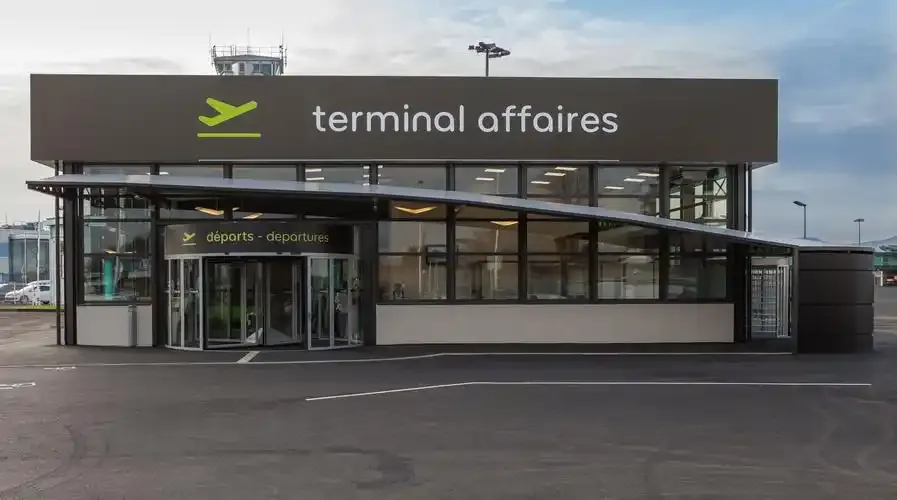
The business-aviation terminal — 'départs / departures' across its dark façade, a revolving door and drop-off lane in front.
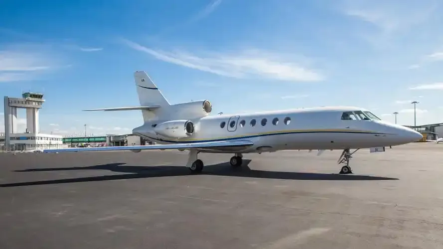
A Dassault Falcon business jet on the apron, with the control tower and terminal behind it.
The photos come from public web sources and remain the copyright of their photographers; full credits and source links sit in the photo gallery on this page.
Airport at a glance
| Item | Detail |
|---|---|
| IATA / ICAO | CFE / LFLC |
| Role | Large airport by this site's classification; regional gateway for Auvergne |
| Elevation | about 332 m |
| Coordinates | 45.7867, 3.1692 |
| Runways | 3: 08/26 at 3,013 m asphalt; 08L/26R at 900 m grass; 01/19 at 705 m grass |
| Non-stop destinations | 6 (4 domestic, 2 international; 2014 snapshot) |
| Official site | clermont-aeroport.com |
Network shape: six routes, five within 1,000 km
By distance: 5 destinations within 1,000 km, 1 between 1,000 and 3,000 km, and none beyond 3,000 km. The near layer is Lyon (149 km), Paris Orly (333 km) and Paris Charles de Gaulle (361 km); the only route over 1,000 km is Porto at 1,079 km. Air France and Airlinair each appear on 3 routes; the carrier column includes codeshares, so the figures describe concentration.
| Distance band | Destinations |
|---|---|
| Under 1,000 km | 5 |
| 1,000–3,000 km | 1 |
| Over 3,000 km | 0 |
Those six routes are all the 2014 snapshot recorded, not proof that the airport serves only six places today; seasonal and charter flights may be missing. The full list is on the Clermont-Ferrand route map.
Getting there and navigating
- Coordinates: 45.7867, 3.1692
- Official site: clermont-aeroport.com
- Open in a map: Google Maps | Amap | Baidu Maps
If fares are close, compare the two Paris airports: Orly (ORY) is about 333 km away with 109 destinations, and Charles de Gaulle (CDG) about 361 km away with 234. The snapshot also shows a CFE–Lyon route (149 km), making Lyon the nearest regional alternative.
The location map on this page shows the field against Clermont-Ferrand and the road network. This page does not cover terminal connections or local transport; confirm them with the airport or airline.
Before you fly
- The airport is small, so 90 minutes before departure is usually enough; add time for an international flight or checked bags.
- The "départs" entrance in the photos belongs to the business-aviation terminal, not the scheduled-flight terminal. Confirm which building you need before setting off.
- The two grass strips serve light aircraft; scheduled flights use the 3,013 m asphalt runway. The six routes are a 2014 snapshot, so check current schedules.
About the data
Runways, elevation and coordinates come from OurAirports open data. Routes and carriers come from the June 2014 OpenFlights snapshot and include codeshares and interline services; they indicate network shape and scale, not current schedules. Photos are from public web sources and remain the copyright of their photographers.
読者コメントディスカッション
質問、旅行記、訂正など、お気軽にお寄せください。コメントは公開されます。
読み込み中…
コメントを読み込み中…