
Clermont-Ferrand Auvergne airport
 Clermont-Ferrand · 프랑스· Clermont-Ferrand Auvergne airport
Clermont-Ferrand Auvergne airport(IATA: CFE, ICAO: LFLC)은 프랑스 Clermont-Ferrand에 위치한 대형 공항입니다.
Clermont-Ferrand Auvergne airport is a large airport, at an elevation of about 1,090 ft, with scheduled passenger service. This page gathers its location map, airport codes and travel information.
공항 지도 다운로드다운로드
공항 실제 사진공항 사진
다음은 이 공항의 실제 사진으로, 모두 공개된 인터넷 출처에서 가져왔으며 사진마다 출처를 표시했습니다. 저작권은 원저작자에게 있습니다. 사진을 클릭하면 크게 볼 수 있고, 출처를 클릭하면 원본 페이지가 열립니다.
비즈니스 항공 터미널 — 어두운 파사드에 'départs / departures'가 걸려 있고, 앞에는 회전문과 하차 차로가 있는 모습.
계류장의 Dassault Falcon 비즈니스 제트기 — 뒤로 관제탑과 터미널.
Clermont-Ferrand Auvergne airport 노선도 · 직항 목적지노선도
직항 목적지 6개: 노선도, 운항 항공사, 비행 거리.
공항 정보 및 상세공항 상세
Clermont-Ferrand Auvergne airport 인터랙티브 지도 — 공항 위치인터랙티브 지도
다른 지도 서비스에서 이 공항 보기:
Clermont-Ferrand Airport (CFE): Business Aviation and Six Routes공항 안내
The photos of Clermont-Ferrand Auvergne airport (IATA CFE, ICAO LFLC) do not show the main terminal. They focus on business aviation: a dark façade carrying the words "départs · departures", a revolving door and a drop-off lane in front; then a Dassault Falcon on the apron with the control tower and terminal behind it. This is not an airport that runs on scheduled flights alone — business and general aviation have a real place here.
The field serves Clermont-Ferrand, France, at an elevation of about 332 m. Its main runway, 08/26, is 3,013 m of asphalt; the other two are grass strips of 900 m and 705 m. The 2014 route snapshot records only 6 non-stop destinations: 4 in France and 2 abroad.
Airport photos
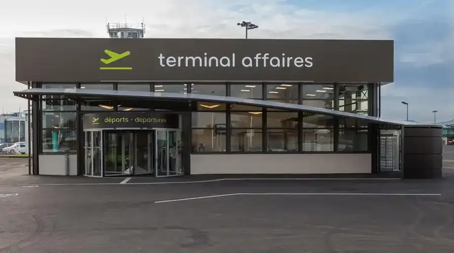
The business-aviation terminal — 'départs / departures' across its dark façade, a revolving door and drop-off lane in front.
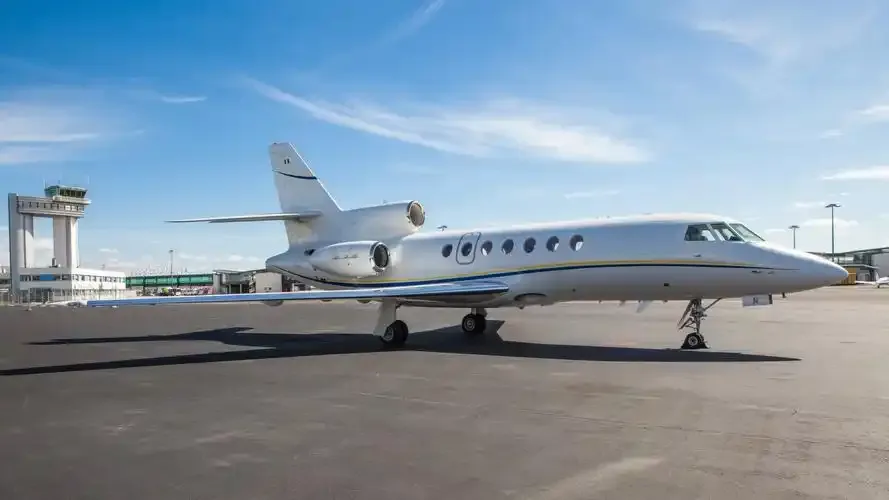
A Dassault Falcon business jet on the apron, with the control tower and terminal behind it.
The photos come from public web sources and remain the copyright of their photographers; full credits and source links sit in the photo gallery on this page.
Airport at a glance
| Item | Detail |
|---|---|
| IATA / ICAO | CFE / LFLC |
| Role | Large airport by this site's classification; regional gateway for Auvergne |
| Elevation | about 332 m |
| Coordinates | 45.7867, 3.1692 |
| Runways | 3: 08/26 at 3,013 m asphalt; 08L/26R at 900 m grass; 01/19 at 705 m grass |
| Non-stop destinations | 6 (4 domestic, 2 international; 2014 snapshot) |
| Official site | clermont-aeroport.com |
Network shape: six routes, five within 1,000 km
By distance: 5 destinations within 1,000 km, 1 between 1,000 and 3,000 km, and none beyond 3,000 km. The near layer is Lyon (149 km), Paris Orly (333 km) and Paris Charles de Gaulle (361 km); the only route over 1,000 km is Porto at 1,079 km. Air France and Airlinair each appear on 3 routes; the carrier column includes codeshares, so the figures describe concentration.
| Distance band | Destinations |
|---|---|
| Under 1,000 km | 5 |
| 1,000–3,000 km | 1 |
| Over 3,000 km | 0 |
Those six routes are all the 2014 snapshot recorded, not proof that the airport serves only six places today; seasonal and charter flights may be missing. The full list is on the Clermont-Ferrand route map.
Getting there and navigating
- Coordinates: 45.7867, 3.1692
- Official site: clermont-aeroport.com
- Open in a map: Google Maps | Amap | Baidu Maps
If fares are close, compare the two Paris airports: Orly (ORY) is about 333 km away with 109 destinations, and Charles de Gaulle (CDG) about 361 km away with 234. The snapshot also shows a CFE–Lyon route (149 km), making Lyon the nearest regional alternative.
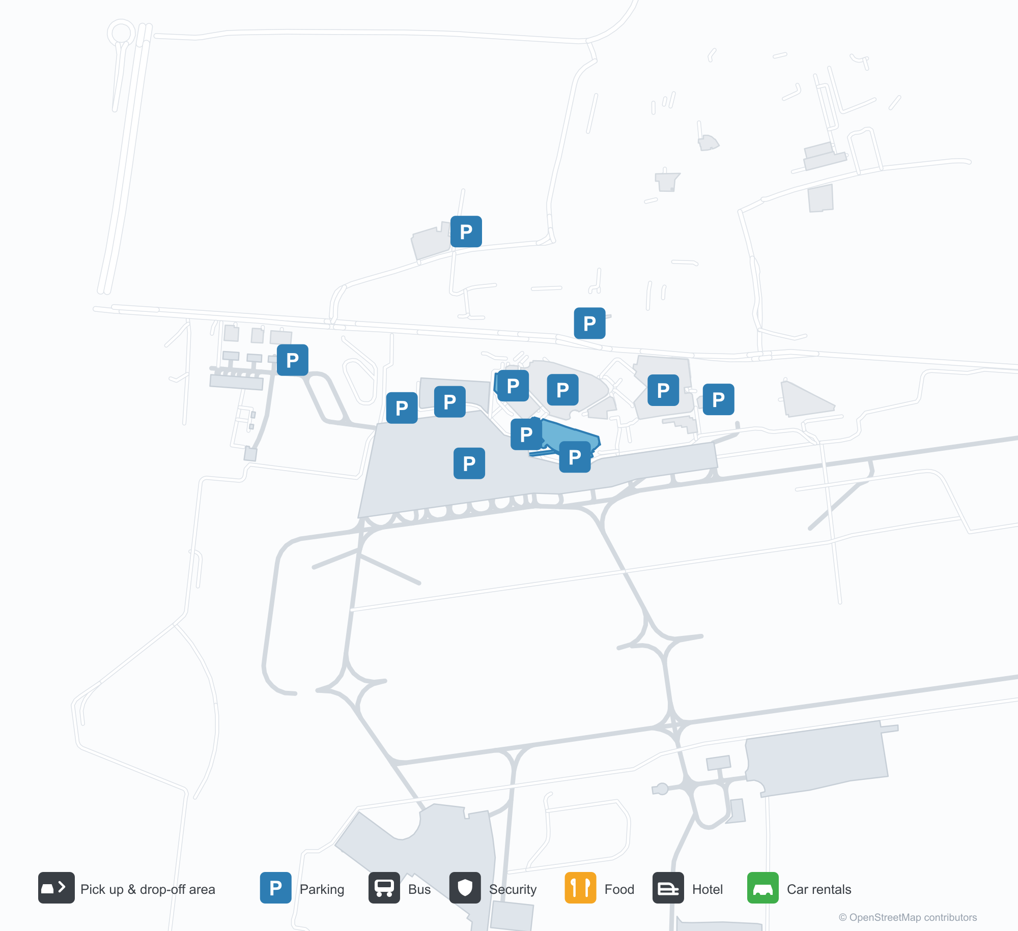
The location map on this page shows the field against Clermont-Ferrand and the road network. This page does not cover terminal connections or local transport; confirm them with the airport or airline.
Before you fly
- The airport is small, so 90 minutes before departure is usually enough; add time for an international flight or checked bags.
- The "départs" entrance in the photos belongs to the business-aviation terminal, not the scheduled-flight terminal. Confirm which building you need before setting off.
- The two grass strips serve light aircraft; scheduled flights use the 3,013 m asphalt runway. The six routes are a 2014 snapshot, so check current schedules.
About the data
Runways, elevation and coordinates come from OurAirports open data. Routes and carriers come from the June 2014 OpenFlights snapshot and include codeshares and interline services; they indicate network shape and scale, not current schedules. Photos are from public web sources and remain the copyright of their photographers.