
Aurangabad Airport
 Aurangabad · インド· Aurangabad Airport
Aurangabad Airport(IATA: IXU、ICAO: VAAU)はAurangabad、インドにある中型空港です。
Aurangabad Airport is a medium-sized airport, at an elevation of about 1,911 ft, with scheduled passenger service. This page gathers its location map, airport codes and travel information.
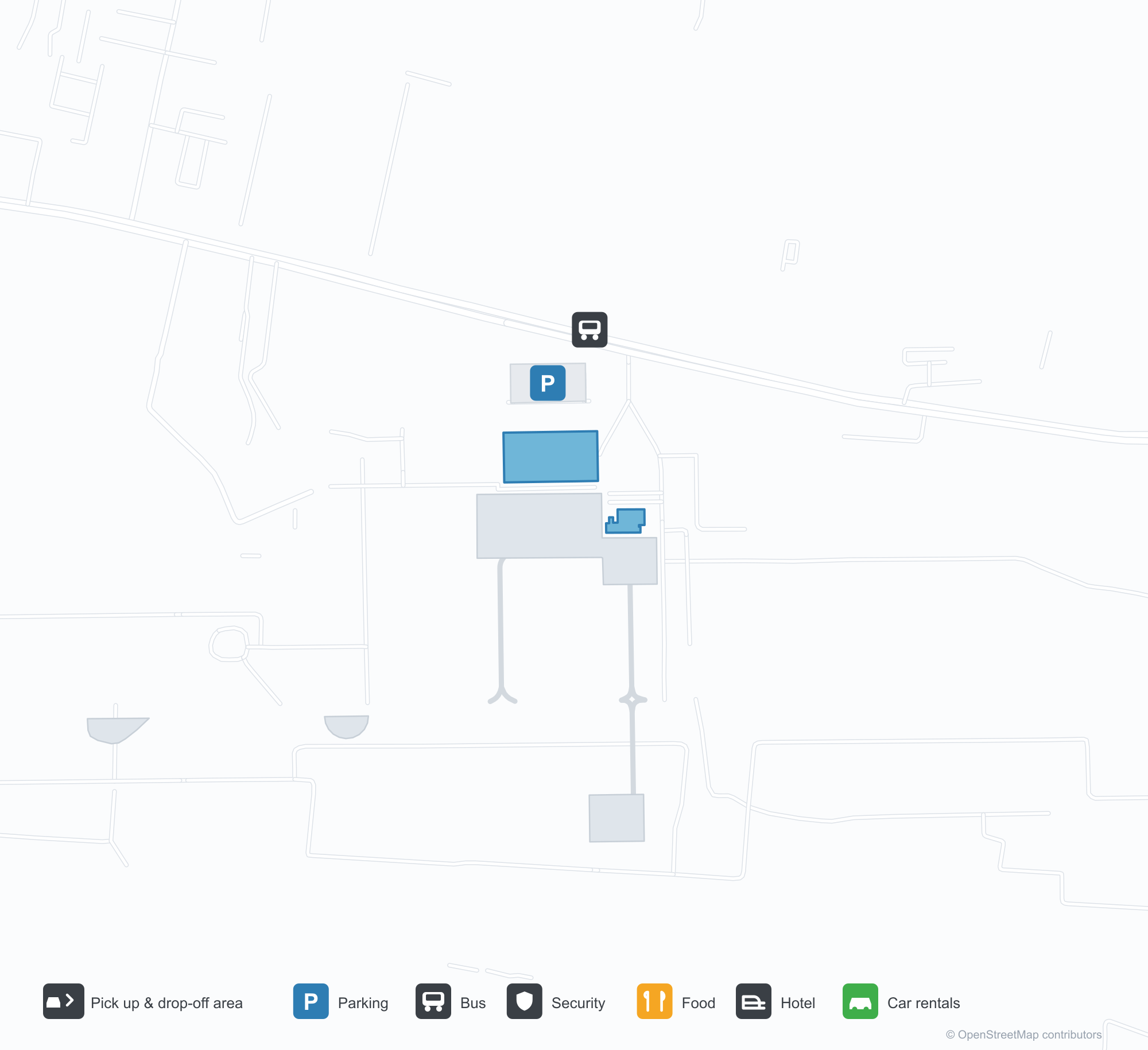
空港マップをダウンロードダウンロード
空港写真空港写真
この空港の実際の写真です。いずれも公開ウェブページを出典として明記しており、著作権は撮影者に帰属します。写真をクリックすると拡大表示され、クレジットをクリックすると元のページが開きます。
ターミナル前庭——車寄せレーンと出発入口の上に白い樽型ヴォールト屋根。
芝生から見たターミナル——正面に沿って曲面屋根が延び、右遠くに管制塔。
出発入口——キャノピーには「WELCOME TO CHHATRAPATI SAMBHAJINAGAR AIRPORT」と「प्रस्थान DEPARTURE」の文字。
ターミナルの青い看板には「Aurangabad Airport」と「Arrival」、縁石沿いに鉢植えが並ぶ。
インディゴのジェット機が低い境界壁の向こうの滑走路を進み、背後に町の屋根、手前の地面には鮮やかな黄色い部分。
低い日差しの中、乗客がエプロンを横切ってターミナルの長い曲面金属屋根へ歩く。
大きな双発機が着陸灯を点けてカメラに向き、左端には霞んだ格子塔の群れ。
鋼鉄トラスのキャノピーの下に青い「Departure」の看板、荷物台車が並び、保安員2人が入ってくる。
夜には入口の上に空港名が白く光り、ヘッドライトがバリアと鉢植えの列を横切る。
赤い尾翼のジェット機が霧雨の中、滑走路を正面から進む。手前は乾いた低木と草。
Aurangabad Airportの路線マップ — 直行便の目的地路線マップ
直行目的地2か所。地図、就航航空会社、距離を掲載しています。
Aurangabad Airport発着便 — 出発と到着フライトボード
便名55件、4社の航空会社、6か所の目的地を出発・到着別に掲載しています。コードシェア便も含みます。
| 便 | 航空会社 | 目的地 | 国・地域 |
|---|---|---|---|
| 6E517 | IndiGo | Kempegowda International Airport Bengaluru | インド |
| 6E2153 | IndiGo | Chhatrapati Shivaji Maharaj International Airport | インド |
| 6E5117 | IndiGo | インディラ・ガンディー国際空港 | インド |
| 6E6093 | IndiGo | Navi Mumbai (NMI) Navi Mumbai International Airport | インド |
| 6E6126 | IndiGo | Chhatrapati Shivaji Maharaj International Airport | インド |
| 6E6257 | IndiGo | インディラ・ガンディー国際空港 | インド |
| 6E7058 | IndiGo | Rajiv Gandhi International Airport | インド |
| 6E7259 | IndiGo | Rajiv Gandhi International Airport | インド |
| 6E7456 | IndiGo | Vasco da Gama (GOI) Goa Dabolim International Airport | インド |
| 6E7598 | IndiGo | Rajiv Gandhi International Airport | インド |
| AI9589 | Air India | インディラ・ガンディー国際空港 | インド |
| AI9914 | Air India | インディラ・ガンディー国際空港 | インド |
| AI9916 | Air India | インディラ・ガンディー国際空港 | インド |
| AI9933 | Air India | インディラ・ガンディー国際空港 | インド |
| IX1820 | Air India Express | インディラ・ガンディー国際空港 | インド |
| IX1822 | Air India Express | インディラ・ガンディー国際空港 | インド |
| IX2240 | Air India Express | インディラ・ガンディー国際空港 | インド |
| IX2246 | Air India Express | インディラ・ガンディー国際空港 | インド |
| JL9017 | Japan Airlines | Kempegowda International Airport Bengaluru | インド |
| JL9020 | Japan Airlines | Kempegowda International Airport Bengaluru | インド |
便名と路線はaviability.comのフライトインデックス(スナップショット:2026年10月26日)に基づきます。コードシェア便を含み、出発時刻は掲載していません。出典:aviability.com ↗
空港情報と詳細空港の詳細
インタラクティブマップ — Aurangabad Airportの位置インタラクティブマップ
他の地図サービスでこの空港を見る:
Aurangabad Airport (IXU): Two Domestic Routes Under a White Vault空港ガイド
The official photos show a white barrel-vaulted roof spanning the drop-off lane, with the departures canopy lettered "WELCOME TO CHHATRAPATI SAMBHAJINAGAR AIRPORT"; another view from the lawn follows the curved roof along the frontage, the control tower far to the right. The airport serves Aurangabad in Maharashtra, India, at an elevation of about 582 m, with a 2,839 m runway; the 2014 snapshot records two domestic destinations, Mumbai at 279 km and Delhi at 982 km.
Airport photos
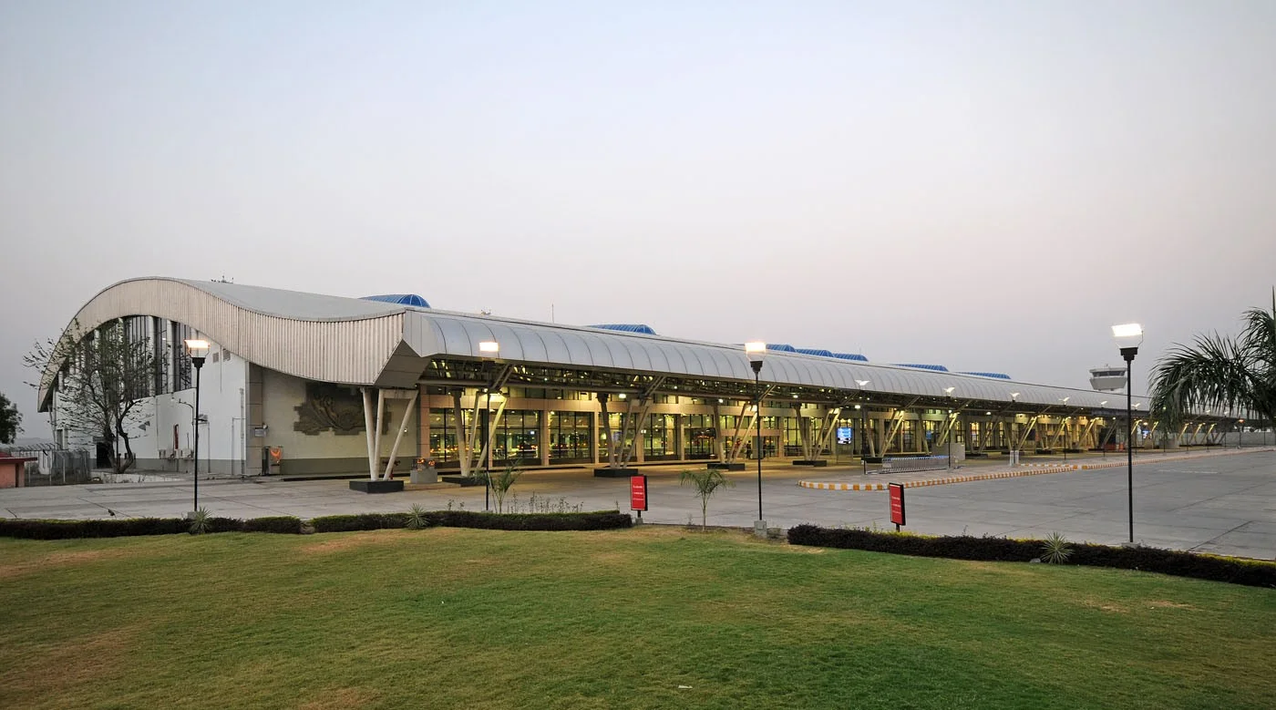
The terminal forecourt — a white barrel-vaulted roof over the drop-off lane and departures entrance.
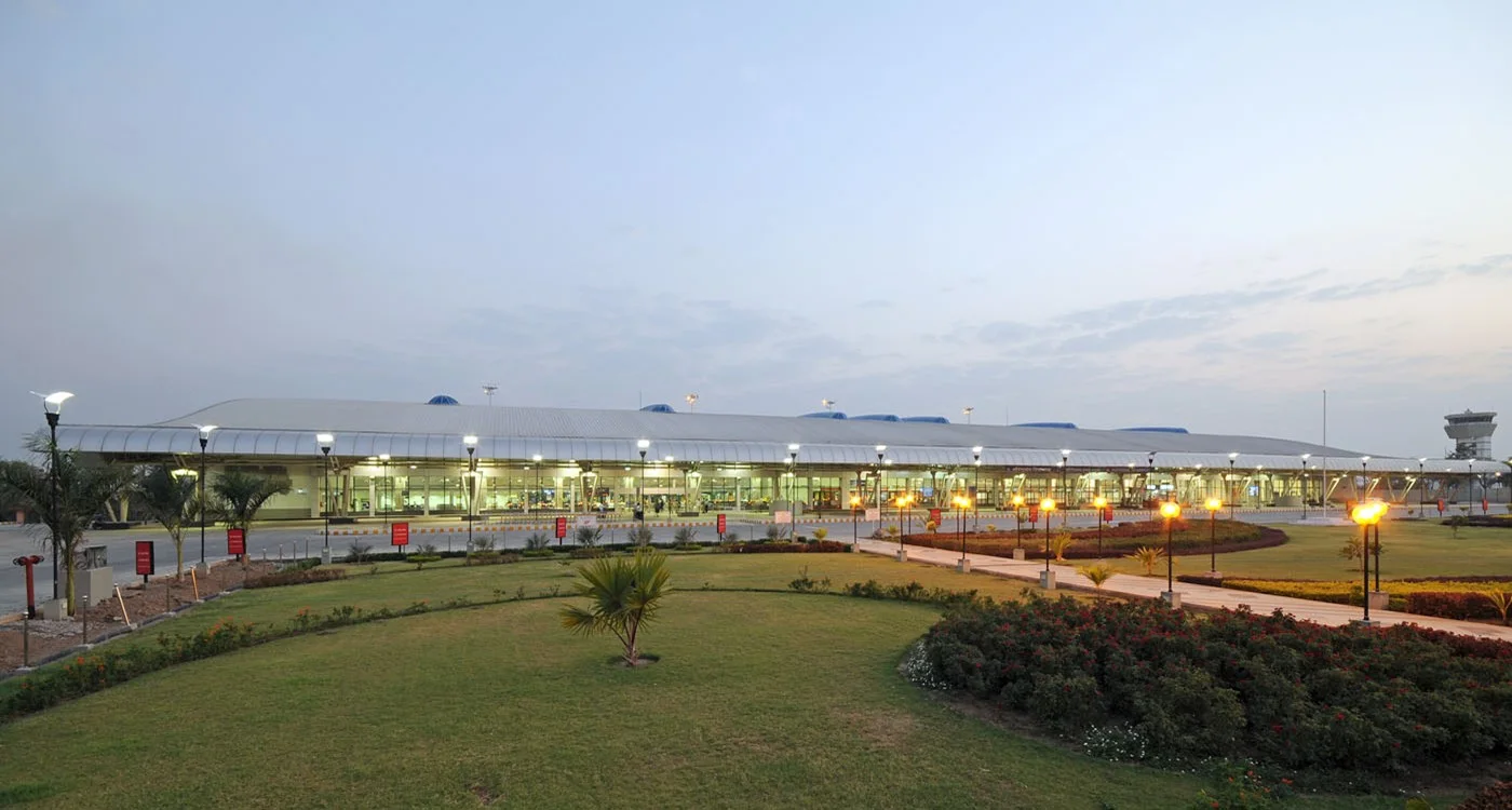
The terminal from the lawn — the curved roof running along the frontage, with the control tower far to the right.
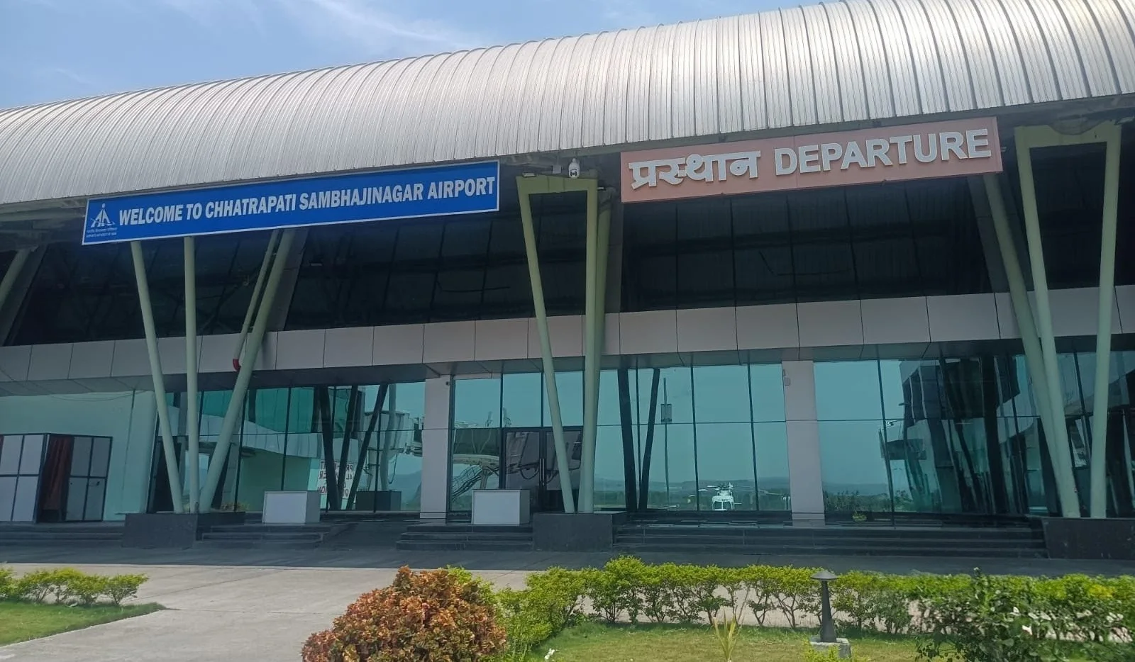
The departures entrance — the canopy lettered 'WELCOME TO CHHATRAPATI SAMBHAJINAGAR AIRPORT' and 'प्रस्थान DEPARTURE'.
The photos come from the Airports Authority of India (AAI) Aurangabad airport page and remain the copyright of their photographers.
Airport at a glance
| Item | Detail |
|---|---|
| IATA / ICAO | IXU / VAAU |
| Role | Medium-sized airport |
| Elevation | about 582 m |
| Coordinates | 19.8629, 75.3963 |
| Runways | 1, 2,839 m |
| Non-stop destinations | 2 (2014 snapshot, all domestic) |
| Official site | www.aai.aero/en/airports/aurangabad |
Runways
| Runway | Length | Width | Surface |
|---|---|---|---|
| 09/27 | 2,839 m | 45 m | Macadam |
1 runway, the longest 2,839 m.
Non-stop routes
2 non-stop destinations, nearest first (OpenFlights route snapshot compiled in 2014 — confirm with the airline or airport):
| Destination | Distance | Carriers |
|---|---|---|
| Chhatrapati Shivaji Maharaj International Airport (BOM) | ~279 km | Jet Airways, Air India Limited, Air Sahara |
| Indira Gandhi International Airport (DEL) | ~982 km | Air India Limited, Spicejet |
The carrier column comes from the same snapshot and includes codeshare and interline services; treat it as an indication of how busy the route is and check the airline for who actually flies it.
Nearby airports to compare
If the fares are close, these are the nearest airports of the same class (medium-sized airport) — straight-line distance, with their own non-stop counts from the same dataset:
| Airport | Distance | Non-stop destinations |
|---|---|---|
| Akola Airport (AKD) | ~197 km | — |
| Amravati Airport (AVR) | ~264 km | — |
Before you fly
- With two domestic routes, 90–120 minutes is usually enough; connect via Mumbai or Delhi for international travel.
- The 2014 snapshot is not today's schedule; Indian domestic networks have changed, so check current airline information.
About the data
Runways, elevation and coordinates come from OurAirports open data. Routes and carriers come from the June 2014 OpenFlights snapshot and include codeshares and interline services; they indicate network shape and scale, not current schedules.
読者コメントディスカッション
質問、旅行記、訂正など、お気軽にお寄せください。コメントは公開されます。
読み込み中…
コメントを読み込み中…