
Aurangabad Airport
 Aurangabad · India· Aurangabad Airport
Aurangabad Airport (IATA: IXU, ICAO VAAU) adalah bandara sedang yang melayani Aurangabad, India.
Aurangabad Airport is a medium-sized airport, at an elevation of about 1,911 ft, with scheduled passenger service. This page gathers its location map, airport codes and travel information.
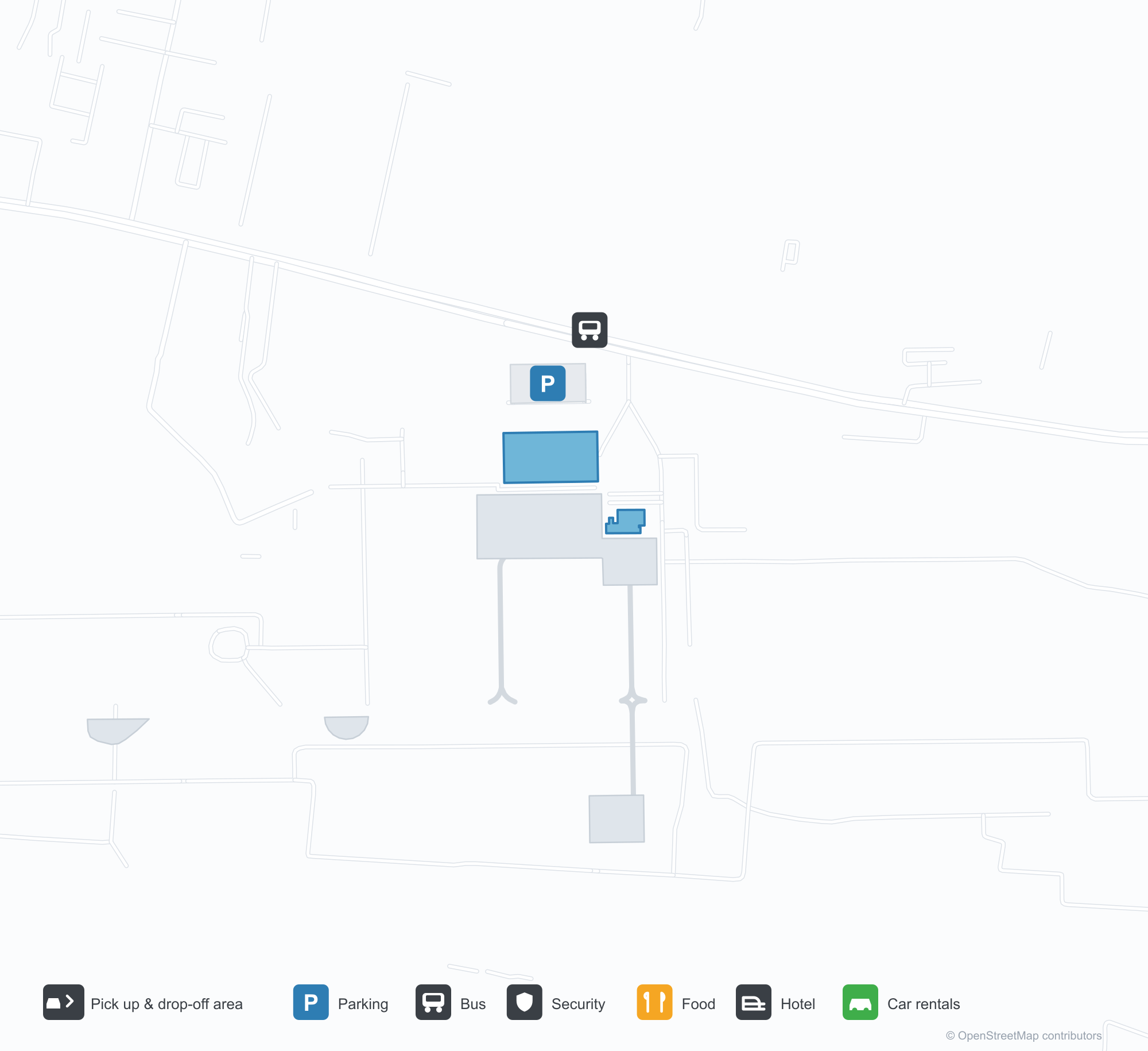
Unduh Peta BandaraUnduhan
Foto bandaraFoto Bandara
Foto asli bandara ini, masing-masing dikreditkan ke halaman web publik tempat foto ditemukan; hak cipta tetap milik fotografer aslinya. Klik foto untuk memperbesar, atau baris kredit untuk membuka halaman sumbernya.
Halaman depan terminal — atap kubah tong putih di atas jalur penurunan penumpang dan pintu keberangkatan.
Terminal dari halaman rumput — atap melengkung membentang di sepanjang fasad, dengan menara kontrol jauh di sebelah kanan.
Pintu keberangkatan — kanopi bertulisan 'WELCOME TO CHHATRAPATI SAMBHAJINAGAR AIRPORT' dan 'प्रस्थान DEPARTURE'.
Papan biru di terminal bertuliskan 'Aurangabad Airport' dan 'Arrival', dengan sederet pot tanaman di sepanjang tepi jalan.
Pesawat jet IndiGo bergulir di landasan pacu di balik dinding pembatas rendah, atap kota di belakang dan tambalan kuning cerah di tanah di depan.
Penumpang berjalan keluar melintasi apron menuju atap logam melengkung panjang terminal dalam cahaya matahari rendah.
Pesawat jet kembar besar menghadap kamera dengan lampu pendarat menyala, tumpukan menara kisi berkabut di tepi kiri.
Papan biru 'Departure' tergantung di bawah kanopi rangka baja, troli bagasi berjajar saat dua petugas keamanan berjalan masuk.
Pada malam hari, nama bandara bersinar putih di atas pintu masuk sementara lampu depan menyapu pembatas dan deretan pot tanaman.
Pesawat jet berekor merah bergulir menghadap kamera di landasan pacu melewati gerimis, semak kering dan rumput memenuhi latar depan.
Peta rute Aurangabad Airport — tujuan langsungPeta Rute
2 tujuan langsung: peta, maskapai yang beroperasi, dan jarak.
Penerbangan Aurangabad Airport — keberangkatan & kedatanganPapan Penerbangan
55 nomor penerbangan dari 4 maskapai dan 6 tujuan, dipisahkan menurut arah. Nomor codeshare disertakan.
| Penerbangan | Maskapai | Tujuan | Negara/wilayah |
|---|---|---|---|
| 6E517 | IndiGo | Kempegowda International Airport Bengaluru | India |
| 6E2153 | IndiGo | Chhatrapati Shivaji Maharaj International Airport | India |
| 6E5117 | IndiGo | Bandara Internasional Indira Gandhi | India |
| 6E6093 | IndiGo | Navi Mumbai (NMI) Navi Mumbai International Airport | India |
| 6E6126 | IndiGo | Chhatrapati Shivaji Maharaj International Airport | India |
| 6E6257 | IndiGo | Bandara Internasional Indira Gandhi | India |
| 6E7058 | IndiGo | Rajiv Gandhi International Airport | India |
| 6E7259 | IndiGo | Rajiv Gandhi International Airport | India |
| 6E7456 | IndiGo | Vasco da Gama (GOI) Goa Dabolim International Airport | India |
| 6E7598 | IndiGo | Rajiv Gandhi International Airport | India |
| AI9589 | Air India | Bandara Internasional Indira Gandhi | India |
| AI9914 | Air India | Bandara Internasional Indira Gandhi | India |
| AI9916 | Air India | Bandara Internasional Indira Gandhi | India |
| AI9933 | Air India | Bandara Internasional Indira Gandhi | India |
| IX1820 | Air India Express | Bandara Internasional Indira Gandhi | India |
| IX1822 | Air India Express | Bandara Internasional Indira Gandhi | India |
| IX2240 | Air India Express | Bandara Internasional Indira Gandhi | India |
| IX2246 | Air India Express | Bandara Internasional Indira Gandhi | India |
| JL9017 | Japan Airlines | Kempegowda International Airport Bengaluru | India |
| JL9020 | Japan Airlines | Kempegowda International Airport Bengaluru | India |
Nomor penerbangan dan rute dari indeks penerbangan aviability.com (cuplikan 26 Oktober 2026); nomor codeshare disertakan dan waktu keberangkatan tidak ditampilkan. Sumber: aviability.com ↗
Informasi & detail bandaraDetail Bandara
Peta interaktif — lokasi Aurangabad AirportPeta Interaktif
Lihat bandara ini di layanan peta lain:
Aurangabad Airport (IXU): Two Domestic Routes Under a White VaultPanduan Bandara
The official photos show a white barrel-vaulted roof spanning the drop-off lane, with the departures canopy lettered "WELCOME TO CHHATRAPATI SAMBHAJINAGAR AIRPORT"; another view from the lawn follows the curved roof along the frontage, the control tower far to the right. The airport serves Aurangabad in Maharashtra, India, at an elevation of about 582 m, with a 2,839 m runway; the 2014 snapshot records two domestic destinations, Mumbai at 279 km and Delhi at 982 km.
Airport photos
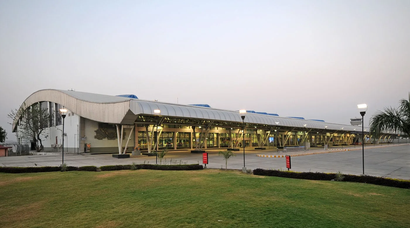
The terminal forecourt — a white barrel-vaulted roof over the drop-off lane and departures entrance.
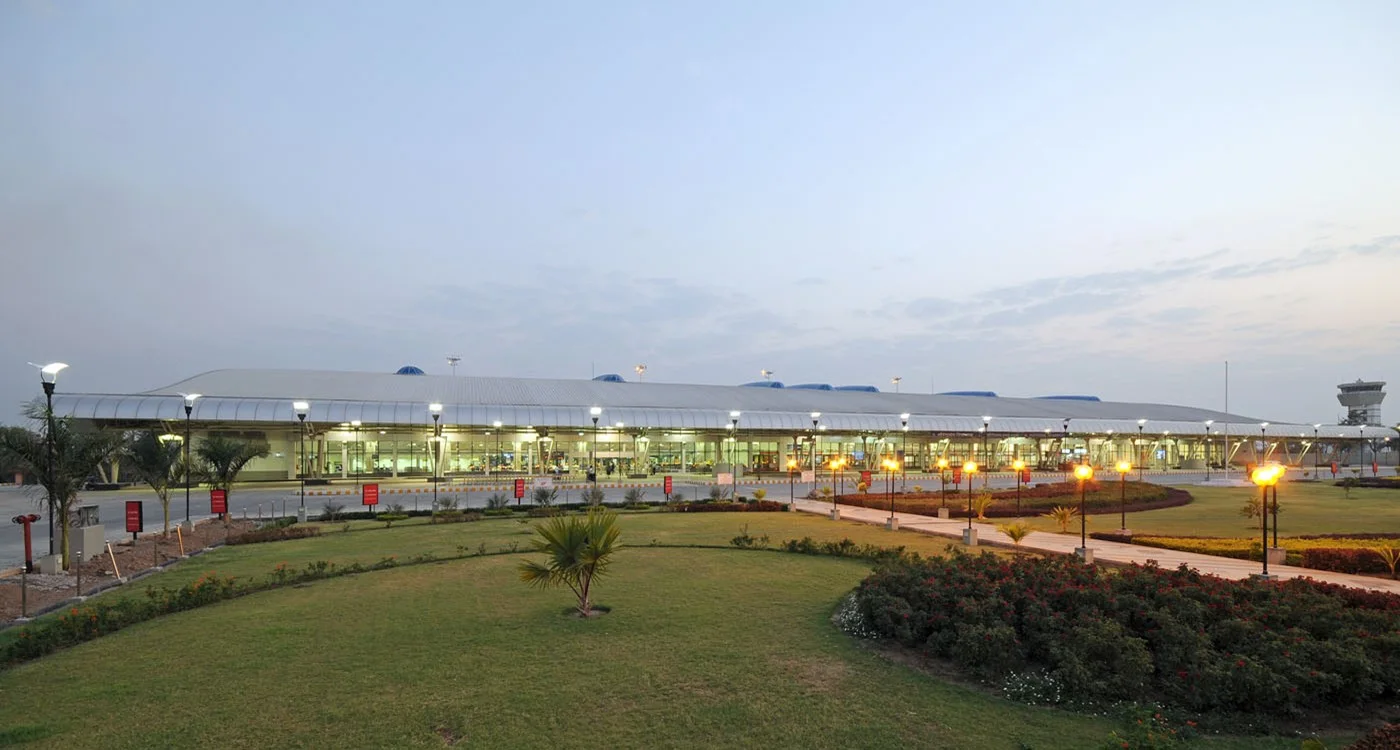
The terminal from the lawn — the curved roof running along the frontage, with the control tower far to the right.
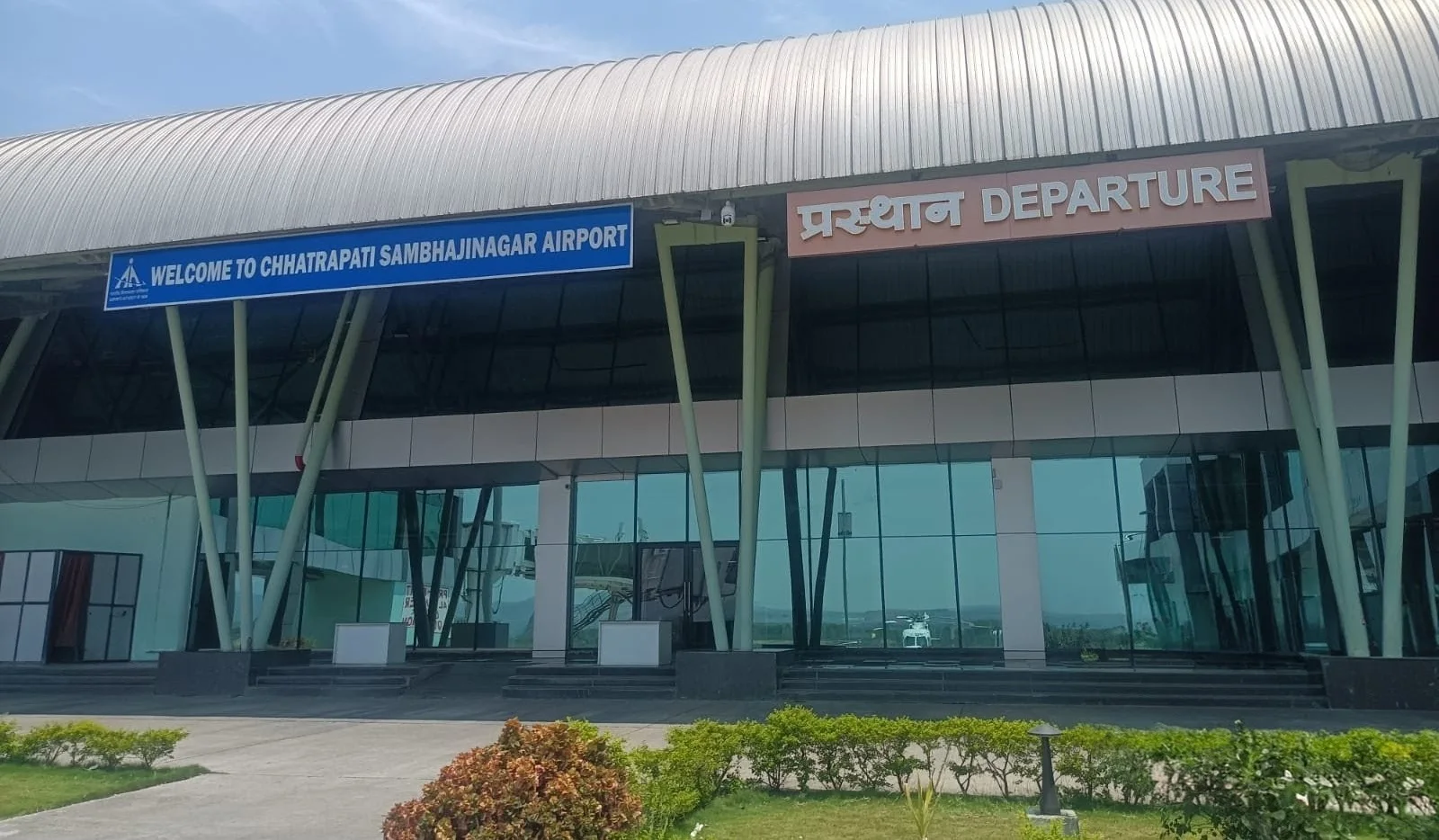
The departures entrance — the canopy lettered 'WELCOME TO CHHATRAPATI SAMBHAJINAGAR AIRPORT' and 'प्रस्थान DEPARTURE'.
The photos come from the Airports Authority of India (AAI) Aurangabad airport page and remain the copyright of their photographers.
Airport at a glance
| Item | Detail |
|---|---|
| IATA / ICAO | IXU / VAAU |
| Role | Medium-sized airport |
| Elevation | about 582 m |
| Coordinates | 19.8629, 75.3963 |
| Runways | 1, 2,839 m |
| Non-stop destinations | 2 (2014 snapshot, all domestic) |
| Official site | www.aai.aero/en/airports/aurangabad |
Runways
| Runway | Length | Width | Surface |
|---|---|---|---|
| 09/27 | 2,839 m | 45 m | Macadam |
1 runway, the longest 2,839 m.
Non-stop routes
2 non-stop destinations, nearest first (OpenFlights route snapshot compiled in 2014 — confirm with the airline or airport):
| Destination | Distance | Carriers |
|---|---|---|
| Chhatrapati Shivaji Maharaj International Airport (BOM) | ~279 km | Jet Airways, Air India Limited, Air Sahara |
| Indira Gandhi International Airport (DEL) | ~982 km | Air India Limited, Spicejet |
The carrier column comes from the same snapshot and includes codeshare and interline services; treat it as an indication of how busy the route is and check the airline for who actually flies it.
Nearby airports to compare
If the fares are close, these are the nearest airports of the same class (medium-sized airport) — straight-line distance, with their own non-stop counts from the same dataset:
| Airport | Distance | Non-stop destinations |
|---|---|---|
| Akola Airport (AKD) | ~197 km | — |
| Amravati Airport (AVR) | ~264 km | — |
Before you fly
- With two domestic routes, 90–120 minutes is usually enough; connect via Mumbai or Delhi for international travel.
- The 2014 snapshot is not today's schedule; Indian domestic networks have changed, so check current airline information.
About the data
Runways, elevation and coordinates come from OurAirports open data. Routes and carriers come from the June 2014 OpenFlights snapshot and include codeshares and interline services; they indicate network shape and scale, not current schedules.
Komentar pembacaDiskusi
Pertanyaan, laporan perjalanan, dan koreksi sangat kami harapkan. Komentar bersifat publik.
Memuat…
Memuat komentar…