
Aurangabad Airport
 Aurangabad · India· Aurangabad Airport
Aurangabad Airport (IATA: IXU, OACI VAAU) es un aeropuerto mediano que da servicio a Aurangabad, India.
Aurangabad Airport is a medium-sized airport, at an elevation of about 1,911 ft, with scheduled passenger service. This page gathers its location map, airport codes and travel information.
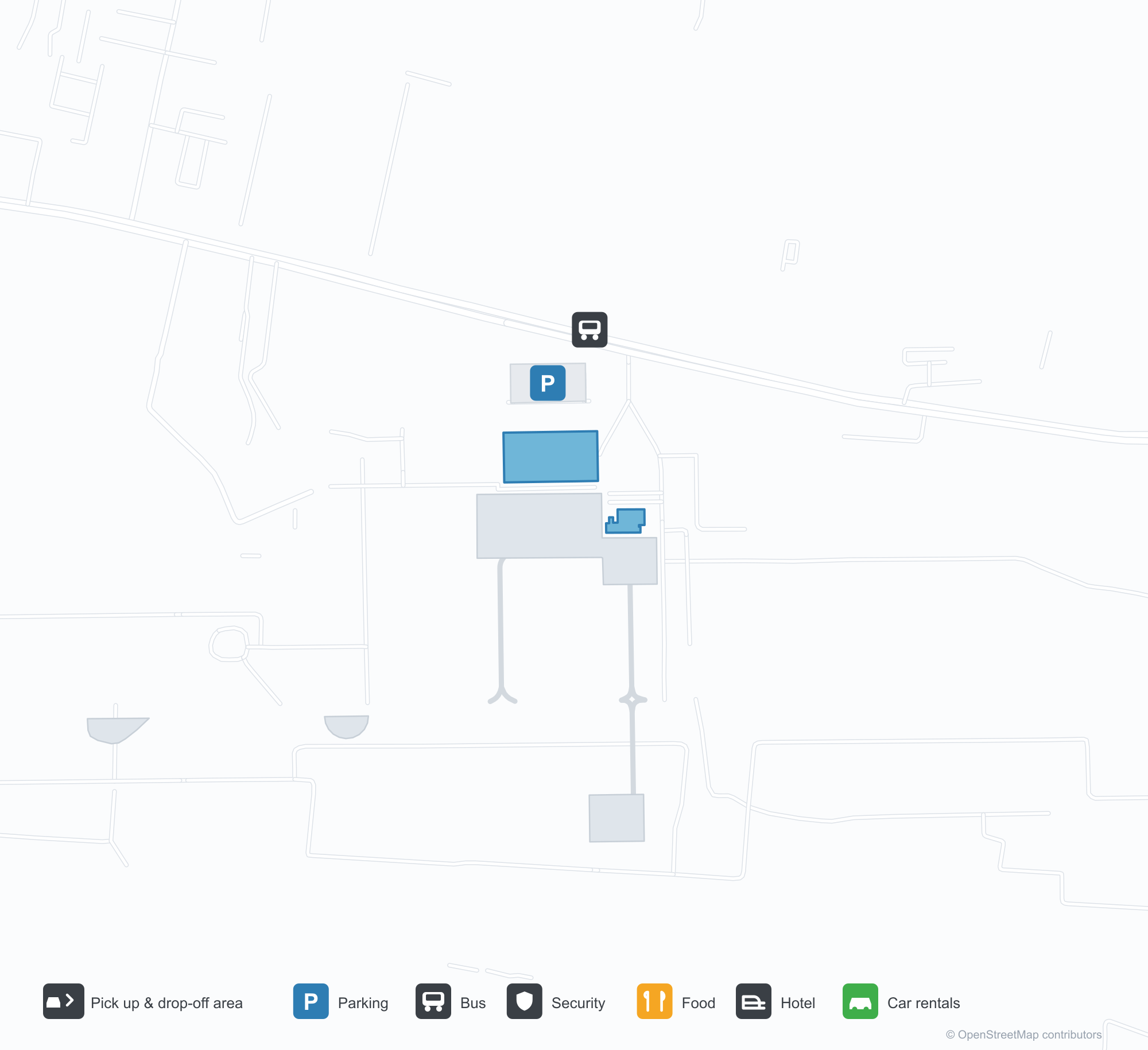
Descargar mapas de aeropuertosDescargas
Fotos del aeropuertoFotos del aeropuerto
Fotos reales de este aeropuerto, cada una con la referencia de la página web pública donde se encontró; los derechos de autor siguen siendo de los fotógrafos originales. Haz clic en una foto para ampliarla o en la línea de crédito para abrir su página de origen.
El patio de la terminal: un tejado blanco en bóveda de cañón sobre el carril de descenso de pasajeros y la entrada de salidas.
La terminal desde el césped: el tejado curvo recorre la fachada, con la torre de control a lo lejos, a la derecha.
La entrada de salidas: la marquesina con el texto «WELCOME TO CHHATRAPATI SAMBHAJINAGAR AIRPORT» y «प्रस्थान DEPARTURE».
Los letreros azules de la terminal dicen «Aurangabad Airport» y «Arrival», con una fila de plantas en macetas a lo largo del bordillo.
Un avión de IndiGo rueda por la pista más allá de un muro bajo, con tejados de la ciudad detrás y una brillante mancha amarilla en el suelo delante.
Los pasajeros cruzan la plataforma hacia el largo tejado metálico curvo de la terminal bajo el sol bajo.
Un gran birreactor mira a la cámara con sus luces de aterrizaje encendidas, con una pila de torres de celosía brumosa en el borde izquierdo.
Un letrero azul de «Departure» cuelga bajo la marquesina de cerchas de acero, con carritos de equipaje alineados mientras dos agentes de seguridad entran.
De noche, el nombre del aeropuerto brilla en blanco sobre la entrada mientras los faros barren las barreras y las hileras de plantas en macetas.
Un avión de cola roja rueda de frente por la pista bajo una llovizna, con matorral seco y hierba llenando el primer plano.
Mapa de rutas de Aurangabad Airport — destinos directosMapa de rutas
2 destinos directos: mapa, aerolíneas que operan y distancias.
Vuelos de Aurangabad Airport — salidas y llegadasPanel de vuelos
55 números de vuelo de 4 aerolíneas y 6 destinos, divididos por dirección. Se incluyen los números de código compartido.
| Vuelo | Aerolínea | Destino | País/región |
|---|---|---|---|
| 6E517 | IndiGo | Kempegowda International Airport Bengaluru | India |
| 6E2153 | IndiGo | Chhatrapati Shivaji Maharaj International Airport | India |
| 6E5117 | IndiGo | Aeropuerto Internacional Indira Gandhi | India |
| 6E6093 | IndiGo | Navi Mumbai (NMI) Navi Mumbai International Airport | India |
| 6E6126 | IndiGo | Chhatrapati Shivaji Maharaj International Airport | India |
| 6E6257 | IndiGo | Aeropuerto Internacional Indira Gandhi | India |
| 6E7058 | IndiGo | Rajiv Gandhi International Airport | India |
| 6E7259 | IndiGo | Rajiv Gandhi International Airport | India |
| 6E7456 | IndiGo | Vasco da Gama (GOI) Goa Dabolim International Airport | India |
| 6E7598 | IndiGo | Rajiv Gandhi International Airport | India |
| AI9589 | Air India | Aeropuerto Internacional Indira Gandhi | India |
| AI9914 | Air India | Aeropuerto Internacional Indira Gandhi | India |
| AI9916 | Air India | Aeropuerto Internacional Indira Gandhi | India |
| AI9933 | Air India | Aeropuerto Internacional Indira Gandhi | India |
| IX1820 | Air India Express | Aeropuerto Internacional Indira Gandhi | India |
| IX1822 | Air India Express | Aeropuerto Internacional Indira Gandhi | India |
| IX2240 | Air India Express | Aeropuerto Internacional Indira Gandhi | India |
| IX2246 | Air India Express | Aeropuerto Internacional Indira Gandhi | India |
| JL9017 | Japan Airlines | Kempegowda International Airport Bengaluru | India |
| JL9020 | Japan Airlines | Kempegowda International Airport Bengaluru | India |
Números de vuelo y rutas del índice de vuelos de aviability.com (instantánea de 26 de octubre de 2026); se incluyen los números de código compartido y no se muestran horarios de salida. Fuente: aviability.com ↗
Información y datos del aeropuertoDatos del aeropuerto
Mapa interactivo — ubicación de Aurangabad AirportMapa interactivo
Consulta este aeropuerto en otros servicios de mapas:
Aurangabad Airport (IXU): Two Domestic Routes Under a White VaultGuía del aeropuerto
The official photos show a white barrel-vaulted roof spanning the drop-off lane, with the departures canopy lettered "WELCOME TO CHHATRAPATI SAMBHAJINAGAR AIRPORT"; another view from the lawn follows the curved roof along the frontage, the control tower far to the right. The airport serves Aurangabad in Maharashtra, India, at an elevation of about 582 m, with a 2,839 m runway; the 2014 snapshot records two domestic destinations, Mumbai at 279 km and Delhi at 982 km.
Airport photos
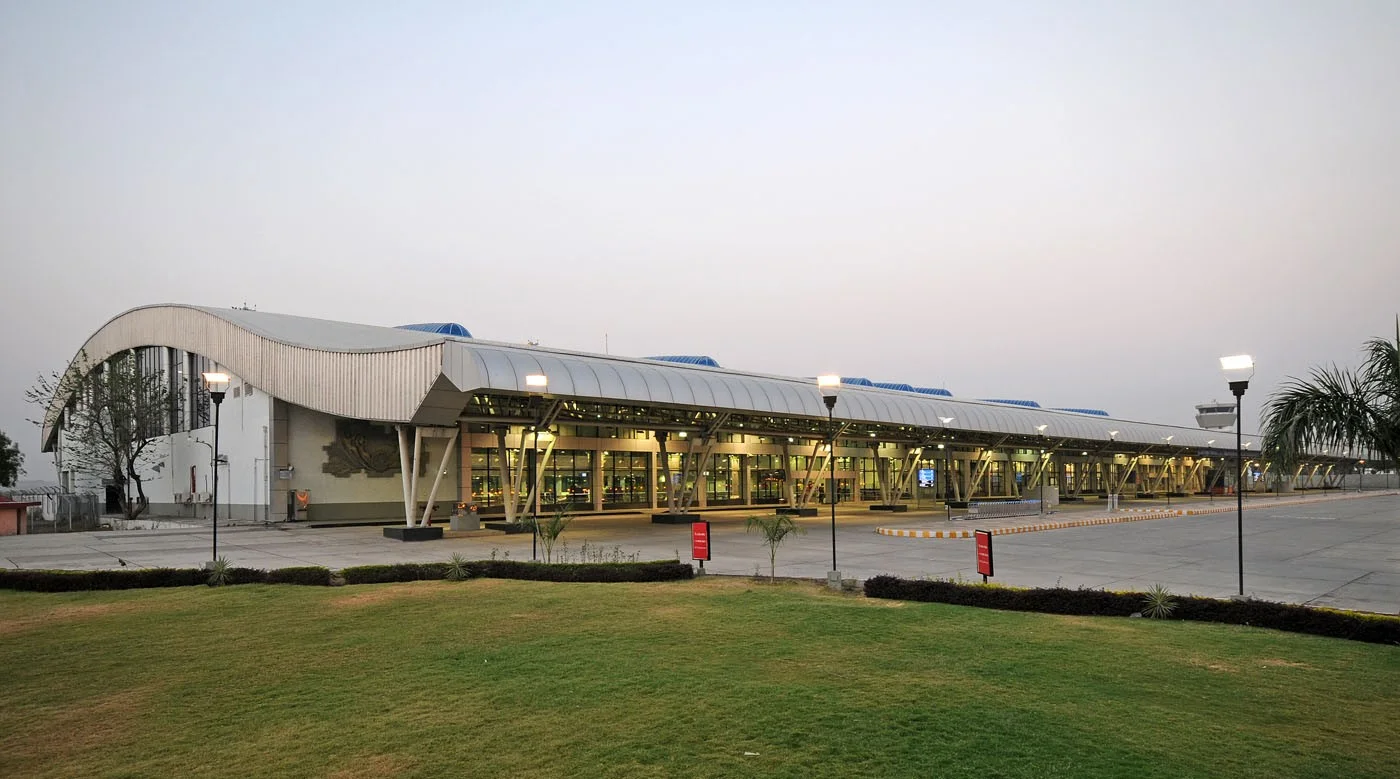
The terminal forecourt — a white barrel-vaulted roof over the drop-off lane and departures entrance.
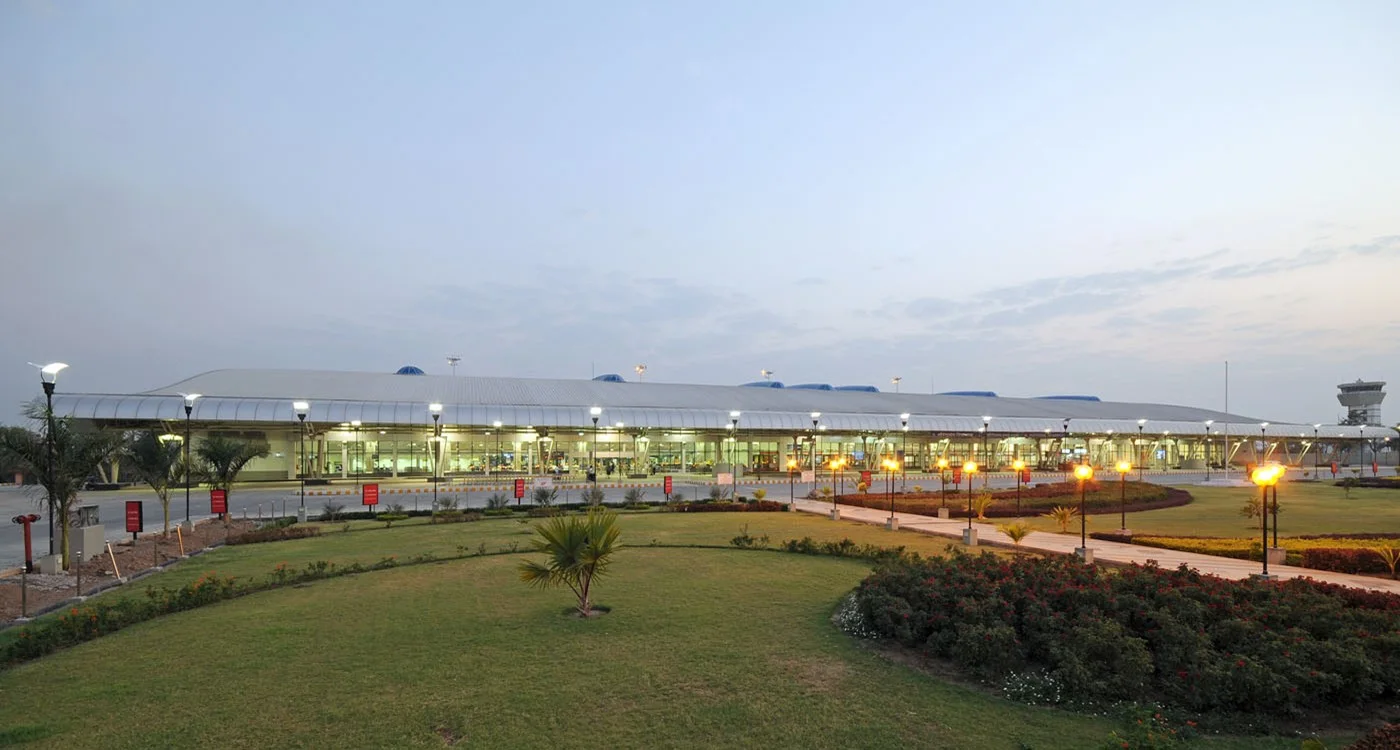
The terminal from the lawn — the curved roof running along the frontage, with the control tower far to the right.
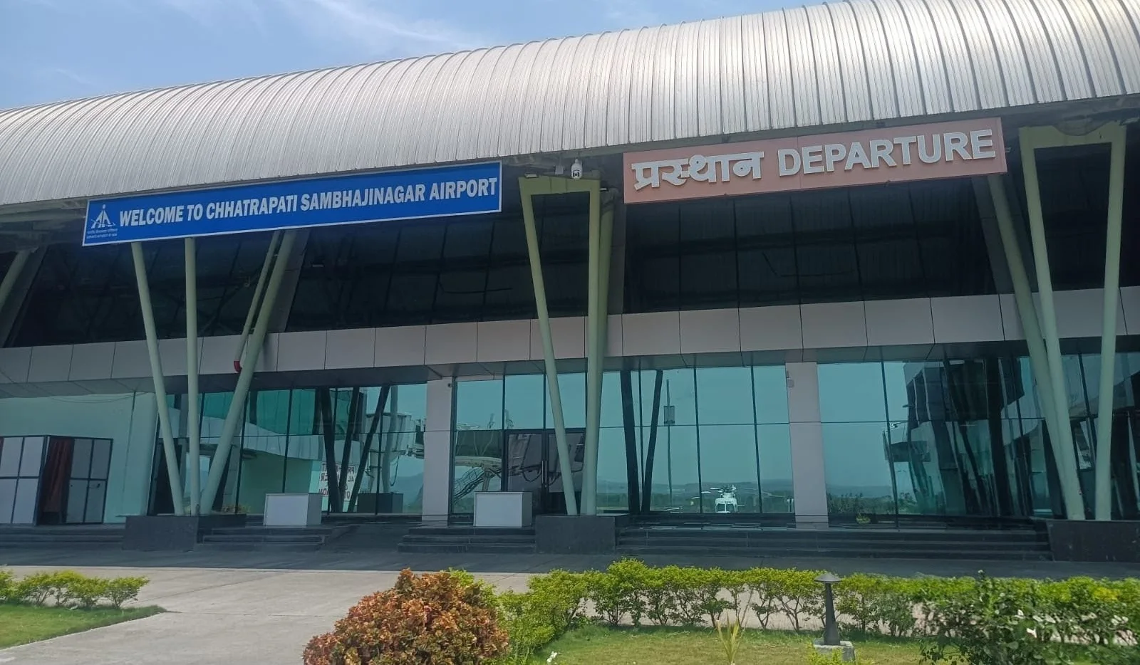
The departures entrance — the canopy lettered 'WELCOME TO CHHATRAPATI SAMBHAJINAGAR AIRPORT' and 'प्रस्थान DEPARTURE'.
The photos come from the Airports Authority of India (AAI) Aurangabad airport page and remain the copyright of their photographers.
Airport at a glance
| Item | Detail |
|---|---|
| IATA / ICAO | IXU / VAAU |
| Role | Medium-sized airport |
| Elevation | about 582 m |
| Coordinates | 19.8629, 75.3963 |
| Runways | 1, 2,839 m |
| Non-stop destinations | 2 (2014 snapshot, all domestic) |
| Official site | www.aai.aero/en/airports/aurangabad |
Runways
| Runway | Length | Width | Surface |
|---|---|---|---|
| 09/27 | 2,839 m | 45 m | Macadam |
1 runway, the longest 2,839 m.
Non-stop routes
2 non-stop destinations, nearest first (OpenFlights route snapshot compiled in 2014 — confirm with the airline or airport):
| Destination | Distance | Carriers |
|---|---|---|
| Chhatrapati Shivaji Maharaj International Airport (BOM) | ~279 km | Jet Airways, Air India Limited, Air Sahara |
| Indira Gandhi International Airport (DEL) | ~982 km | Air India Limited, Spicejet |
The carrier column comes from the same snapshot and includes codeshare and interline services; treat it as an indication of how busy the route is and check the airline for who actually flies it.
Nearby airports to compare
If the fares are close, these are the nearest airports of the same class (medium-sized airport) — straight-line distance, with their own non-stop counts from the same dataset:
| Airport | Distance | Non-stop destinations |
|---|---|---|
| Akola Airport (AKD) | ~197 km | — |
| Amravati Airport (AVR) | ~264 km | — |
Before you fly
- With two domestic routes, 90–120 minutes is usually enough; connect via Mumbai or Delhi for international travel.
- The 2014 snapshot is not today's schedule; Indian domestic networks have changed, so check current airline information.
About the data
Runways, elevation and coordinates come from OurAirports open data. Routes and carriers come from the June 2014 OpenFlights snapshot and include codeshares and interline services; they indicate network shape and scale, not current schedules.
Comentarios de los lectoresDebate
Las preguntas, los relatos de viaje y las correcciones son bienvenidos. Los comentarios son públicos.
Cargando…
Cargando comentarios…