
Aurangabad Airport
 Aurangabad · อินเดีย· Aurangabad Airport
Aurangabad Airport (IATA: IXU, ICAO VAAU) เป็นสนามบินขนาดกลางที่ให้บริการAurangabad, อินเดีย
Aurangabad Airport is a medium-sized airport, at an elevation of about 1,911 ft, with scheduled passenger service. This page gathers its location map, airport codes and travel information.
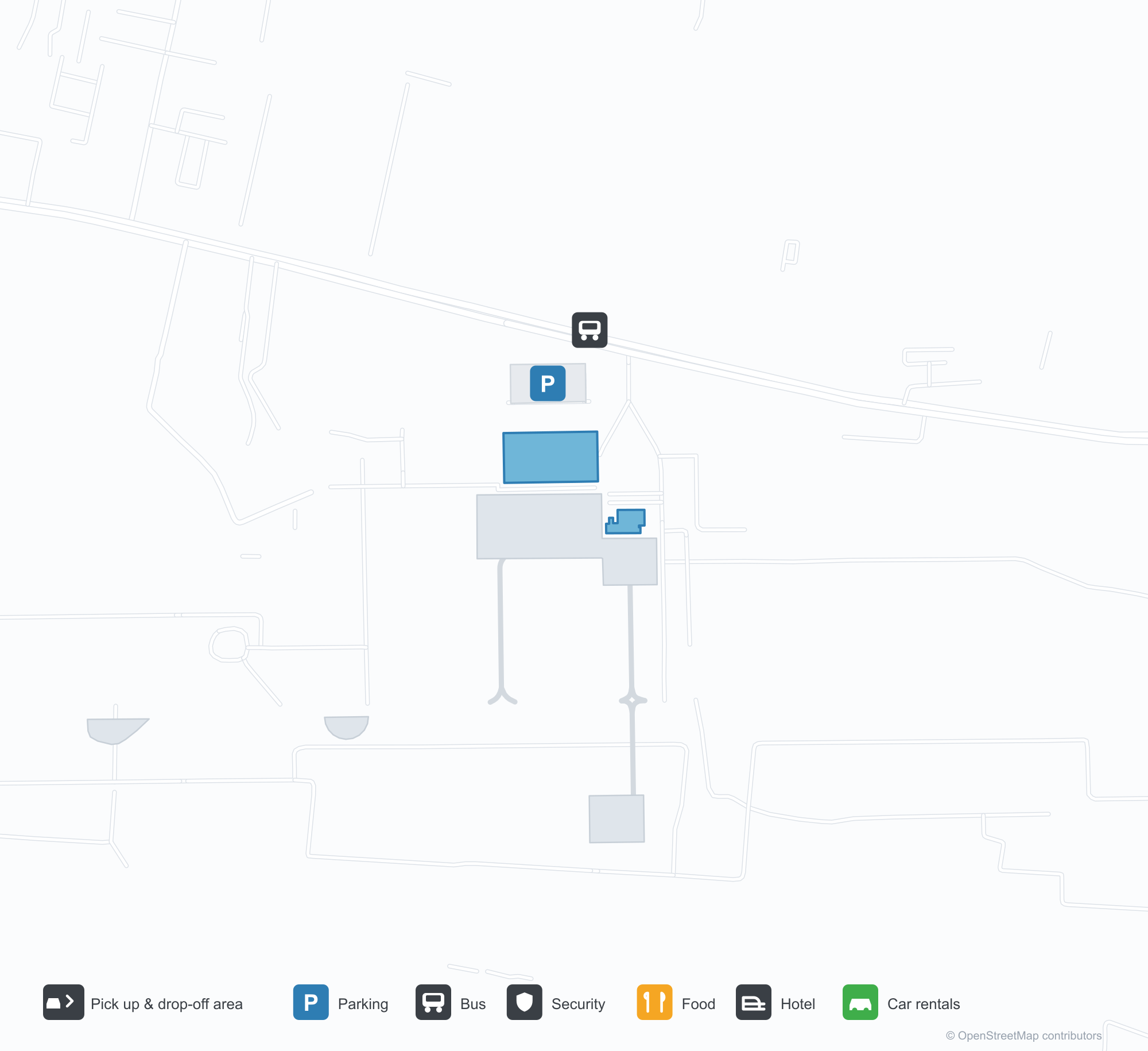
ดาวน์โหลดแผนที่สนามบินดาวน์โหลด
ภาพสนามบินภาพสนามบิน
ภาพจริงของสนามบินแห่งนี้ พร้อมเครดิตของหน้าเว็บสาธารณะที่พบภาพ; ลิขสิทธิ์ยังเป็นของผู้ถ่ายภาพต้นฉบับ คลิกที่ภาพเพื่อขยาย หรือคลิกบรรทัดเครดิตเพื่อเปิดหน้าแหล่งที่มา
ลานหน้าอาคารผู้โดยสาร — หลังคาโค้งทรงกระบอกสีขาวเหนือช่องจอดส่งผู้โดยสารและทางเข้าขาออก
อาคารผู้โดยสารมองจากสนามหญ้า — หลังคาโค้งทอดตามด้านหน้า โดยมีหอบังคับการบินอยู่ไกลทางขวา
ทางเข้าขาออก — หลังคากันแดดมีตัวอักษร 'WELCOME TO CHHATRAPATI SAMBHAJINAGAR AIRPORT' และ 'प्रस्थान DEPARTURE'
ป้ายสีฟ้าบนอาคารผู้โดยสารเขียนว่า 'Aurangabad Airport' และ 'Arrival' โดยมีกระถางต้นไม้เรียงตามขอบถนน
เครื่องบินเจ็ต IndiGo แล่นไปตามทางวิ่งเลยกำแพงขอบเตี้ย ๆ โดยมีหลังคาบ้านในเมืองอยู่ด้านหลังและพื้นสีเหลืองสดเป็นหย่อมด้านหน้า
ผู้โดยสารเดินออกไปทั่วลานจอดไปยังหลังคาโลหะโค้งยาวของอาคารผู้โดยสารในแสงแดดต่ำ
เครื่องบินเจ็ตสองเครื่องยนต์ขนาดใหญ่หันหน้าเข้าหากล้องโดยเปิดไฟลงจอด มีเสาโครงตาข่ายเรียงรายอยู่ในหมอกที่ขอบซ้าย
ป้าย 'Departure' สีฟ้าห้อยอยู่ใต้หลังคาโครงเหล็ก รถเข็นสัมภาระเรียงเป็นแถวขณะเจ้าหน้าที่รักษาความปลอดภัยสองคนเดินเข้ามา
ยามค่ำคืน ชื่อสนามบินเรืองแสงสีขาวเหนือทางเข้า ขณะที่ไฟหน้ารถกวาดผ่านแผงกั้นและแถวกระถางต้นไม้
เครื่องบินเจ็ตหางสีแดงแล่นตรงเข้ามาตามทางวิ่งท่ามกลางฝนปรอย ๆ โดยมีไม้พุ่มแห้งและหญ้าเต็มฉากหน้า
แผนที่เส้นทาง Aurangabad Airport — จุดหมายบินตรงแผนที่เส้นทาง
2 จุดหมายบินตรง: แผนที่ สายการบินที่ให้บริการ และระยะทาง
เที่ยวบินของAurangabad Airport — ขาออกและขาเข้าป้ายเที่ยวบิน
55 หมายเลขเที่ยวบิน ครอบคลุม 4 สายการบิน และ 6 จุดหมายปลายทาง แยกตามทิศทาง หมายเลขเที่ยวบินร่วม (codeshare) รวมอยู่ด้วย
| เที่ยวบิน | สายการบิน | จุดหมายปลายทาง | ประเทศ/ภูมิภาค |
|---|---|---|---|
| 6E517 | IndiGo | Kempegowda International Airport Bengaluru | อินเดีย |
| 6E2153 | IndiGo | Chhatrapati Shivaji Maharaj International Airport | อินเดีย |
| 6E5117 | IndiGo | ท่าอากาศยานนานาชาติอินทิรา คานธี | อินเดีย |
| 6E6093 | IndiGo | Navi Mumbai (NMI) Navi Mumbai International Airport | อินเดีย |
| 6E6126 | IndiGo | Chhatrapati Shivaji Maharaj International Airport | อินเดีย |
| 6E6257 | IndiGo | ท่าอากาศยานนานาชาติอินทิรา คานธี | อินเดีย |
| 6E7058 | IndiGo | Rajiv Gandhi International Airport | อินเดีย |
| 6E7259 | IndiGo | Rajiv Gandhi International Airport | อินเดีย |
| 6E7456 | IndiGo | Vasco da Gama (GOI) Goa Dabolim International Airport | อินเดีย |
| 6E7598 | IndiGo | Rajiv Gandhi International Airport | อินเดีย |
| AI9589 | Air India | ท่าอากาศยานนานาชาติอินทิรา คานธี | อินเดีย |
| AI9914 | Air India | ท่าอากาศยานนานาชาติอินทิรา คานธี | อินเดีย |
| AI9916 | Air India | ท่าอากาศยานนานาชาติอินทิรา คานธี | อินเดีย |
| AI9933 | Air India | ท่าอากาศยานนานาชาติอินทิรา คานธี | อินเดีย |
| IX1820 | Air India Express | ท่าอากาศยานนานาชาติอินทิรา คานธี | อินเดีย |
| IX1822 | Air India Express | ท่าอากาศยานนานาชาติอินทิรา คานธี | อินเดีย |
| IX2240 | Air India Express | ท่าอากาศยานนานาชาติอินทิรา คานธี | อินเดีย |
| IX2246 | Air India Express | ท่าอากาศยานนานาชาติอินทิรา คานธี | อินเดีย |
| JL9017 | Japan Airlines | Kempegowda International Airport Bengaluru | อินเดีย |
| JL9020 | Japan Airlines | Kempegowda International Airport Bengaluru | อินเดีย |
หมายเลขเที่ยวบินและเส้นทางจากดัชนีเที่ยวบิน aviability.com (ข้อมูล ณ วันที่ 26 ตุลาคม 2569); รวมหมายเลขเที่ยวบินร่วมและไม่แสดงเวลาเดินทาง ที่มา: aviability.com ↗
ข้อมูลและรายละเอียดสนามบินรายละเอียดสนามบิน
แผนที่อินเทอร์แอกทีฟ — ตำแหน่ง Aurangabad Airportแผนที่อินเทอร์แอกทีฟ
ดูสนามบินนี้บนบริการแผนที่อื่น:
Aurangabad Airport (IXU): Two Domestic Routes Under a White Vaultคู่มือสนามบิน
The official photos show a white barrel-vaulted roof spanning the drop-off lane, with the departures canopy lettered "WELCOME TO CHHATRAPATI SAMBHAJINAGAR AIRPORT"; another view from the lawn follows the curved roof along the frontage, the control tower far to the right. The airport serves Aurangabad in Maharashtra, India, at an elevation of about 582 m, with a 2,839 m runway; the 2014 snapshot records two domestic destinations, Mumbai at 279 km and Delhi at 982 km.
Airport photos
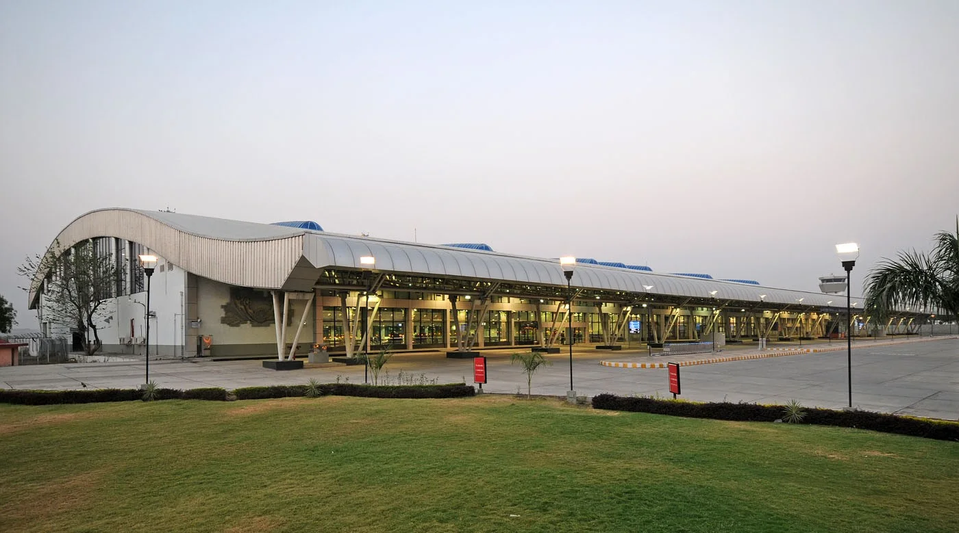
The terminal forecourt — a white barrel-vaulted roof over the drop-off lane and departures entrance.
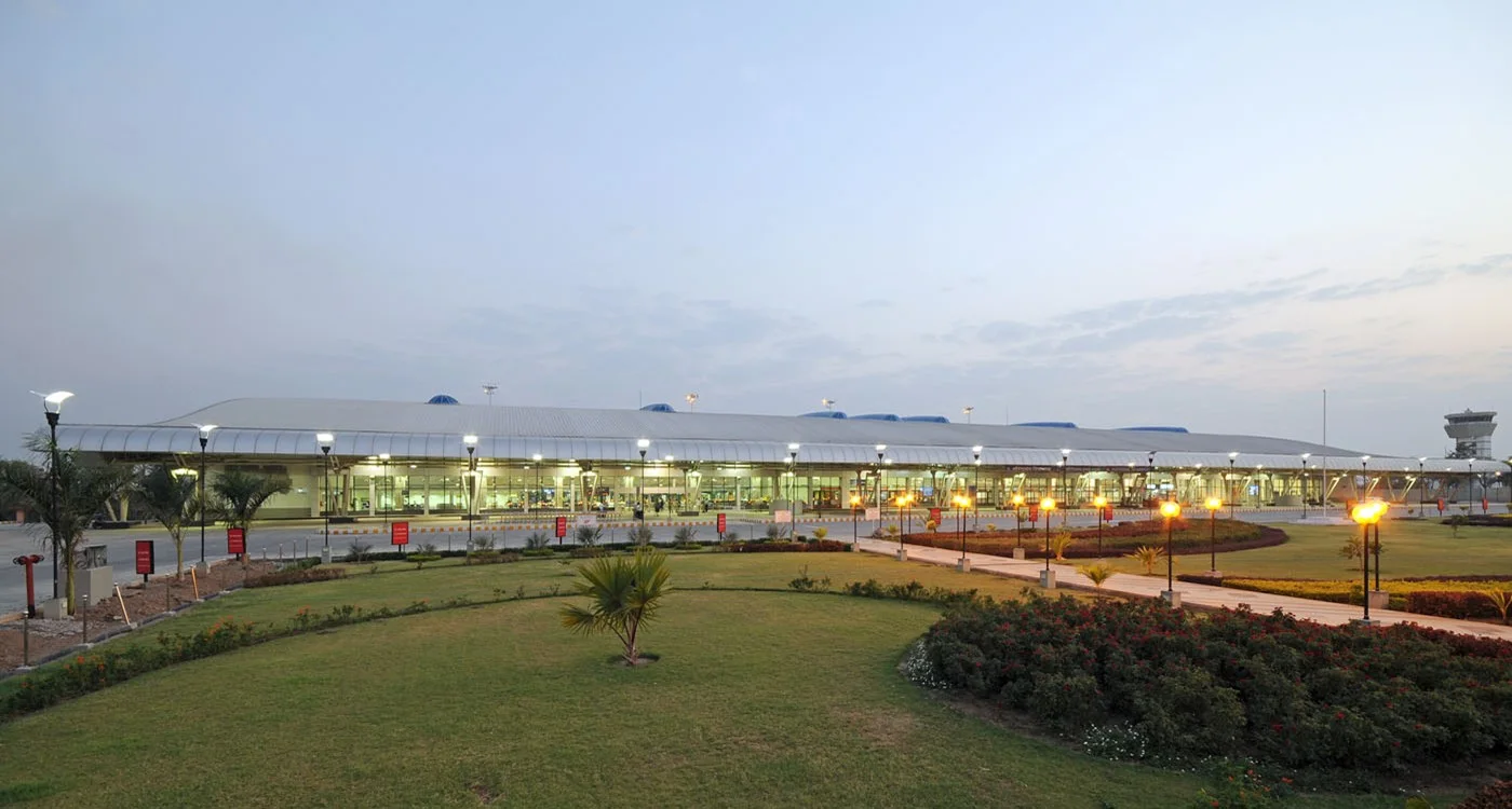
The terminal from the lawn — the curved roof running along the frontage, with the control tower far to the right.
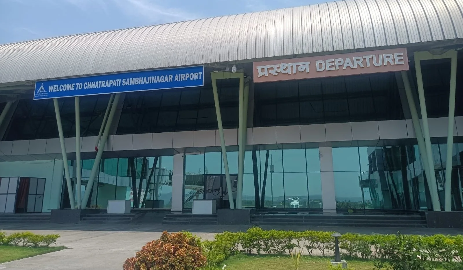
The departures entrance — the canopy lettered 'WELCOME TO CHHATRAPATI SAMBHAJINAGAR AIRPORT' and 'प्रस्थान DEPARTURE'.
The photos come from the Airports Authority of India (AAI) Aurangabad airport page and remain the copyright of their photographers.
Airport at a glance
| Item | Detail |
|---|---|
| IATA / ICAO | IXU / VAAU |
| Role | Medium-sized airport |
| Elevation | about 582 m |
| Coordinates | 19.8629, 75.3963 |
| Runways | 1, 2,839 m |
| Non-stop destinations | 2 (2014 snapshot, all domestic) |
| Official site | www.aai.aero/en/airports/aurangabad |
Runways
| Runway | Length | Width | Surface |
|---|---|---|---|
| 09/27 | 2,839 m | 45 m | Macadam |
1 runway, the longest 2,839 m.
Non-stop routes
2 non-stop destinations, nearest first (OpenFlights route snapshot compiled in 2014 — confirm with the airline or airport):
| Destination | Distance | Carriers |
|---|---|---|
| Chhatrapati Shivaji Maharaj International Airport (BOM) | ~279 km | Jet Airways, Air India Limited, Air Sahara |
| Indira Gandhi International Airport (DEL) | ~982 km | Air India Limited, Spicejet |
The carrier column comes from the same snapshot and includes codeshare and interline services; treat it as an indication of how busy the route is and check the airline for who actually flies it.
Nearby airports to compare
If the fares are close, these are the nearest airports of the same class (medium-sized airport) — straight-line distance, with their own non-stop counts from the same dataset:
| Airport | Distance | Non-stop destinations |
|---|---|---|
| Akola Airport (AKD) | ~197 km | — |
| Amravati Airport (AVR) | ~264 km | — |
Before you fly
- With two domestic routes, 90–120 minutes is usually enough; connect via Mumbai or Delhi for international travel.
- The 2014 snapshot is not today's schedule; Indian domestic networks have changed, so check current airline information.
About the data
Runways, elevation and coordinates come from OurAirports open data. Routes and carriers come from the June 2014 OpenFlights snapshot and include codeshares and interline services; they indicate network shape and scale, not current schedules.
ความคิดเห็นจากผู้อ่านการสนทนา
ยินดีรับคำถาม รายงานการเดินทาง และการแก้ไข ความคิดเห็นเป็นสาธารณะ
กำลังโหลด…
กำลังโหลดความคิดเห็น…