
Aberdeen Regional Airport
 Aberdeen · ABD· Aberdeen Regional Airport
Aberdeen Regional Airport (IATA: ABR, ICAO KABR), Aberdeen, ABD kentine hizmet veren bir orta büyüklükte havalimanıdır.
Aberdeen Regional Airport is a medium-sized airport, at an elevation of about 1,302 ft, with scheduled passenger service. This page gathers its location map, airport codes and travel information.
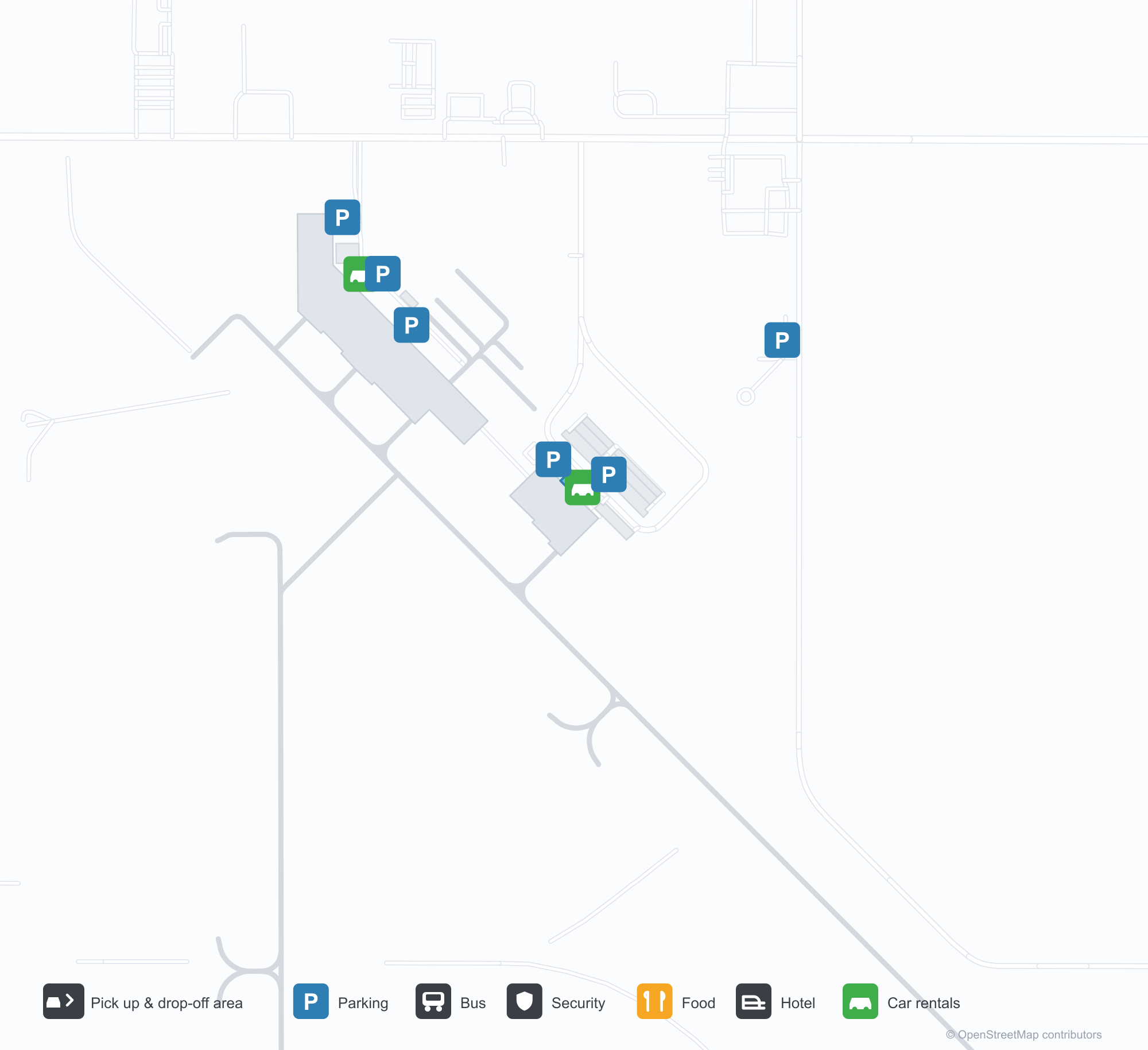
Havalimanı Haritalarını İndirinİndirmeler
Havalimanı fotoğraflarıHavalimanı Fotoğrafları
Bu havalimanının gerçek fotoğrafları; her fotoğrafın altında, fotoğrafın bulunduğu kamuya açık web sayfasına bir atıf yer alır ve telif hakkı özgün fotoğrafçılarda kalır. Yakınlaştırmak için bir fotoğrafa, kaynak sayfasını açmak için bir atıf satırına tıklayın.
Bekleme alanının üzerindeki büyük duvar resmi — tüm duvara yayılan bir bozkır kasabası sokak manzarası; terminalin en çarpıcı özelliği.
GİDİŞLER kapısının önündeki kıvrımlı kuyruk; sağda Delta self-servis kioskları ve check-in gişeleri.
Kapı bekleme alanı — yolcular duvar resmini taşıyan ahşap tavanın altında, pencerelerin yanındaki sıralarda bekliyor.
Kapalı bir kış gününde havalimanının adı cam cephe boyunca uzanıyor; apron kenarında kar lekeleri duruyor.
Alacakaranlıkta koyu taş duvardaki kabartma metal harfler turuncu gökyüzünden bir şerit yakalıyor; yürüyüş yolunda hâlâ kar var.
Bir harita ekran görüntüsü, Aberdeen Bölge Havalimanı'nı kırmızı bir iğneyle işaretliyor; pisti yeşil tarım arazilerini çaprazlama kesiyor.
Tepeden uydu görünümü: bir pist ve ona paralel taksi yolu çimenleri geçiyor; binalar kuzeybatı köşesinde toplanmış.
Bir uydu altlık haritası, haritalama hizmeti filigranları taşıyor; eğik pisti bir otoyolun yanındaki yamalı tarlalar arasında gösteriyor.
Aberdeen Regional Airport rota haritası — doğrudan varış noktalarıRota Haritası
1 doğrudan varış noktası: harita, sefer yapan havayolu şirketleri ve mesafeler.
Aberdeen Regional Airport uçuşları — kalkışlar ve varışlarUçuş Panosu
6 uçuş numarası, 1 havayolu şirketi ve 1 varış noktası, yönlere göre ayrılmıştır. Ortak uçuş numaraları dahildir.
| Uçuş | Havayolu şirketi | Varış noktası | Ülke/bölge |
|---|---|---|---|
| DL4238 | Delta Air Lines | Minneapolis–Saint Paul International Airport / Wold–Chamberlain Field | ABD |
| DL4262 | Delta Air Lines | Minneapolis–Saint Paul International Airport / Wold–Chamberlain Field | ABD |
| DL4334 | Delta Air Lines | Minneapolis–Saint Paul International Airport / Wold–Chamberlain Field | ABD |
Uçuş numaraları ve rotalar aviability.com uçuş dizininden (anlık görüntü: 26 Ekim 2026); ortak uçuş numaraları dahildir ve kalkış saatleri gösterilmez. Kaynak: aviability.com ↗
Havalimanı bilgileri ve ayrıntılarıHavalimanı Ayrıntıları
Etkileşimli harita — Aberdeen Regional Airport konumuEtkileşimli Harita
Bu havalimanını diğer harita hizmetlerinde görüntüleyin:
Aberdeen Regional Airport (ABR): A Mural and One Route to MinneapolisHavalimanı Rehberi
What stands out at Aberdeen Regional Airport (IATA ABR, ICAO KABR) is not the runway but the mural: a prairie-town street scene covering the whole wall above the waiting area. Another photo shows the serpentine queue before the DEPARTURES doorway, with Delta self-service kiosks and check-in counters to the right. A third looks over the gate seating — passengers by the windows under a timber ceiling that carries the artwork. For an airport with only one scheduled route, these details say more about its role than the runway data: it is the local doorway.
The field serves Aberdeen, South Dakota, at an elevation of about 397 m, with runways of 2,103 m and 1,676 m. The 2014 route snapshot records one non-stop destination: Minneapolis–St. Paul, 412 km away, operated by Delta Air Lines.
Airport photos
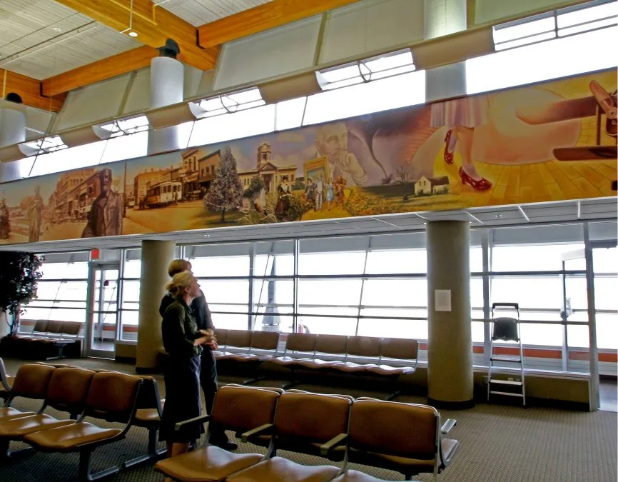
The large mural above the waiting area — a prairie-town street scene painted across the whole wall, the terminal's most striking feature.
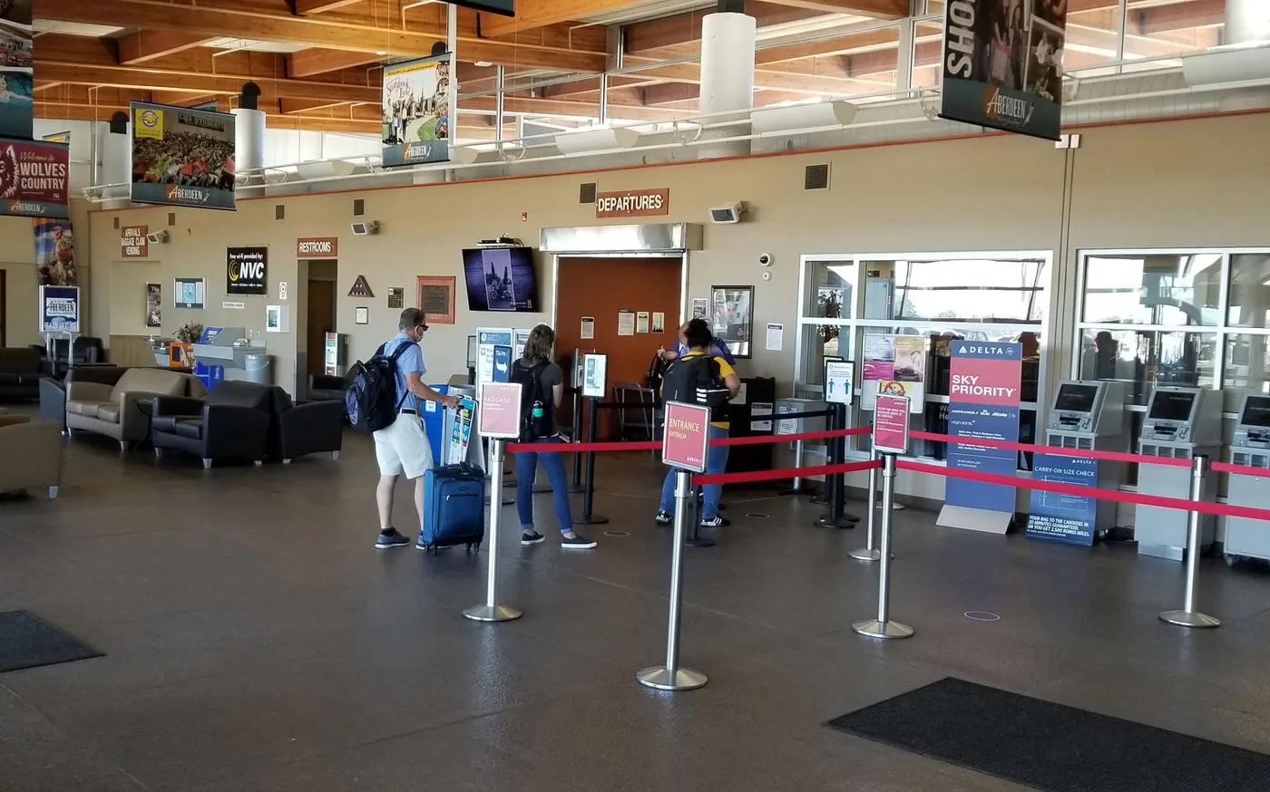
The serpentine queue before the DEPARTURES doorway, with Delta self-service kiosks and check-in counters to the right.
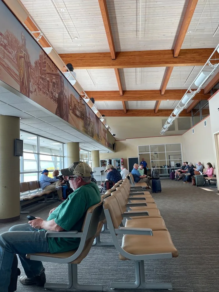
The gate seating area — passengers waiting in rows by the windows under the timber ceiling that carries the mural.
The photos come from public web sources and remain the copyright of their photographers; full credits and source links sit in the photo gallery on this page.
Airport at a glance
| Item | Detail |
|---|---|
| IATA / ICAO | ABR / KABR |
| Role | Medium-sized airport in South Dakota, United States |
| Elevation | about 397 m |
| Coordinates | 45.4491, -98.4218 |
| Runways | 2: 13/31 at 2,103 m, 17/35 at 1,676 m |
| Non-stop destinations | 1 (Minneapolis–St. Paul; 2014 snapshot) |
Network shape: one route, one hub
ABR's 2014 table has a single entry: Minneapolis–St. Paul (MSP), 412 km, operated by Delta Air Lines. By distance it falls in the under-1,000 km band, and there is no second destination. This is a familiar pattern among small Midwestern US airports: one short feeder route to a large hub, which then connects passengers onward.
| Distance band | Destinations |
|---|---|
| Under 1,000 km | 1 |
| Over 1,000 km | 0 |
That makes ABR's travel highly dependent on MSP's schedule. If the flight is cancelled or full, the alternatives are usually a drive to a larger airport or a different hub. The one-route record is on the Aberdeen route map.
Getting there and navigating
- Coordinates: 45.4491, -98.4218
- Open in a map: Google Maps | Amap | Baidu Maps
In the comparison table, Alliance Municipal (AIA) is about 516 km away with 1 destination, and Yibin (YIB) about 632 km away with no comparable route data. Neither is a practical substitute for ABR; Minneapolis remains the real connection.
The location map on this page shows the field against Aberdeen and the surrounding highways. Terminal connections and local transport are not covered here; check the airport's or airline's own information.
Before you fly
- With only one scheduled route, confirm the flight is operating after booking; for a connection, leave enough time at MSP.
- The terminal is small, so 90 minutes before departure is usually enough. Winter weather on the prairie can disrupt flights, so check airline notices.
- The single destination is a 2014 snapshot; Delta's regional schedule changes, so check the current timetable.
About the data
Runways, elevation and coordinates come from OurAirports open data. Routes and carriers come from the June 2014 OpenFlights snapshot and include codeshares and interline services; they indicate network shape and scale, not current schedules. Photos are from public web sources and remain the copyright of their photographers.
History
A city-owned public field east of downtown Aberdeen, dominated by general aviation but kept on the scheduled map by a single commercial carrier — the main air gateway for north-eastern South Dakota.
Source: Aberdeen Rgnl Airport.
Okuyucu yorumlarıTartışma
Sorular, seyahat deneyimleri ve düzeltmeler memnuniyetle karşılanır. Yorumlar herkese açıktır.
Yükleniyor…
Yorumlar yükleniyor…