
Aberdeen Regional Airport
 Aberdeen · สหรัฐอเมริกา· Aberdeen Regional Airport
Aberdeen Regional Airport (IATA: ABR, ICAO KABR) เป็นสนามบินขนาดกลางที่ให้บริการAberdeen, สหรัฐอเมริกา
Aberdeen Regional Airport is a medium-sized airport, at an elevation of about 1,302 ft, with scheduled passenger service. This page gathers its location map, airport codes and travel information.
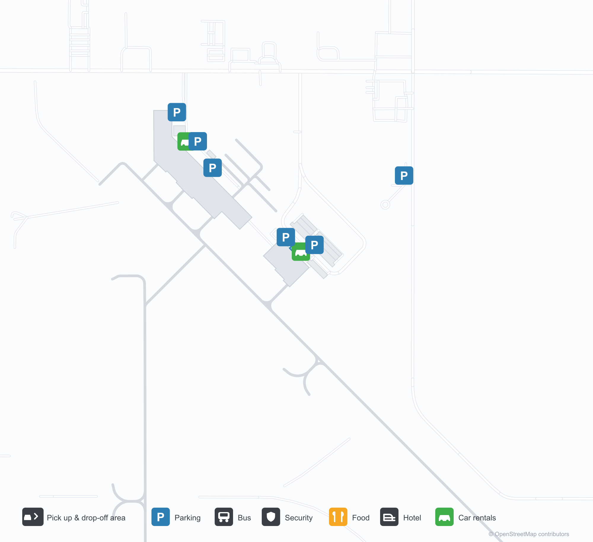
ดาวน์โหลดแผนที่สนามบินดาวน์โหลด
ภาพสนามบินภาพสนามบิน
ภาพจริงของสนามบินแห่งนี้ พร้อมเครดิตของหน้าเว็บสาธารณะที่พบภาพ; ลิขสิทธิ์ยังเป็นของผู้ถ่ายภาพต้นฉบับ คลิกที่ภาพเพื่อขยาย หรือคลิกบรรทัดเครดิตเพื่อเปิดหน้าแหล่งที่มา
ภาพจิตรกรรมฝาผนังขนาดใหญ่เหนือพื้นที่พักคอย — ภาพทิวทัศน์ถนนในเมืองทุ่งหญ้าที่วาดเต็มผนัง ถือเป็นจุดเด่นที่สุดของอาคารผู้โดยสาร
คิวยาวคดเคี้ยวหน้าประตู DEPARTURES โดยมีตู้บริการตนเองของเดลตาและเคาน์เตอร์เช็คอินอยู่ทางขวา
พื้นที่นั่งรอที่ประตูขึ้นเครื่อง — ผู้โดยสารรอเป็นแถวข้างหน้าต่างใต้เพดานไม้ที่ประดับภาพจิตรกรรมฝาผนังไว้
ในวันฤดูหนาวที่มีเมฆมาก ชื่อสนามบินพาดผ่านด้านหน้ากระจก โดยมีหิมะตกค้างเป็นหย่อม ๆ ที่ขอบลานจอด
ยามพลบค่ำ ตัวอักษรโลหะนูนบนผนังหินสีเข้มรับแสงสีส้มเป็นแถบจากท้องฟ้า โดยยังมีหิมะอยู่บนทางเดิน
ภาพหน้าจอแผนที่ทำเครื่องหมายท่าอากาศยานภูมิภาคอาเบอร์ดีน (Aberdeen) ด้วยหมุดสีแดง ทางวิ่งตัดผ่านทุ่งเกษตรสีเขียวเป็นแนวทแยง
ภาพถ่ายดาวเทียมมองตรงลงมา: ทางวิ่งหนึ่งเส้นและทางขับขนานกันตัดผ่านสนามหญ้า โดยมีอาคารรวมกลุ่มอยู่ที่มุมตะวันตกเฉียงเหนือ
แผนที่ฐานดาวเทียมที่มีลายน้ำของบริการแผนที่ แสดงทางวิ่งเอียง ๆ ท่ามกลางทุ่งนาที่เป็นผืนแปลงข้างทางหลวง
แผนที่เส้นทาง Aberdeen Regional Airport — จุดหมายบินตรงแผนที่เส้นทาง
1 จุดหมายบินตรง: แผนที่ สายการบินที่ให้บริการ และระยะทาง
เที่ยวบินของAberdeen Regional Airport — ขาออกและขาเข้าป้ายเที่ยวบิน
6 หมายเลขเที่ยวบิน ครอบคลุม 1 สายการบิน และ 1 จุดหมายปลายทาง แยกตามทิศทาง หมายเลขเที่ยวบินร่วม (codeshare) รวมอยู่ด้วย
| เที่ยวบิน | สายการบิน | จุดหมายปลายทาง | ประเทศ/ภูมิภาค |
|---|---|---|---|
| DL4238 | Delta Air Lines | Minneapolis–Saint Paul International Airport / Wold–Chamberlain Field | สหรัฐอเมริกา |
| DL4262 | Delta Air Lines | Minneapolis–Saint Paul International Airport / Wold–Chamberlain Field | สหรัฐอเมริกา |
| DL4334 | Delta Air Lines | Minneapolis–Saint Paul International Airport / Wold–Chamberlain Field | สหรัฐอเมริกา |
หมายเลขเที่ยวบินและเส้นทางจากดัชนีเที่ยวบิน aviability.com (ข้อมูล ณ วันที่ 26 ตุลาคม 2569); รวมหมายเลขเที่ยวบินร่วมและไม่แสดงเวลาเดินทาง ที่มา: aviability.com ↗
ข้อมูลและรายละเอียดสนามบินรายละเอียดสนามบิน
แผนที่อินเทอร์แอกทีฟ — ตำแหน่ง Aberdeen Regional Airportแผนที่อินเทอร์แอกทีฟ
ดูสนามบินนี้บนบริการแผนที่อื่น:
Aberdeen Regional Airport (ABR): A Mural and One Route to Minneapolisคู่มือสนามบิน
What stands out at Aberdeen Regional Airport (IATA ABR, ICAO KABR) is not the runway but the mural: a prairie-town street scene covering the whole wall above the waiting area. Another photo shows the serpentine queue before the DEPARTURES doorway, with Delta self-service kiosks and check-in counters to the right. A third looks over the gate seating — passengers by the windows under a timber ceiling that carries the artwork. For an airport with only one scheduled route, these details say more about its role than the runway data: it is the local doorway.
The field serves Aberdeen, South Dakota, at an elevation of about 397 m, with runways of 2,103 m and 1,676 m. The 2014 route snapshot records one non-stop destination: Minneapolis–St. Paul, 412 km away, operated by Delta Air Lines.
Airport photos
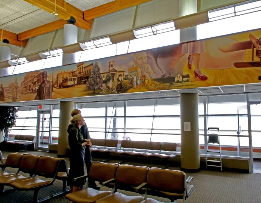
The large mural above the waiting area — a prairie-town street scene painted across the whole wall, the terminal's most striking feature.
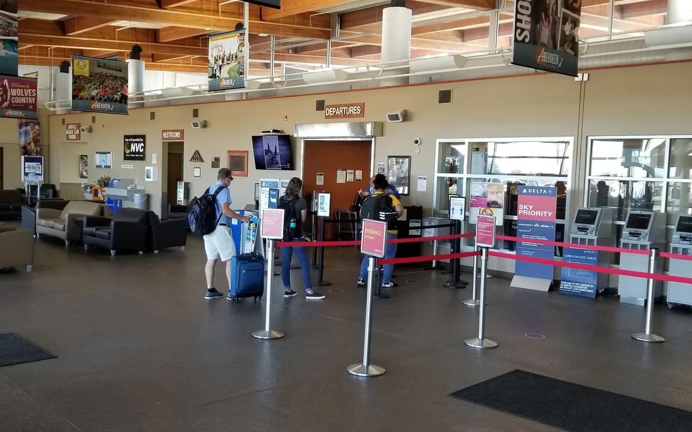
The serpentine queue before the DEPARTURES doorway, with Delta self-service kiosks and check-in counters to the right.
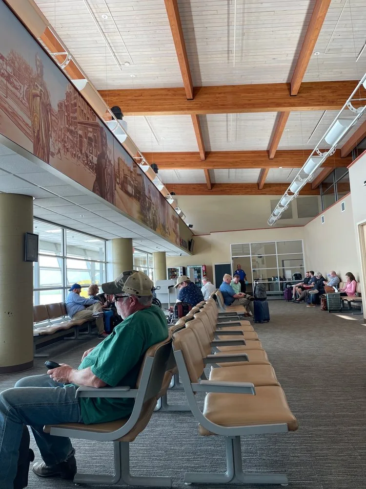
The gate seating area — passengers waiting in rows by the windows under the timber ceiling that carries the mural.
The photos come from public web sources and remain the copyright of their photographers; full credits and source links sit in the photo gallery on this page.
Airport at a glance
| Item | Detail |
|---|---|
| IATA / ICAO | ABR / KABR |
| Role | Medium-sized airport in South Dakota, United States |
| Elevation | about 397 m |
| Coordinates | 45.4491, -98.4218 |
| Runways | 2: 13/31 at 2,103 m, 17/35 at 1,676 m |
| Non-stop destinations | 1 (Minneapolis–St. Paul; 2014 snapshot) |
Network shape: one route, one hub
ABR's 2014 table has a single entry: Minneapolis–St. Paul (MSP), 412 km, operated by Delta Air Lines. By distance it falls in the under-1,000 km band, and there is no second destination. This is a familiar pattern among small Midwestern US airports: one short feeder route to a large hub, which then connects passengers onward.
| Distance band | Destinations |
|---|---|
| Under 1,000 km | 1 |
| Over 1,000 km | 0 |
That makes ABR's travel highly dependent on MSP's schedule. If the flight is cancelled or full, the alternatives are usually a drive to a larger airport or a different hub. The one-route record is on the Aberdeen route map.
Getting there and navigating
- Coordinates: 45.4491, -98.4218
- Open in a map: Google Maps | Amap | Baidu Maps
In the comparison table, Alliance Municipal (AIA) is about 516 km away with 1 destination, and Yibin (YIB) about 632 km away with no comparable route data. Neither is a practical substitute for ABR; Minneapolis remains the real connection.
The location map on this page shows the field against Aberdeen and the surrounding highways. Terminal connections and local transport are not covered here; check the airport's or airline's own information.
Before you fly
- With only one scheduled route, confirm the flight is operating after booking; for a connection, leave enough time at MSP.
- The terminal is small, so 90 minutes before departure is usually enough. Winter weather on the prairie can disrupt flights, so check airline notices.
- The single destination is a 2014 snapshot; Delta's regional schedule changes, so check the current timetable.
About the data
Runways, elevation and coordinates come from OurAirports open data. Routes and carriers come from the June 2014 OpenFlights snapshot and include codeshares and interline services; they indicate network shape and scale, not current schedules. Photos are from public web sources and remain the copyright of their photographers.
History
A city-owned public field east of downtown Aberdeen, dominated by general aviation but kept on the scheduled map by a single commercial carrier — the main air gateway for north-eastern South Dakota.
Source: Aberdeen Rgnl Airport.
ความคิดเห็นจากผู้อ่านการสนทนา
ยินดีรับคำถาม รายงานการเดินทาง และการแก้ไข ความคิดเห็นเป็นสาธารณะ
กำลังโหลด…
กำลังโหลดความคิดเห็น…