
Aberdeen Regional Airport
 Aberdeen · 미국· Aberdeen Regional Airport
Aberdeen Regional Airport(IATA: ABR, ICAO: KABR)은 미국 Aberdeen에 위치한 중형 공항입니다.
Aberdeen Regional Airport is a medium-sized airport, at an elevation of about 1,302 ft, with scheduled passenger service. This page gathers its location map, airport codes and travel information.
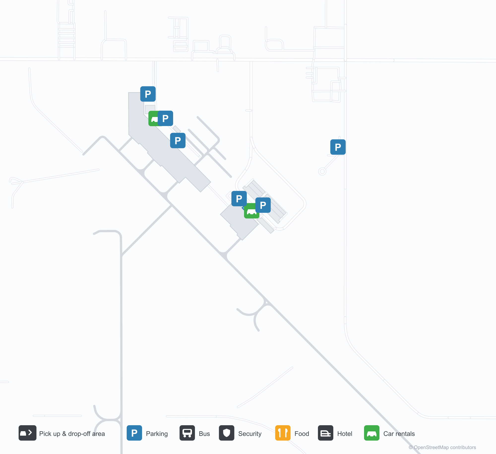
공항 지도 다운로드다운로드
공항 실제 사진공항 사진
다음은 이 공항의 실제 사진으로, 모두 공개된 인터넷 출처에서 가져왔으며 사진마다 출처를 표시했습니다. 저작권은 원저작자에게 있습니다. 사진을 클릭하면 크게 볼 수 있고, 출처를 클릭하면 원본 페이지가 열립니다.
대기 구역 위의 큰 벽화 — 벽 전체에 그려진 프레리 마을 거리 풍경, 터미널에서 가장 눈에 띄는 요소.
DEPARTURES 출입구 앞의 구불구불한 줄, 오른쪽의 Delta 셀프서비스 키오스크와 체크인 카운터.
게이트 대기 구역 — 벽화를 이고 있는 목재 천장 아래 창가에 줄지어 앉아 기다리는 승객들.
Aberdeen Regional Airport 노선도 · 직항 목적지노선도
직항 목적지 1개: 노선도, 운항 항공사, 비행 거리.
공항 정보 및 상세공항 상세
Aberdeen Regional Airport 인터랙티브 지도 — 공항 위치인터랙티브 지도
다른 지도 서비스에서 이 공항 보기:
Aberdeen Regional Airport (ABR): A Mural and One Route to Minneapolis공항 안내
What stands out at Aberdeen Regional Airport (IATA ABR, ICAO KABR) is not the runway but the mural: a prairie-town street scene covering the whole wall above the waiting area. Another photo shows the serpentine queue before the DEPARTURES doorway, with Delta self-service kiosks and check-in counters to the right. A third looks over the gate seating — passengers by the windows under a timber ceiling that carries the artwork. For an airport with only one scheduled route, these details say more about its role than the runway data: it is the local doorway.
The field serves Aberdeen, South Dakota, at an elevation of about 397 m, with runways of 2,103 m and 1,676 m. The 2014 route snapshot records one non-stop destination: Minneapolis–St. Paul, 412 km away, operated by Delta Air Lines.
Airport photos
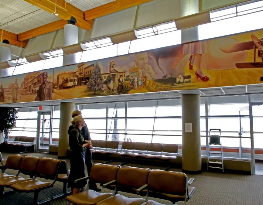
The large mural above the waiting area — a prairie-town street scene painted across the whole wall, the terminal's most striking feature.
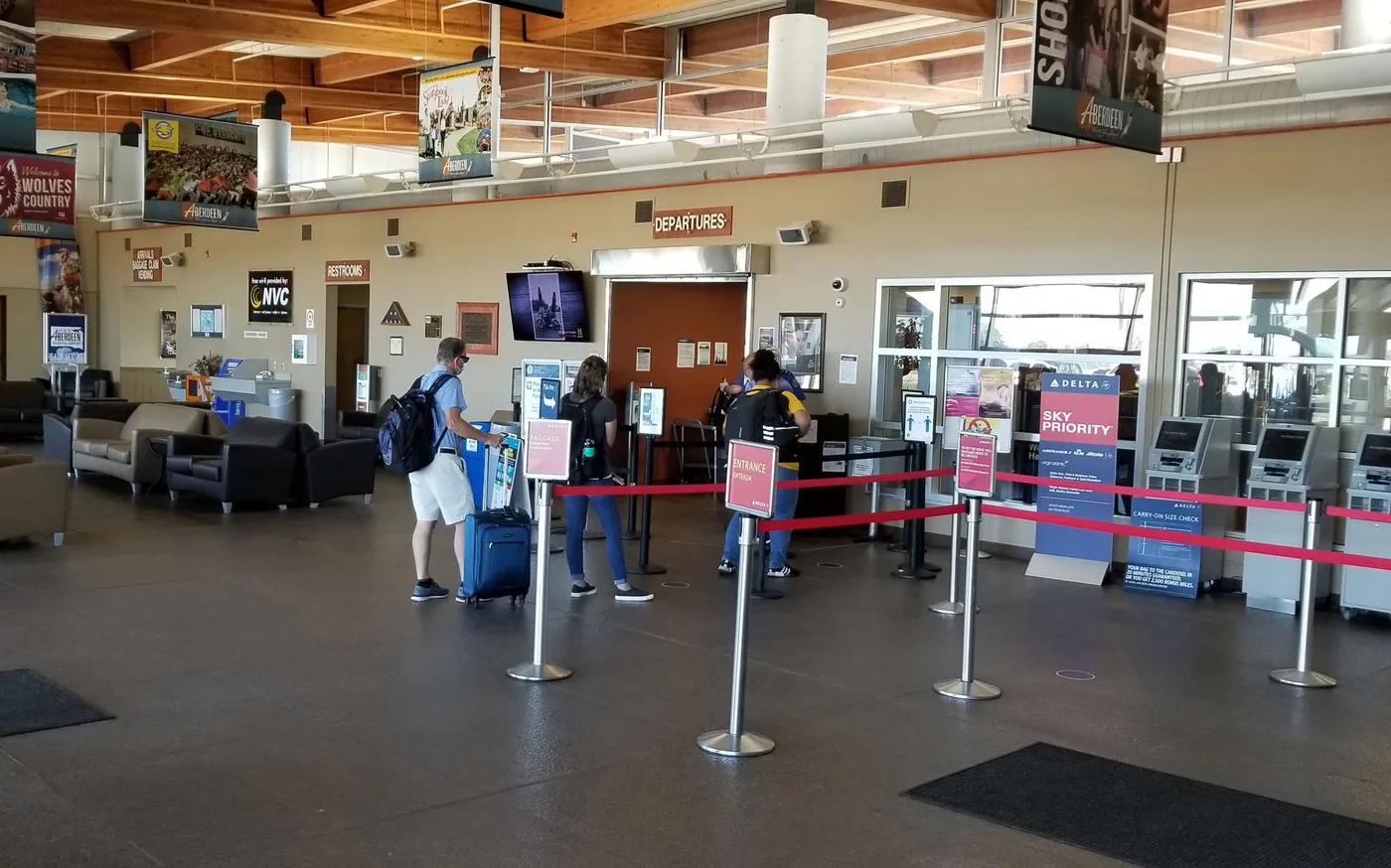
The serpentine queue before the DEPARTURES doorway, with Delta self-service kiosks and check-in counters to the right.
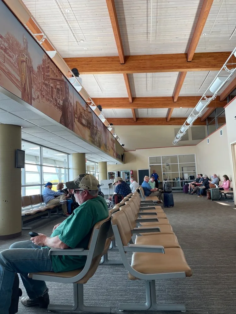
The gate seating area — passengers waiting in rows by the windows under the timber ceiling that carries the mural.
The photos come from public web sources and remain the copyright of their photographers; full credits and source links sit in the photo gallery on this page.
Airport at a glance
| Item | Detail |
|---|---|
| IATA / ICAO | ABR / KABR |
| Role | Medium-sized airport in South Dakota, United States |
| Elevation | about 397 m |
| Coordinates | 45.4491, -98.4218 |
| Runways | 2: 13/31 at 2,103 m, 17/35 at 1,676 m |
| Non-stop destinations | 1 (Minneapolis–St. Paul; 2014 snapshot) |
Network shape: one route, one hub
ABR's 2014 table has a single entry: Minneapolis–St. Paul (MSP), 412 km, operated by Delta Air Lines. By distance it falls in the under-1,000 km band, and there is no second destination. This is a familiar pattern among small Midwestern US airports: one short feeder route to a large hub, which then connects passengers onward.
| Distance band | Destinations |
|---|---|
| Under 1,000 km | 1 |
| Over 1,000 km | 0 |
That makes ABR's travel highly dependent on MSP's schedule. If the flight is cancelled or full, the alternatives are usually a drive to a larger airport or a different hub. The one-route record is on the Aberdeen route map.
Getting there and navigating
- Coordinates: 45.4491, -98.4218
- Open in a map: Google Maps | Amap | Baidu Maps
In the comparison table, Alliance Municipal (AIA) is about 516 km away with 1 destination, and Yibin (YIB) about 632 km away with no comparable route data. Neither is a practical substitute for ABR; Minneapolis remains the real connection.
The location map on this page shows the field against Aberdeen and the surrounding highways. Terminal connections and local transport are not covered here; check the airport's or airline's own information.
Before you fly
- With only one scheduled route, confirm the flight is operating after booking; for a connection, leave enough time at MSP.
- The terminal is small, so 90 minutes before departure is usually enough. Winter weather on the prairie can disrupt flights, so check airline notices.
- The single destination is a 2014 snapshot; Delta's regional schedule changes, so check the current timetable.
About the data
Runways, elevation and coordinates come from OurAirports open data. Routes and carriers come from the June 2014 OpenFlights snapshot and include codeshares and interline services; they indicate network shape and scale, not current schedules. Photos are from public web sources and remain the copyright of their photographers.
History
A city-owned public field east of downtown Aberdeen, dominated by general aviation but kept on the scheduled map by a single commercial carrier — the main air gateway for north-eastern South Dakota.
Source: Aberdeen Rgnl Airport.