
Adirondack Regional Airport
 Saranac Lake · สหรัฐอเมริกา· Adirondack Regional Airport
Adirondack Regional Airport (IATA: SLK, ICAO KSLK) เป็นสนามบินขนาดกลางที่ให้บริการSaranac Lake, สหรัฐอเมริกา
Adirondack Regional Airport is a medium-sized airport, at an elevation of about 1,663 ft, with scheduled passenger service. This page gathers its location map, airport codes and travel information.
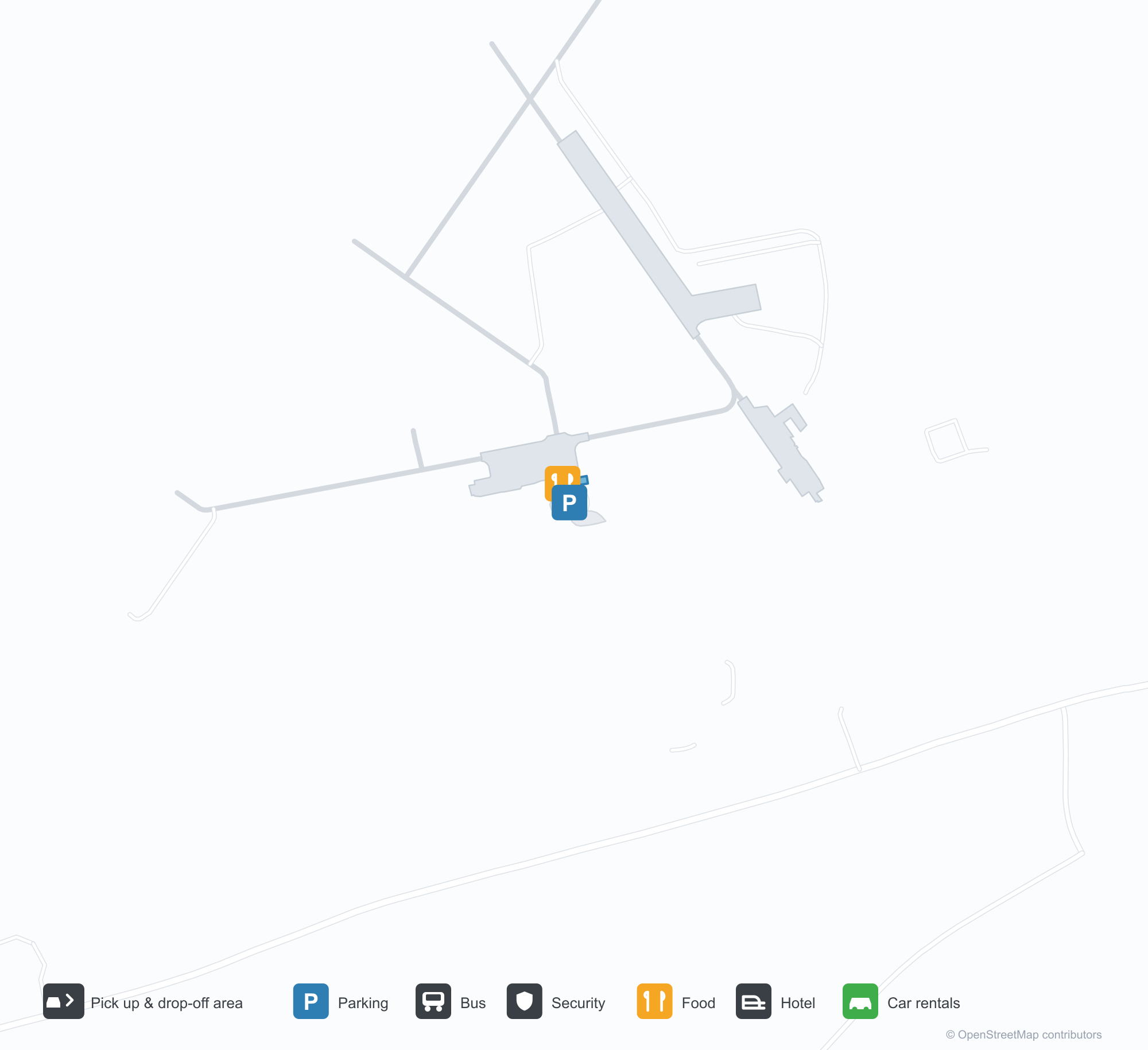
ดาวน์โหลดแผนที่สนามบินดาวน์โหลด
ภาพสนามบินภาพสนามบิน
ภาพจริงของสนามบินแห่งนี้ พร้อมเครดิตของหน้าเว็บสาธารณะที่พบภาพ; ลิขสิทธิ์ยังเป็นของผู้ถ่ายภาพต้นฉบับ คลิกที่ภาพเพื่อขยาย หรือคลิกบรรทัดเครดิตเพื่อเปิดหน้าแหล่งที่มา
ภาพถ่ายดาวเทียม: ท่าอากาศยานภูมิภาคแอดิรอนแด็ก (SLK) ล้อมรอบด้วยพืชพรรณสีเขียวและพื้นที่เกษตรกรรม
อาคารผู้โดยสารไม้สีน้ำตาลเข้มมีเฉลียงไม้หนา พร้อมทางเดินคอนกรีตและแปลงกรวดอยู่ด้านหน้าใต้ท้องฟ้าไร้เมฆ
มองจากอากาศ ทางวิ่งสองเส้นบรรจบกันท่ามกลางสนามหญ้าที่ตัดแล้วและป่าสนหนาแน่น โดยมีเมฆทอดเงาบนเนินเขาไกล ๆ
ยามพลบค่ำ เครื่องบินสองเครื่องยนต์ลำเล็กของ Cape Air รออยู่บนลานจอดหน้าอาคารผู้โดยสารไม้แอดิรอนแด็ก ขณะที่คนสองคนเดินผ่าน
ถ่ายจากที่สูงยามพระอาทิตย์ตก อาคารผู้โดยสารไม้ซุงและโรงเก็บสีขาวขนาบลานจอดที่มีอากาศยานเล็กสองลำ โดยมีลานจอดรถที่แน่นขนัดในฉากหน้า
ตัวเลขและแถบหัวทางวิ่ง 27 ที่จางลงนำเข้าสู่สนามหญ้าสีเขียวในยามพลบค่ำ โดยมีเมฆสีส้มและม่วงเหนือภูเขา
แถวเก้าอี้ไม้เบาะหนังตั้งอยู่บนพรมสีเทา ต้นไม้อยู่ข้างหน้าต่าง และป้ายสีน้ำตาลชี้ไปยังคาเฟ่และห้องน้ำ
เครื่องบินสองใบพัดของ Cape Air ที่มีรูปนกสีขาวบนหางสีฟ้าพักอยู่บนทางขับ ตัวอักษรทะเบียนมองเห็นได้ชัดเจน
เครื่องบินสองใบพัดไต่ขึ้นทันทีหลังบินขึ้น เหนือแนวต้นไม้และทางวิ่ง โดยมีเนินเขาที่เต็มไปด้วยป่าเต็มฉากหลัง
แผนที่เส้นทาง Adirondack Regional Airport — จุดหมายบินตรงแผนที่เส้นทาง
1 จุดหมายบินตรง: แผนที่ สายการบินที่ให้บริการ และระยะทาง
เที่ยวบินของAdirondack Regional Airport — ขาออกและขาเข้าป้ายเที่ยวบิน
6 หมายเลขเที่ยวบิน ครอบคลุม 1 สายการบิน และ 2 จุดหมายปลายทาง แยกตามทิศทาง หมายเลขเที่ยวบินร่วม (codeshare) รวมอยู่ด้วย
| เที่ยวบิน | สายการบิน | จุดหมายปลายทาง | ประเทศ/ภูมิภาค |
|---|---|---|---|
| 9K1022 | Cape Air | ท่าอากาศยานนานาชาติจอห์น เอฟ. เคนเนดี | สหรัฐอเมริกา |
| 9K1026 | Cape Air | Boston Logan International Airport | สหรัฐอเมริกา |
| 9K1034 | Cape Air | Boston Logan International Airport | สหรัฐอเมริกา |
หมายเลขเที่ยวบินและเส้นทางจากดัชนีเที่ยวบิน aviability.com (ข้อมูล ณ วันที่ 26 ตุลาคม 2569); รวมหมายเลขเที่ยวบินร่วมและไม่แสดงเวลาเดินทาง ที่มา: aviability.com ↗
ข้อมูลและรายละเอียดสนามบินรายละเอียดสนามบิน
แผนที่อินเทอร์แอกทีฟ — ตำแหน่ง Adirondack Regional Airportแผนที่อินเทอร์แอกทีฟ
ดูสนามบินนี้บนบริการแผนที่อื่น:
Adirondack Regional Airport (SLK) Guide: One route to Boston Logan International Airportคู่มือสนามบิน
From above, Adirondack Regional Airport (SLK) lies in the United States, surrounded by green vegetation and farmland. It is a medium-sized airport at an elevation of about 507 m, with 2 runways, the longest 2,003 m; the 2014 snapshot records one destination, Boston Logan International Airport (343 km).
Satellite view
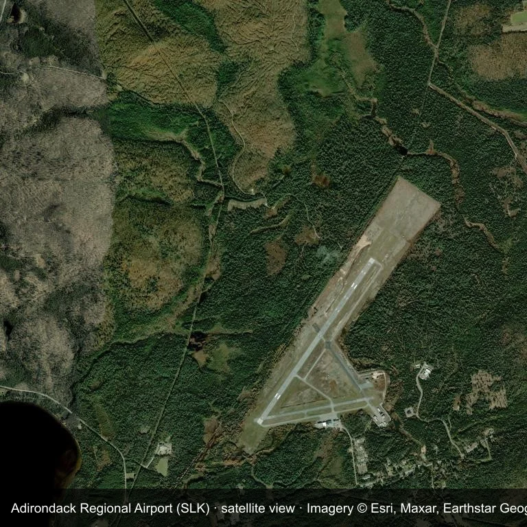
Satellite view: Adirondack Regional Airport (SLK) is surrounded by green vegetation and farmland.
The satellite image comes from Esri World Imagery (© Esri, Maxar, Earthstar Geographics); the field and attribution are labelled in the image. This is a satellite view, not a ground-level photograph.
Airport at a glance
| Item | Detail |
|---|---|
| IATA / ICAO | SLK / KSLK |
| Role | medium-sized airport |
| Elevation | about 507 m |
| Coordinates | 44.3869, -74.2046 |
| Runways | 2, longest 2,003 m |
| Non-stop destinations | 1 (2014 snapshot) |
Runways
| Runway | Length | Surface |
|---|---|---|
| 05/23 | 2,003 m | ASP |
| 09/27 | 1,218 m | ASP |
Routes and connections
| Destination | Distance | Carriers |
|---|---|---|
| Boston Logan International Airport (BOS) | ~343 km | Cape Air |
The full list is on the Adirondack Regional Airport route map.
Nearby airports
| Airport | Distance | Non-stop destinations |
|---|---|---|
| Plattsburgh International Airport (PBG) | ~65.4 km | 5 |
| Massena International Airport Richards Field (MSS) | ~79.3 km | 1 |
| Patrick Leahy Burlington International Airport (BTV) | ~84 km | 10 |
Getting there and navigating
- Coordinates: 44.3869, -74.2046
- Open in a map: Google Maps | Amap | Baidu Maps
The location map on this page shows the field against nearby towns and roads. This page does not cover terminal connections or local transport; confirm them with the airport or airline.
Runway and surroundings
From the air, Adirondack Regional Airport appears within dense green vegetation and small fields in the United States. The primary strip, 05/23, is oriented northeast–southwest and extends 2,003 m at about 507 m.
That 2,003 m length is typical of regional-jet operations. The paved surface supports regular operations, though it does not imply scheduled service. The nearest airport is Plattsburgh International Airport, 65.4 km away, with 5 destinations in the same snapshot.
The 2014 snapshot records a single route to Boston Logan International Airport, 343 km away. Treat it as historical network evidence and confirm the carrier before planning around it.
Before you fly
- With one scheduled route, confirm the flight is operating after booking; long trips usually connect at the other end.
- The 2014 snapshot is not today's schedule; check the airline's current information.
About the data
Runways, elevation and coordinates come from OurAirports open data. Routes come from the June 2014 OpenFlights snapshot and indicate network shape and scale, not current schedules.
References
- OurAirports airport record — KSLK
- Wikipedia article
- OpenFlights route data
- Country page: United States
- Route map: SLK routes
ความคิดเห็นจากผู้อ่านการสนทนา
ยินดีรับคำถาม รายงานการเดินทาง และการแก้ไข ความคิดเห็นเป็นสาธารณะ
กำลังโหลด…
กำลังโหลดความคิดเห็น…