
Adirondack Regional Airport
 Saranac Lake · アメリカ合衆国· Adirondack Regional Airport
Adirondack Regional Airport(IATA: SLK、ICAO: KSLK)はSaranac Lake、アメリカ合衆国にある中型空港です。
Adirondack Regional Airport is a medium-sized airport, at an elevation of about 1,663 ft, with scheduled passenger service. This page gathers its location map, airport codes and travel information.
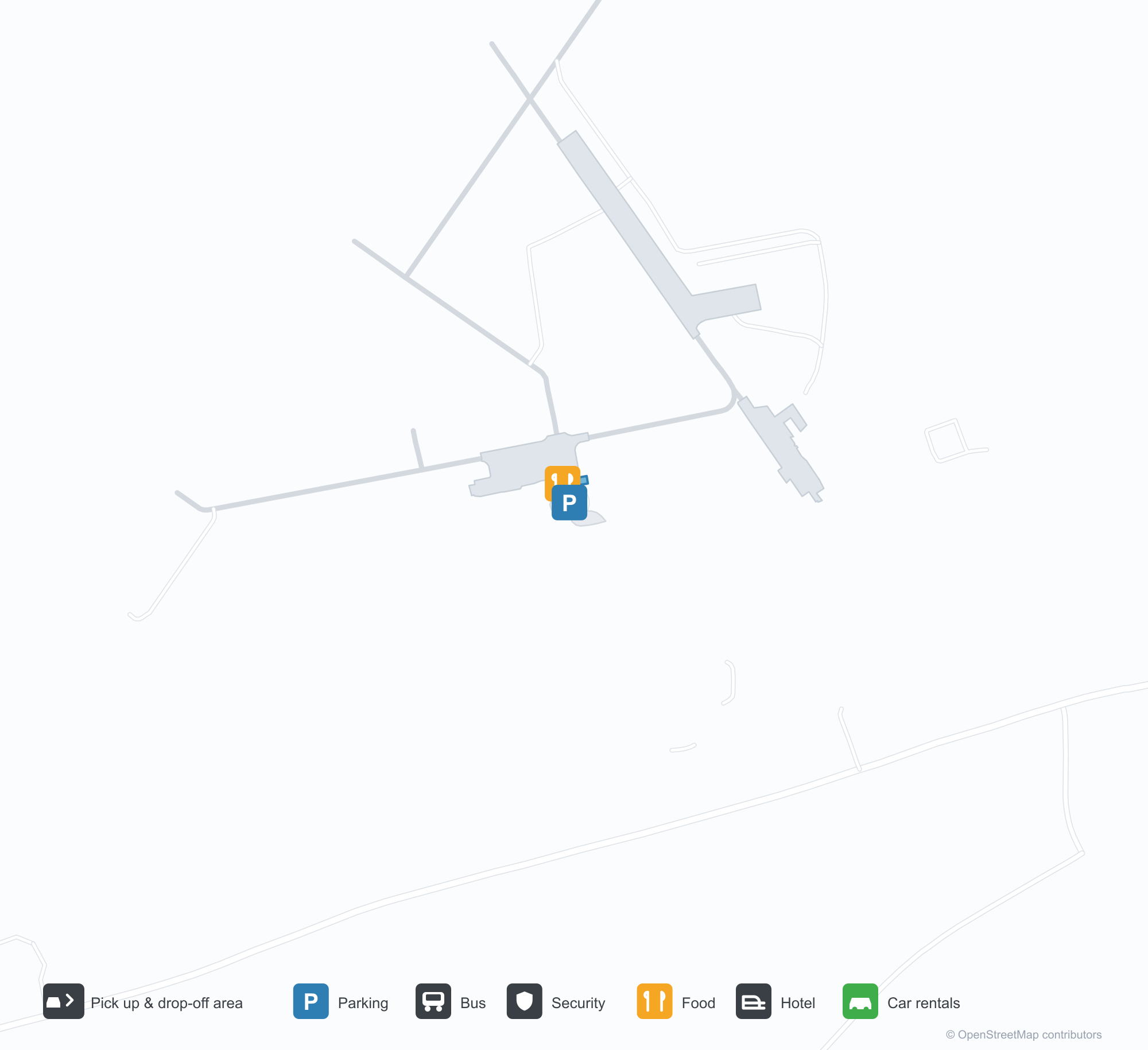
空港マップをダウンロードダウンロード
空港写真空港写真
この空港の実際の写真です。いずれも公開ウェブページを出典として明記しており、著作権は撮影者に帰属します。写真をクリックすると拡大表示され、クレジットをクリックすると元のページが開きます。
衛星画像:アディロンダック地域空港(SLK)は緑の植生と農地に囲まれている。
暗い茶色の木造ターミナルは重厚な木のポーチを持ち、手前にはコンクリートの歩道と砂利の花壇、雲のない空。
空から見ると、刈り込まれた草地と密な常緑樹林の間で2本の滑走路が出会い、雲が遠い丘に影を落とす。
夕暮れ、小さなケープエアの双発機が木造のアディロンダック空港ターミナル前のエプロンで待ち、2人が通り過ぎる。
日没に上空から撮影:丸太造りのターミナルと白い格納庫が、小型機2機のエプロンを挟み、手前には満車の駐車場。
滑走路27のかすれた数字と進入端の縞が夕暮れの緑の草へ導き、山の上にはオレンジと紫の雲。
革張り座面の木の椅子が灰色のカーペットに並び、窓際には植物、茶色の案内板がカフェとトイレを示す。
青い尾翼に白い鳥の描かれたケープエアの双発プロペラ機が誘導路に停まり、登録記号がはっきり読める。
双発ターボプロップ機が離陸直後に上昇し、樹冠と滑走路の上、背景は森の丘陵。
Adirondack Regional Airportの路線マップ — 直行便の目的地路線マップ
直行目的地1か所。地図、就航航空会社、距離を掲載しています。
Adirondack Regional Airport発着便 — 出発と到着フライトボード
便名6件、1社の航空会社、2か所の目的地を出発・到着別に掲載しています。コードシェア便も含みます。
| 便 | 航空会社 | 目的地 | 国・地域 |
|---|---|---|---|
| 9K1022 | Cape Air | ジョン・F・ケネディ国際空港 | アメリカ合衆国 |
| 9K1026 | Cape Air | Boston Logan International Airport | アメリカ合衆国 |
| 9K1034 | Cape Air | Boston Logan International Airport | アメリカ合衆国 |
便名と路線はaviability.comのフライトインデックス(スナップショット:2026年10月26日)に基づきます。コードシェア便を含み、出発時刻は掲載していません。出典:aviability.com ↗
空港情報と詳細空港の詳細
インタラクティブマップ — Adirondack Regional Airportの位置インタラクティブマップ
他の地図サービスでこの空港を見る:
Adirondack Regional Airport (SLK) Guide: One route to Boston Logan International Airport空港ガイド
From above, Adirondack Regional Airport (SLK) lies in the United States, surrounded by green vegetation and farmland. It is a medium-sized airport at an elevation of about 507 m, with 2 runways, the longest 2,003 m; the 2014 snapshot records one destination, Boston Logan International Airport (343 km).
Satellite view
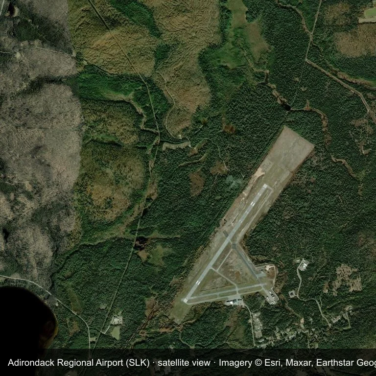
Satellite view: Adirondack Regional Airport (SLK) is surrounded by green vegetation and farmland.
The satellite image comes from Esri World Imagery (© Esri, Maxar, Earthstar Geographics); the field and attribution are labelled in the image. This is a satellite view, not a ground-level photograph.
Airport at a glance
| Item | Detail |
|---|---|
| IATA / ICAO | SLK / KSLK |
| Role | medium-sized airport |
| Elevation | about 507 m |
| Coordinates | 44.3869, -74.2046 |
| Runways | 2, longest 2,003 m |
| Non-stop destinations | 1 (2014 snapshot) |
Runways
| Runway | Length | Surface |
|---|---|---|
| 05/23 | 2,003 m | ASP |
| 09/27 | 1,218 m | ASP |
Routes and connections
| Destination | Distance | Carriers |
|---|---|---|
| Boston Logan International Airport (BOS) | ~343 km | Cape Air |
The full list is on the Adirondack Regional Airport route map.
Nearby airports
| Airport | Distance | Non-stop destinations |
|---|---|---|
| Plattsburgh International Airport (PBG) | ~65.4 km | 5 |
| Massena International Airport Richards Field (MSS) | ~79.3 km | 1 |
| Patrick Leahy Burlington International Airport (BTV) | ~84 km | 10 |
Getting there and navigating
- Coordinates: 44.3869, -74.2046
- Open in a map: Google Maps | Amap | Baidu Maps
The location map on this page shows the field against nearby towns and roads. This page does not cover terminal connections or local transport; confirm them with the airport or airline.
Runway and surroundings
From the air, Adirondack Regional Airport appears within dense green vegetation and small fields in the United States. The primary strip, 05/23, is oriented northeast–southwest and extends 2,003 m at about 507 m.
That 2,003 m length is typical of regional-jet operations. The paved surface supports regular operations, though it does not imply scheduled service. The nearest airport is Plattsburgh International Airport, 65.4 km away, with 5 destinations in the same snapshot.
The 2014 snapshot records a single route to Boston Logan International Airport, 343 km away. Treat it as historical network evidence and confirm the carrier before planning around it.
Before you fly
- With one scheduled route, confirm the flight is operating after booking; long trips usually connect at the other end.
- The 2014 snapshot is not today's schedule; check the airline's current information.
About the data
Runways, elevation and coordinates come from OurAirports open data. Routes come from the June 2014 OpenFlights snapshot and indicate network shape and scale, not current schedules.
References
- OurAirports airport record — KSLK
- Wikipedia article
- OpenFlights route data
- Country page: United States
- Route map: SLK routes
読者コメントディスカッション
質問、旅行記、訂正など、お気軽にお寄せください。コメントは公開されます。
読み込み中…
コメントを読み込み中…