
Adirondack Regional Airport
 Saranac Lake · Amerika Serikat· Adirondack Regional Airport
Adirondack Regional Airport (IATA: SLK, ICAO KSLK) adalah bandara sedang yang melayani Saranac Lake, Amerika Serikat.
Adirondack Regional Airport is a medium-sized airport, at an elevation of about 1,663 ft, with scheduled passenger service. This page gathers its location map, airport codes and travel information.
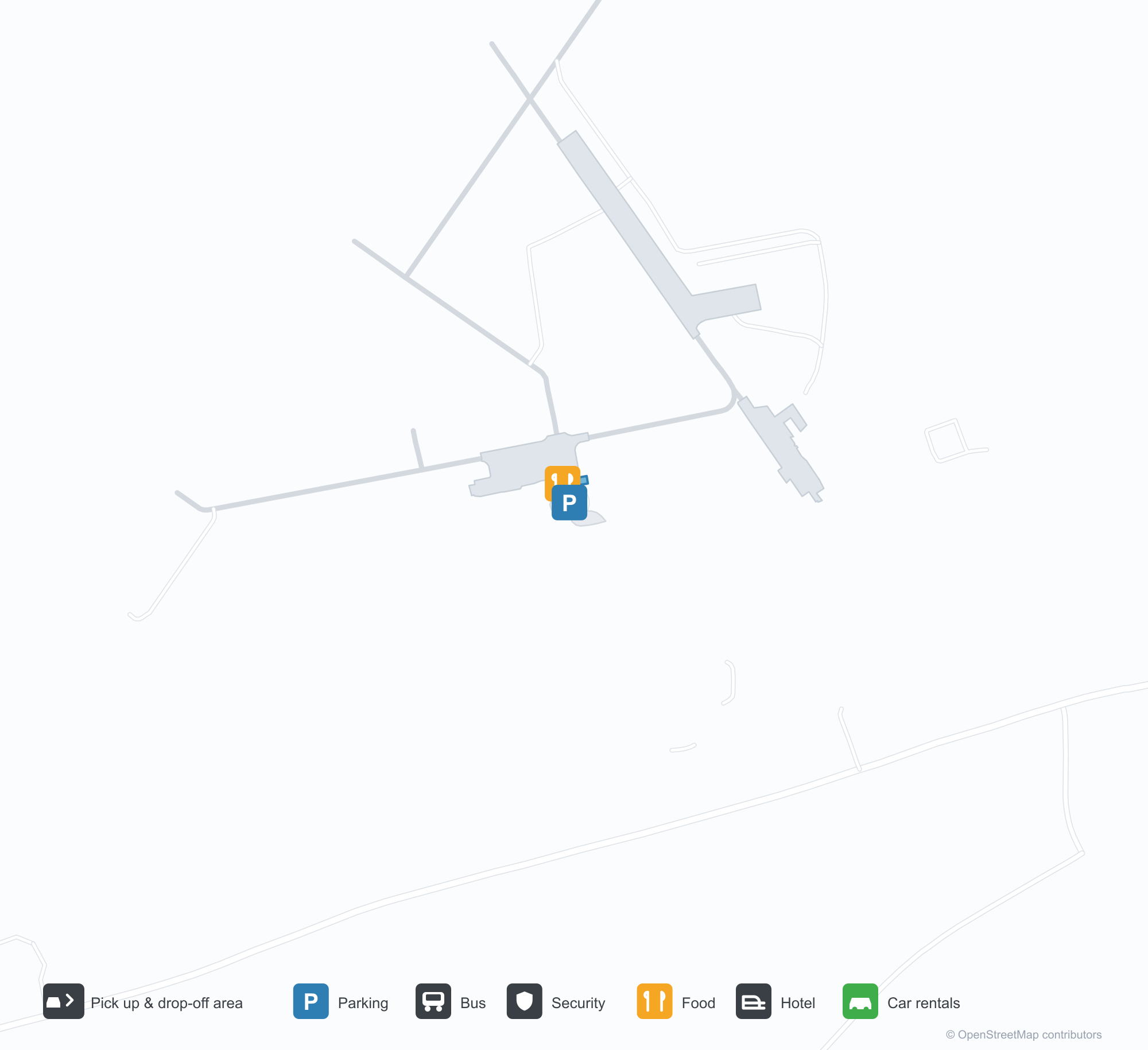
Unduh Peta BandaraUnduhan
Foto bandaraFoto Bandara
Foto asli bandara ini, masing-masing dikreditkan ke halaman web publik tempat foto ditemukan; hak cipta tetap milik fotografer aslinya. Klik foto untuk memperbesar, atau baris kredit untuk membuka halaman sumbernya.
Citra satelit: Bandara Regional Adirondack (SLK) dikelilingi vegetasi hijau dan lahan pertanian.
Terminal kayu cokelat gelap menampilkan serambi kayu berat, dengan jalur beton dan bedeng kerikil di depannya di bawah langit tanpa awan.
Dari udara, dua landasan pacu bertemu di antara rumput yang dipangkas dan hutan hijau lebat, dengan awan menimbulkan bayangan di perbukitan jauh.
Saat senja, pesawat kecil bermesin ganda Cape Air menunggu di apron di depan terminal kayu Bandara Adirondack saat dua orang berjalan lewat.
Diambil dari atas saat matahari terbenam, terminal kayu gelondongan dan hanggar putih mengapit apron berisi dua pesawat kecil, dengan parkiran padat di latar depan.
Angka dan garis ambang landasan pacu 27 yang memudar menuju ke rumput hijau saat senja, dengan awan oranye dan ungu di atas pegunungan.
Deretan kursi kayu dengan dudukan kulit berada di atas karpet kelabu, tanaman di dekat jendela, dan papan cokelat menunjuk ke kafe dan toilet.
Pesawat baling-baling kembar Cape Air dengan burung putih tercat di ekor birunya beristirahat di taxiway, huruf registrasinya terlihat jelas.
Pesawat turboprop bermesin ganda menanjak tepat setelah lepas landas, di atas barisan pohon dan landasan pacu, dengan perbukitan berhutan memenuhi latar belakang.
Peta rute Adirondack Regional Airport — tujuan langsungPeta Rute
1 tujuan langsung: peta, maskapai yang beroperasi, dan jarak.
Penerbangan Adirondack Regional Airport — keberangkatan & kedatanganPapan Penerbangan
6 nomor penerbangan dari 1 maskapai dan 2 tujuan, dipisahkan menurut arah. Nomor codeshare disertakan.
| Penerbangan | Maskapai | Tujuan | Negara/wilayah |
|---|---|---|---|
| 9K1022 | Cape Air | Bandara Internasional John F. Kennedy | Amerika Serikat |
| 9K1026 | Cape Air | Boston Logan International Airport | Amerika Serikat |
| 9K1034 | Cape Air | Boston Logan International Airport | Amerika Serikat |
Nomor penerbangan dan rute dari indeks penerbangan aviability.com (cuplikan 26 Oktober 2026); nomor codeshare disertakan dan waktu keberangkatan tidak ditampilkan. Sumber: aviability.com ↗
Informasi & detail bandaraDetail Bandara
Peta interaktif — lokasi Adirondack Regional AirportPeta Interaktif
Lihat bandara ini di layanan peta lain:
Adirondack Regional Airport (SLK) Guide: One route to Boston Logan International AirportPanduan Bandara
From above, Adirondack Regional Airport (SLK) lies in the United States, surrounded by green vegetation and farmland. It is a medium-sized airport at an elevation of about 507 m, with 2 runways, the longest 2,003 m; the 2014 snapshot records one destination, Boston Logan International Airport (343 km).
Satellite view
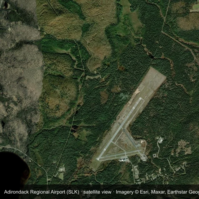
Satellite view: Adirondack Regional Airport (SLK) is surrounded by green vegetation and farmland.
The satellite image comes from Esri World Imagery (© Esri, Maxar, Earthstar Geographics); the field and attribution are labelled in the image. This is a satellite view, not a ground-level photograph.
Airport at a glance
| Item | Detail |
|---|---|
| IATA / ICAO | SLK / KSLK |
| Role | medium-sized airport |
| Elevation | about 507 m |
| Coordinates | 44.3869, -74.2046 |
| Runways | 2, longest 2,003 m |
| Non-stop destinations | 1 (2014 snapshot) |
Runways
| Runway | Length | Surface |
|---|---|---|
| 05/23 | 2,003 m | ASP |
| 09/27 | 1,218 m | ASP |
Routes and connections
| Destination | Distance | Carriers |
|---|---|---|
| Boston Logan International Airport (BOS) | ~343 km | Cape Air |
The full list is on the Adirondack Regional Airport route map.
Nearby airports
| Airport | Distance | Non-stop destinations |
|---|---|---|
| Plattsburgh International Airport (PBG) | ~65.4 km | 5 |
| Massena International Airport Richards Field (MSS) | ~79.3 km | 1 |
| Patrick Leahy Burlington International Airport (BTV) | ~84 km | 10 |
Getting there and navigating
- Coordinates: 44.3869, -74.2046
- Open in a map: Google Maps | Amap | Baidu Maps
The location map on this page shows the field against nearby towns and roads. This page does not cover terminal connections or local transport; confirm them with the airport or airline.
Runway and surroundings
From the air, Adirondack Regional Airport appears within dense green vegetation and small fields in the United States. The primary strip, 05/23, is oriented northeast–southwest and extends 2,003 m at about 507 m.
That 2,003 m length is typical of regional-jet operations. The paved surface supports regular operations, though it does not imply scheduled service. The nearest airport is Plattsburgh International Airport, 65.4 km away, with 5 destinations in the same snapshot.
The 2014 snapshot records a single route to Boston Logan International Airport, 343 km away. Treat it as historical network evidence and confirm the carrier before planning around it.
Before you fly
- With one scheduled route, confirm the flight is operating after booking; long trips usually connect at the other end.
- The 2014 snapshot is not today's schedule; check the airline's current information.
About the data
Runways, elevation and coordinates come from OurAirports open data. Routes come from the June 2014 OpenFlights snapshot and indicate network shape and scale, not current schedules.
References
- OurAirports airport record — KSLK
- Wikipedia article
- OpenFlights route data
- Country page: United States
- Route map: SLK routes
Komentar pembacaDiskusi
Pertanyaan, laporan perjalanan, dan koreksi sangat kami harapkan. Komentar bersifat publik.
Memuat…
Memuat komentar…