
Antoine-Simon International Airport
 Les Cayes · เฮติ· Antoine-Simon International Airport
Antoine-Simon International Airport (IATA: CYA, ICAO MTCA) เป็นสนามบินขนาดกลางที่ให้บริการLes Cayes, เฮติ
Antoine-Simon International Airport is a medium-sized airport, at an elevation of about 203 ft, with scheduled passenger service. This page gathers its location map, airport codes and travel information.
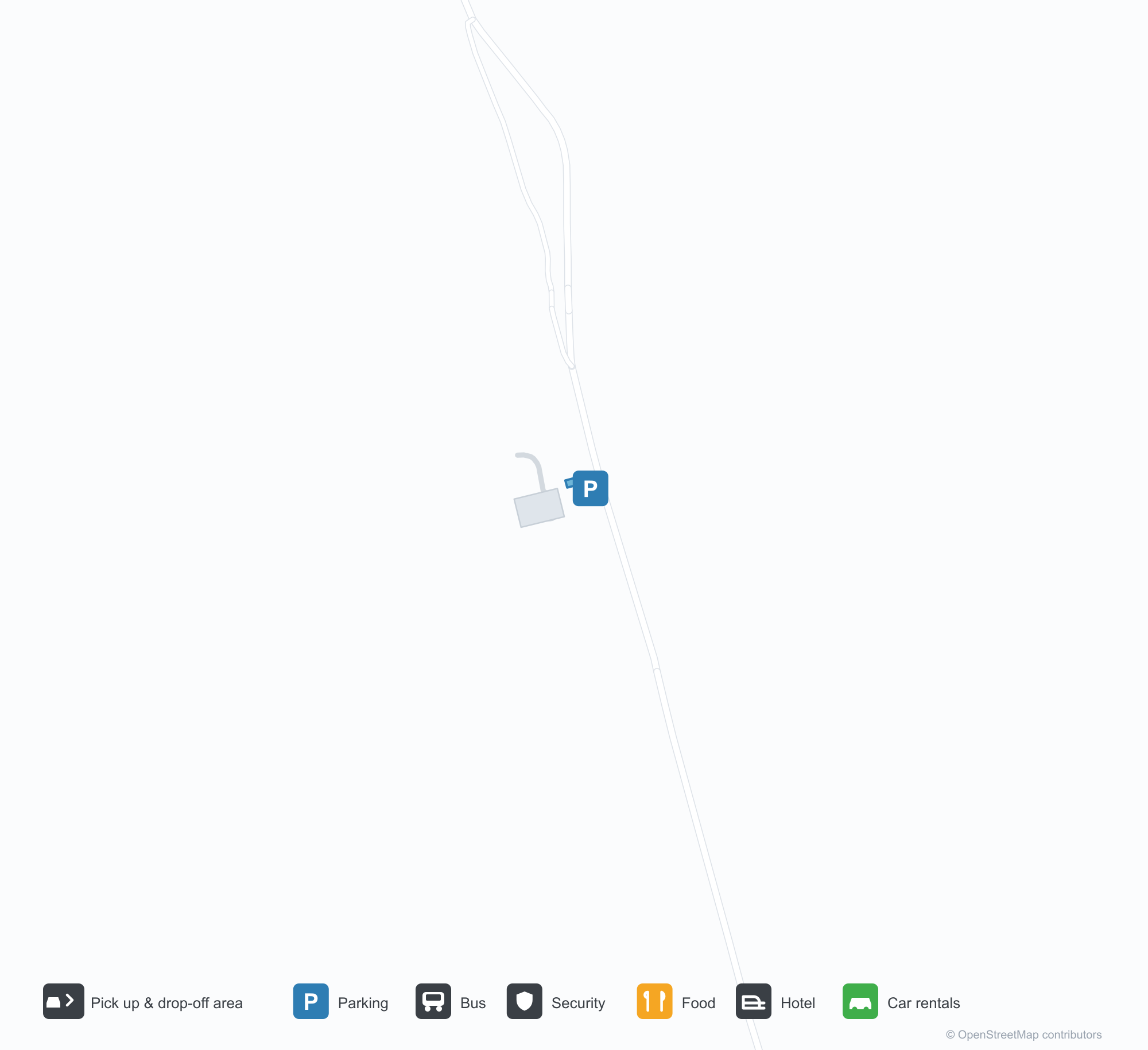
ดาวน์โหลดแผนที่สนามบินดาวน์โหลด
ภาพสนามบินภาพสนามบิน
ภาพจริงของสนามบินแห่งนี้ พร้อมเครดิตของหน้าเว็บสาธารณะที่พบภาพ; ลิขสิทธิ์ยังเป็นของผู้ถ่ายภาพต้นฉบับ คลิกที่ภาพเพื่อขยาย หรือคลิกบรรทัดเครดิตเพื่อเปิดหน้าแหล่งที่มา
ในภาพถ่ายดาวเทียม ทางวิ่งของท่าอากาศยานนานาชาติอองตวน-ซีมง (CYA) อยู่ระหว่างตัวเมือง พื้นที่เกษตรกรรม และพืชพรรณ
ป้ายสีขาวใต้หลังคากันแดดสีเขียวอ่อนต้อนรับผู้มาเยือนเป็นภาษาฝรั่งเศสสู่ท่าอากาศยานนานาชาติอองตวน ซีมงที่เลแคร์ โดยมีผู้คนเดินผ่านด้านล่าง
ภายใต้ท้องฟ้าครึ้ม เครื่องบินเจ็ตภูมิภาคสีขาวเครื่องยนต์ท้ายและหางตัว T กำลังขับเคลื่อนข้ามลานแอสฟัลต์สีเข้มผ่านแนวต้นไม้สีเขียว
ในแสงแดดเที่ยงวันจ้า เครื่องบินใบพัดเครื่องยนต์เดียวสีเขียวขาวลำเล็กจอดอยู่บนลานคอนกรีต ประตูห้องโดยสารเปิดและมีคนยืนที่บันได
เครื่องบินเจ็ตภูมิภาคสีฟ้าขาวแล่นไปตามทางวิ่งที่เปียกผ่านการฉีดน้ำแสดงความยินดี ขณะที่นักดับเพลิงสองคนในชุดสีเข้มเล็งสายยางจากสนามหญ้า
ป้ายสีฟ้าที่เขียนว่า Aeroport Antoine Simon des Cayes ตั้งอยู่ข้างรั้วลวดตาข่าย โดยมีต้นปาล์มและดอกยี่โถสีชมพูภายใต้ท้องฟ้าสว่างที่มีเมฆคิวมูลัส
พระอาทิตย์ตกย้อมลานจอดเป็นสีทองหลังอาคารผู้โดยสารสีขาวเล็ก ๆ ที่ผนังเขียนว่า Les Cayes Airport ขณะที่ผู้เดินทางไม่กี่คนยืนอยู่ใกล้ทางเข้า
ทางเข้าขาเข้าสีเขียวมิ้นต์อ่อนมีป้ายสีขาวเขียนว่า Arrivee เหนือลูกศรชี้ลงสองอัน โดยมีราวกั้นสีฟ้าและไม้พุ่มอยู่ด้านหน้า
เที่ยวบินของAntoine-Simon International Airport — ขาออกและขาเข้าป้ายเที่ยวบิน
15 หมายเลขเที่ยวบิน ครอบคลุม 1 สายการบิน และ 2 จุดหมายปลายทาง แยกตามทิศทาง หมายเลขเที่ยวบินร่วม (codeshare) รวมอยู่ด้วย
| เที่ยวบิน | สายการบิน | จุดหมายปลายทาง | ประเทศ/ภูมิภาค |
|---|---|---|---|
| S630 | Sunrise Airways | Port-au-Prince (PAP) Toussaint Louverture International Airport | เฮติ |
| S632 | Sunrise Airways | Port-au-Prince (PAP) Toussaint Louverture International Airport | เฮติ |
| S640 | Sunrise Airways | Cap Haitien (CAP) Cap Haitien International Airport | เฮติ |
| S642 | Sunrise Airways | Cap Haitien (CAP) Cap Haitien International Airport | เฮติ |
| S644 | Sunrise Airways | Cap Haitien (CAP) Cap Haitien International Airport | เฮติ |
| S646 | Sunrise Airways | Cap Haitien (CAP) Cap Haitien International Airport | เฮติ |
| S648 | Sunrise Airways | Cap Haitien (CAP) Cap Haitien International Airport | เฮติ |
| S62030 | Sunrise Airways | Port-au-Prince (PAP) Toussaint Louverture International Airport | เฮติ |
หมายเลขเที่ยวบินและเส้นทางจากดัชนีเที่ยวบิน aviability.com (ข้อมูล ณ วันที่ 26 ตุลาคม 2569); รวมหมายเลขเที่ยวบินร่วมและไม่แสดงเวลาเดินทาง ที่มา: aviability.com ↗
ข้อมูลและรายละเอียดสนามบินรายละเอียดสนามบิน
แผนที่อินเทอร์แอกทีฟ — ตำแหน่ง Antoine-Simon International Airportแผนที่อินเทอร์แอกทีฟ
ดูสนามบินนี้บนบริการแผนที่อื่น:
Antoine-Simon International Airport (CYA) Guide: A regional runway in contextคู่มือสนามบิน
Satellite imagery of Antoine-Simon International Airport (CYA) in Haiti shows a field surrounded by a patchwork of vegetation and open ground. At about 62 m above sea level, it has a single 981 m runway. The 2014 snapshot lists no scheduled destinations; Jérémie Airport is 59.4 km away.
Satellite view
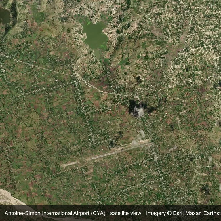
Satellite view of Antoine-Simon International Airport (CYA), with the airfield visible among a patchwork of vegetation and open ground.
Imagery: Esri World Imagery (© Esri, Maxar, Earthstar Geographics), with attribution in the image. It shows the field from orbit, not from the ground.
Airport at a glance
| Item | Detail |
|---|---|
| IATA / ICAO | CYA / MTCA |
| Role | medium-sized airport |
| Elevation | about 62 m |
| Coordinates | 18.2711, -73.7883 |
| Runways | 1, longest 981 m |
| Non-stop destinations | 0 in the 2014 snapshot |
Runways
| Runway | Length | Surface |
|---|---|---|
| 08/26 | 981 m | ASP |
Why there is no route table
The 2014 OpenFlights snapshot contains no scheduled services for CYA. Absence from that dataset is not proof that the field is unused today; check current airport and airline information before travelling.
Nearby airports
| Airport | Distance | Non-stop destinations |
|---|---|---|
| Jérémie Airport (JEE) | ~59.4 km | — |
| Toussaint Louverture International Airport (PAP) | ~161 km | 12 |
| Cap Haitien International Airport (CAP) | ~232 km | 2 |
Getting there and navigating
- Coordinates: 18.2711, -73.7883
- Open in a map: Google Maps | Amap | Baidu Maps
The location map on this page places the field in relation to nearby towns and roads. Terminal connections and local transport fall outside this dataset; the airport or airline can confirm them.
Airport sketch
Antoine-Simon International Airport occupies ground in Haiti surrounded by a patchwork of vegetation and open ground. The 08/26 runway runs east–west and offers 981 m of asphalt; elevation is about 62 m.
The runway gives 981 m of asphalt, a turboprop and light-jet profile. The paved surface supports regular operations, though it does not imply scheduled service. Jérémie Airport is 59.4 km away, with no recorded destinations in the same snapshot.
With no routes in the 2014 data, this is not a reliable scheduled destination. Use Jérémie Airport as the nearest back-up and verify access with the airport operator.
Before you fly
- The 981 m runway limits operations to small aircraft; baggage and payload limits are usually strict.
- The runway is paved, which supports year-round operations, but scheduled service is still not guaranteed.
- Jérémie Airport is the nearest airport in this dataset, 59.4 km away, but it also has no recorded destinations for 2014.
- The site has no terminal guide on this page, so allow extra time for local arrangements and onward transport.
- Treat this as a general-aviation or charter field rather than a large terminal; confirm handling and opening hours in advance.
About the data
Runways, elevation and coordinates come from OurAirports open data; routes come from the June 2014 OpenFlights snapshot. That snapshot describes network shape and scale, not current schedules.
ความคิดเห็นจากผู้อ่านการสนทนา
ยินดีรับคำถาม รายงานการเดินทาง และการแก้ไข ความคิดเห็นเป็นสาธารณะ
กำลังโหลด…
กำลังโหลดความคิดเห็น…