
Antoine-Simon International Airport
 Les Cayes · Haiti· Antoine-Simon International Airport
O Antoine-Simon International Airport (IATA: CYA, ICAO MTCA) é um aeroporto de porte médio que atende Les Cayes, Haiti.
Antoine-Simon International Airport is a medium-sized airport, at an elevation of about 203 ft, with scheduled passenger service. This page gathers its location map, airport codes and travel information.
Baixar mapas do aeroportoDownloads
Fotos do aeroportoFotos do aeroporto
Fotos reais deste aeroporto, cada uma creditada à página pública da web onde foi encontrada; os direitos autorais continuam com os fotógrafos originais. Clique em uma foto para ampliar ou em uma linha de crédito para abrir a página de origem.
Na imagem de satélite, a pista do Aeroporto Internacional Antoine-Simon (CYA) fica entre cidade, terras agrícolas e vegetação.
Uma placa branca sob uma cobertura verde-clara dá boas-vindas em francês ao Aeroporto Internacional Antoine Simon, em Les Cayes, com pessoas passando abaixo.
Sob um céu nublado, um jato regional branco com motores traseiros e cauda em T taxiando pelo pátio de asfalto escuro passando por uma parede de árvores verdes.
Sob sol forte de meio-dia, um pequeno turboélice monomotor verde e branco está no pátio de concreto com a porta da cabine aberta e uma pessoa no degrau.
Um jato regional azul e branco rola pela pista molhada sob uma saudação de canhões de água, enquanto dois bombeiros com equipamento escuro apontam mangueiras do gramado.
Uma placa azul com os dizeres Aeroport Antoine Simon des Cayes está junto a uma cerca de tela, com uma palmeira e flores de oleandro rosa sob um céu claro salpicado de nuvens cúmulos.
O sol poente doura o pátio atrás de um pequeno terminal branco cuja parede diz Les Cayes Airport, com alguns viajantes perto da entrada.
Uma entrada de desembarque em verde-menta claro traz uma placa branca com a inscrição Arrivee acima de duas setas para baixo, com grades azuis e arbustos à frente.
Antoine-Simon International Airport: voos — partidas e chegadasPainel de voos
15 números de voo de 1 companhia aérea para 2 destinos, separados por direção. Números de codeshare estão incluídos.
| Voo | Companhia aérea | Destino | País/região |
|---|---|---|---|
| S630 | Sunrise Airways | Port-au-Prince (PAP) Toussaint Louverture International Airport | Haiti |
| S632 | Sunrise Airways | Port-au-Prince (PAP) Toussaint Louverture International Airport | Haiti |
| S640 | Sunrise Airways | Cap Haitien (CAP) Cap Haitien International Airport | Haiti |
| S642 | Sunrise Airways | Cap Haitien (CAP) Cap Haitien International Airport | Haiti |
| S644 | Sunrise Airways | Cap Haitien (CAP) Cap Haitien International Airport | Haiti |
| S646 | Sunrise Airways | Cap Haitien (CAP) Cap Haitien International Airport | Haiti |
| S648 | Sunrise Airways | Cap Haitien (CAP) Cap Haitien International Airport | Haiti |
| S62030 | Sunrise Airways | Port-au-Prince (PAP) Toussaint Louverture International Airport | Haiti |
Números de voo e rotas do índice de voos da aviability.com (instantâneo de 26 de outubro de 2026); números de codeshare estão incluídos e nenhum horário de partida é exibido. Fonte: aviability.com ↗
Informações e detalhes do aeroportoDetalhes do aeroporto
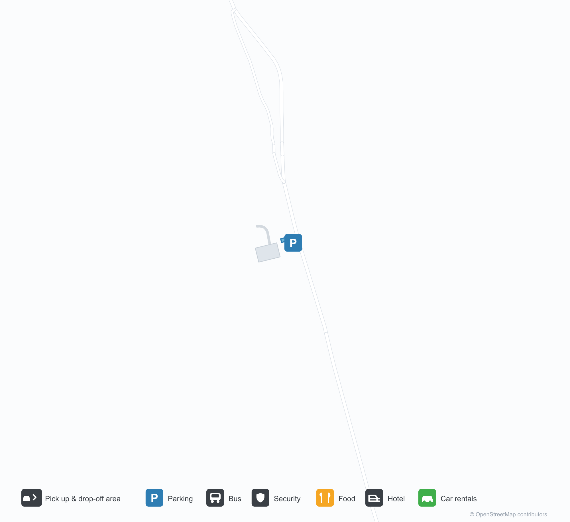
Mapa interativo — localização do Antoine-Simon International AirportMapa interativo
Veja este aeroporto em outros serviços de mapas:
Antoine-Simon International Airport (CYA) Guide: A regional runway in contextGuia do aeroporto
Satellite imagery of Antoine-Simon International Airport (CYA) in Haiti shows a field surrounded by a patchwork of vegetation and open ground. At about 62 m above sea level, it has a single 981 m runway. The 2014 snapshot lists no scheduled destinations; Jérémie Airport is 59.4 km away.
Satellite view
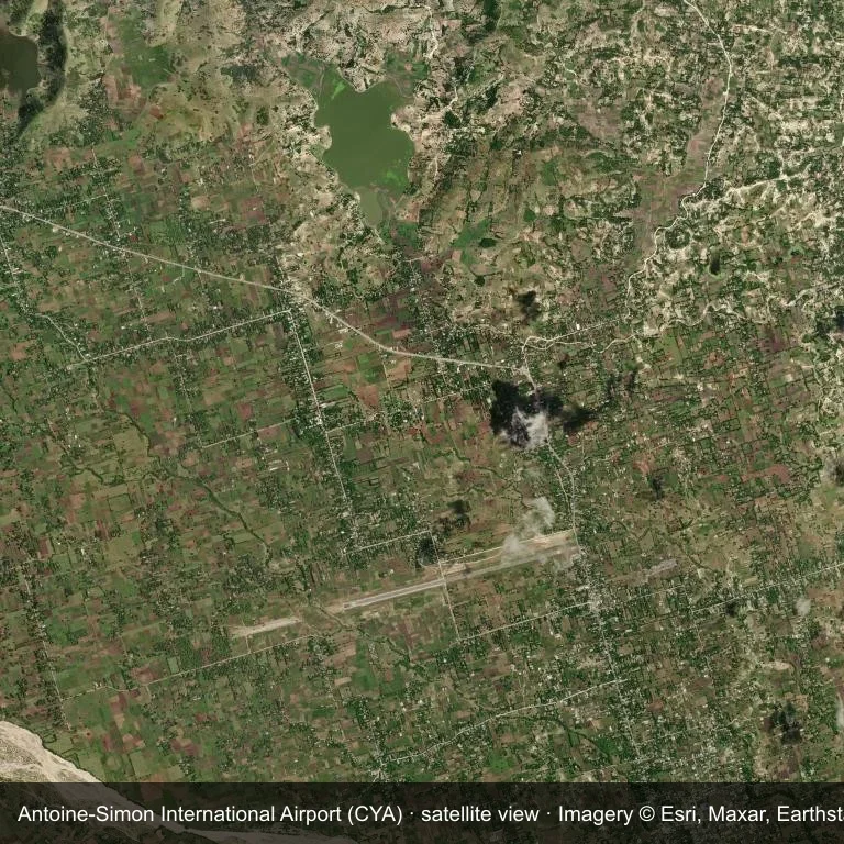
Satellite view of Antoine-Simon International Airport (CYA), with the airfield visible among a patchwork of vegetation and open ground.
Imagery: Esri World Imagery (© Esri, Maxar, Earthstar Geographics), with attribution in the image. It shows the field from orbit, not from the ground.
Airport at a glance
| Item | Detail |
|---|---|
| IATA / ICAO | CYA / MTCA |
| Role | medium-sized airport |
| Elevation | about 62 m |
| Coordinates | 18.2711, -73.7883 |
| Runways | 1, longest 981 m |
| Non-stop destinations | 0 in the 2014 snapshot |
Runways
| Runway | Length | Surface |
|---|---|---|
| 08/26 | 981 m | ASP |
Why there is no route table
The 2014 OpenFlights snapshot contains no scheduled services for CYA. Absence from that dataset is not proof that the field is unused today; check current airport and airline information before travelling.
Nearby airports
| Airport | Distance | Non-stop destinations |
|---|---|---|
| Jérémie Airport (JEE) | ~59.4 km | — |
| Toussaint Louverture International Airport (PAP) | ~161 km | 12 |
| Cap Haitien International Airport (CAP) | ~232 km | 2 |
Getting there and navigating
- Coordinates: 18.2711, -73.7883
- Open in a map: Google Maps | Amap | Baidu Maps
The location map on this page places the field in relation to nearby towns and roads. Terminal connections and local transport fall outside this dataset; the airport or airline can confirm them.
Airport sketch
Antoine-Simon International Airport occupies ground in Haiti surrounded by a patchwork of vegetation and open ground. The 08/26 runway runs east–west and offers 981 m of asphalt; elevation is about 62 m.
The runway gives 981 m of asphalt, a turboprop and light-jet profile. The paved surface supports regular operations, though it does not imply scheduled service. Jérémie Airport is 59.4 km away, with no recorded destinations in the same snapshot.
With no routes in the 2014 data, this is not a reliable scheduled destination. Use Jérémie Airport as the nearest back-up and verify access with the airport operator.
Before you fly
- The 981 m runway limits operations to small aircraft; baggage and payload limits are usually strict.
- The runway is paved, which supports year-round operations, but scheduled service is still not guaranteed.
- Jérémie Airport is the nearest airport in this dataset, 59.4 km away, but it also has no recorded destinations for 2014.
- The site has no terminal guide on this page, so allow extra time for local arrangements and onward transport.
- Treat this as a general-aviation or charter field rather than a large terminal; confirm handling and opening hours in advance.
About the data
Runways, elevation and coordinates come from OurAirports open data; routes come from the June 2014 OpenFlights snapshot. That snapshot describes network shape and scale, not current schedules.
Comentários dos leitoresDiscussão
Perguntas, relatos de viagem e correções são bem-vindos. Os comentários são públicos.
Carregando…
Carregando comentários…