
Akure Airport
 Akure · 나이지리아· Akure Airport
Akure Airport(IATA: AKR, ICAO: DNAK)은 나이지리아 Akure에 위치한 중형 공항입니다.
Akure Airport is a medium-sized airport, at an elevation of about 1,100 ft, with scheduled passenger service. This page gathers its location map, airport codes and travel information.
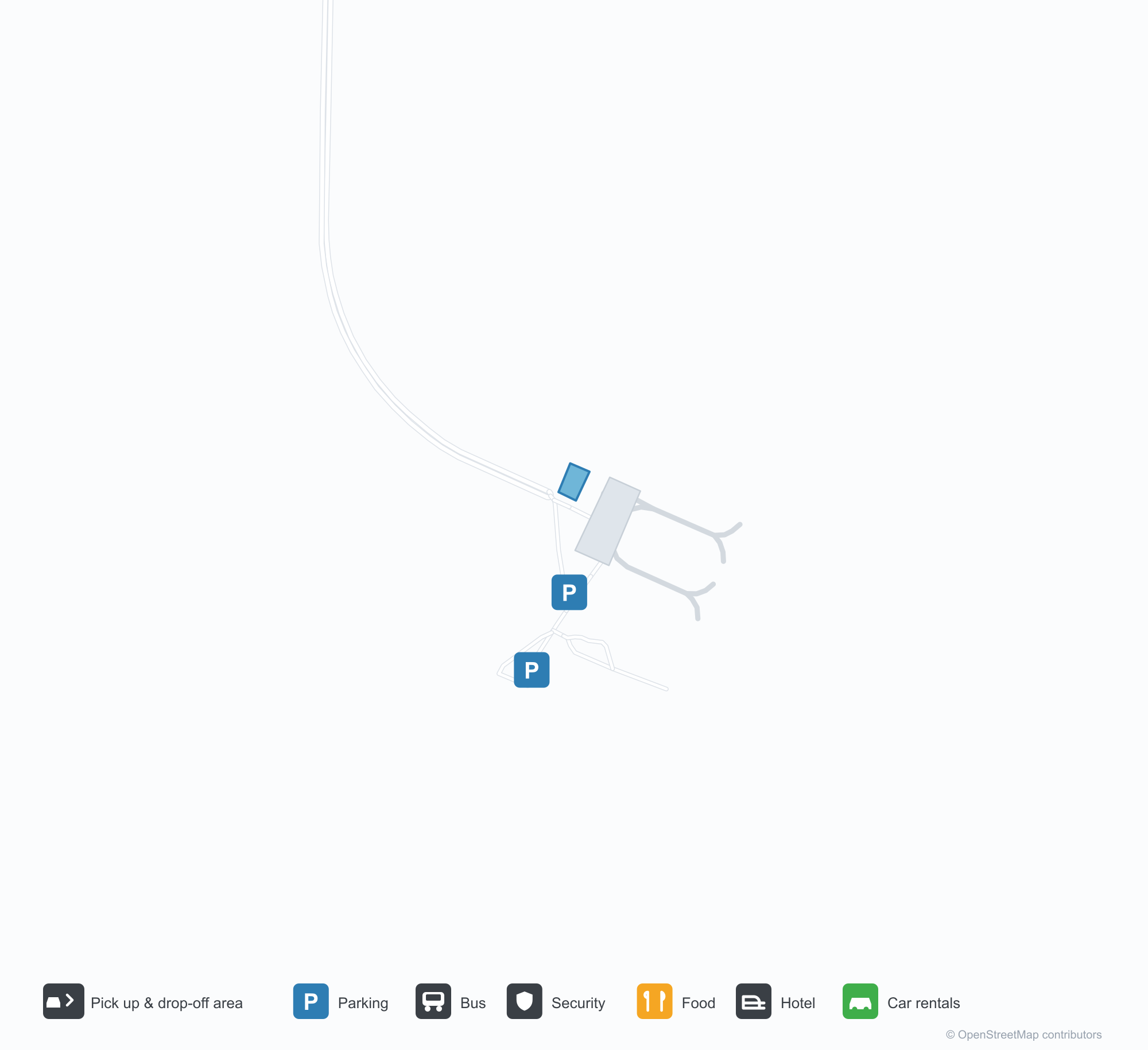
공항 지도 다운로드다운로드
공항 실제 사진공항 사진
다음은 이 공항의 실제 사진으로, 모두 공개된 인터넷 출처에서 가져왔으며 사진마다 출처를 표시했습니다. 저작권은 원저작자에게 있습니다. 사진을 클릭하면 크게 볼 수 있고, 출처를 클릭하면 원본 페이지가 열립니다.
아쿠레 공항 터미널 — 파란 지붕 아래 크림색 벽, 출입구 위의 곡선 캐노피, 파란색과 흰색의 연석선.
아쿠레 계류장에 주기된 Overland Airways ATR 72(등록기호 5N-BPE).
공항 정보 및 상세공항 상세
Akure Airport 인터랙티브 지도 — 공항 위치인터랙티브 지도
다른 지도 서비스에서 이 공항 보기:
Akure Airport (AKR): A Regional Field With No Route Data공항 안내
Akure Airport (IATA AKR, ICAO DNAK) begins with a gap that needs stating plainly: the 2014 OpenFlights route snapshot records no scheduled non-stop routes for it. The photos offer another clue. In the second image, an Overland Airways ATR 72 turboprop (registration 5N-BPE) sits on Akure's apron. The airport is not necessarily without flights; the 2014 dataset simply did not capture its schedule.
The field serves Akure, Nigeria, at an elevation of about 335 m, with a single 2,803 m runway. The terminal photo shows cream walls under a blue roof, curved canopies over the entrances and a blue-and-white kerb line — the scale of a typical West African regional airport.
Airport photos
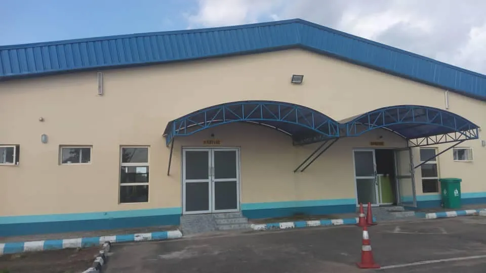
Akure Airport's terminal — cream walls under a blue roof, curved canopies over the entrances and a blue-and-white kerb line.
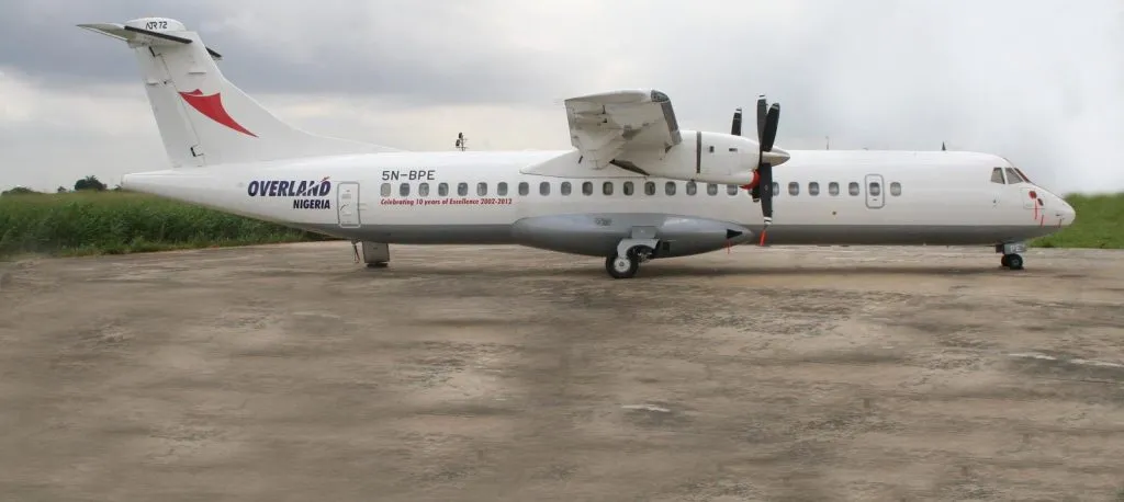
An Overland Airways ATR 72 (registration 5N-BPE) parked on Akure's apron.
The photos come from public web sources and remain the copyright of their photographers; full credits and source links sit in the photo gallery on this page.
Airport at a glance
| Item | Detail |
|---|---|
| IATA / ICAO | AKR / DNAK |
| Role | Medium-sized regional airport in south-western Nigeria |
| Elevation | about 335 m |
| Coordinates | 7.2467, 5.3010 |
| Runway | 1: 03/21, 2,803 m |
| Non-stop destinations | 0 in the 2014 snapshot (not proof that none operate today) |
| Official site | faannigeria.org |
Why there is no route table
OpenFlights' 2014 snapshot covers more than 2,600 airports worldwide, but it does not capture every regional schedule. AKR is one of those gaps: the dataset has no scheduled routes for it, while the ATR 72 in the photo shows that turboprop regional service has at least existed at Akure. The two facts are not in conflict — one is the coverage of a historical snapshot, the other is evidence of actual operations.
So this page lists no route table and does not guess destinations. To find out what operates today, check the websites of Nigerian regional carriers such as Overland Airways, or contact the airport directly.
Getting there and navigating
- Coordinates: 7.2467, 5.3010
- Official site: faannigeria.org
- Open in a map: Google Maps | Amap | Baidu Maps
The nearby-airport table lists Mopti (MZI, about 1,304 km) and Abéché (AEH, about 1,850 km), neither with route data, so neither is a reliable substitute. If no AKR flight turns up, use the search box at the top of the page to compare other Nigerian airports before deciding whether to start from a larger gateway.
The location map on this page shows the field against Akure and the road network. This page does not cover terminal connections or local transport; confirm them with the airport or airline.
Before you fly
- Regional schedules change often. After booking, confirm with the airline that the flight is operating rather than relying on an aggregator's display alone.
- With one runway and a small terminal, 90 minutes before departure is usually enough. For international connections, route through a larger Nigerian airport.
- The ATR 72 in the photo signals turboprop regional equipment; cabin-bag rules and boarding arrangements follow the airline, not the airport building.
About the data
Runways, elevation and coordinates come from OurAirports open data. Route data comes from the June 2014 OpenFlights snapshot, in which AKR has no scheduled routes recorded. Photos are from public web sources and remain the copyright of their photographers.