
Albany International Airport
 Albany · Amerika Serikat· Albany International Airport
Albany International Airport (IATA: ALB, ICAO KALB) adalah bandara besar yang melayani Albany, Amerika Serikat.
Albany International Airport is a large airport, at an elevation of about 285 ft, with scheduled passenger service. This page gathers its location map, airport codes and travel information.
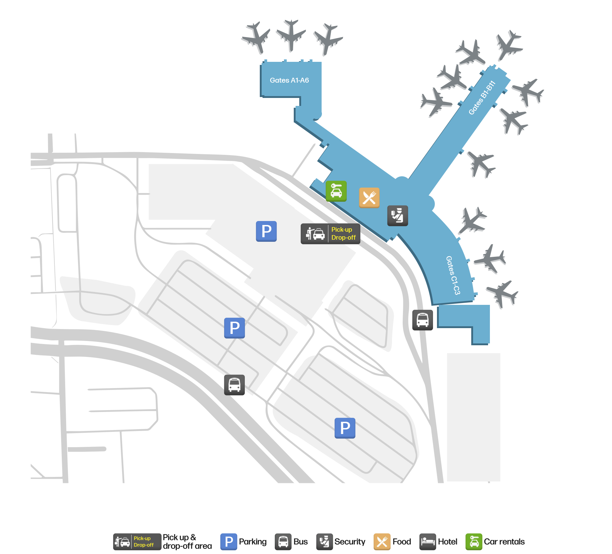
Unduh Peta BandaraUnduhan
Foto bandaraFoto Bandara
Foto asli bandara ini, masing-masing dikreditkan ke halaman web publik tempat foto ditemukan; hak cipta tetap milik fotografer aslinya. Klik foto untuk memperbesar, atau baris kredit untuk membuka halaman sumbernya.
Citra satelit: landasan pacu Albany membentang di tepi kota-kota Lembah Hudson, dengan terminal dan apron di timur lapangan.
Peta rute Albany International Airport — tujuan langsungPeta Rute
19 tujuan langsung: peta, maskapai yang beroperasi, dan jarak.
Penerbangan Albany International Airport — keberangkatan & kedatanganPapan Penerbangan
982 nomor penerbangan dari 25 maskapai dan 26 tujuan, dipisahkan menurut arah. Nomor codeshare disertakan.
| Penerbangan | Maskapai | Tujuan | Negara/wilayah |
|---|---|---|---|
| AA440 | American Airlines | Charlotte Douglas International Airport | Amerika Serikat |
| AA710 | American Airlines | Charlotte Douglas International Airport | Amerika Serikat |
| AA1050 | American Airlines | Charlotte Douglas International Airport | Amerika Serikat |
| AA1247 | American Airlines | Charlotte Douglas International Airport | Amerika Serikat |
| AA1857 | American Airlines | Charlotte Douglas International Airport | Amerika Serikat |
| AA2180 | American Airlines | Charlotte Douglas International Airport | Amerika Serikat |
| AA2394 | American Airlines | Charlotte Douglas International Airport | Amerika Serikat |
| AA2663 | American Airlines | Charlotte Douglas International Airport | Amerika Serikat |
| AA3480 | American Airlines | Ronald Reagan Washington National Airport | Amerika Serikat |
| AA3729 | American Airlines | Bandara Internasional O'Hare | Amerika Serikat |
| AA3826 | American Airlines | Bandara Internasional O'Hare | Amerika Serikat |
| AA3835 | American Airlines | Bandara Internasional O'Hare | Amerika Serikat |
| AA4028 | American Airlines | Bandara Internasional Miami | Amerika Serikat |
| AA4256 | American Airlines | Bandara Internasional O'Hare | Amerika Serikat |
| AA4337 | American Airlines | Ronald Reagan Washington National Airport | Amerika Serikat |
| AA4340 | American Airlines | Bandara Internasional Miami | Amerika Serikat |
| AA4341 | American Airlines | Ronald Reagan Washington National Airport | Amerika Serikat |
| AA4346 | American Airlines | Ronald Reagan Washington National Airport | Amerika Serikat |
| AA4362 | American Airlines | Ronald Reagan Washington National Airport | Amerika Serikat |
| AA4420 | American Airlines | Ronald Reagan Washington National Airport | Amerika Serikat |
Nomor penerbangan dan rute dari indeks penerbangan aviability.com (cuplikan 26 Oktober 2026); nomor codeshare disertakan dan waktu keberangkatan tidak ditampilkan. Sumber: aviability.com ↗
Informasi & detail bandaraDetail Bandara
Peta interaktif — lokasi Albany International AirportPeta Interaktif
Lihat bandara ini di layanan peta lain:
Albany Airport (ALB): Nineteen Domestic Routes in the Hudson ValleyPanduan Bandara
On satellite imagery, Albany's runways run along the edge of the Hudson Valley towns, with the terminal and apron east of the field. The airport serves Albany, New York, at an elevation of about 87 m, with runways of 2,591 m and 2,195 m; the 2014 snapshot records 19 domestic destinations, from Newark at 231 km to Las Vegas at 3,591 km.
Satellite view
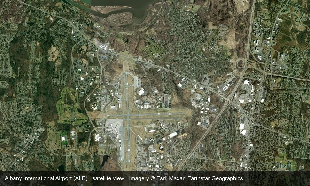
Satellite view: Albany's runways run along the edge of the Hudson Valley towns, with the terminal and apron east of the field.
The satellite image comes from Esri World Imagery (© Esri, Maxar, Earthstar Geographics); the field and attribution are labelled in the image. This is a satellite view, not a ground-level photograph.
Airport at a glance
| Item | Detail |
|---|---|
| IATA / ICAO | ALB / KALB |
| Role | Large airport |
| Elevation | about 87 m |
| Coordinates | 42.7483, -73.8017 |
| Runways | 2, longest 2,591 m |
| Non-stop destinations | 19 (2014 snapshot, all domestic US) |
| Official site | www.albanyairport.com |
Nearby airports
If nothing fits, these nearby fields are worth comparing:
| Airport | Distance |
|---|---|
| Adirondack Regional Airport (SLK) | 185 km |
| Westchester County Airport (HPN) | 187 km |
| LaGuardia Airport (LGA) | 219 km |
Before you fly
- Allow 90–120 minutes for a domestic departure; upstate New York winter weather can disrupt flights.
- The 19 destinations are a 2014 snapshot and Southwest and AirTran have consolidated routes; check current schedules.
About the data
Runways, elevation and coordinates come from OurAirports open data. Routes and carriers come from the June 2014 OpenFlights snapshot and include codeshares and interline services; they indicate network shape and scale, not current schedules.
Komentar pembacaDiskusi
Pertanyaan, laporan perjalanan, dan koreksi sangat kami harapkan. Komentar bersifat publik.
Memuat…
Memuat komentar…