
Bill & Hillary Clinton National Airport/Adams Field
 Little Rock · สหรัฐอเมริกา· Bill & Hillary Clinton National Airport/Adams Field
Bill & Hillary Clinton National Airport/Adams Field (IATA: LIT, ICAO KLIT) เป็นสนามบินขนาดกลางที่ให้บริการLittle Rock, สหรัฐอเมริกา
Bill & Hillary Clinton National Airport/Adams Field is a medium-sized airport, at an elevation of about 262 ft, with scheduled passenger service. This page gathers its location map, airport codes and travel information.
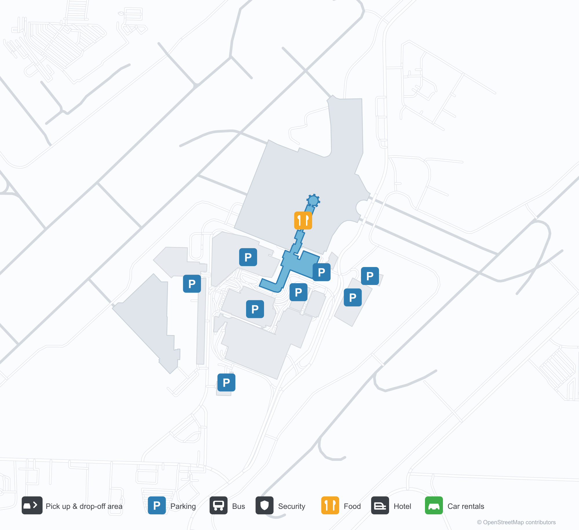
ดาวน์โหลดแผนที่สนามบินดาวน์โหลด
ภาพสนามบินภาพสนามบิน
ภาพจริงของสนามบินแห่งนี้ พร้อมเครดิตของหน้าเว็บสาธารณะที่พบภาพ; ลิขสิทธิ์ยังเป็นของผู้ถ่ายภาพต้นฉบับ คลิกที่ภาพเพื่อขยาย หรือคลิกบรรทัดเครดิตเพื่อเปิดหน้าแหล่งที่มา
ภาพถ่ายดาวเทียม: ทางวิ่งของลิตเทิลร็อกทอดเลียบฝั่งใต้ของแม่น้ำอาร์คันซอ โดยมีอาคารผู้โดยสารและลานจอดอยู่ทางเหนือของสนามบิน
แผนที่เส้นทาง Bill & Hillary Clinton National Airport/Adams Field — จุดหมายบินตรงแผนที่เส้นทาง
17 จุดหมายบินตรง: แผนที่ สายการบินที่ให้บริการ และระยะทาง
เที่ยวบินของBill & Hillary Clinton National Airport/Adams Field — ขาออกและขาเข้าป้ายเที่ยวบิน
965 หมายเลขเที่ยวบิน ครอบคลุม 29 สายการบิน และ 16 จุดหมายปลายทาง แยกตามทิศทาง หมายเลขเที่ยวบินร่วม (codeshare) รวมอยู่ด้วย
| เที่ยวบิน | สายการบิน | จุดหมายปลายทาง | ประเทศ/ภูมิภาค |
|---|---|---|---|
| AA3345 | American Airlines | Dallas Fort Worth International Airport | สหรัฐอเมริกา |
| AA3354 | American Airlines | Dallas Fort Worth International Airport | สหรัฐอเมริกา |
| AA3371 | American Airlines | Charlotte Douglas International Airport | สหรัฐอเมริกา |
| AA3400 | American Airlines | ท่าอากาศยานนานาชาติโอแฮร์ | สหรัฐอเมริกา |
| AA3403 | American Airlines | ท่าอากาศยานนานาชาติโอแฮร์ | สหรัฐอเมริกา |
| AA3408 | American Airlines | Dallas Fort Worth International Airport | สหรัฐอเมริกา |
| AA3410 | American Airlines | Dallas Fort Worth International Airport | สหรัฐอเมริกา |
| AA3411 | American Airlines | ท่าอากาศยานนานาชาติโอแฮร์ | สหรัฐอเมริกา |
| AA3415 | American Airlines | Dallas Fort Worth International Airport | สหรัฐอเมริกา |
| AA3475 | American Airlines | Dallas Fort Worth International Airport | สหรัฐอเมริกา |
| AA3505 | American Airlines | Dallas Fort Worth International Airport | สหรัฐอเมริกา |
| AA3520 | American Airlines | Dallas Fort Worth International Airport | สหรัฐอเมริกา |
| AA3563 | American Airlines | Phoenix Sky Harbor International Airport | สหรัฐอเมริกา |
| AA3565 | American Airlines | Dallas Fort Worth International Airport | สหรัฐอเมริกา |
| AA3581 | American Airlines | ท่าอากาศยานนานาชาติโอแฮร์ | สหรัฐอเมริกา |
| AA3588 | American Airlines | ท่าอากาศยานนานาชาติโอแฮร์ | สหรัฐอเมริกา |
| AA3589 | American Airlines | Dallas Fort Worth International Airport | สหรัฐอเมริกา |
| AA3598 | American Airlines | Charlotte Douglas International Airport | สหรัฐอเมริกา |
| AA3603 | American Airlines | Phoenix Sky Harbor International Airport | สหรัฐอเมริกา |
| AA3605 | American Airlines | Dallas Fort Worth International Airport | สหรัฐอเมริกา |
หมายเลขเที่ยวบินและเส้นทางจากดัชนีเที่ยวบิน aviability.com (ข้อมูล ณ วันที่ 26 ตุลาคม 2569); รวมหมายเลขเที่ยวบินร่วมและไม่แสดงเวลาเดินทาง ที่มา: aviability.com ↗
ข้อมูลและรายละเอียดสนามบินรายละเอียดสนามบิน
แผนที่อินเทอร์แอกทีฟ — ตำแหน่ง Bill & Hillary Clinton National Airport/Adams Fieldแผนที่อินเทอร์แอกทีฟ
ดูสนามบินนี้บนบริการแผนที่อื่น:
Little Rock Airport (LIT): Seventeen Domestic Routes by the Arkansas Riverคู่มือสนามบิน
Seen from above, Little Rock's runways run along the south bank of the Arkansas River, with the terminal and apron north of the field. The airport serves Little Rock, Arkansas, at an elevation of about 80 m, with three runways up to 2,522 m; the 2014 snapshot records 17 domestic destinations, from Dallas at 476 km to Las Vegas at 2,079 km.
Satellite view
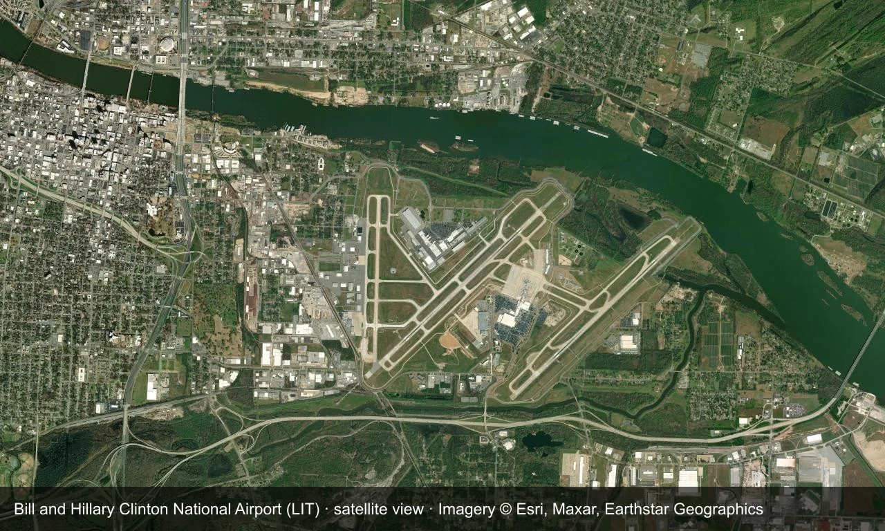
Satellite view: Little Rock's runways run along the south bank of the Arkansas River, with the terminal and apron north of the field.
The satellite image comes from Esri World Imagery (© Esri, Maxar, Earthstar Geographics); the field and attribution are labelled in the image. This is a satellite view, not a ground-level photograph.
Airport at a glance
| Item | Detail |
|---|---|
| IATA / ICAO | LIT / KLIT |
| Role | Medium-sized airport |
| Elevation | about 80 m |
| Coordinates | 34.7292, -92.2236 |
| Runways | 3, longest 2,522 m |
| Non-stop destinations | 17 (2014 snapshot, all domestic US) |
| Official site | www.clintonairport.com |
Nearby airports
If nothing fits, these nearby fields are worth comparing:
| Airport | Distance |
|---|---|
| Arkansas International Airport (BYH) | 248 km |
| Alexandria International Airport (AEX) | 380 km |
| Ardmore Municipal Airport (ADM) | 442 km |
Before you fly
- Allow 90–120 minutes for a domestic departure; Dallas and Atlanta are the usual connections.
- The 17 destinations are a 2014 snapshot and Southwest and American have adjusted routes; check current schedules.
About the data
Runways, elevation and coordinates come from OurAirports open data. Routes and carriers come from the June 2014 OpenFlights snapshot and include codeshares and interline services; they indicate network shape and scale, not current schedules.
ความคิดเห็นจากผู้อ่านการสนทนา
ยินดีรับคำถาม รายงานการเดินทาง และการแก้ไข ความคิดเห็นเป็นสาธารณะ
กำลังโหลด…
กำลังโหลดความคิดเห็น…