
Akita Airport
 Akita · ญี่ปุ่น· Akita Airport
Akita Airport (IATA: AXT, ICAO RJSK) เป็นสนามบินขนาดกลางที่ให้บริการAkita, ญี่ปุ่น
Akita Airport is a medium-sized airport, at an elevation of about 313 ft, with scheduled passenger service. This page gathers its location map, airport codes and travel information.
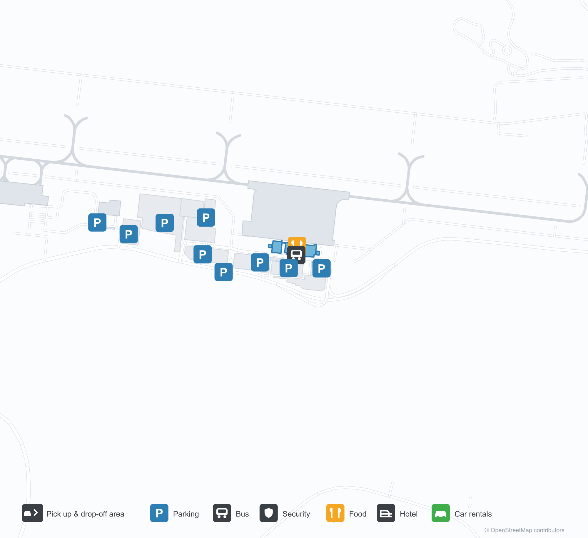
ดาวน์โหลดแผนที่สนามบินดาวน์โหลด
ภาพสนามบินภาพสนามบิน
ภาพจริงของสนามบินแห่งนี้ พร้อมเครดิตของหน้าเว็บสาธารณะที่พบภาพ; ลิขสิทธิ์ยังเป็นของผู้ถ่ายภาพต้นฉบับ คลิกที่ภาพเพื่อขยาย หรือคลิกบรรทัดเครดิตเพื่อเปิดหน้าแหล่งที่มา
อาคารผู้โดยสารของอากิตะยามพลบค่ำ — ตัวอักษร '秋田空港' เหนือด้านหน้าสีอิฐ หอบังคับการบินอยู่ตรงกลาง และแสงโทนอุ่นอยู่หลังกระจก
ด้านหน้าอาคารผู้โดยสารในยามกลางวัน — แถบผนังสีสนิมแดงสลับกระจกสีเข้ม มีการจราจรเบา ๆ บนถนนลานหน้า
ข้างทางเข้าอาคารผู้โดยสาร — เสาและกระถางต้นไม้ใต้ชายคาสีส้ม ทางเดินไปยังลานจอดรถอยู่ไกลออกไป
แผนที่เส้นทาง Akita Airport — จุดหมายบินตรงแผนที่เส้นทาง
5 จุดหมายบินตรง: แผนที่ สายการบินที่ให้บริการ และระยะทาง
เที่ยวบินของAkita Airport — ขาออกและขาเข้าป้ายเที่ยวบิน
91 หมายเลขเที่ยวบิน ครอบคลุม 16 สายการบิน และ 6 จุดหมายปลายทาง แยกตามทิศทาง หมายเลขเที่ยวบินร่วม (codeshare) รวมอยู่ด้วย
| เที่ยวบิน | สายการบิน | จุดหมายปลายทาง | ประเทศ/ภูมิภาค |
|---|---|---|---|
| AM7745 | Aeroméxico | ท่าอากาศยานโตเกียวฮาเนดะ | ญี่ปุ่น |
| AS7362 | Alaska Airlines | ท่าอากาศยานโตเกียวฮาเนดะ | ญี่ปุ่น |
| AS7363 | Alaska Airlines | ท่าอากาศยานโตเกียวฮาเนดะ | ญี่ปุ่น |
| AY5069 | Finnair | ท่าอากาศยานโตเกียวฮาเนดะ | ญี่ปุ่น |
| AY5284 | Finnair | ท่าอากาศยานโตเกียวฮาเนดะ | ญี่ปุ่น |
| AZ2801 | ITA Airways | ท่าอากาศยานโตเกียวฮาเนดะ | ญี่ปุ่น |
| CI8442 | China Airlines | ท่าอากาศยานโตเกียวฮาเนดะ | ญี่ปุ่น |
| CI8444 | China Airlines | ท่าอากาศยานโตเกียวฮาเนดะ | ญี่ปุ่น |
| CI8446 | China Airlines | ท่าอากาศยานโตเกียวฮาเนดะ | ญี่ปุ่น |
| CI8448 | China Airlines | ท่าอากาศยานโตเกียวฮาเนดะ | ญี่ปุ่น |
| GA9355 | Garuda Indonesia | ท่าอากาศยานโตเกียวฮาเนดะ | ญี่ปุ่น |
| IT257 | Tigerair Taiwan | Taiwan Taoyuan International Airport | ไต้หวัน |
| JL162 | Japan Airlines | ท่าอากาศยานโตเกียวฮาเนดะ | ญี่ปุ่น |
| JL164 | Japan Airlines | ท่าอากาศยานโตเกียวฮาเนดะ | ญี่ปุ่น |
| JL166 | Japan Airlines | ท่าอากาศยานโตเกียวฮาเนดะ | ญี่ปุ่น |
| JL168 | Japan Airlines | ท่าอากาศยานโตเกียวฮาเนดะ | ญี่ปุ่น |
| JL2172 | Japan Airlines | Osaka Itami International Airport | ญี่ปุ่น |
| JL2174 | Japan Airlines | Osaka Itami International Airport | ญี่ปุ่น |
| JL2176 | Japan Airlines | Osaka Itami International Airport | ญี่ปุ่น |
| JL2824 | Japan Airlines | ซัปโปโร (OKD) Sapporo Okadama Airport | ญี่ปุ่น |
หมายเลขเที่ยวบินและเส้นทางจากดัชนีเที่ยวบิน aviability.com (ข้อมูล ณ วันที่ 26 ตุลาคม 2569); รวมหมายเลขเที่ยวบินร่วมและไม่แสดงเวลาเดินทาง ที่มา: aviability.com ↗
ข้อมูลและรายละเอียดสนามบินรายละเอียดสนามบิน
แผนที่อินเทอร์แอกทีฟ — ตำแหน่ง Akita Airportแผนที่อินเทอร์แอกทีฟ
ดูสนามบินนี้บนบริการแผนที่อื่น:
Akita Airport (AXT): A Brick-Red Terminal and Five Routesคู่มือสนามบิน
At dusk, the "Akita Airport" lettering and the tower glow above a brick-red façade, with the glass frontage lit from within. The daytime photo shows the same rhythm of ochre panels and dark glazing bands. The airport serves Akita, Japan, at an elevation of about 95 m, with a 2,499 m runway; the 2014 snapshot records five destinations, four domestic and one international, from Sapporo at 372 km to Seoul at 1,220 km.
Airport photos
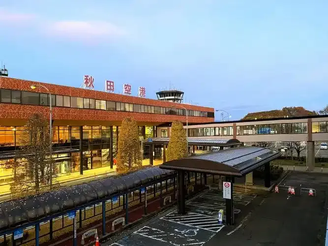
Akita's terminal at dusk — '秋田空港' lettered above the brick-toned façade, the control tower at its centre and warm light behind the glass.

The terminal front by day — bands of rust-red cladding between dark glazing, with light traffic on the forecourt road.
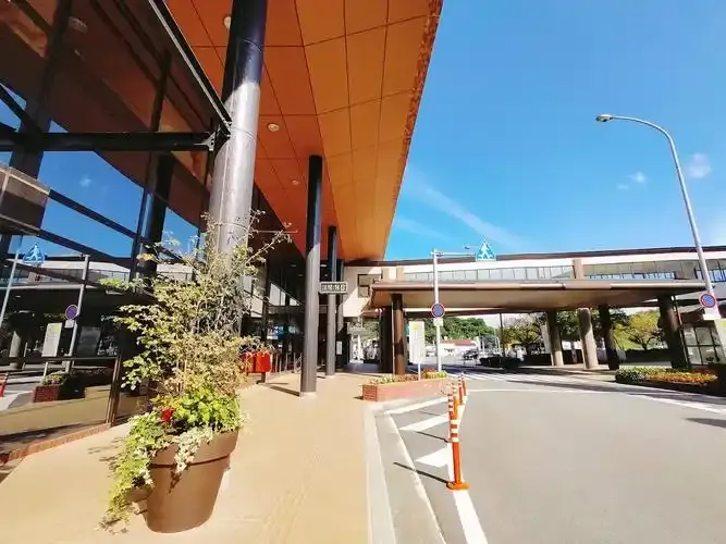
Beside the terminal entrance — columns and planters beneath the orange soffit, a walkway to the car park beyond.
The photos come from public web sources and remain the copyright of their photographers; full credits and source links sit in the photo gallery on this page.
Airport at a glance
| Item | Detail |
|---|---|
| IATA / ICAO | AXT / RJSK |
| Role | Medium-sized airport |
| Elevation | about 95 m |
| Coordinates | 39.6156, 140.2190 |
| Runways | 1, 2,499 m |
| Non-stop destinations | 5 (4 domestic, 1 international; 2014 snapshot) |
Runways
| Runway | Length | Width | Surface |
|---|---|---|---|
| 10/28 | 2,499 m | 61 m | asphalt |
1 runway, the longest 2,499 m.
Non-stop routes
5 non-stop destinations, nearest first (OpenFlights route snapshot compiled in 2014 — confirm with the airline or airport):
| Destination | Distance | Carriers |
|---|---|---|
| New Chitose Airport (CTS) | ~372 km | Japan Airlines Domestic, All Nippon Airways |
| Tokyo Haneda International Airport (HND) | ~454 km | Japan Airlines Domestic, All Nippon Airways |
| Chubu Centrair International Airport (NGO) | ~609 km | All Nippon Airways |
| Osaka Itami International Airport (ITM) | ~684 km | Japan Airlines Domestic, All Nippon Airways |
| Incheon International Airport (ICN) | ~1220 km | Korean Air |
The carrier column comes from the same snapshot and includes codeshare and interline services; treat it as an indication of how busy the route is and check the airline for who actually flies it.
Nearby airports to compare
If the fares are close, these are the nearest airports of the same class (medium-sized airport) — straight-line distance, with their own non-stop counts from the same dataset:
| Airport | Distance | Non-stop destinations |
|---|---|---|
| Asahikawa Airport (AKJ) | ~487 km | 3 |
Before you fly
- Allow 90–120 minutes for domestic and about 2 hours for the Seoul flight.
- Akita sees heavy winter snow; early flights can be affected by de-icing and runway clearing, so leave a buffer.
About the data
Runways, elevation and coordinates come from OurAirports open data. Routes and carriers come from the June 2014 OpenFlights snapshot and include codeshares and interline services; they indicate network shape and scale, not current schedules.
History
Operated by Akita Prefecture about 14 km south-east of Akita Station, the field has a single 2,500 m asphalt-concrete runway and is the prefecture's principal air link.
Source: Akita Airport.
ความคิดเห็นจากผู้อ่านการสนทนา
ยินดีรับคำถาม รายงานการเดินทาง และการแก้ไข ความคิดเห็นเป็นสาธารณะ
กำลังโหลด…
กำลังโหลดความคิดเห็น…