
Amami Airport
 Amami · ญี่ปุ่น· Amami Airport
Amami Airport (IATA: ASJ, ICAO RJKA) เป็นสนามบินขนาดกลางที่ให้บริการAmami, ญี่ปุ่น
Amami Airport is a medium-sized airport, at an elevation of about 27 ft, with scheduled passenger service. This page gathers its location map, airport codes and travel information.
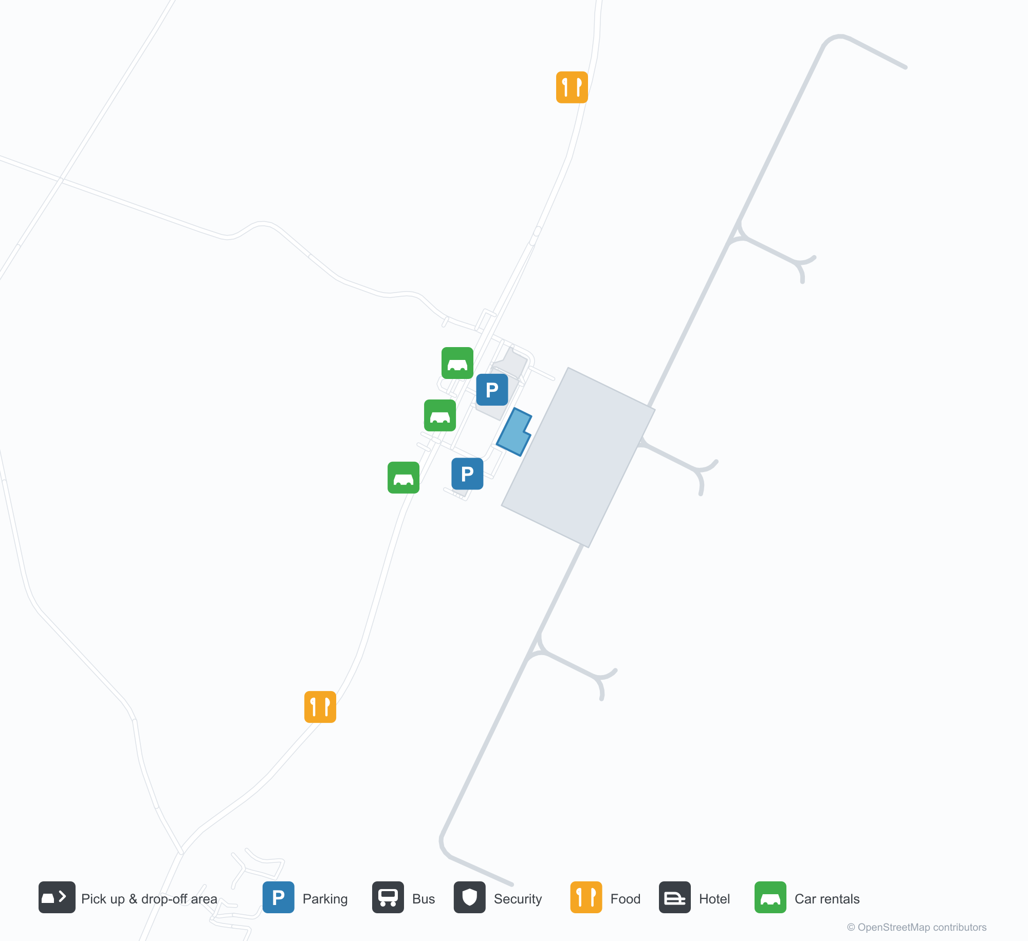
ดาวน์โหลดแผนที่สนามบินดาวน์โหลด
ภาพสนามบินภาพสนามบิน
ภาพจริงของสนามบินแห่งนี้ พร้อมเครดิตของหน้าเว็บสาธารณะที่พบภาพ; ลิขสิทธิ์ยังเป็นของผู้ถ่ายภาพต้นฉบับ คลิกที่ภาพเพื่อขยาย หรือคลิกบรรทัดเครดิตเพื่อเปิดหน้าแหล่งที่มา
บนลานจอดหน้าอาคารผู้โดยสาร — ผู้โดยสารพร้อมสัมภาระมุ่งไปยังอาคารที่เขียนว่า 'AMAMI' โดยมีเจ้าหน้าที่ภาคพื้นชี้ทาง
อากาศยานของ Japan Air Commuter ที่ช่องจอด — เครื่องบินเจ็ตภูมิภาคสองลำกำลังขึ้นเครื่องใต้ป้าย โดยมีทะเลอยู่เลยทางวิ่งออกไป
อามามิมองจากอากาศ — ทางวิ่งทอดเลียบชายฝั่ง ผืนน้ำที่เต็มไปด้วยแนวปะการังทอดยาวอยู่ด้านล่าง
แผนที่เส้นทาง Amami Airport — จุดหมายบินตรงแผนที่เส้นทาง
2 จุดหมายบินตรง: แผนที่ สายการบินที่ให้บริการ และระยะทาง
เที่ยวบินของAmami Airport — ขาออกและขาเข้าป้ายเที่ยวบิน
63 หมายเลขเที่ยวบิน ครอบคลุม 8 สายการบิน และ 10 จุดหมายปลายทาง แยกตามทิศทาง หมายเลขเที่ยวบินร่วม (codeshare) รวมอยู่ด้วย
| เที่ยวบิน | สายการบิน | จุดหมายปลายทาง | ประเทศ/ภูมิภาค |
|---|---|---|---|
| AS7958 | Alaska Airlines | ท่าอากาศยานโตเกียวฮาเนดะ | ญี่ปุ่น |
| BC382 | Skymark Airlines | คาโกชิมะ (KOJ) Kagoshima Airport | ญี่ปุ่น |
| BC388 | Skymark Airlines | คาโกชิมะ (KOJ) Kagoshima Airport | ญี่ปุ่น |
| CI9900 | China Airlines | คาโกชิมะ (KOJ) Kagoshima Airport | ญี่ปุ่น |
| CI9924 | China Airlines | Fukuoka Airport | ญี่ปุ่น |
| JL658 | Japan Airlines | ท่าอากาศยานโตเกียวฮาเนดะ | ญี่ปุ่น |
| JL2464 | Japan Airlines | Osaka Itami International Airport | ญี่ปุ่น |
| JL2468 | Japan Airlines | Osaka Itami International Airport | ญี่ปุ่น |
| JL3684 | Japan Airlines | Fukuoka Airport | ญี่ปุ่น |
| JL3722 | Japan Airlines | คาโกชิมะ (KOJ) Kagoshima Airport | ญี่ปุ่น |
| JL3724 | Japan Airlines | คาโกชิมะ (KOJ) Kagoshima Airport | ญี่ปุ่น |
| JL3726 | Japan Airlines | คาโกชิมะ (KOJ) Kagoshima Airport | ญี่ปุ่น |
| JL3728 | Japan Airlines | คาโกชิมะ (KOJ) Kagoshima Airport | ญี่ปุ่น |
| JL3730 | Japan Airlines | คาโกชิมะ (KOJ) Kagoshima Airport | ญี่ปุ่น |
| JL3734 | Japan Airlines | คาโกชิมะ (KOJ) Kagoshima Airport | ญี่ปุ่น |
| JL3738 | Japan Airlines | คาโกชิมะ (KOJ) Kagoshima Airport | ญี่ปุ่น |
| JL3831 | Japan Airlines | Kikai (KKX) Kikai Airport | ญี่ปุ่น |
| JL3837 | Japan Airlines | Kikai (KKX) Kikai Airport | ญี่ปุ่น |
| JL3841 | Japan Airlines | Amagi (TKN) Tokunoshima Airport | ญี่ปุ่น |
| JL3843 | Japan Airlines | Amagi (TKN) Tokunoshima Airport | ญี่ปุ่น |
หมายเลขเที่ยวบินและเส้นทางจากดัชนีเที่ยวบิน aviability.com (ข้อมูล ณ วันที่ 26 ตุลาคม 2569); รวมหมายเลขเที่ยวบินร่วมและไม่แสดงเวลาเดินทาง ที่มา: aviability.com ↗
ข้อมูลและรายละเอียดสนามบินรายละเอียดสนามบิน
แผนที่อินเทอร์แอกทีฟ — ตำแหน่ง Amami Airportแผนที่อินเทอร์แอกทีฟ
ดูสนามบินนี้บนบริการแผนที่อื่น:
Amami Airport (ASJ): A Coastal Runway and Two Mainland Routesคู่มือสนามบิน
In one photo, passengers with bags walk towards the terminal marked "AMAMI" while ground crew guide them. Another shows two Japan Air Commuter (JAC) regional aircraft at the stands, the airport pressed against the coastline; from the air, the runway follows the shore with sea and coral visible beneath the wing. The airport serves Amami, Japan, at an elevation of about 8 m, with a 1,999 m runway; the 2014 snapshot records two domestic destinations, Osaka Itami at 890 km and Tokyo Haneda at 1,235 km.
Airport photos

On the apron before the terminal — passengers with luggage heading for the building marked 'AMAMI', ground staff directing them.
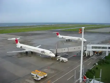
Japan Air Commuter aircraft at the stands — two regional jets boarding beneath the signs, the sea just beyond the runway.
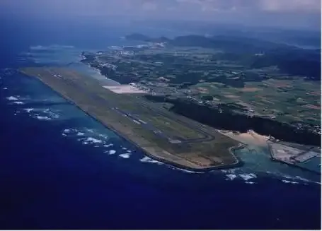
Amami from the air — the runway strung along the coast, reef-flecked water stretching below.
The photos come from public web sources and remain the copyright of their photographers; full credits and source links sit in the photo gallery on this page.
Airport at a glance
| Item | Detail |
|---|---|
| IATA / ICAO | ASJ / RJKA |
| Role | Medium-sized airport |
| Elevation | about 8 m |
| Coordinates | 28.4306, 129.7130 |
| Runways | 1, 1,999 m |
| Non-stop destinations | 2 (2014 snapshot, all domestic) |
Runways
| Runway | Length | Width | Surface |
|---|---|---|---|
| 03/21 | 1,999 m | 46 m | asphalt |
1 runway, the longest 1,999 m.
Non-stop routes
2 non-stop destinations, nearest first (OpenFlights route snapshot compiled in 2014 — confirm with the airline or airport):
| Destination | Distance | Carriers |
|---|---|---|
| Osaka Itami International Airport (ITM) | ~890 km | Japan Airlines Domestic |
| Tokyo Haneda International Airport (HND) | ~1235 km | Japan Airlines Domestic |
The carrier column comes from the same snapshot and includes codeshare and interline services; treat it as an indication of how busy the route is and check the airline for who actually flies it.
Nearby airports to compare
If the fares are close, these are the nearest airports of the same class (medium-sized airport) — straight-line distance, with their own non-stop counts from the same dataset:
| Airport | Distance | Non-stop destinations |
|---|---|---|
| Amakusa Airport (AXJ) | ~453 km | — |
Before you fly
- With two mainland routes, 90–120 minutes is usually enough; typhoon season and coastal wind can affect flights.
- The airport sits by the coast; buses or rental cars handle onward transport, so check connection times before arrival.
About the data
Runways, elevation and coordinates come from OurAirports open data. Routes and carriers come from the June 2014 OpenFlights snapshot and include codeshares and interline services; they indicate network shape and scale, not current schedules.
History
On Amami Ōshima about 22 km from the city, the field was long called Amami Oshima Airport before shortening to its present name; its routes mainly link the island with Kagoshima, Tokyo and Osaka.
Source: Amami Airport.
ความคิดเห็นจากผู้อ่านการสนทนา
ยินดีรับคำถาม รายงานการเดินทาง และการแก้ไข ความคิดเห็นเป็นสาธารณะ
กำลังโหลด…
กำลังโหลดความคิดเห็น…