
Akita Airport
 Akita · 일본· Akita Airport
Akita Airport(IATA: AXT, ICAO: RJSK)은 일본 Akita에 위치한 중형 공항입니다.
Akita Airport is a medium-sized airport, at an elevation of about 313 ft, with scheduled passenger service. This page gathers its location map, airport codes and travel information.
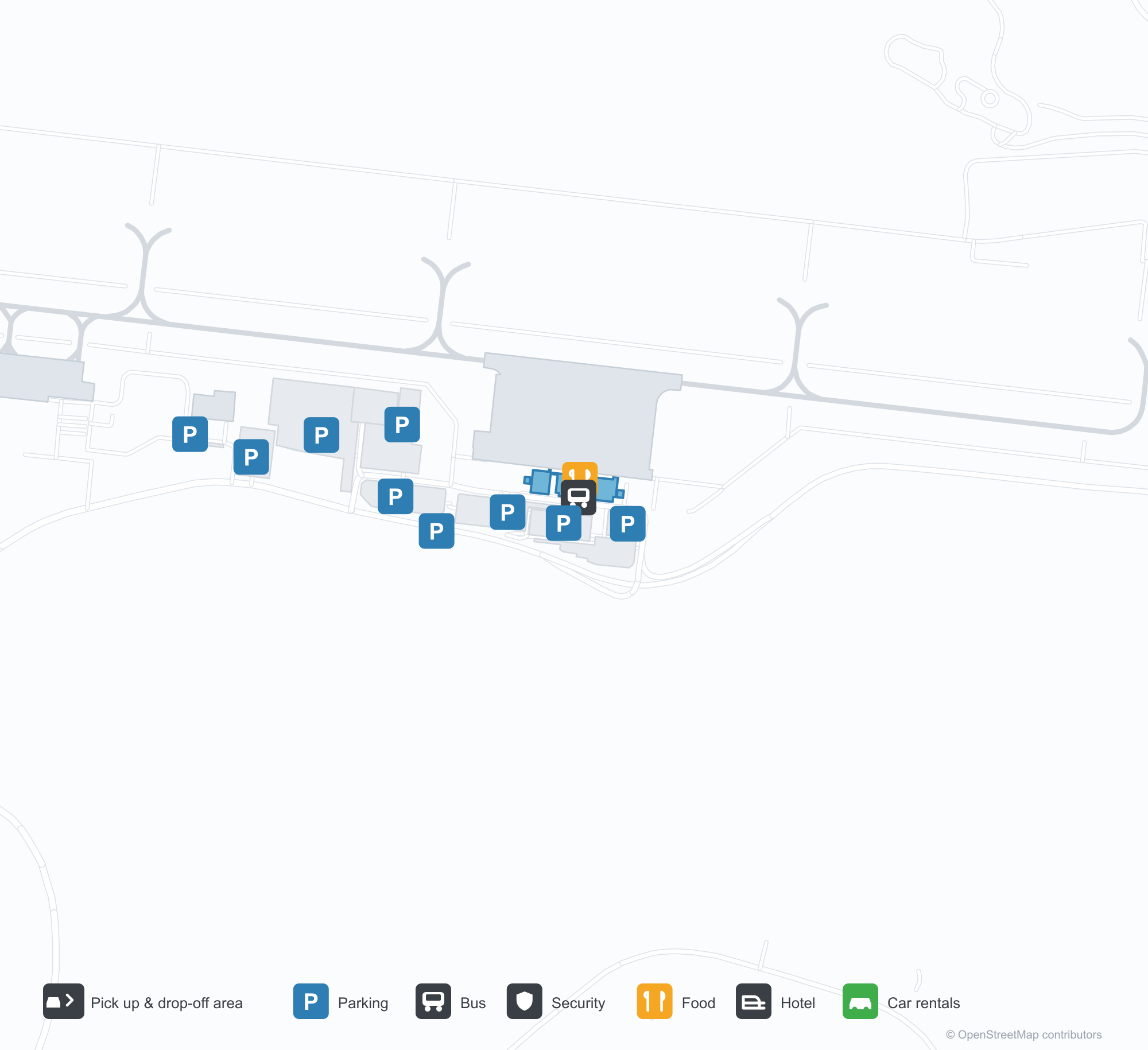
공항 지도 다운로드다운로드
공항 실제 사진공항 사진
다음은 이 공항의 실제 사진으로, 모두 공개된 인터넷 출처에서 가져왔으며 사진마다 출처를 표시했습니다. 저작권은 원저작자에게 있습니다. 사진을 클릭하면 크게 볼 수 있고, 출처를 클릭하면 원본 페이지가 열립니다.
해질녘의 아키타 터미널 — 벽돌색 외벽 위에 적힌 '秋田空港', 가운데의 관제탑, 유리 뒤로 비치는 따뜻한 빛.
낮의 터미널 정면 — 어두운 유리 사이로 이어지는 녹슨 붉은색 외장재, 앞마당 도로의 한산한 차량.
터미널 출입구 옆 — 주황색 처마 밑의 기둥과 화분, 너머 주차장으로 이어지는 보도.
Akita Airport 노선도 · 직항 목적지노선도
직항 목적지 5개: 노선도, 운항 항공사, 비행 거리.
공항 정보 및 상세공항 상세
Akita Airport 인터랙티브 지도 — 공항 위치인터랙티브 지도
다른 지도 서비스에서 이 공항 보기:
Akita Airport (AXT): A Brick-Red Terminal and Five Routes공항 안내
At dusk, the "Akita Airport" lettering and the tower glow above a brick-red façade, with the glass frontage lit from within. The daytime photo shows the same rhythm of ochre panels and dark glazing bands. The airport serves Akita, Japan, at an elevation of about 95 m, with a 2,499 m runway; the 2014 snapshot records five destinations, four domestic and one international, from Sapporo at 372 km to Seoul at 1,220 km.
Airport photos
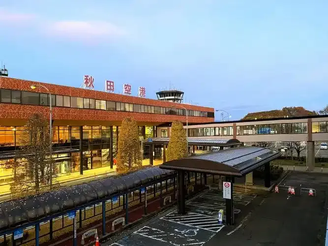
Akita's terminal at dusk — '秋田空港' lettered above the brick-toned façade, the control tower at its centre and warm light behind the glass.
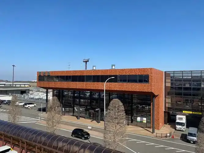
The terminal front by day — bands of rust-red cladding between dark glazing, with light traffic on the forecourt road.
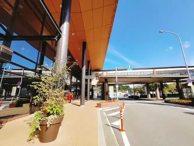
Beside the terminal entrance — columns and planters beneath the orange soffit, a walkway to the car park beyond.
The photos come from public web sources and remain the copyright of their photographers; full credits and source links sit in the photo gallery on this page.
Airport at a glance
| Item | Detail |
|---|---|
| IATA / ICAO | AXT / RJSK |
| Role | Medium-sized airport |
| Elevation | about 95 m |
| Coordinates | 39.6156, 140.2190 |
| Runways | 1, 2,499 m |
| Non-stop destinations | 5 (4 domestic, 1 international; 2014 snapshot) |
Runways
| Runway | Length | Width | Surface |
|---|---|---|---|
| 10/28 | 2,499 m | 61 m | asphalt |
1 runway, the longest 2,499 m.
Non-stop routes
5 non-stop destinations, nearest first (OpenFlights route snapshot compiled in 2014 — confirm with the airline or airport):
| Destination | Distance | Carriers |
|---|---|---|
| New Chitose Airport (CTS) | ~372 km | Japan Airlines Domestic, All Nippon Airways |
| Tokyo Haneda International Airport (HND) | ~454 km | Japan Airlines Domestic, All Nippon Airways |
| Chubu Centrair International Airport (NGO) | ~609 km | All Nippon Airways |
| Osaka Itami International Airport (ITM) | ~684 km | Japan Airlines Domestic, All Nippon Airways |
| Incheon International Airport (ICN) | ~1220 km | Korean Air |
The carrier column comes from the same snapshot and includes codeshare and interline services; treat it as an indication of how busy the route is and check the airline for who actually flies it.
Nearby airports to compare
If the fares are close, these are the nearest airports of the same class (medium-sized airport) — straight-line distance, with their own non-stop counts from the same dataset:
| Airport | Distance | Non-stop destinations |
|---|---|---|
| Asahikawa Airport (AKJ) | ~487 km | 3 |
Before you fly
- Allow 90–120 minutes for domestic and about 2 hours for the Seoul flight.
- Akita sees heavy winter snow; early flights can be affected by de-icing and runway clearing, so leave a buffer.
About the data
Runways, elevation and coordinates come from OurAirports open data. Routes and carriers come from the June 2014 OpenFlights snapshot and include codeshares and interline services; they indicate network shape and scale, not current schedules.
History
Operated by Akita Prefecture about 14 km south-east of Akita Station, the field has a single 2,500 m asphalt-concrete runway and is the prefecture's principal air link.
Source: Akita Airport.