
Angers Marcé airport
 Angers · ฝรั่งเศส· Angers Marcé airport
Angers Marcé airport (IATA: ANE, ICAO LFJR) เป็นสนามบินขนาดกลางที่ให้บริการAngers, ฝรั่งเศส
Angers Marcé airport is a medium-sized airport, at an elevation of about 194 ft. This page gathers its location map, airport codes and travel information.
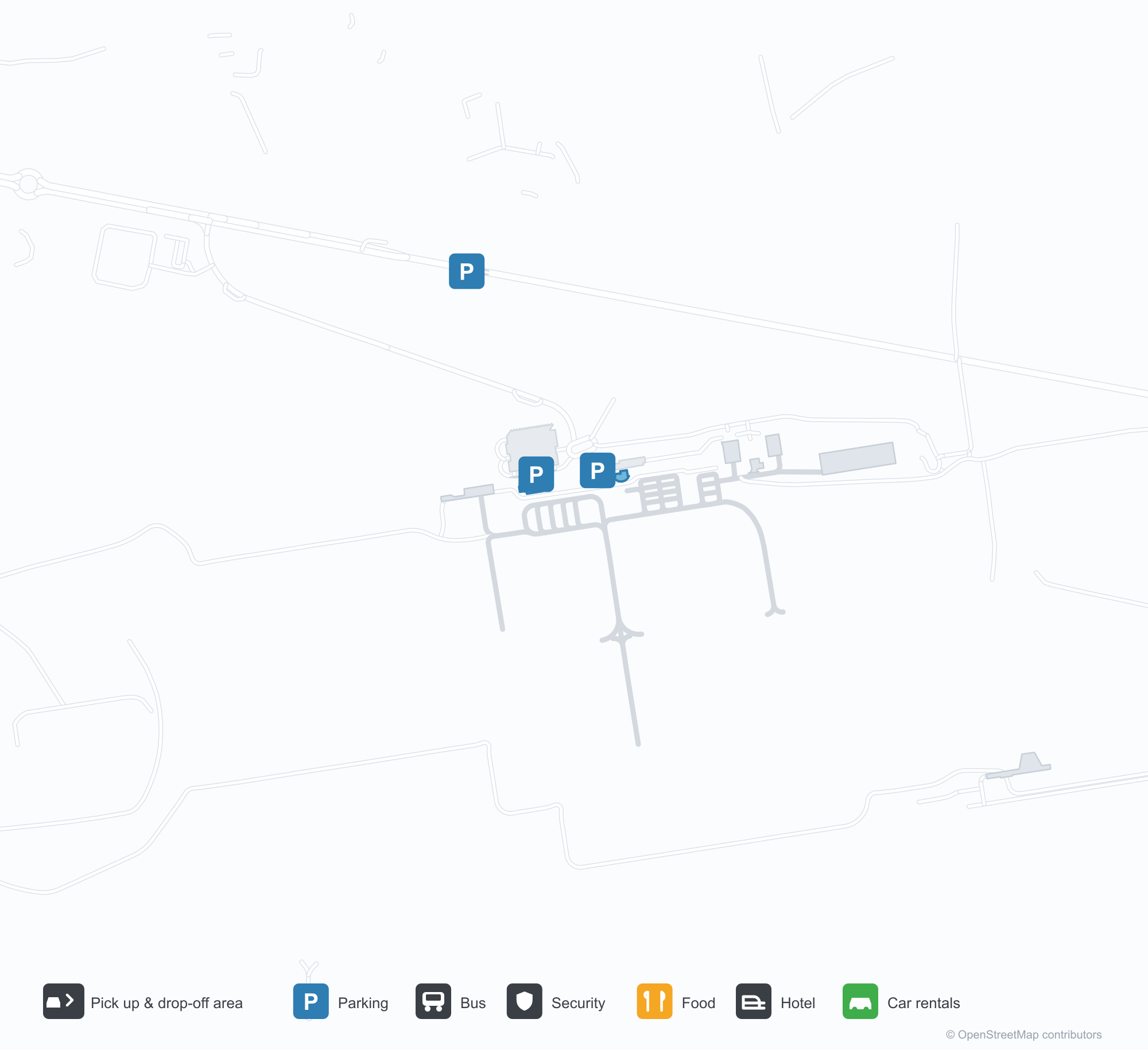
ดาวน์โหลดแผนที่สนามบินดาวน์โหลด
ภาพสนามบินภาพสนามบิน
ภาพจริงของสนามบินแห่งนี้ พร้อมเครดิตของหน้าเว็บสาธารณะที่พบภาพ; ลิขสิทธิ์ยังเป็นของผู้ถ่ายภาพต้นฉบับ คลิกที่ภาพเพื่อขยาย หรือคลิกบรรทัดเครดิตเพื่อเปิดหน้าแหล่งที่มา
ภาพถ่ายดาวเทียม: สนามบินอองเฌ มาร์เซ (ANE) อยู่ท่ามกลางพืชพรรณสีเขียวและพื้นที่เกษตรกรรม
ภายใต้เมฆหนา อาคารผู้โดยสารสีเทาเตี้ย ๆ ทอดยาวกว้าง มีชื่อสนามบินเป็นตัวอักษรสีส้มเหนือกระจก และลานหน้าว่างเปล่าอยู่ด้านหน้า
ในแสงเย็นที่ต่ำ เครื่องบินโดยสารใบพัดพักอยู่หน้าอาคารผู้โดยสาร โดยมีหอบังคับการบินและอาคารเตี้ยที่มีตัวอักษร Angers-Marce อยู่ข้าง ๆ และเจ้าหน้าที่ภาคพื้นอยู่ใกล้ ๆ
ภาพถ่ายทางอากาศแสดงแถวโรงเก็บอากาศยานสีเทาตามลานจอด หอบังคับการบินอยู่ตรงกลาง และเครื่องบินเบาหลายลำจอดอยู่บนคอนกรีต
ภาพหน้าจอจากเครื่องจำลองการบินแสดงทางวิ่ง 26 ทอดตรงไปในระยะไกล โดยมีเส้นกลางทางและเครื่องหมายสัมผัสพื้นชัดเจนระหว่างสนามหญ้าและป่าไม้
ภายใต้ท้องฟ้าสีเทาแบนราบ เครื่องบินเบาสีขาวลำเล็กพักอยู่บนสนามหญ้าข้างป้ายสีแดงที่ระบุ 26-08
บนผนังสีขาวที่ทางเข้าสนามบิน มีกราฟิกเครื่องบินสีส้มอยู่ข้างข้อความ Angers Loire Aéroport โดยมีชื่อตำบลมาร์เซกำกับด้านล่าง
เครื่องบินเบาสีขาวเขียวจอดอยู่ข้างเส้นแท็กซี่สีเหลืองบนลานจอด โดยมีแถวโรงเก็บอากาศยานสีเข้มอยู่ด้านหลังภายใต้ท้องฟ้าใส
ข้อมูลและรายละเอียดสนามบินรายละเอียดสนามบิน
แผนที่อินเทอร์แอกทีฟ — ตำแหน่ง Angers Marcé airportแผนที่อินเทอร์แอกทีฟ
ดูสนามบินนี้บนบริการแผนที่อื่น:
Angers Marcé airport (ANE) Guide: The field and the landscape around itคู่มือสนามบิน
Angers Marcé airport (ANE) serves France. Seen from above, it sits among dense green vegetation and small fields; its elevation is about 59 m above sea level and it has 3 runways, the longest 1,800 m. No scheduled non-stop services are recorded for 2014. The nearest airport is Tours Val de Loire Airport (79.4 km).
Satellite view
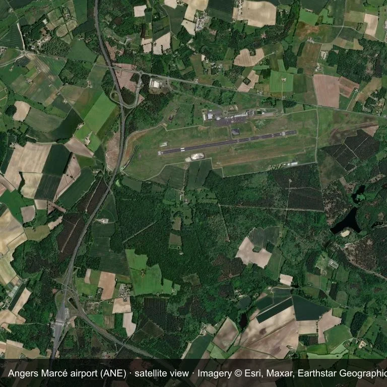
Satellite view: Angers Marcé airport (ANE) set among dense green vegetation and small fields.
Satellite imagery © Esri, Maxar, Earthstar Geographics; the field and attribution are labelled in the image. This is an overhead view, not a ground-level photograph.
Airport at a glance
| Item | Detail |
|---|---|
| IATA / ICAO | ANE / LFJR |
| Role | medium-sized airport |
| Elevation | about 59 m |
| Coordinates | 47.5603, -0.3122 |
| Runways | 3, longest 1,800 m |
| Non-stop destinations | 0 in the 2014 snapshot |
| Official site | www.angers.aeroport.fr/en |
Runways
| Runway | Length | Surface |
|---|---|---|
| 08/26 | 1,800 m | ASP |
| 08R/26L | 1,100 m | GRS |
| 08L/26R | 720 m | GRS |
Why there is no route table
ANE has an empty route table in the 2014 snapshot. The dataset only covers services it recorded, so treat the blank as a gap rather than a closure notice.
Nearby airports
| Airport | Distance | Non-stop destinations |
|---|---|---|
| Tours Val de Loire Airport (TUF) | ~79.4 km | 5 |
| Nantes Atlantique Airport (NTE) | ~108 km | 54 |
| Poitiers-Biard Airport (PIS) | ~118 km | 5 |
Getting there and navigating
- Coordinates: 47.5603, -0.3122
- Official site: www.angers.aeroport.fr/en
- Open in a map: Google Maps | Amap | Baidu Maps
The location map gives the field's position relative to nearby roads and towns. Terminal and local-transport details are outside this dataset.
Local context
The site at Angers Marcé airport is set in dense green vegetation and small fields in France. Its main runway, 08/26, is aligned east–west and measures 1,800 m; the field lies at about 59 m.
With 1,800 m of asphalt, the airport sits in the regional-jet bracket. The paved surface supports regular operations, though it does not imply scheduled service. The closest airport, Tours Val de Loire Airport, lies 79.4 km away, with 5 destinations in the same snapshot.
Because no scheduled routes were captured in 2014, the practical question is charter or private access; ask the operator before building an itinerary around it.
Before you fly
- At 1,800 m, the runway suits turboprops and smaller jets rather than widebodies; confirm the aircraft type with the operator.
- The runway is paved, which supports year-round operations, but scheduled service is still not guaranteed.
- Tours Val de Loire Airport is 79.4 km away with 5 destinations in the 2014 snapshot, making it the nearest alternative for a scheduled flight.
- Treat this as a general-aviation or charter field rather than a large terminal; confirm handling and opening hours in advance.
- The site has no terminal guide on this page, so allow extra time for local arrangements and onward transport.
About the data
Runway and location data follow OurAirports. The route table is the June 2014 OpenFlights snapshot and may lag current airline schedules.
ความคิดเห็นจากผู้อ่านการสนทนา
ยินดีรับคำถาม รายงานการเดินทาง และการแก้ไข ความคิดเห็นเป็นสาธารณะ
กำลังโหลด…
กำลังโหลดความคิดเห็น…