
Angers Marcé airport
 Angers · Francia· Angers Marcé airport
Angers Marcé airport (IATA: ANE, OACI LFJR) es un aeropuerto mediano que da servicio a Angers, Francia.
Angers Marcé airport is a medium-sized airport, at an elevation of about 194 ft. This page gathers its location map, airport codes and travel information.
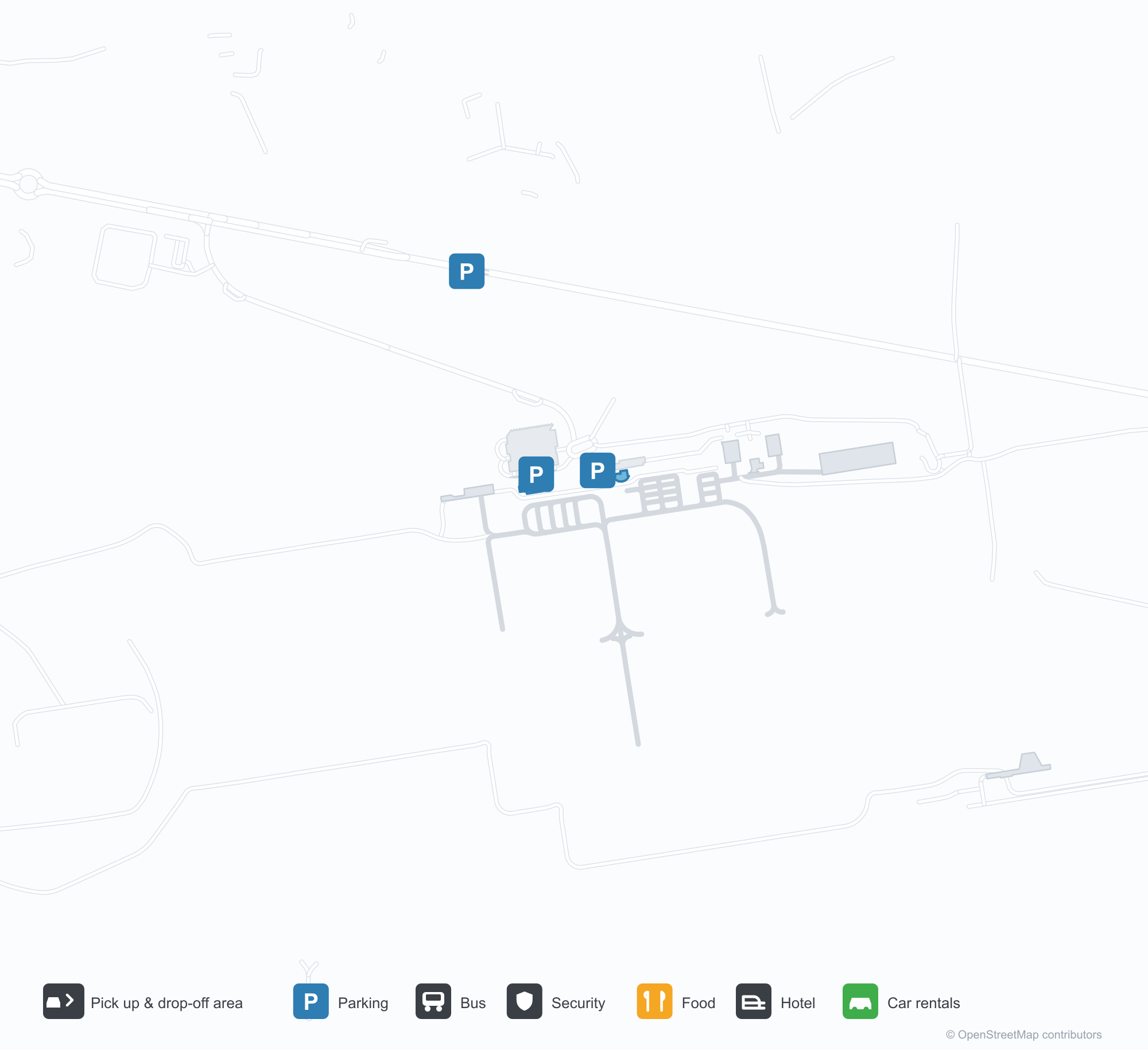
Descargar mapas de aeropuertosDescargas
Fotos del aeropuertoFotos del aeropuerto
Fotos reales de este aeropuerto, cada una con la referencia de la página web pública donde se encontró; los derechos de autor siguen siendo de los fotógrafos originales. Haz clic en una foto para ampliarla o en la línea de crédito para abrir su página de origen.
Vista satelital: el aeropuerto de Angers Marcé (ANE) se encuentra entre vegetación verde y tierras agrícolas.
Bajo nubes densas, la baja terminal gris se extiende ampliamente, con su nombre en letras naranjas sobre el acristalamiento y un patio vacío delante.
Con el sol bajo del atardecer, un avión turbohélice descansa frente a la terminal, con la torre de control y un edificio bajo con el letrero Angers-Marce junto a él y personal de tierra cerca.
Una vista aérea muestra hileras de hangares grises a lo largo de la plataforma, una torre de control en el centro y varias avionetas aparcadas en el hormigón.
Una captura de simulador de vuelo muestra la pista 26 corriendo recta hacia la distancia, con su eje y marcas de toma de contacto nítidos entre hierba y bosque.
Bajo un cielo gris plano, una pequeña avioneta blanca descansa en la hierba junto a un letrero rojo que marca 26-08.
En una pared blanca de la entrada del aeropuerto, un gráfico naranja de un avión aparece junto a las palabras Angers Loire Aéroport, con el municipio de Marcé indicado debajo.
Una avioneta blanca y verde está aparcada junto a líneas amarillas de rodaje en la plataforma, con una fila de hangares oscuros detrás bajo un cielo despejado.
Información y datos del aeropuertoDatos del aeropuerto
Mapa interactivo — ubicación de Angers Marcé airportMapa interactivo
Consulta este aeropuerto en otros servicios de mapas:
Angers Marcé airport (ANE) Guide: The field and the landscape around itGuía del aeropuerto
Angers Marcé airport (ANE) serves France. Seen from above, it sits among dense green vegetation and small fields; its elevation is about 59 m above sea level and it has 3 runways, the longest 1,800 m. No scheduled non-stop services are recorded for 2014. The nearest airport is Tours Val de Loire Airport (79.4 km).
Satellite view
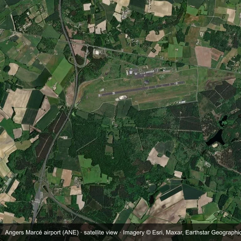
Satellite view: Angers Marcé airport (ANE) set among dense green vegetation and small fields.
Satellite imagery © Esri, Maxar, Earthstar Geographics; the field and attribution are labelled in the image. This is an overhead view, not a ground-level photograph.
Airport at a glance
| Item | Detail |
|---|---|
| IATA / ICAO | ANE / LFJR |
| Role | medium-sized airport |
| Elevation | about 59 m |
| Coordinates | 47.5603, -0.3122 |
| Runways | 3, longest 1,800 m |
| Non-stop destinations | 0 in the 2014 snapshot |
| Official site | www.angers.aeroport.fr/en |
Runways
| Runway | Length | Surface |
|---|---|---|
| 08/26 | 1,800 m | ASP |
| 08R/26L | 1,100 m | GRS |
| 08L/26R | 720 m | GRS |
Why there is no route table
ANE has an empty route table in the 2014 snapshot. The dataset only covers services it recorded, so treat the blank as a gap rather than a closure notice.
Nearby airports
| Airport | Distance | Non-stop destinations |
|---|---|---|
| Tours Val de Loire Airport (TUF) | ~79.4 km | 5 |
| Nantes Atlantique Airport (NTE) | ~108 km | 54 |
| Poitiers-Biard Airport (PIS) | ~118 km | 5 |
Getting there and navigating
- Coordinates: 47.5603, -0.3122
- Official site: www.angers.aeroport.fr/en
- Open in a map: Google Maps | Amap | Baidu Maps
The location map gives the field's position relative to nearby roads and towns. Terminal and local-transport details are outside this dataset.
Local context
The site at Angers Marcé airport is set in dense green vegetation and small fields in France. Its main runway, 08/26, is aligned east–west and measures 1,800 m; the field lies at about 59 m.
With 1,800 m of asphalt, the airport sits in the regional-jet bracket. The paved surface supports regular operations, though it does not imply scheduled service. The closest airport, Tours Val de Loire Airport, lies 79.4 km away, with 5 destinations in the same snapshot.
Because no scheduled routes were captured in 2014, the practical question is charter or private access; ask the operator before building an itinerary around it.
Before you fly
- At 1,800 m, the runway suits turboprops and smaller jets rather than widebodies; confirm the aircraft type with the operator.
- The runway is paved, which supports year-round operations, but scheduled service is still not guaranteed.
- Tours Val de Loire Airport is 79.4 km away with 5 destinations in the 2014 snapshot, making it the nearest alternative for a scheduled flight.
- Treat this as a general-aviation or charter field rather than a large terminal; confirm handling and opening hours in advance.
- The site has no terminal guide on this page, so allow extra time for local arrangements and onward transport.
About the data
Runway and location data follow OurAirports. The route table is the June 2014 OpenFlights snapshot and may lag current airline schedules.
Comentarios de los lectoresDebate
Las preguntas, los relatos de viaje y las correcciones son bienvenidos. Los comentarios son públicos.
Cargando…
Cargando comentarios…