
Aji Pangeran Tumenggung Pranoto International Airport
 Samarinda · อินโดนีเซีย· Aji Pangeran Tumenggung Pranoto International Airport
Aji Pangeran Tumenggung Pranoto International Airport (IATA: AAP, ICAO WALS) เป็นสนามบินขนาดกลางที่ให้บริการSamarinda, อินโดนีเซีย
Aji Pangeran Tumenggung Pranoto International Airport is a medium-sized airport, at an elevation of about 82 ft, with scheduled passenger service. This page gathers its location map, airport codes and travel information.
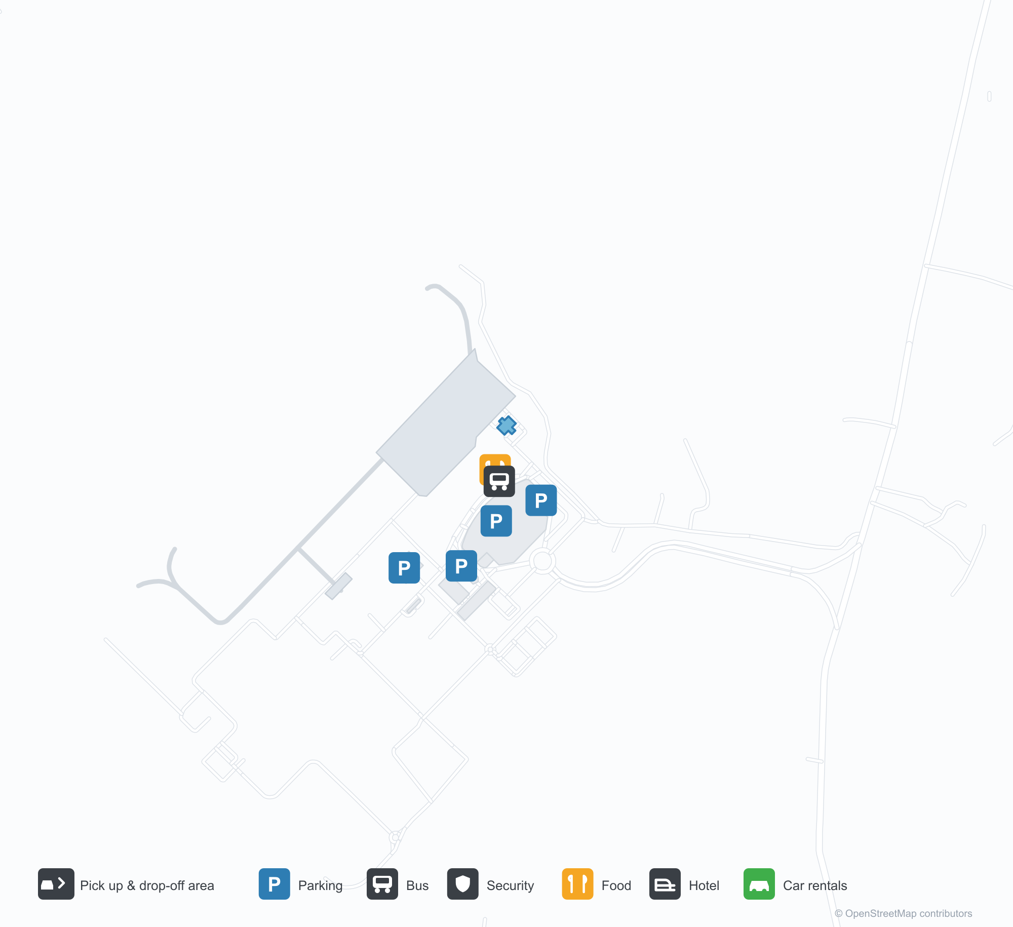
ดาวน์โหลดแผนที่สนามบินดาวน์โหลด
ภาพสนามบินภาพสนามบิน
ภาพจริงของสนามบินแห่งนี้ พร้อมเครดิตของหน้าเว็บสาธารณะที่พบภาพ; ลิขสิทธิ์ยังเป็นของผู้ถ่ายภาพต้นฉบับ คลิกที่ภาพเพื่อขยาย หรือคลิกบรรทัดเครดิตเพื่อเปิดหน้าแหล่งที่มา
อาคารผู้โดยสารของท่าอากาศยานนานาชาติ APT Pranoto ในซามารินดา (Samarinda): ด้านหน้าต่างกระจกกว้างค้ำด้วยโครงเหล็กสีขาวเอียง โดยมีหลังคากันแดดยื่นออกไปเหนือพื้นที่จอดส่งผู้โดยสาร
เครื่องบินใบพัดสีแดงขาวลำหนึ่งจอดรอที่ลานจอด ขณะที่เมฆหนาทึบก่อตัวเหนืออาคารผู้โดยสารกระจกยาวซึ่งมีหลังคารองรับด้วยโครงเหล็กสีขาว
ป้ายตัวอักษรสีแดงที่ทางเข้าสนามบินเขียนชื่อ Aji Pangeran Tumenggung Pranoto โดยมีอาคารผู้โดยสารหลังคาโค้งสีขาวตั้งอยู่ด้านหลัง
ป้ายชื่อสีเขียวและแผ่นป้ายหมายเลขสีเหลืองเรียงตลอดผนังอาคารผู้โดยสาร โดยมีผู้โดยสารเดินข้ามลานคอนกรีตใต้สะพานทางเดินกระจกและเหล็ก
จากสนามหญ้า หลังคาสีเงินของอาคารผู้โดยสารยกสูงขึ้นทั้งสองด้านเหนือด้านหน้ากระจกที่สะท้อนท้องฟ้าสีเทาขาว โดยมีรถบัสจอดรออยู่ทางซ้าย
โรงเก็บอากาศยานหลังคาโค้งกว้างเปิดโล่งอยู่ที่ลานจอด โดยมีบันไดขึ้นเครื่องจอดอยู่ภายใน ขณะที่หอบังคับการบินสีขาวตั้งตระหง่านอยู่ข้าง ๆ ในแสงยามเย็น
เที่ยวบินของAji Pangeran Tumenggung Pranoto International Airport — ขาออกและขาเข้าป้ายเที่ยวบิน
26 หมายเลขเที่ยวบิน ครอบคลุม 5 สายการบิน และ 6 จุดหมายปลายทาง แยกตามทิศทาง หมายเลขเที่ยวบินร่วม (codeshare) รวมอยู่ด้วย
| เที่ยวบิน | สายการบิน | จุดหมายปลายทาง | ประเทศ/ภูมิภาค |
|---|---|---|---|
| GA581 | Garuda Indonesia | ท่าอากาศยานนานาชาติซูการ์โน-ฮัตตา | อินโดนีเซีย |
| GA8831 | Garuda Indonesia | ท่าอากาศยานนานาชาติซูการ์โน-ฮัตตา | อินโดนีเซีย |
| ID6257 | Batik Air | ท่าอากาศยานนานาชาติซูการ์โน-ฮัตตา | อินโดนีเซีย |
| ID6677 | Batik Air | ท่าอากาศยานนานาชาติซูการ์โน-ฮัตตา | อินโดนีเซีย |
| IU641 | Super Air Jet | Juanda International Airport | อินโดนีเซีย |
| IU653 | Super Air Jet | Juanda International Airport | อินโดนีเซีย |
| IU659 | Super Air Jet | Yogyakarta (YIA) Yogyakarta International Airport | อินโดนีเซีย |
| IW1472 | Wings Air | GHS | |
| IW1480 | Wings Air | Banjarbaru (BDJ) Syamsudin Noor International Airport | อินโดนีเซีย |
| IW1484 | Wings Air | Tanjung Redeb - Borneo Island (BEJ) Kalimarau Airport | อินโดนีเซีย |
| IW1486 | Wings Air | Tanjung Redeb - Borneo Island (BEJ) Kalimarau Airport | อินโดนีเซีย |
| QG423 | Citilink | ท่าอากาศยานนานาชาติซูการ์โน-ฮัตตา | อินโดนีเซีย |
| QG461 | Citilink | Juanda International Airport | อินโดนีเซีย |
หมายเลขเที่ยวบินและเส้นทางจากดัชนีเที่ยวบิน aviability.com (ข้อมูล ณ วันที่ 26 ตุลาคม 2569); รวมหมายเลขเที่ยวบินร่วมและไม่แสดงเวลาเดินทาง ที่มา: aviability.com ↗
ข้อมูลและรายละเอียดสนามบินรายละเอียดสนามบิน
แผนที่อินเทอร์แอกทีฟ — ตำแหน่ง Aji Pangeran Tumenggung Pranoto International Airportแผนที่อินเทอร์แอกทีฟ
ดูสนามบินนี้บนบริการแผนที่อื่น:
Samarinda Airport (AAP): A New Terminal Under Steel and Glassคู่มือสนามบิน
Samarinda's new terminal uses diagonal white steel to carry a wide glass frontage, with the canopy running out over the drop-off lane. The airport serves Samarinda in East Kalimantan, Indonesia, at an elevation of about 25 m, with a 2,250 m runway; the 2014 snapshot records no scheduled routes.
Airport photos
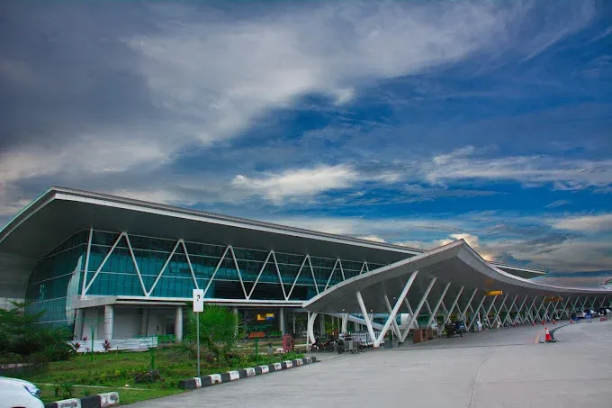
The terminal of Samarinda's APT Pranoto International Airport: a wide glass façade braced by angled white steelwork, with the canopy reaching out over the drop-off area.
The photos come from public web sources and remain the copyright of their photographers; full credits and source links sit in the photo gallery on this page.
Airport at a glance
| Item | Detail |
|---|---|
| IATA / ICAO | AAP / WALS |
| Role | Medium-sized airport |
| Elevation | about 25 m |
| Coordinates | -0.3745, 117.2501 |
| Runways | 1, 2,250 m |
| Non-stop destinations | 0 in the 2014 snapshot |
Runways
| Runway | Length | Width | Surface |
|---|---|---|---|
| 04/22 | 2,250 m | 45 m | asphalt |
1 runway, the longest 2,250 m.
Non-stop routes
The route dataset carries no scheduled non-stop services for this airport. Regional schedules change often — confirm with the airline or airport before booking.
Nearby airports to compare
If the fares are close, these are the nearest airports of the same class (medium-sized airport) — straight-line distance, with their own non-stop counts from the same dataset:
| Airport | Distance | Non-stop destinations |
|---|---|---|
| Abdul Rachman Saleh Airport (MLG) | ~979 km | 2 |
| Adisutjipto International Airport (JOG) | ~1,118 km | 13 |
Before you fly
- The 2014 snapshot has no scheduled routes; check the airport and airlines for current services.
- Onward travel in East Kalimantan often involves road or small-aircraft legs, so allow time for bags and transfers.
About the data
Runways, elevation and coordinates come from OurAirports open data. Routes and carriers come from the June 2014 OpenFlights snapshot and include codeshares and interline services; they indicate network shape and scale, not current schedules.
ความคิดเห็นจากผู้อ่านการสนทนา
ยินดีรับคำถาม รายงานการเดินทาง และการแก้ไข ความคิดเห็นเป็นสาธารณะ
กำลังโหลด…
กำลังโหลดความคิดเห็น…